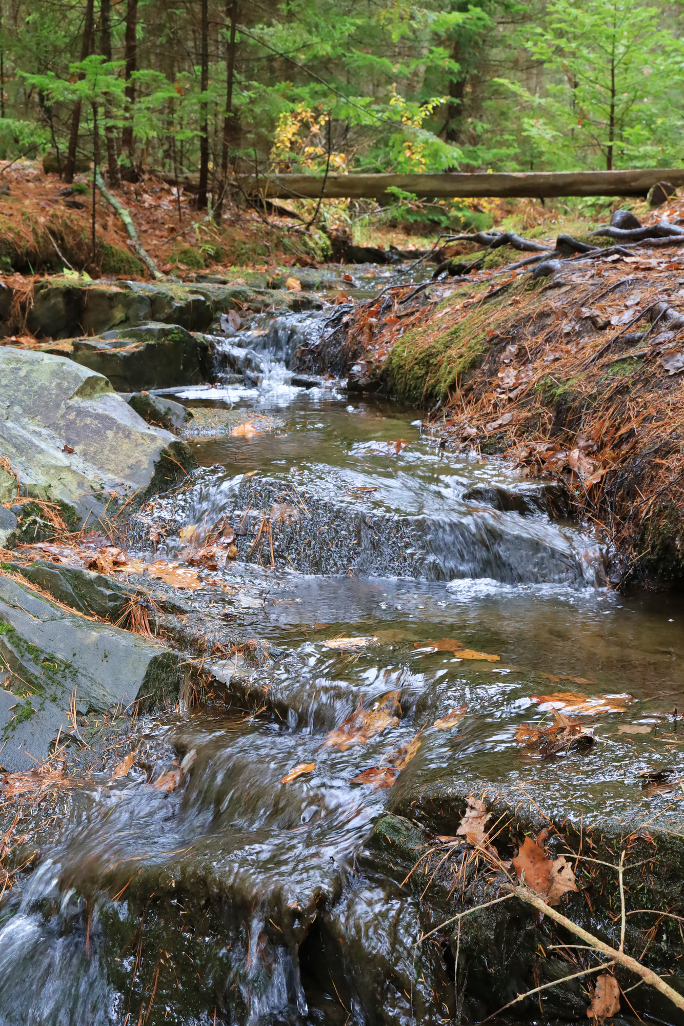
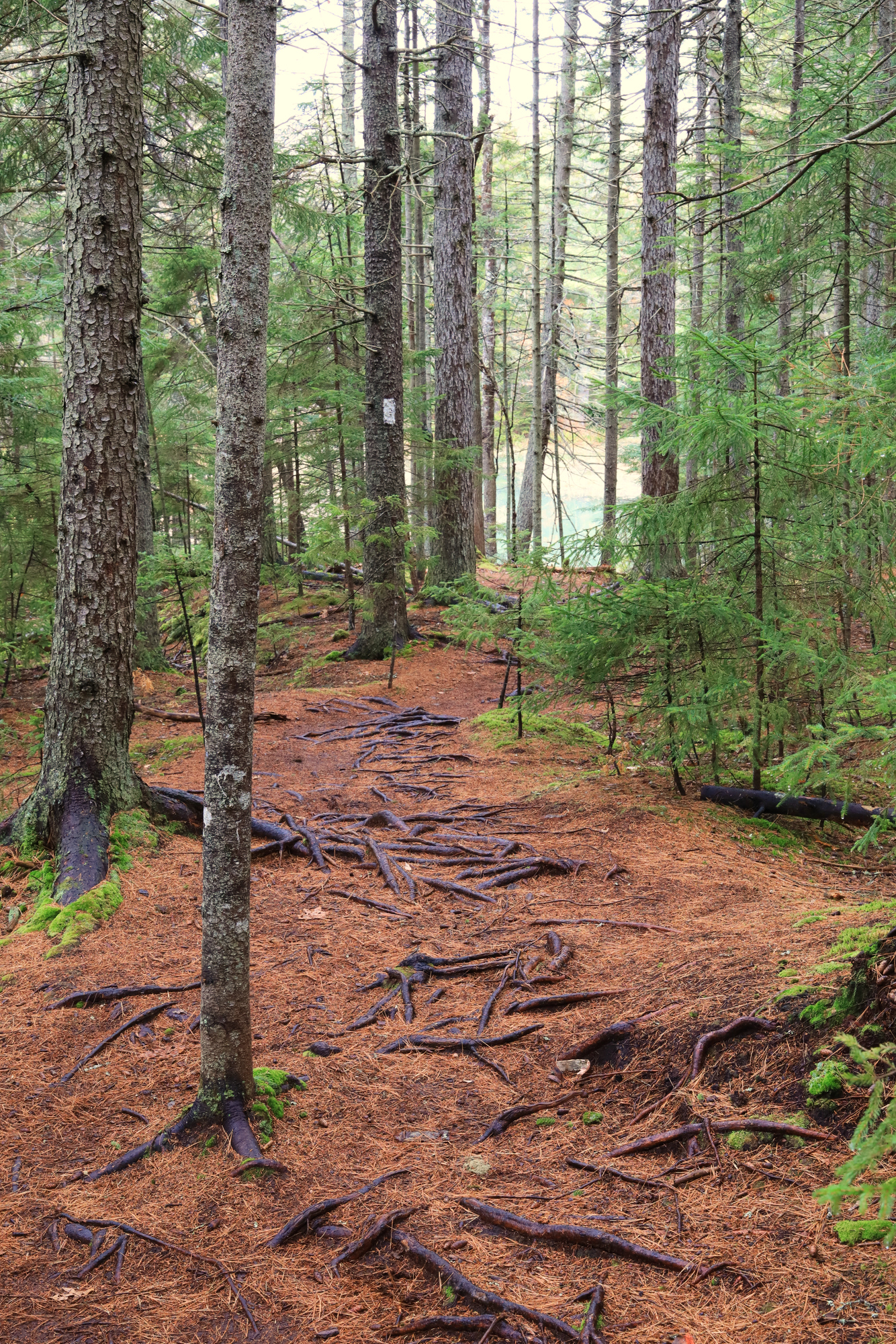
After the success of our Halloween adventures I decided to check out another destination that came recommended by the locals, Harpswell’s Cliff Trail. It was definitely not as nice out, but I decided to go for it anyways. The trail started off by winding along the side of a little tidal creek through a classic Maine pine forest.
A little bridge for a little brook
The pine needles always make these trails so peaceful
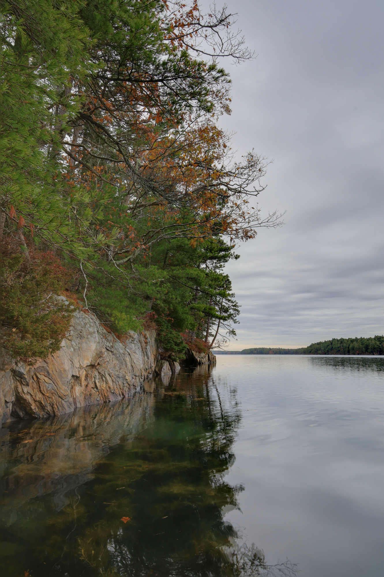
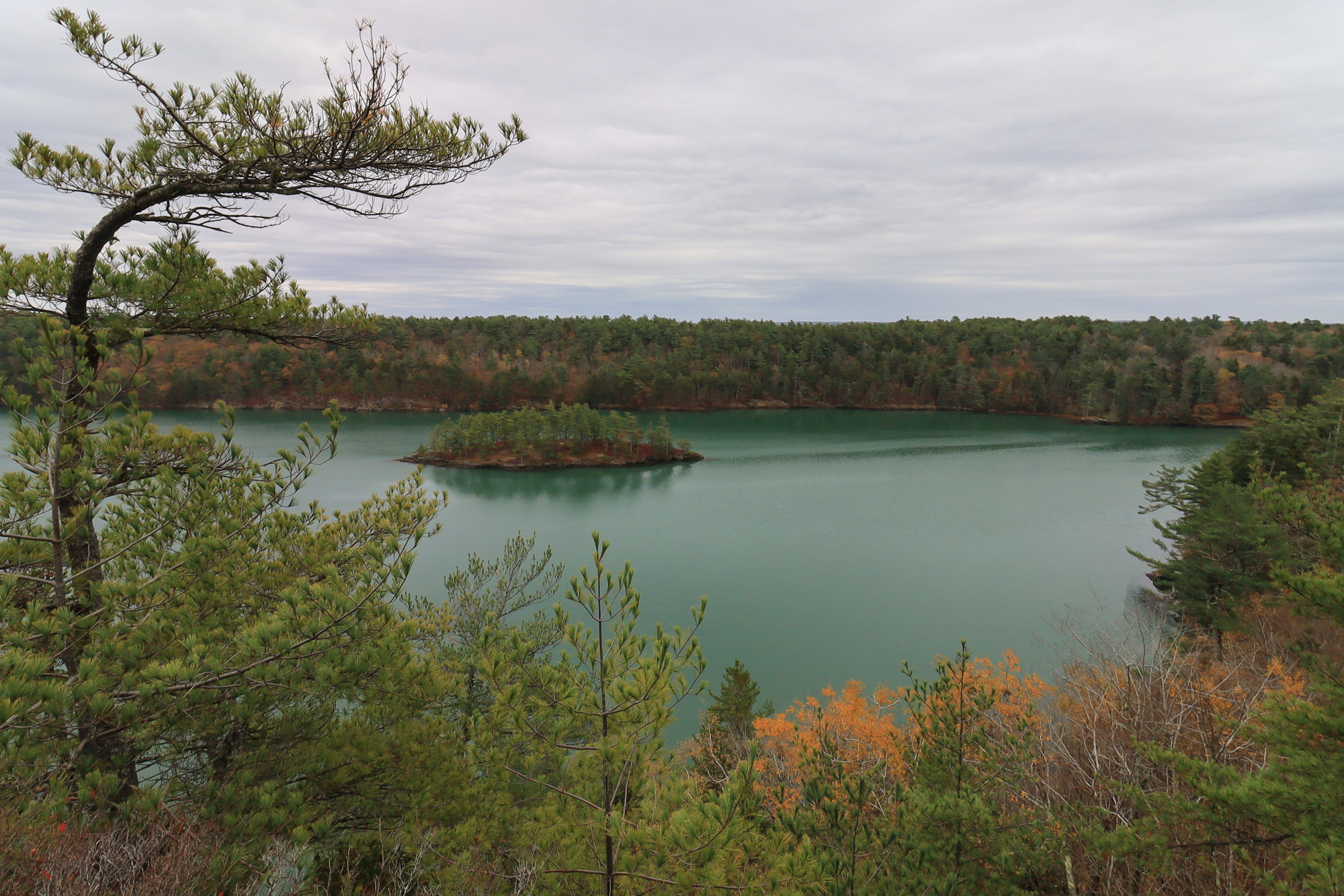
After crossing to the other side of the park, the trails starts to follow Long Reach, a tidal inlet. At times the trail drops right down to the water, showing off the tranquility of this remote stretch of water.
The view from my snack break
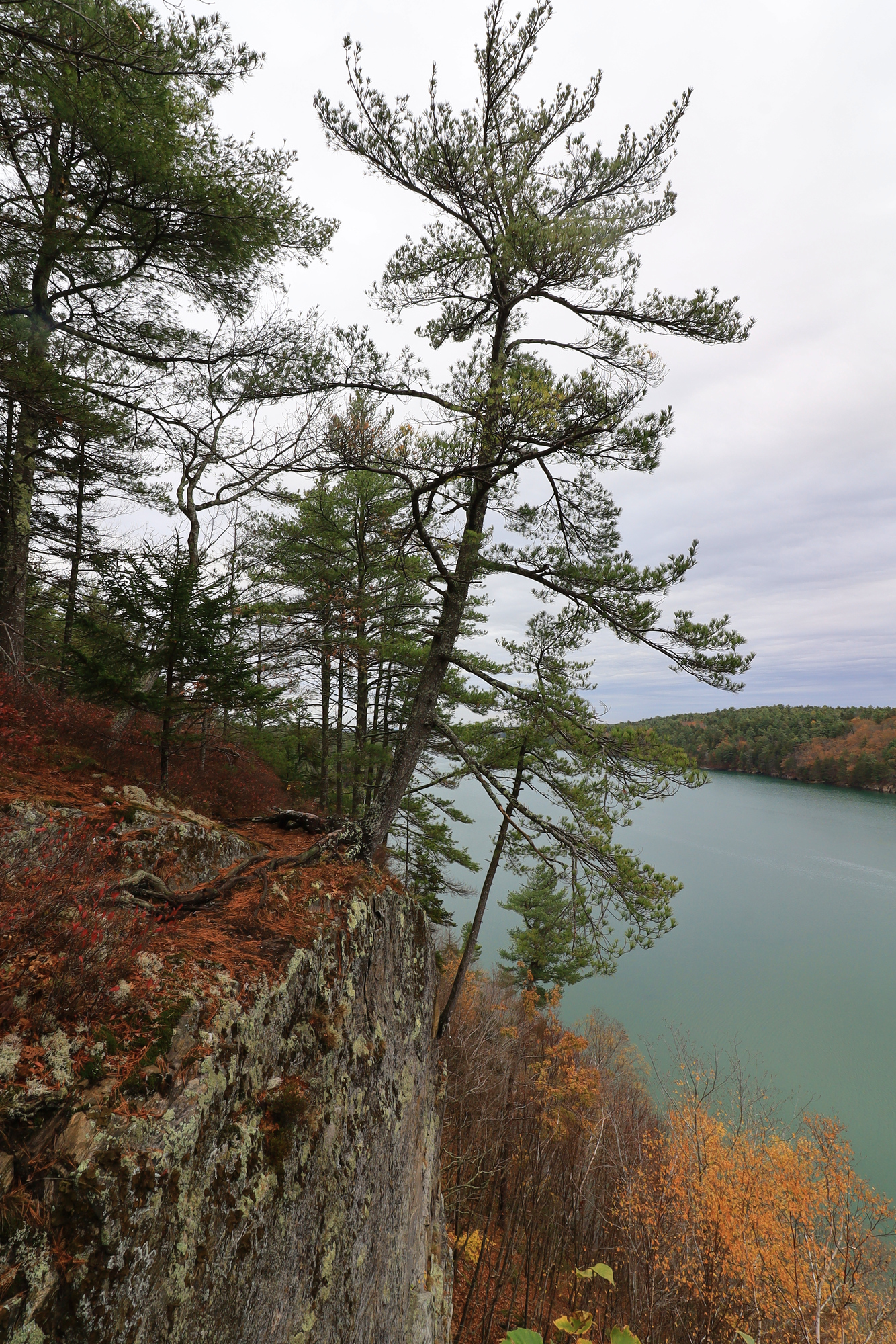
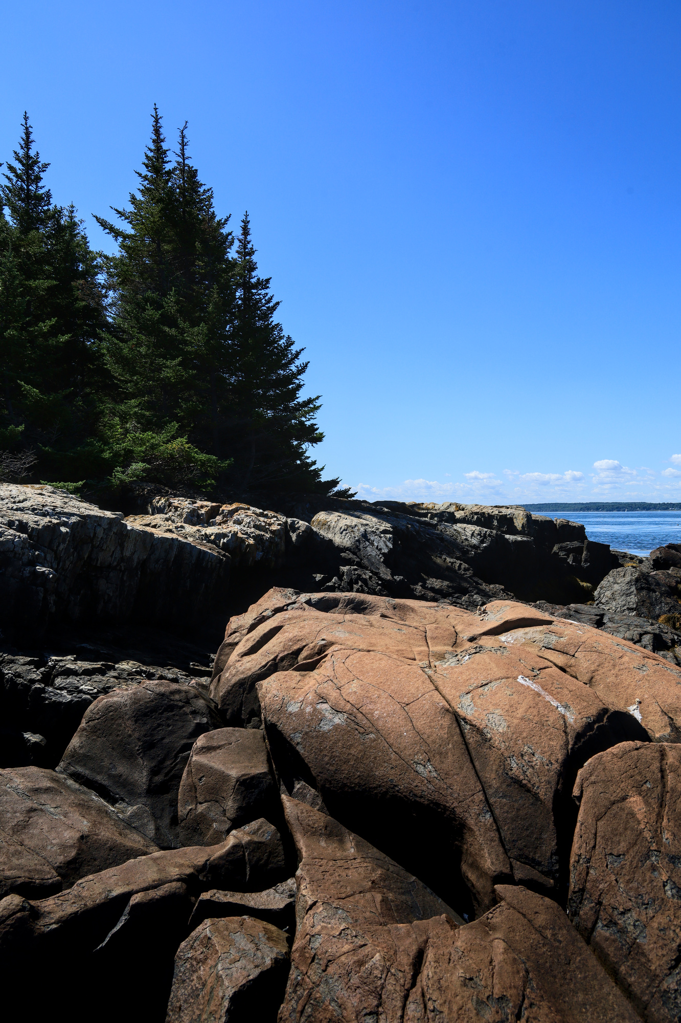
As it climbs up the ridge you start to get views from the Cliffs that give this trail it’s name. The combination of the trees and shrubs which grow out over the edge with the dizzying drop off make it hard to really capture the feeling of being here in a photo. The views were very impressive for such a short hike, and I never would have guessed there were such large cliffs so close to the coast here.
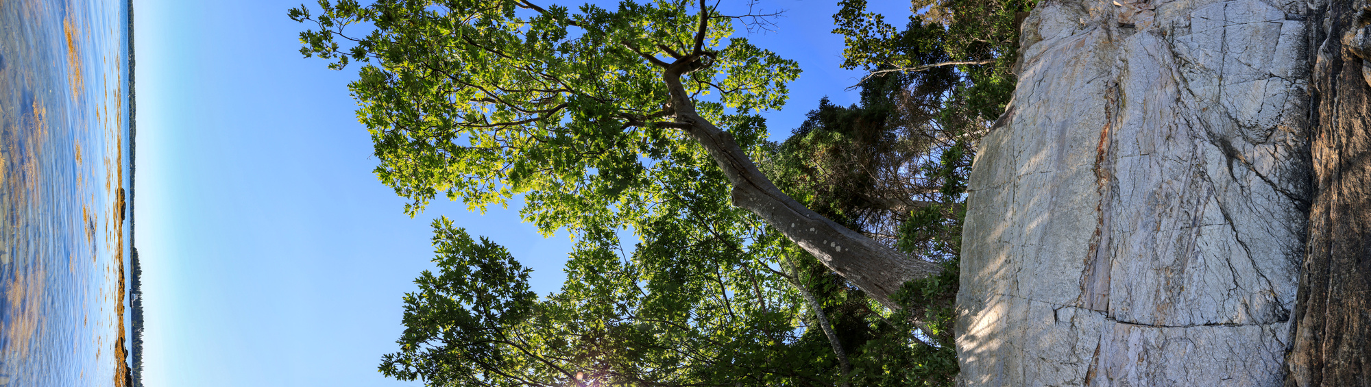
Though the interrupt the view, these trees are certainly impressively perched
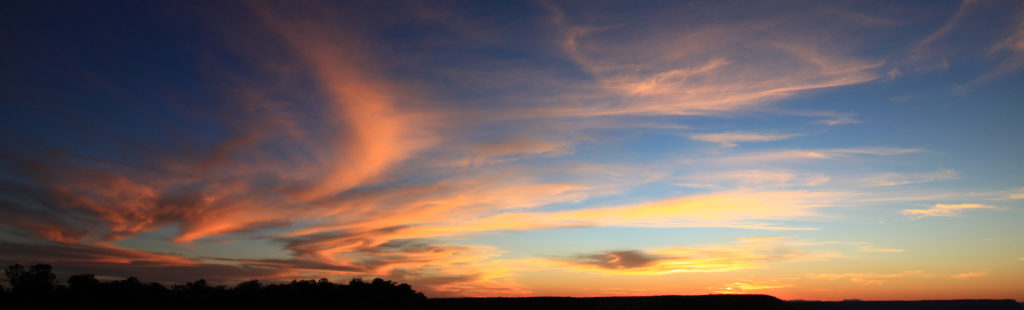
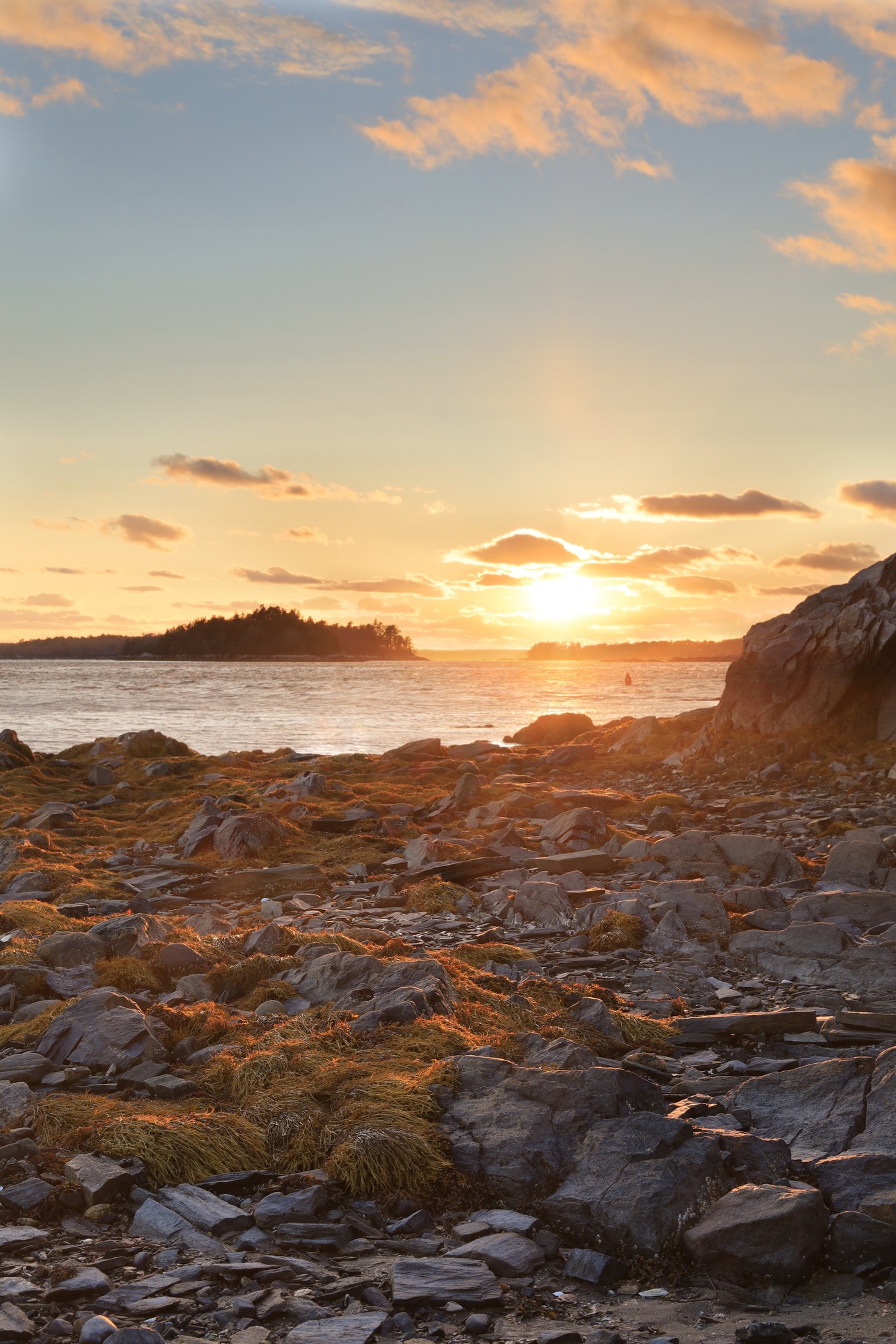
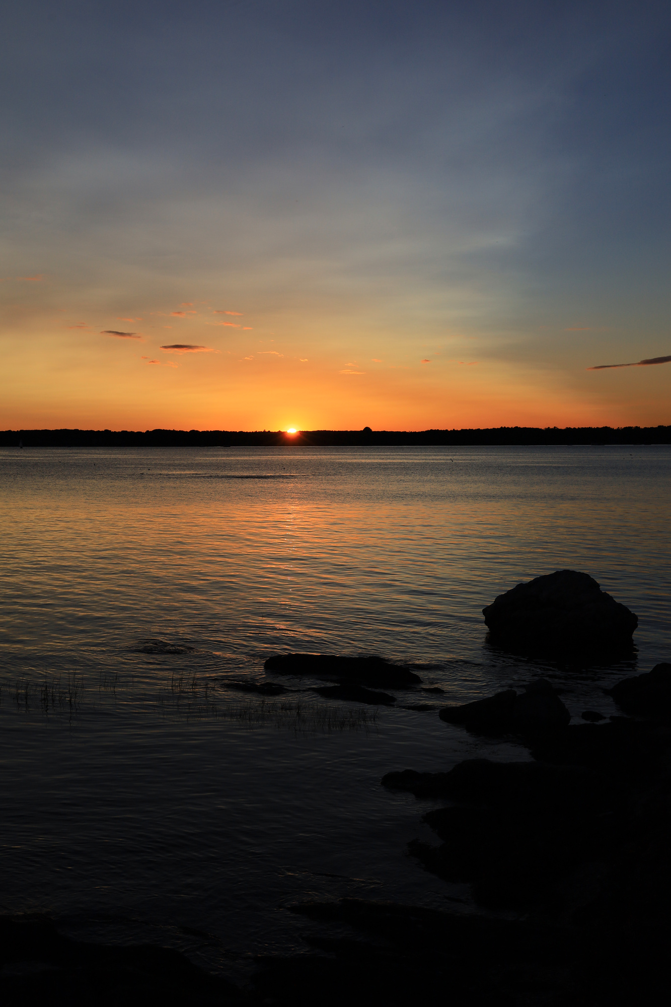
From the cliffs it was a short hike back down to the parking lot. I am certainly happy that I checked this one out, and I’ll have to return another time when there is better weather. I’ll leave you with a final shot of the sunset we got the next evening. It definitely would have been nice to see something like this from the cliffs!
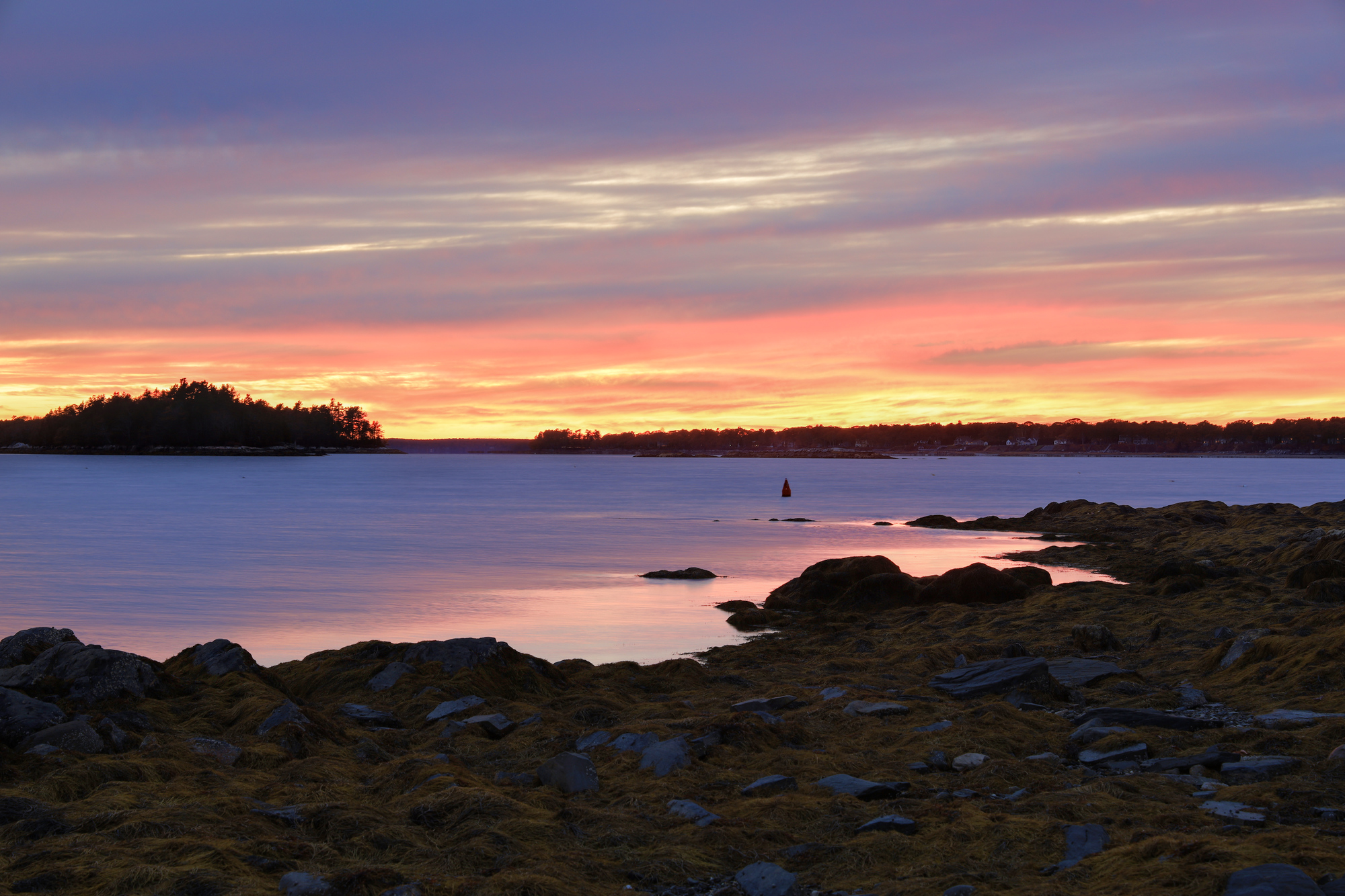
For Halloween this year we decided to mix it up a bit and spend the day up in Maine. It was a very quiet weekend at the point. We spent a lot of time relaxing at the house and enjoying the change of scenery. The night before Halloween we also were treated to a very nice, though cold, sunset.
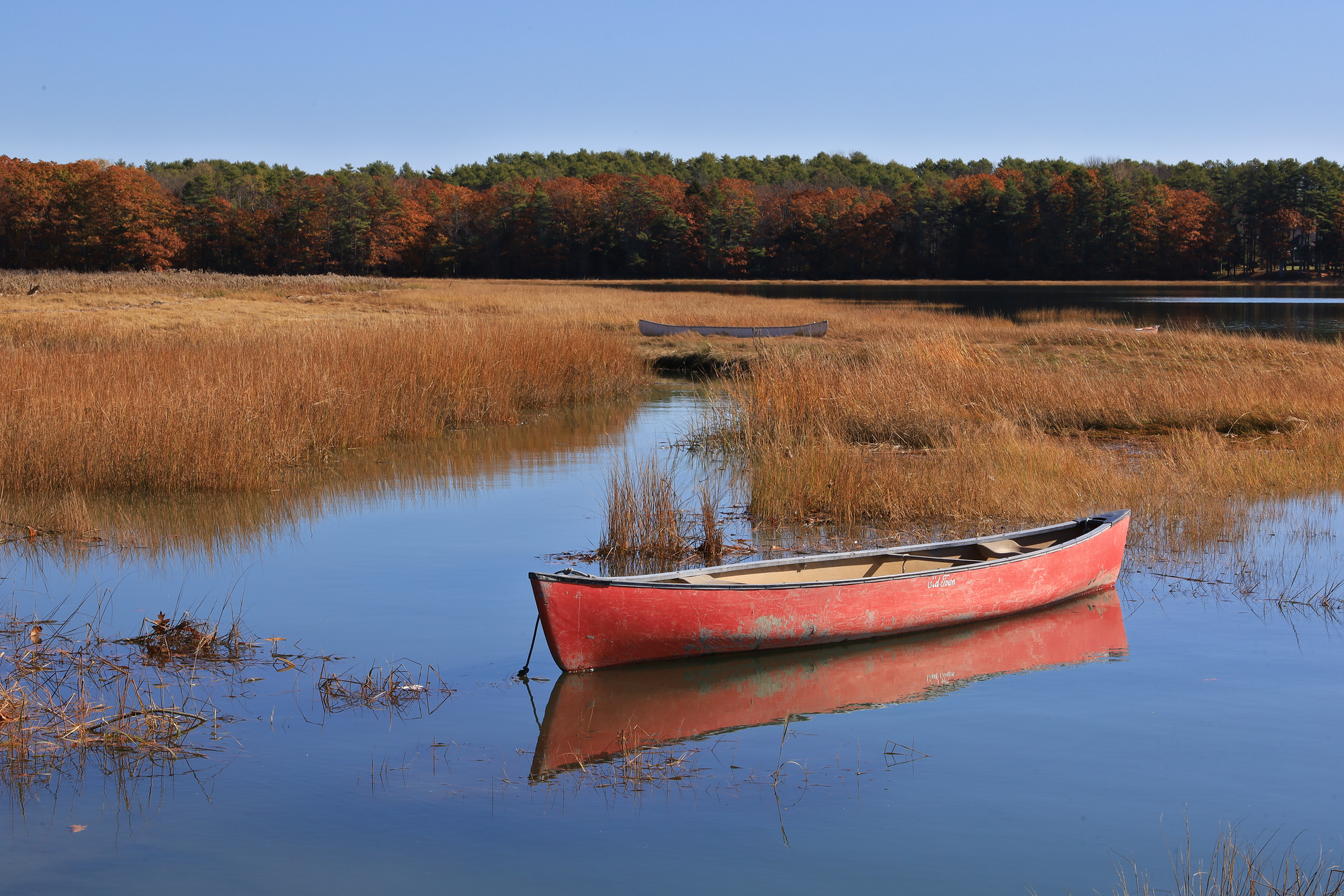
The next morning we put together a little tour of some conservation land that we had not explored before. The first stop was at the Wharton Point Landing. It was very quiet there in the morning, and I spent a few minutes taking pictures of the canoes peacefully floating on the bay.
After that it was on to the Marquoit Bay Conservation Land. This was a small park with just a single trail, but the view of the bay from the end of the trail was quite nice. We even ran into some relatives out for a walk at the same park while we were there. A surprise for both of us!
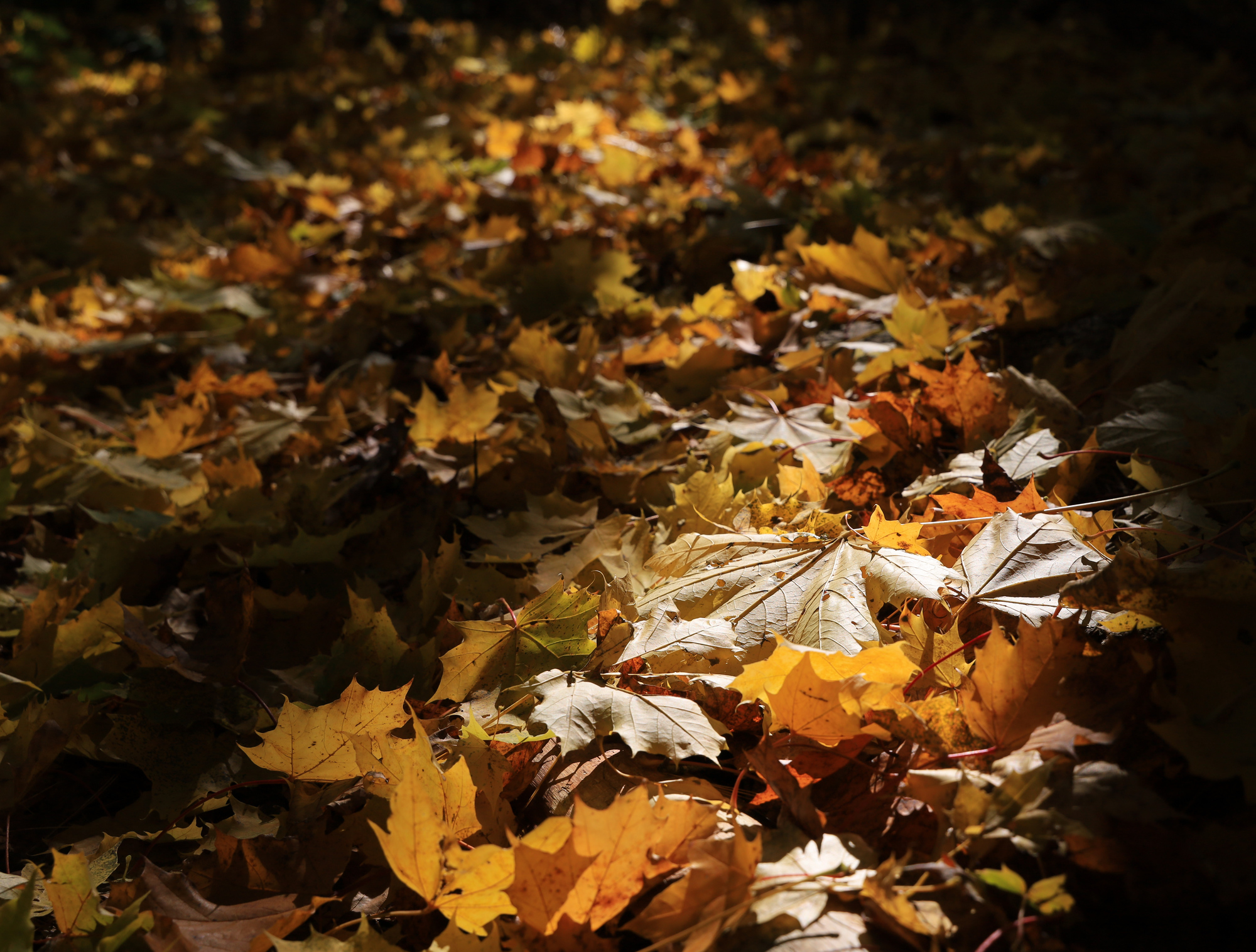
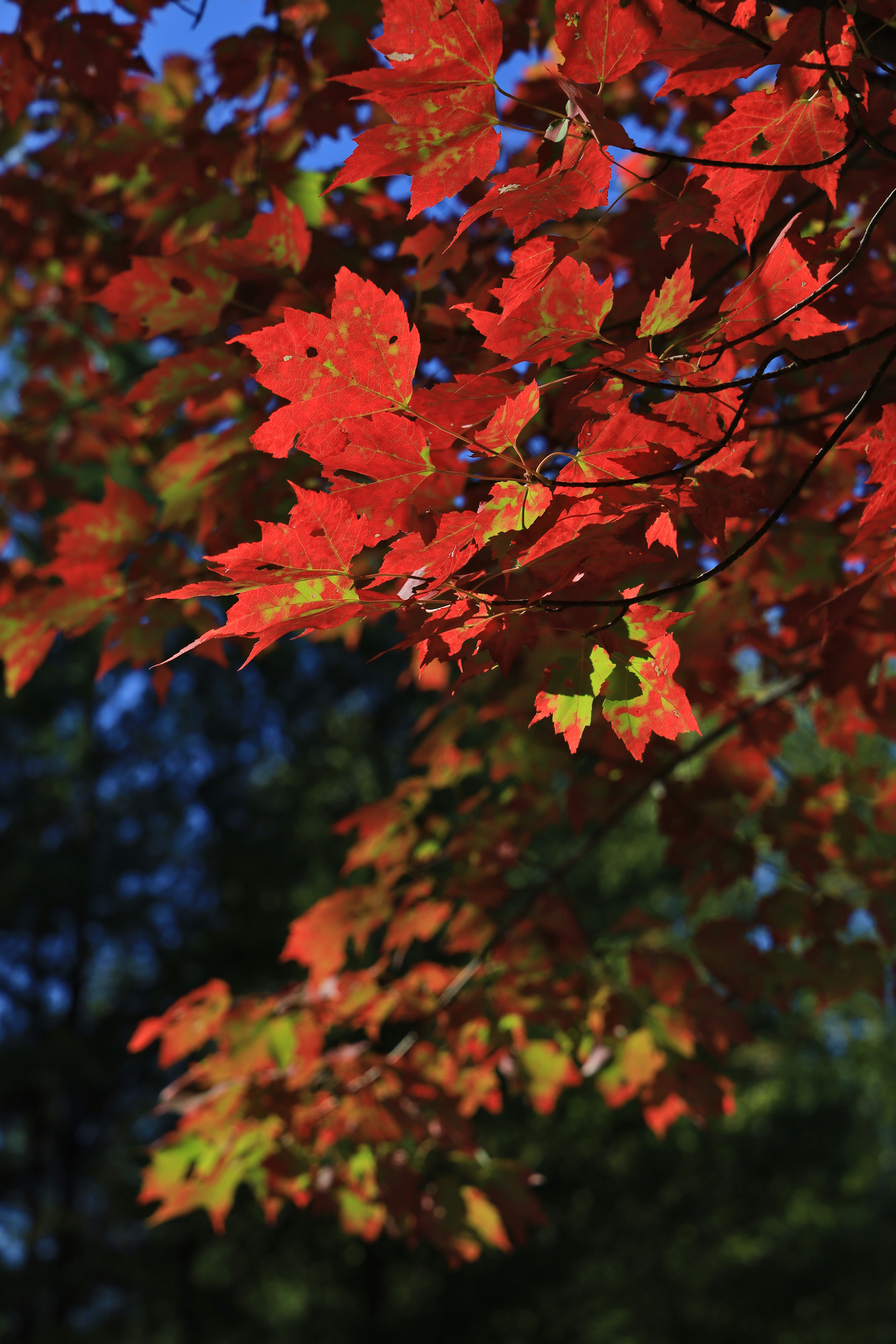
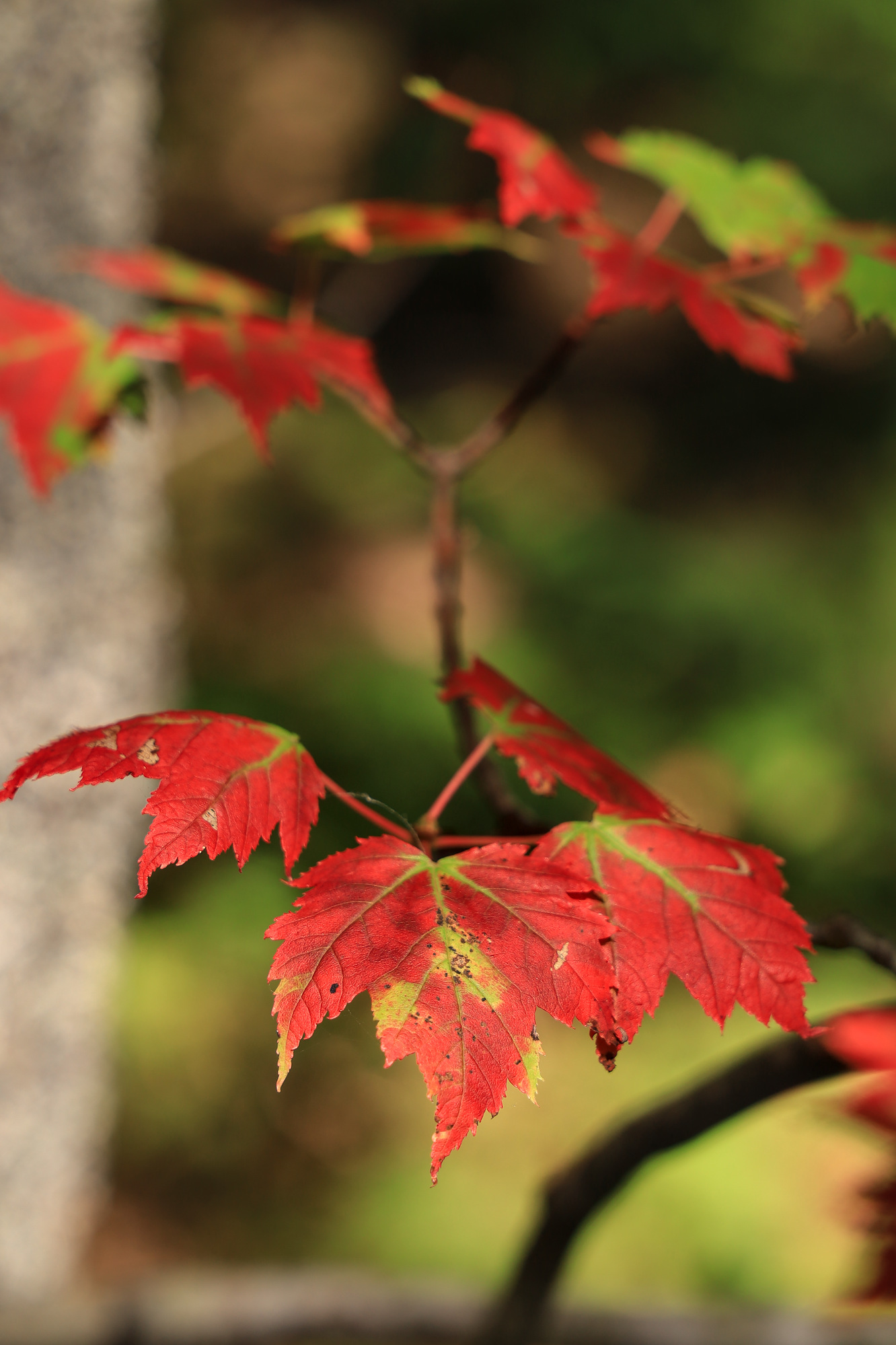
Fall leaves beside the trail catching the morning sun
Next we moved on to the larger Wolfe’s Neck State Park. This one was definitely the happening place for the day, and the parking lot was nearly full by the time we arrived. We grabbed a spot and then started our little hike. The park turned out to be beautifully maintained, with some very impressive trails along the bluff looking over the ocean. The east side of the park was clearly the most popular part, but we also appreciated the west side as part of our loop around the perimeter of the park.
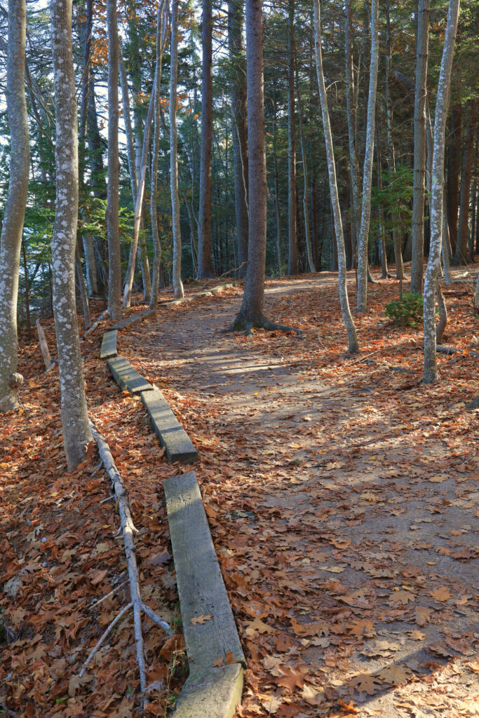
An example of extreme trail maintenance
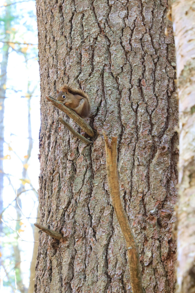
The friendly neighborhood red squirrel watching us go by
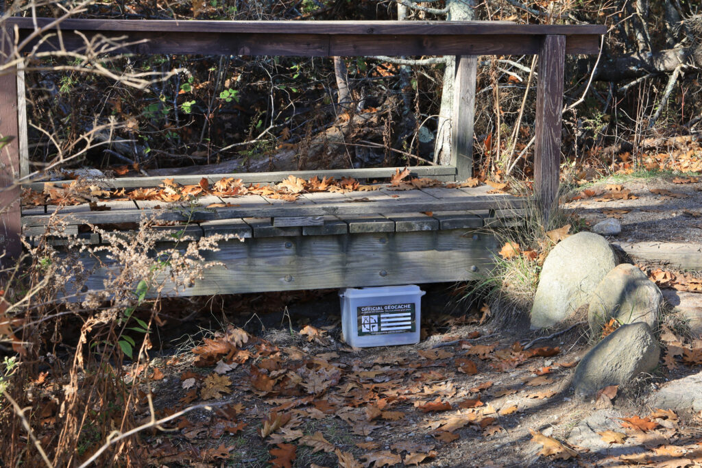
We accidentally found this official park geocache. Maybe they should hide it better…
After a stop in downtown Freeport for a late lunch, it was on to our final park, Hedgehog Mountain. Now to be honest we chose to stop here purely based on the name. We had to find out if there was any resemblance to our pet hedgehog, Pepper.
Pepper, a hedgehog
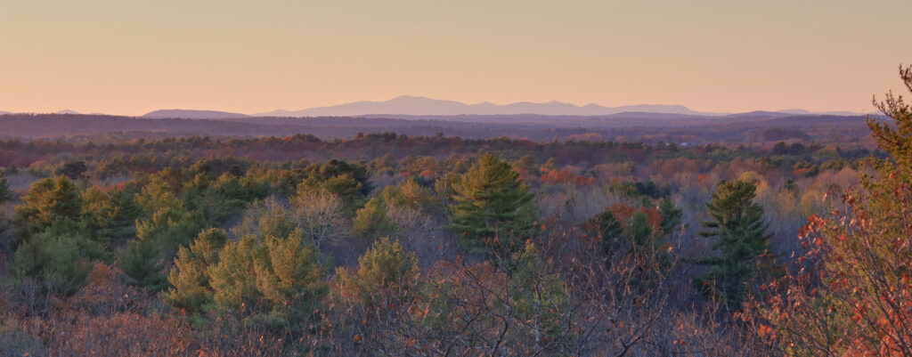
As it turns out, Hedgehog Mountain doesn’t look much like a hedgehog or a mountain. It turned out to be a nice, but short, walk up to the top of a ridge where we got a view out to the west. Our timing was excellent, as we watched the sun go down from the viewpoint before returning to our car.
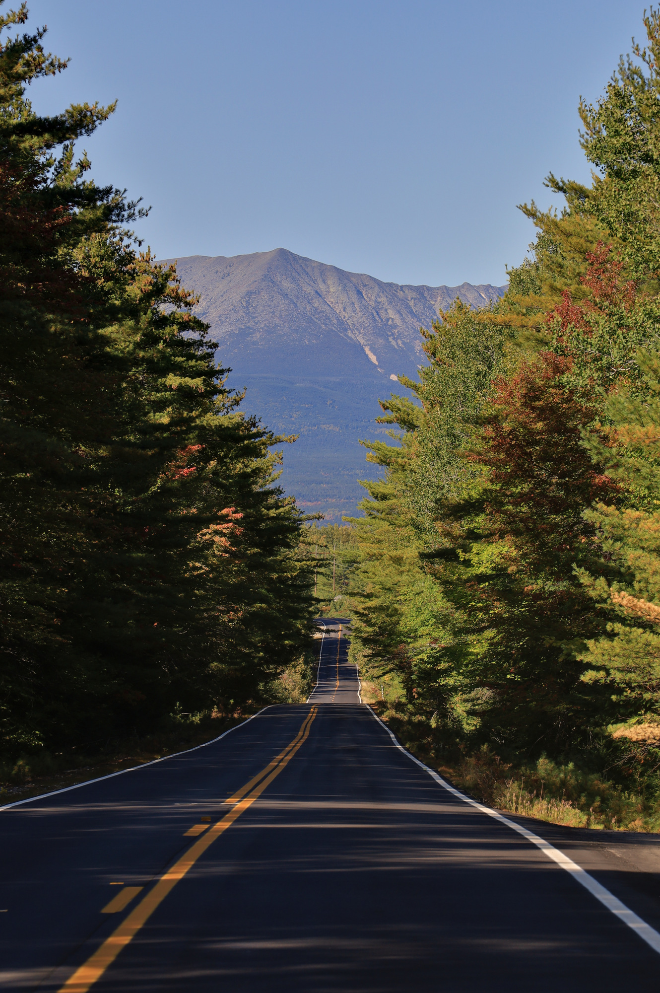
As nice as the previous evening was, the real purpose of the trip was slated for the next morning. We got up early and set out on the road to the Roaring Brook trail head. According to what we had read online we thought we had to be there early to make sure that we would get a parking spot at the trail head, so it was an early start. However, when we got there we were the first cars in the lot. Oh well, who needs sleep.
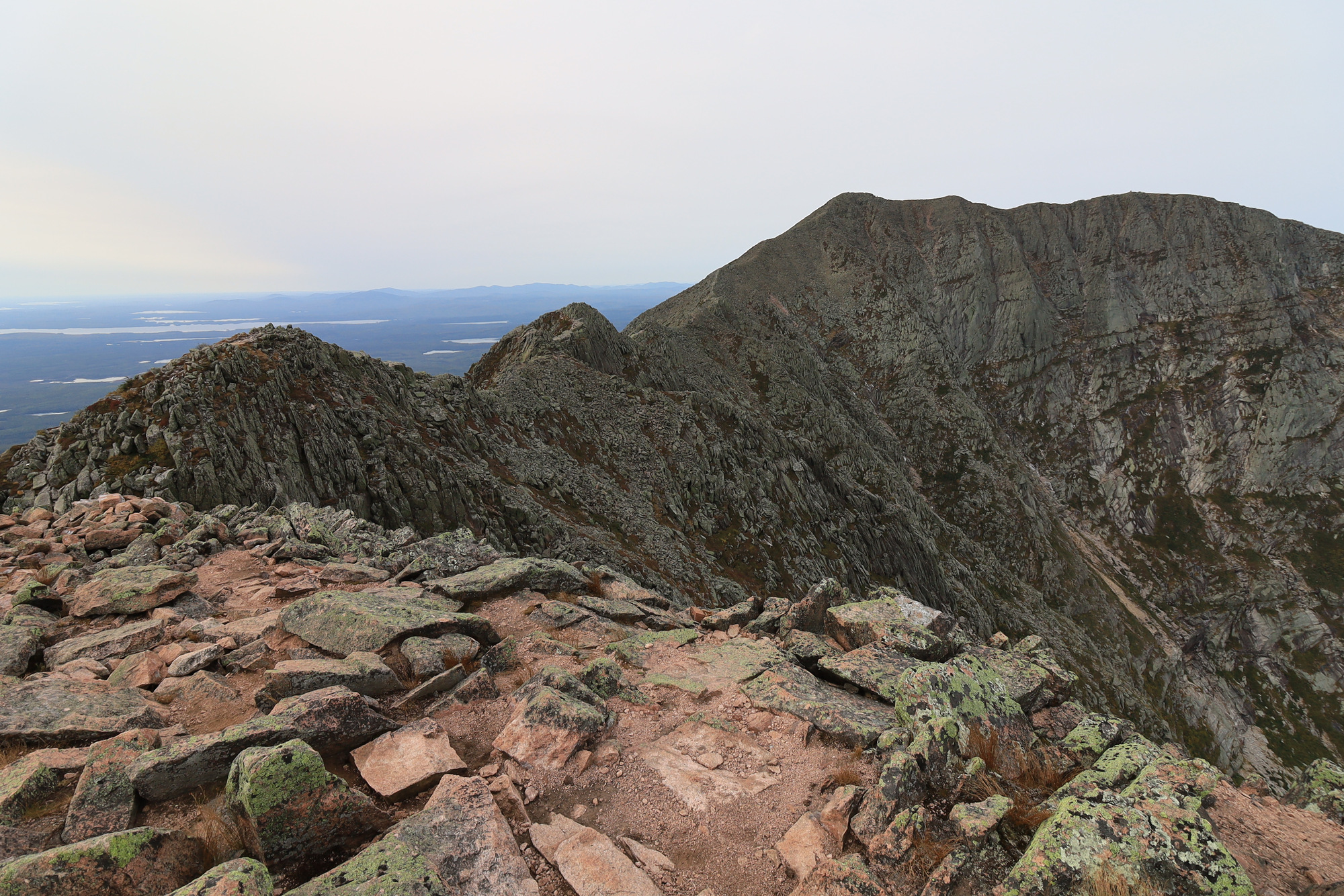
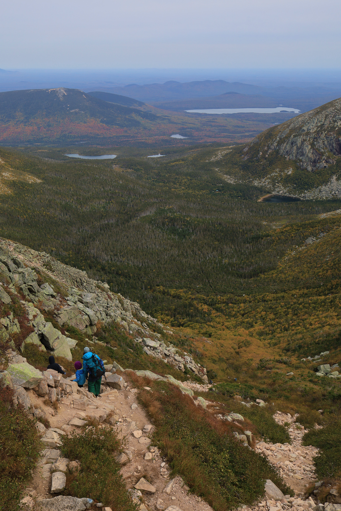
Once we were on the trail we quickly started gaining altitude as we climbed the Helon Taylor Trail. Before we knew it we were above the tree line heading for Pamola Peak, which towered above us for the whole climb. The views around us kept getting better, but it didn’t really sink in until we arrived at peak itself. In one moment as we crested the ridge the entirety of the knife edge trail and the towering Baxter Peak were on full display. It was quite the view, but one that I was not really able to capture in a photo very well.
The first view of Baxter Peak
After a short break to grab a snack, it was off towards the chimney section. This was where the trail started to make me think “Ah, this is what they mean by exposure.” Just barely past the summit the trail immediately descends a wall of rock to a small saddle, only to immediately climb right back up a similarly steep face. According to the map this section is only about 100 yards long as the crow flies, but descends and climbs 100′.
Looking down at other hikers on the descent into the chimney section
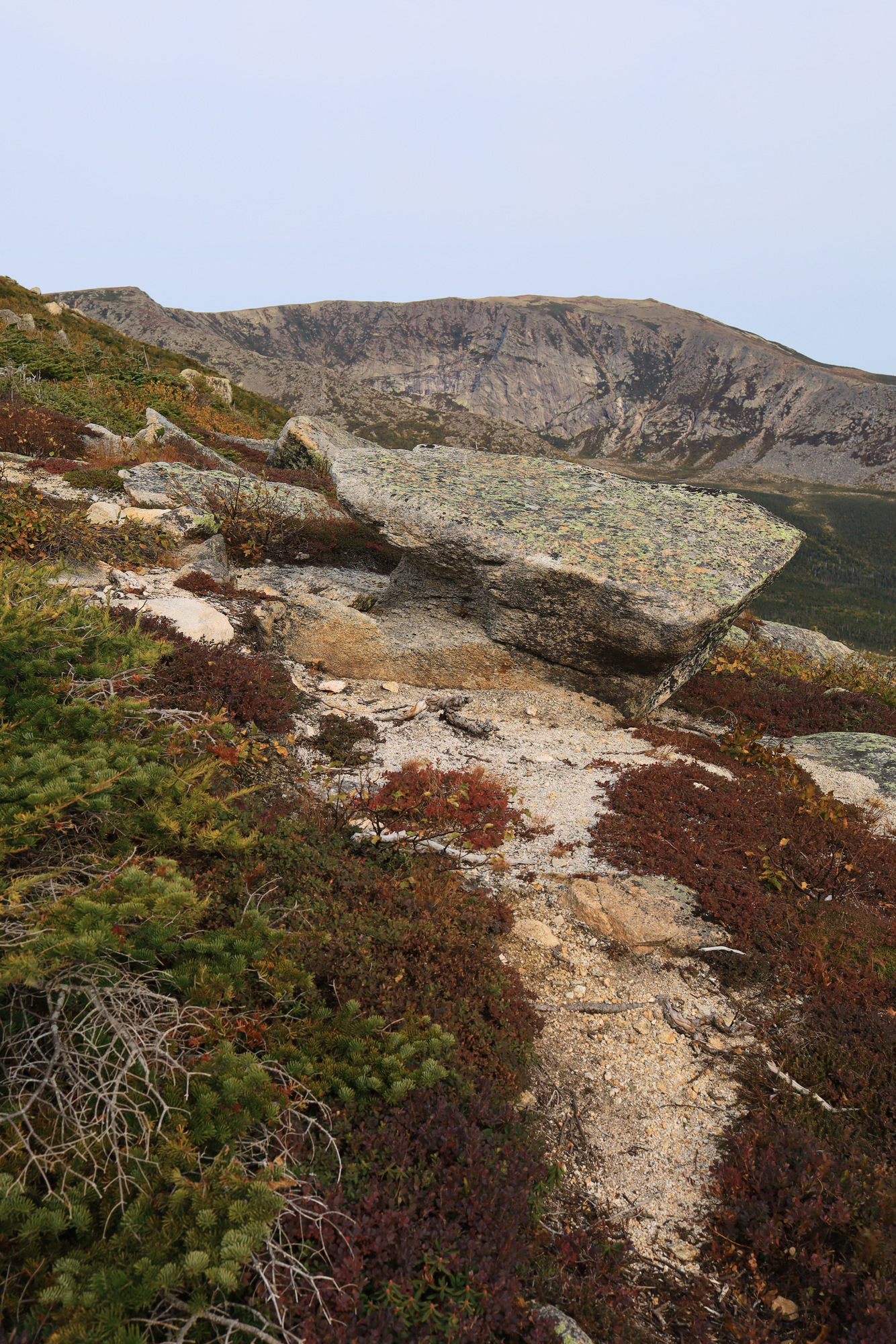
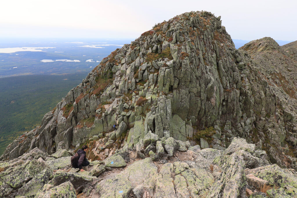
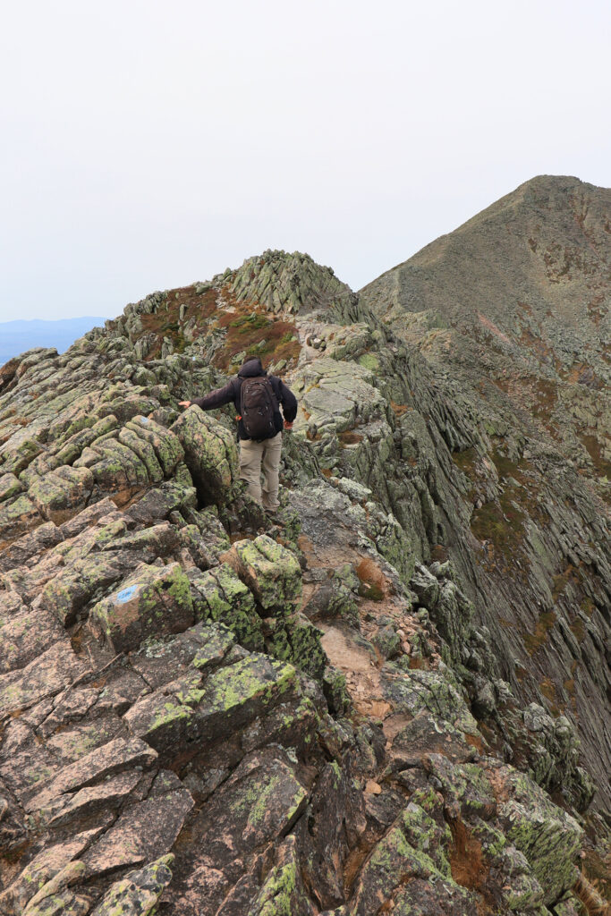
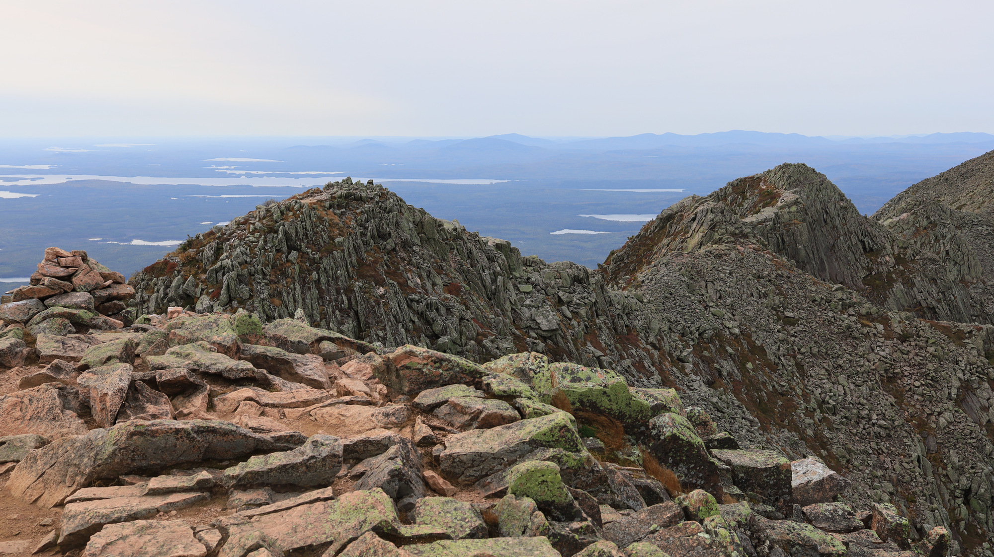
Once past the chimney we started really making progress up the ridge. I found this section of the trail to be the most interesting. I had been warned before hand about the exposure on this trail, but I was not expecting it to be this significant. For around the next half mile the trail was consistently narrow with large drops on one side or the other. Fortunately most of the trail has a rock face or boulder to reach out to and give you some comfort, so in the end it was not as frightening as I was expecting either.
Definitely lean left through here
Now one thing I saw many times before hiking this trail was to be careful about the weather. The last thing you want is to be on a ridge like this in bad weather. Fortunately, we had a pretty comfortable day, with no sign of rain. Unfortunately, there was a steady 30 mph wind blowing across the ridge. This certainly made things more interesting, and there were multiple spots where we had to “hike” with our hands on the ground to make sure we did not get blown off balance. I’m just glad it wasn’t gusty.
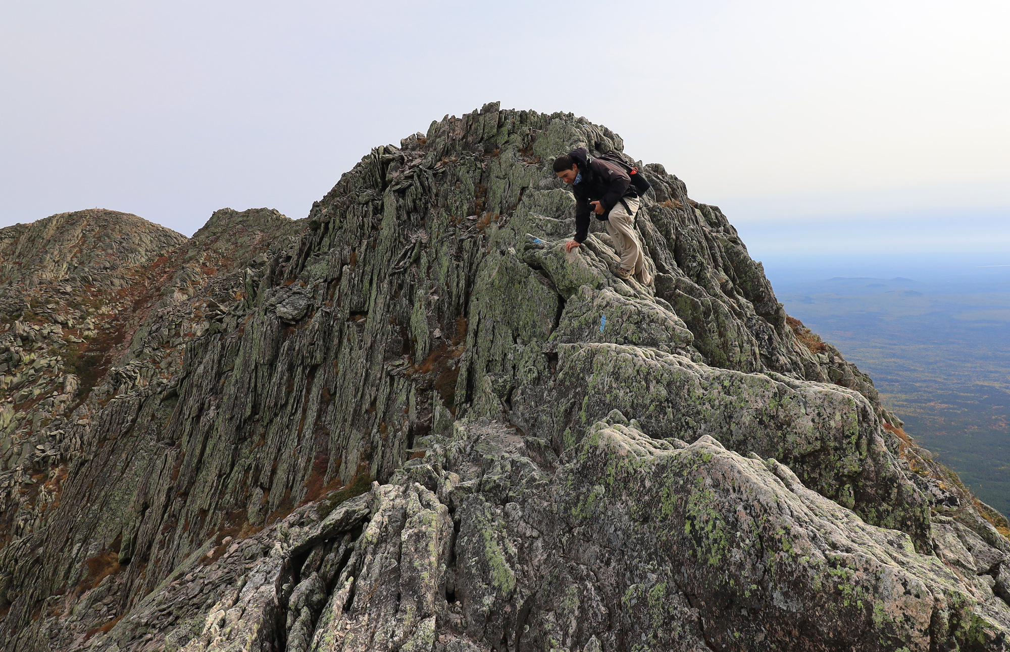
One of the last really narrow sectionsLooking up towards Baxter Peak
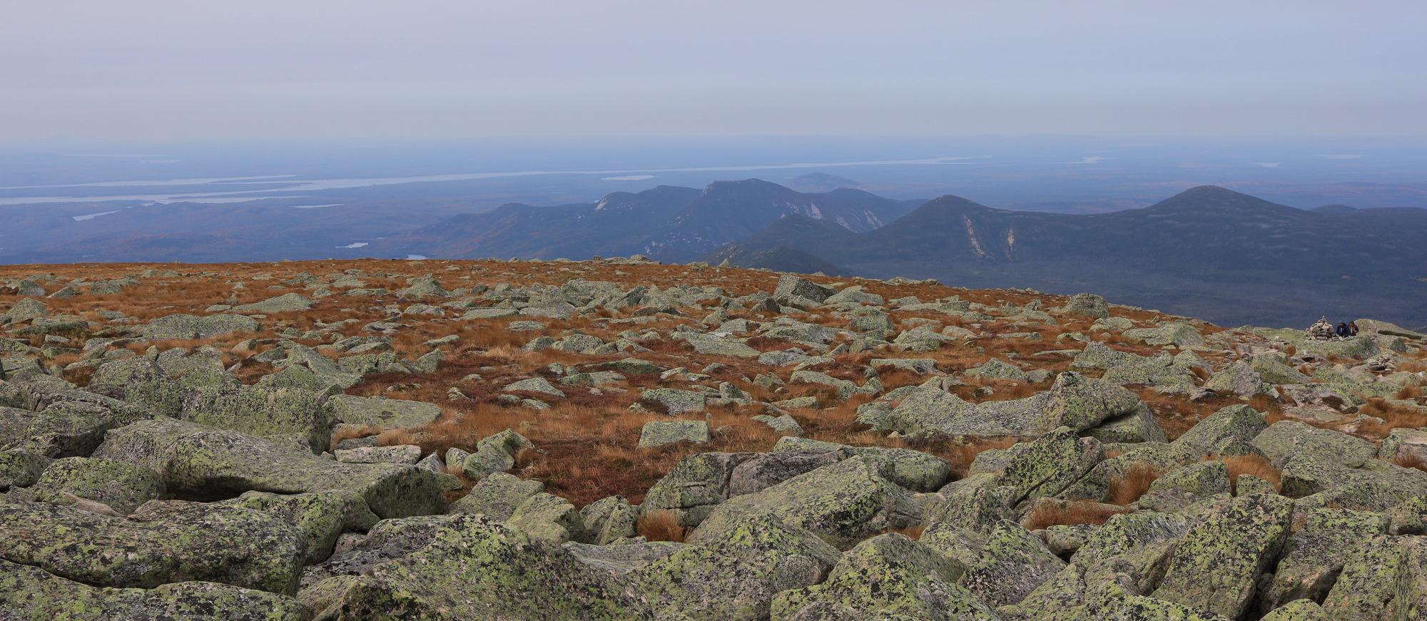
Soon enough the trail widened up a bit and the drops got slightly less sheer. The trail was still exposed, but now more like something that you might find at other summits. We climbed up the rest of the ridge and stopped for lunch just before the top. Once there, the character of the trail changed completely. Suddenly we were hiking across a gently sloping boulder field with alpine grasses all around.
Not hiking on knives any more
We slowly descended down the ridge on the other side of the summit where we were greeted by the next surprise. Our route down into the valley, chosen because it was the gentlest descent, turned out do drop straight down a rock slide. It made for awesome views, but also slow going. It was not until we were much lower in the valley before we were really able to pick up the pace.
The trail here goes straight down
From here on out the trail was very manageable. It featured a number of pretty views, a couple of bridges, and a pond. We knew we were close to done when we met up with Roaring Brook again for the final walk to the trail head.
This hike really felt exciting, and was a real treat after the isolation of 2020. I was really impressed at what Baxter State Park has to offer, and definitely want to return some other time to explore the rest of the hike. For now though it was back in the car to head back to civilization.
With all of the chaos that has been 2020 I decided I wanted to find something special to do. Given the limits on travel I was focused closer to home, and ended up setting on a trip up to Baxter State Park to hike the Knife’s Edge trail. I booked a lean to, completed my Maine quarantine, and headed up. My goal for the first day was to really just get up there and get set up for the hike the next day. However, it turned out to be an amazing day all by itself.
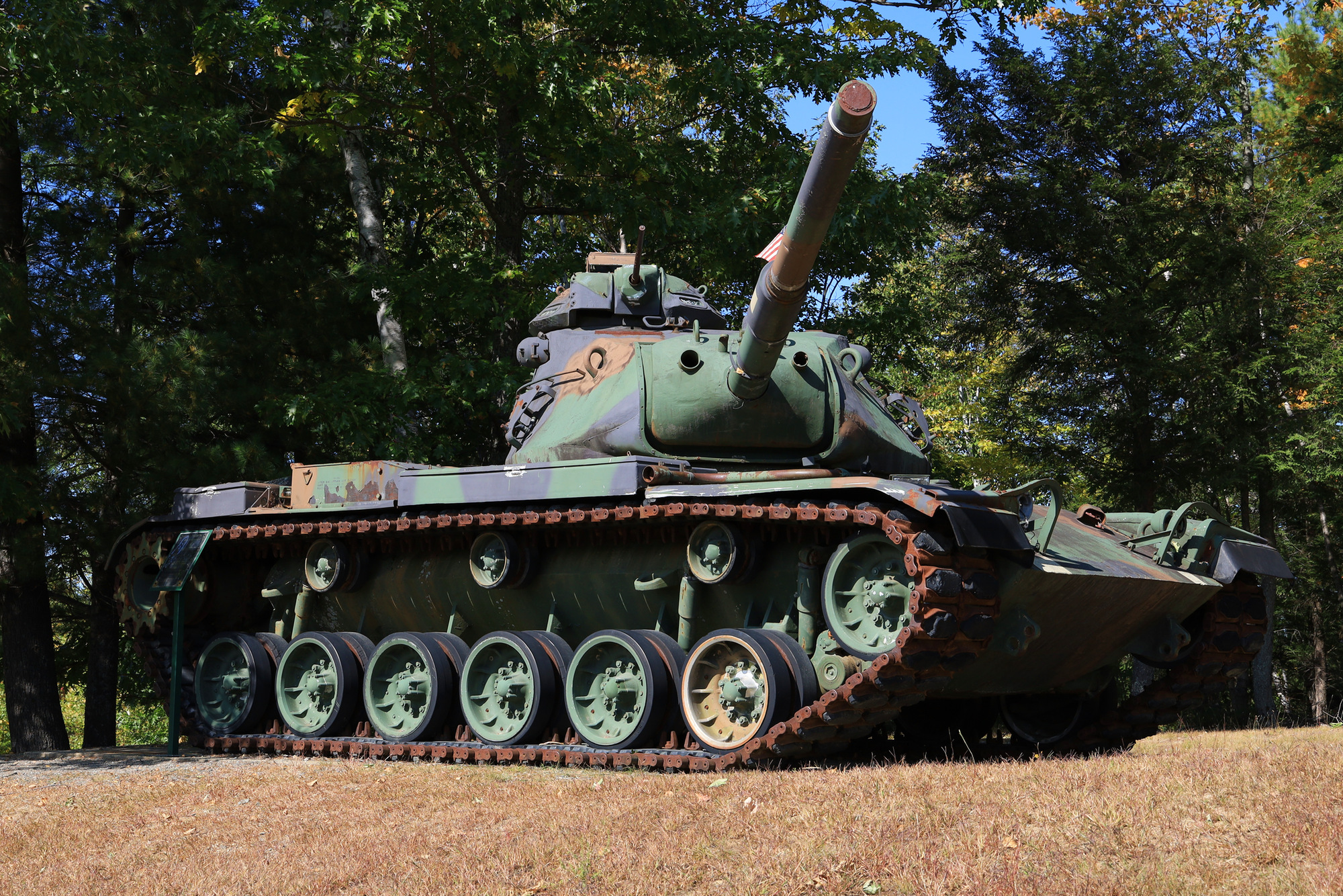
The first sight that caught my eye was the Medway Veterans Memorial Park in the town of East Millinocket. It was in a pretty little park just off the side of the road, but had an impressive tank on display as well. Given that I had been in the car for nearly 3 hours at this point, it was a nice little spot to stop and stretch my legs.
After another 20 minutes of driving I started to catch sight of the mountains in the distance. I made a few more stops to take in the amazing fall color and to simply enjoy the solitude. There isn’t much development this far north, so everything felt quiet and private, even when I was standing in the middle of a road.
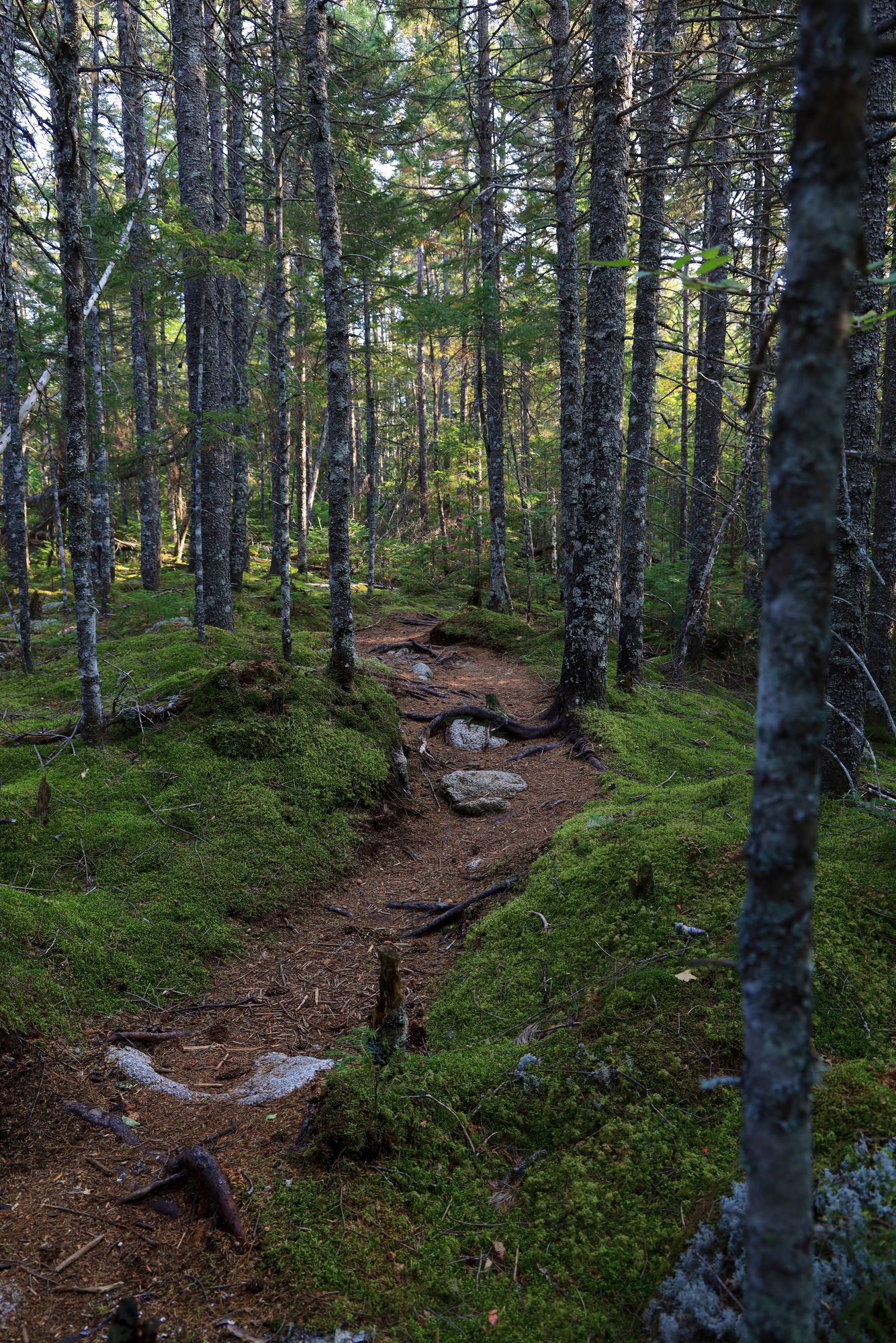
Once I made it to the camp site I dropped off my camping gear at the lean-to and went for a walk along the Appalachian Trail. I hardly made it 100 yards before I was amazed at the beauty of this place. The tails were beautifully maintained, the landscape changed at every turn. I walked through clear pine forests, across small streams, through marshes, and over little hills.
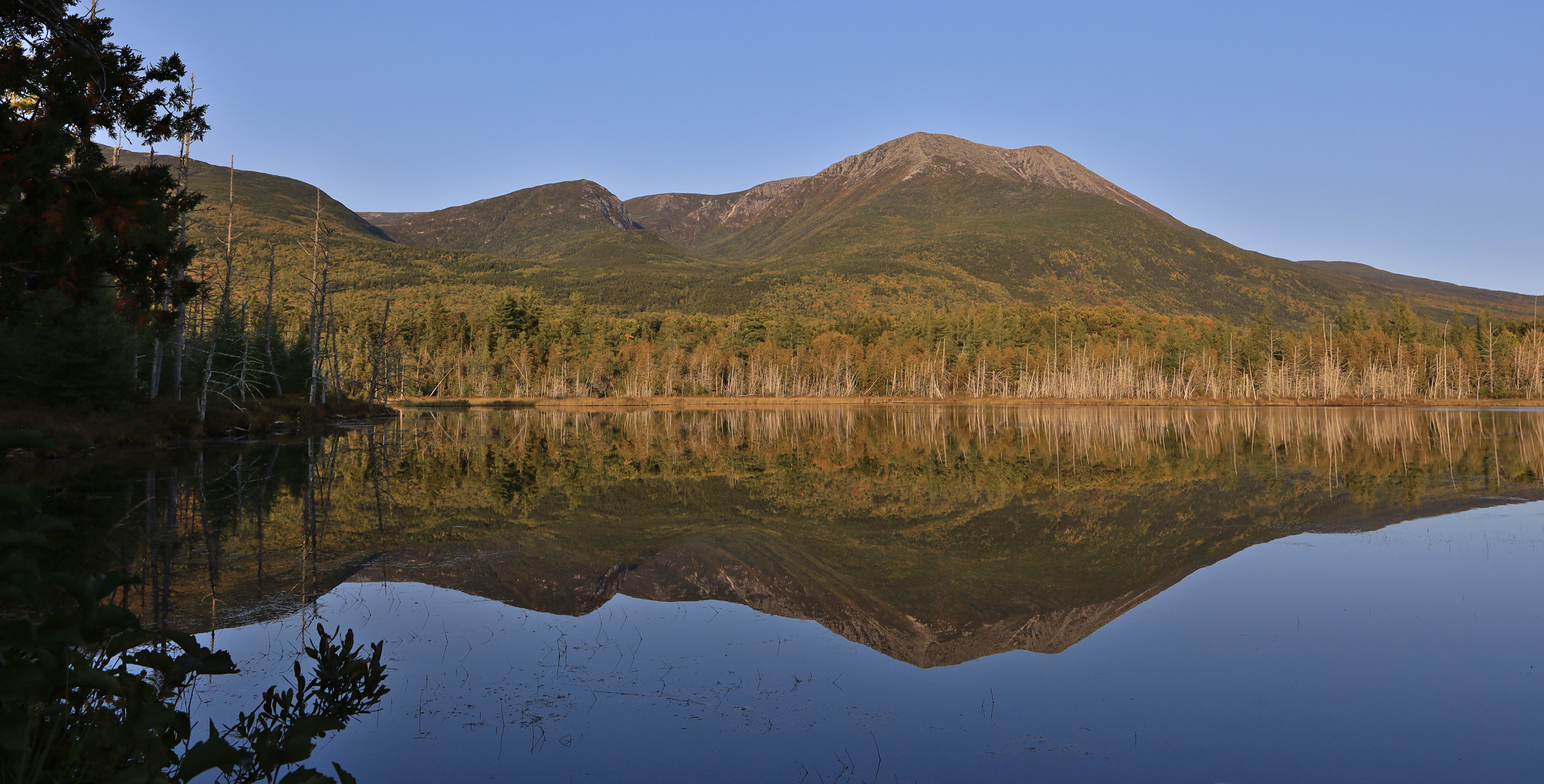
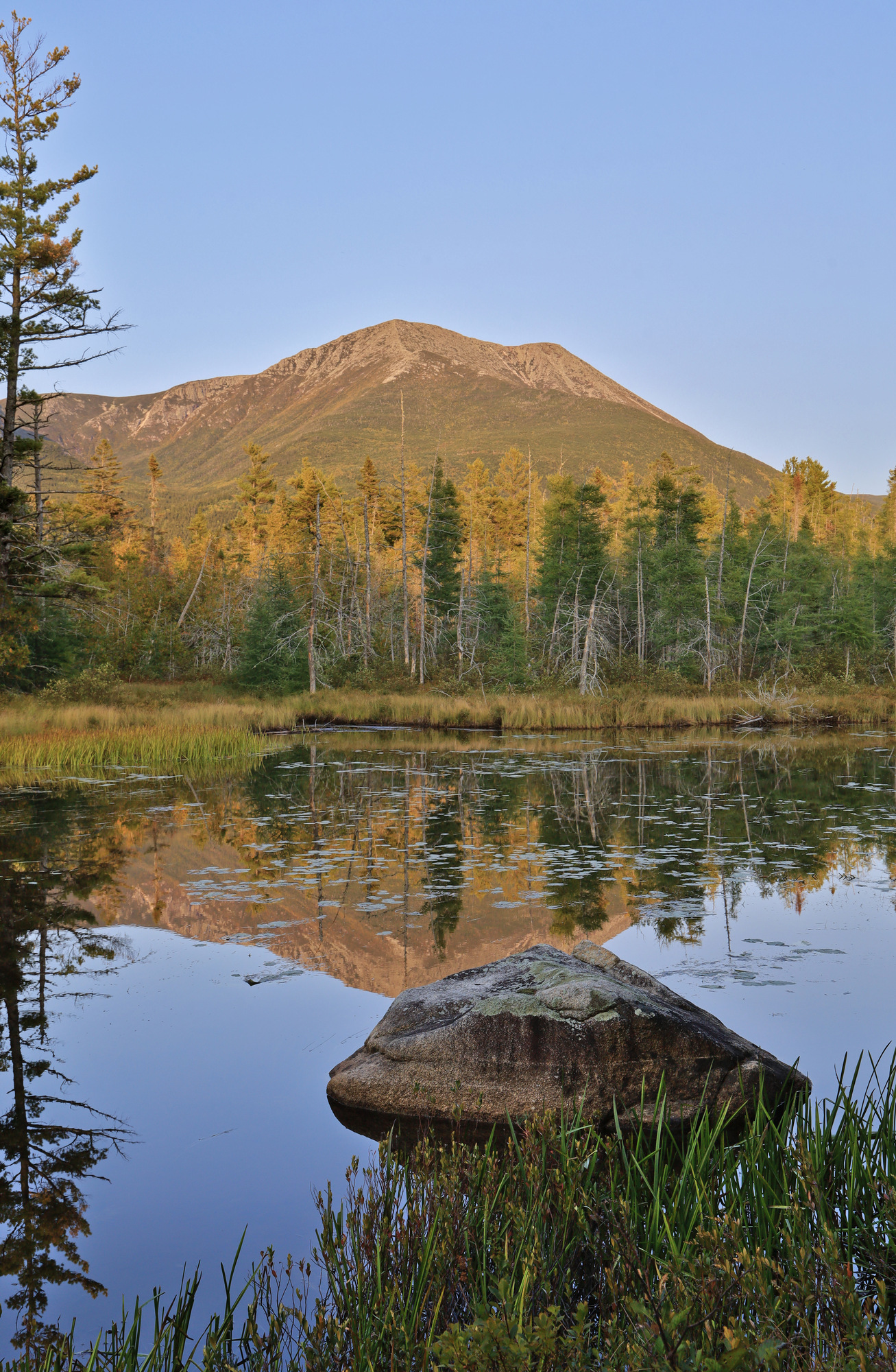
The clear highlight of the hike though was the string of little ponds I wove through. The images above are from Grassy Pond. The glassy water perfectly reflected the mountains glowing in the evening light. I’m sure my hiking pace was slow as I stopped every quarter mile to take in another incredible view. Throughout all of this I never encountered another person. Some day I will have to come back here just to explore these ponds some more.
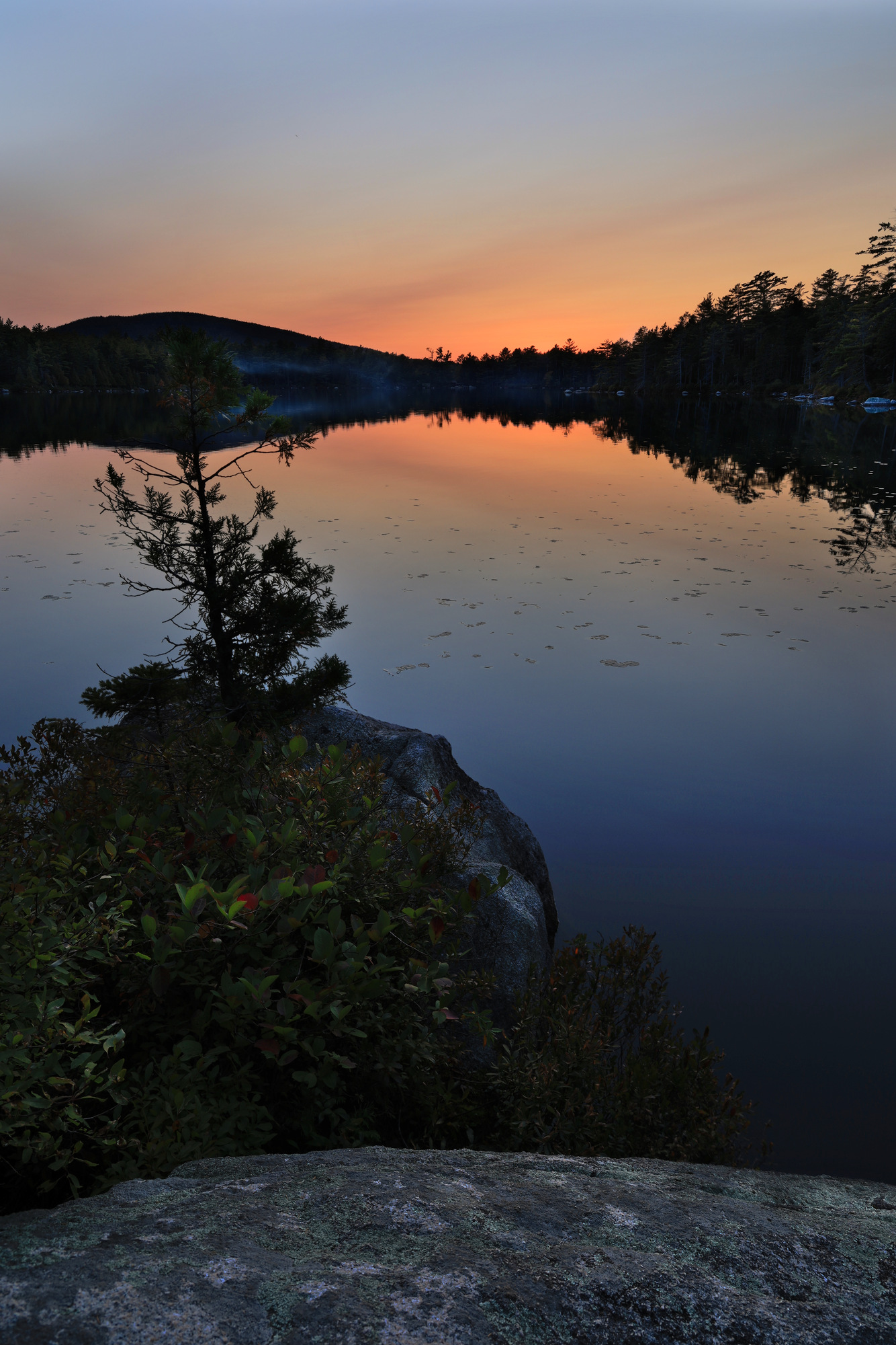
After weaving my way past Elbow Pond I ended up at Daicey Pond just as the sun was setting. Though I still didn’t run into anyone, I did see some signs of activity here. I could hear a few people cooking dinner at the campground at the end of the pond and saw the smoke from the fires floating just above the water. I also saw two people out enjoying the sunset in one of the canoes provided by Baxter. I tell you, this place has more to offer than any other state park I have seen.
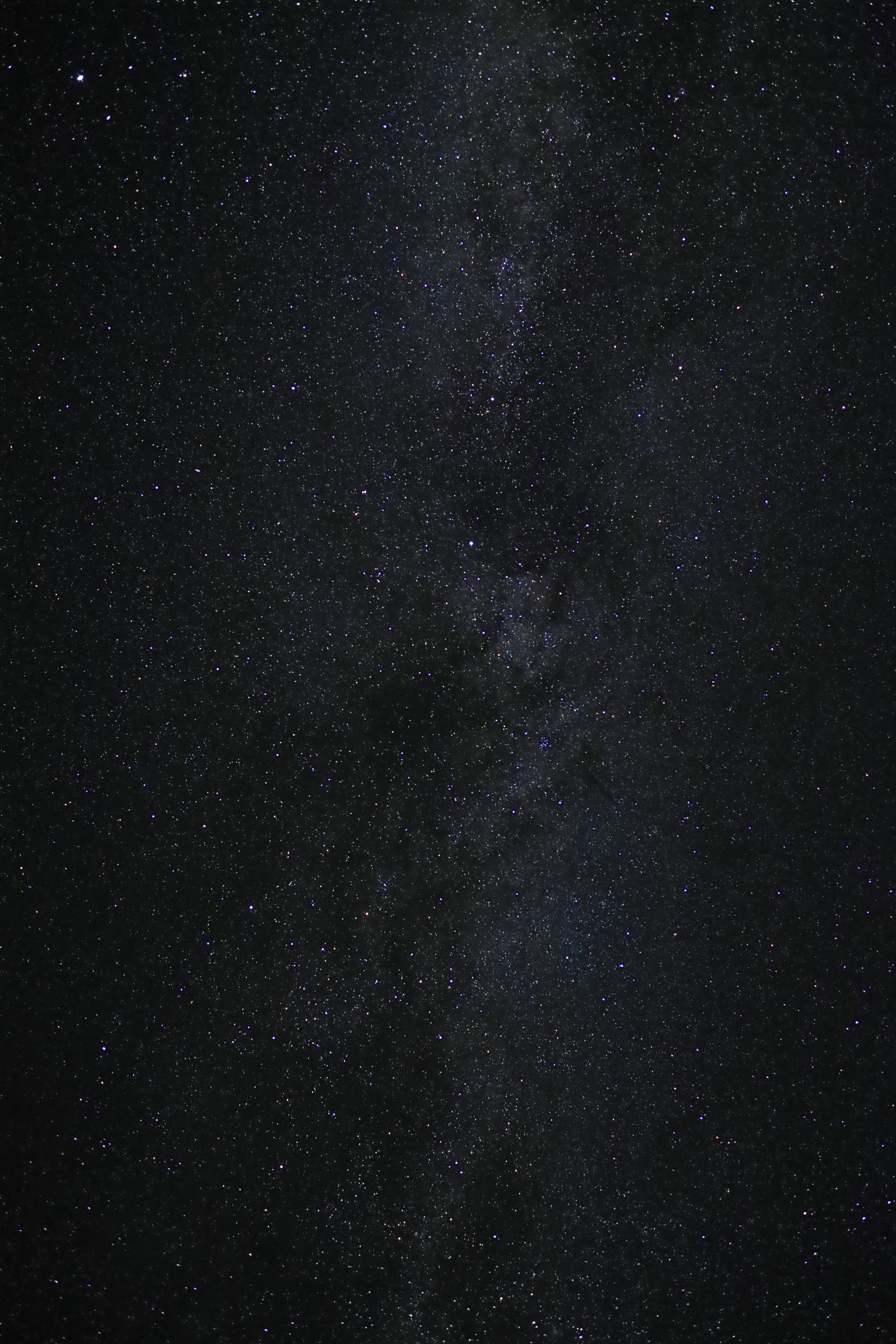
After the colors started to fade I pulled out my headlamp and headed back towards camp. The last mile of the hike went by quickly. Once back at my lean-to I put together one of my top backpacking dinners: tortellini. Once the dishes were washed and all of the food was safely hidden in the car, I stopped by the group campsite to see how the stars looked so far north. Once again Baxter did not disappoint.
One of our last boating adventures of the season this year was another trip out to Little Whaleboat Island. Our last trip out there was mostly focused on paddling and enjoying the water, so this time I spent a lot more time on the island itself. It turned out to be a fairly cool and breezy day, and the trees were starting to show more signs of the rapidly approaching fall.
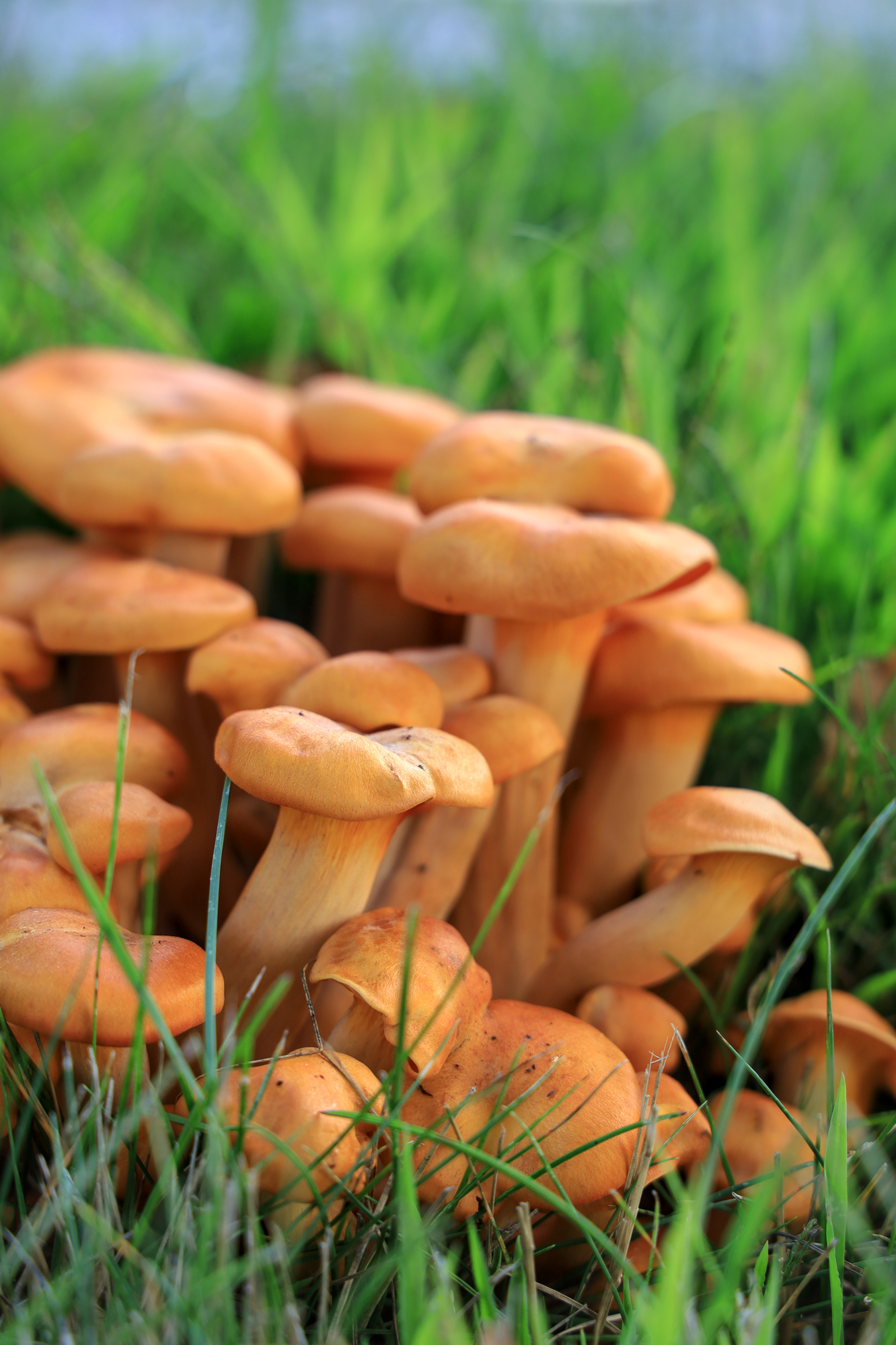
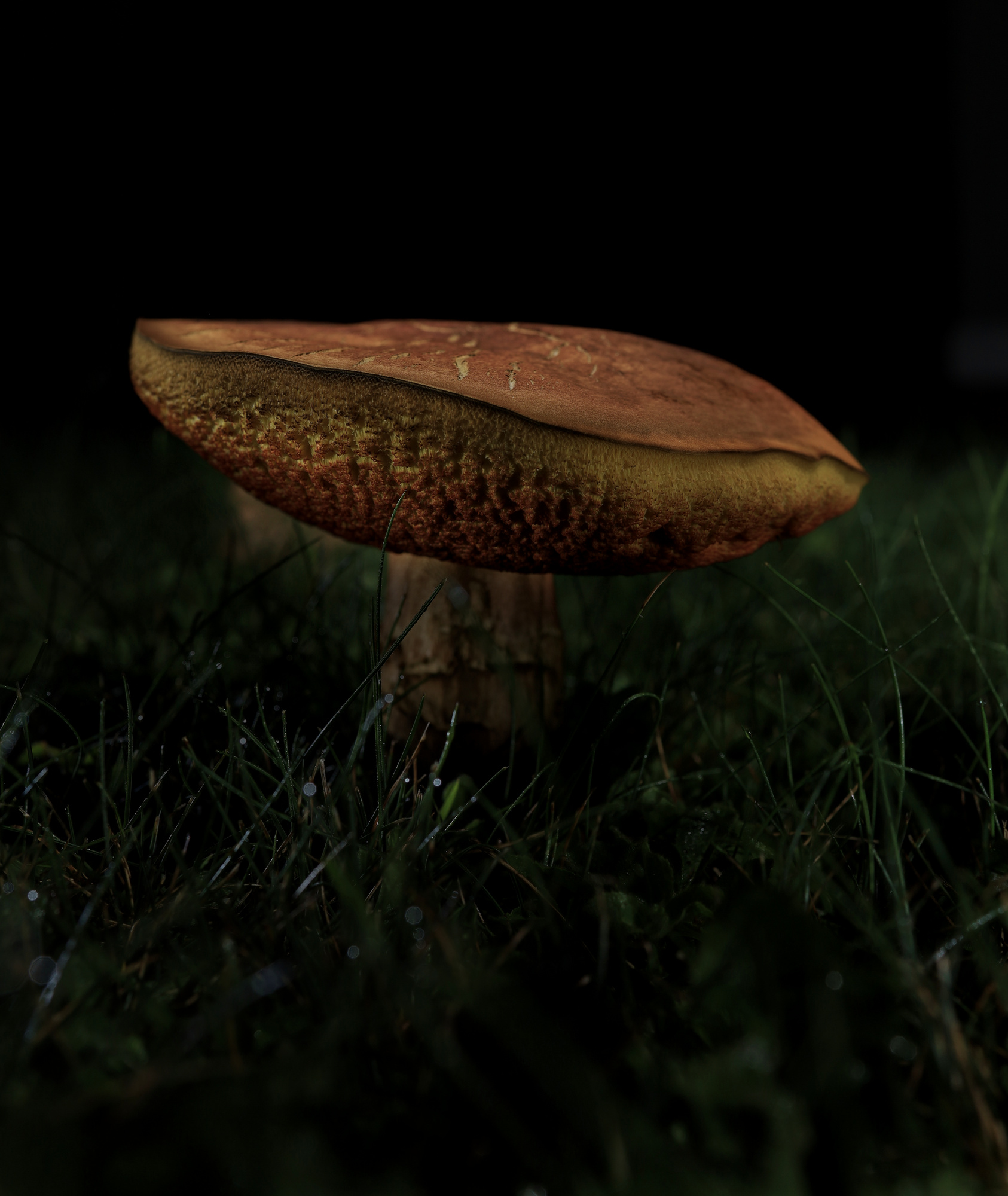
We anchored in a small cove we visited last time, and I tossed the kayak in to head toward shore. Given how late in the season it was, the island was completely deserted. I spent some time poking around the woods as well as the shore. In addition to the fall colors I found some wildflowers, and even what looked like flowering fungi.
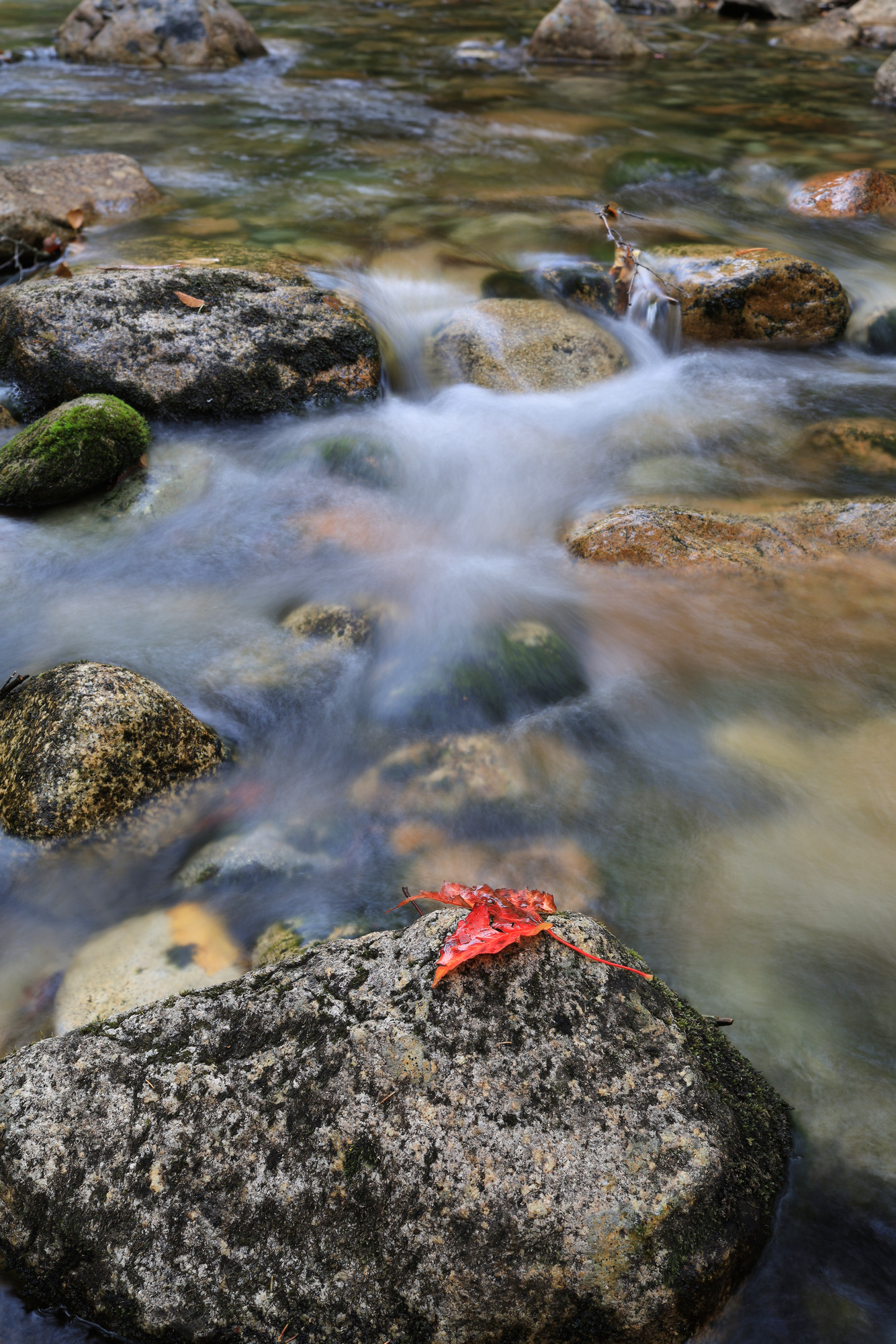
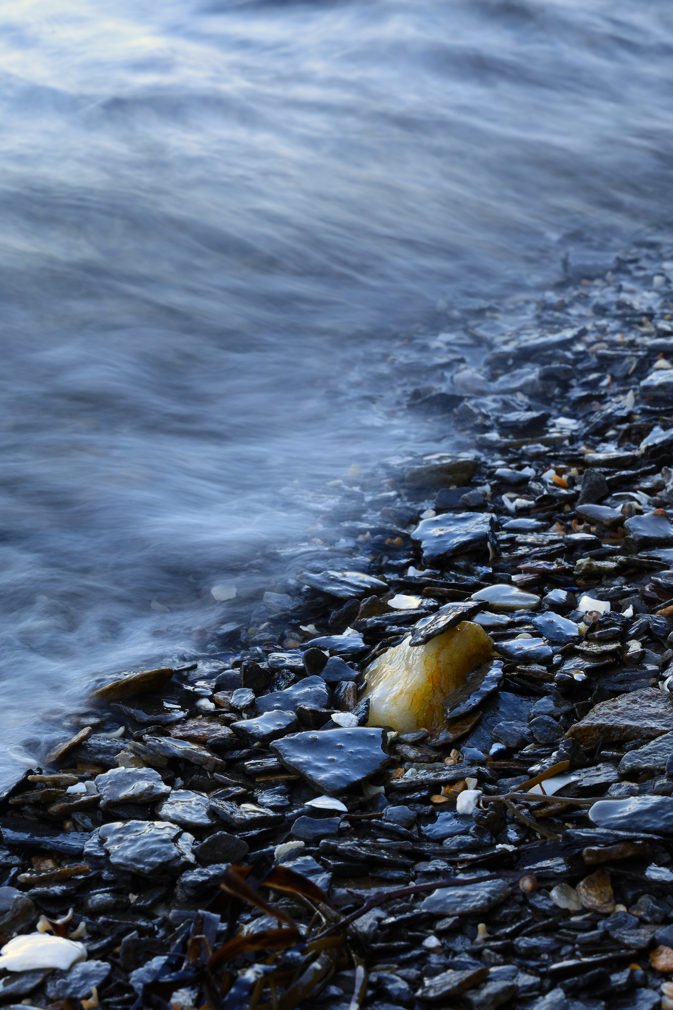
It was a bit of an overcast day, so I also stopped to have some fun capturing the waves in motion. I was particularly happy with how this one came out. I had actually set up this shot before a wave came along and perched the little flake on the tip of the piece of quartz.
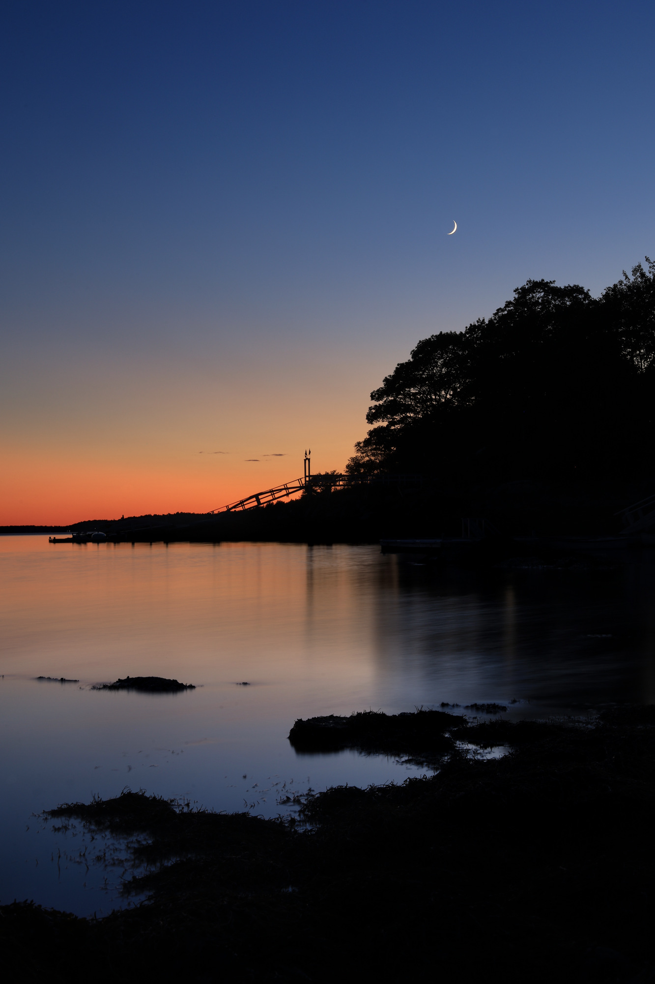
Later in the evening I took some time to capture some photos of the water after the sun had set. By this time the water had calmed almost completely, and the moon was chasing the sun down toward the horizon. The combination looked quite serene. Definitely a fitting end to the day.
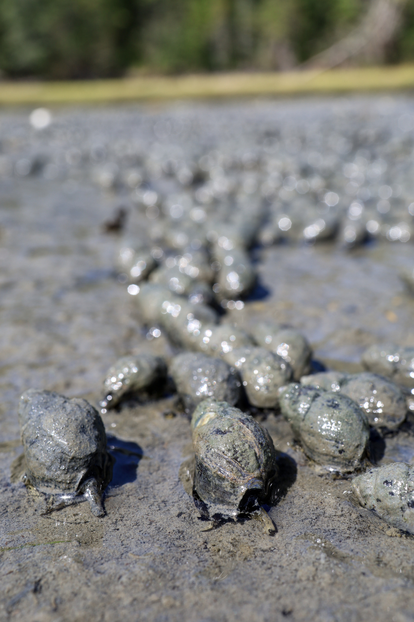
A few more ocean side odds and ends today. We went for a walk one afternoon down to the boat launch at low tide and spent some time poking around the tide pools. However, these snails on the mud flats were even more interesting. There were easily thousands of them. A herd of little snails all “running” towards the receding tide. They were fascinating to watch, and you could really see them making progress.
One of the other highlights was seeing our own effects of the California and Oregon wildfires. We had a couple days of strangely overcast weather with some very odd sunset colors. One evening the sun basically just faded out as it got lower until it was gone. It really drives home how bad it all was out west.
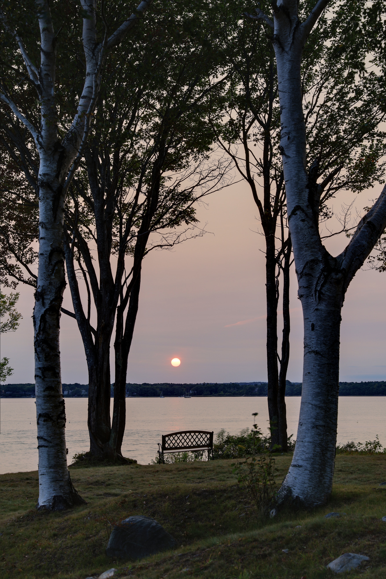
It wasn’t intentional, but our day started early. We woke up at around 5:45 AM, early enough that the sun wasn’t up, so we decided to head outside to watch it rise over the bay. It was a very peaceful and quiet way to start off.
It was a lot colder than we were expecting so early in the morning, but a warm drink and every layer we had brought up to Maine made it manageable. I don’t know why, but I always feel like sunrises have the best color. We had a really nice time taking that color in and watching it give way to a beautiful blue sky day.
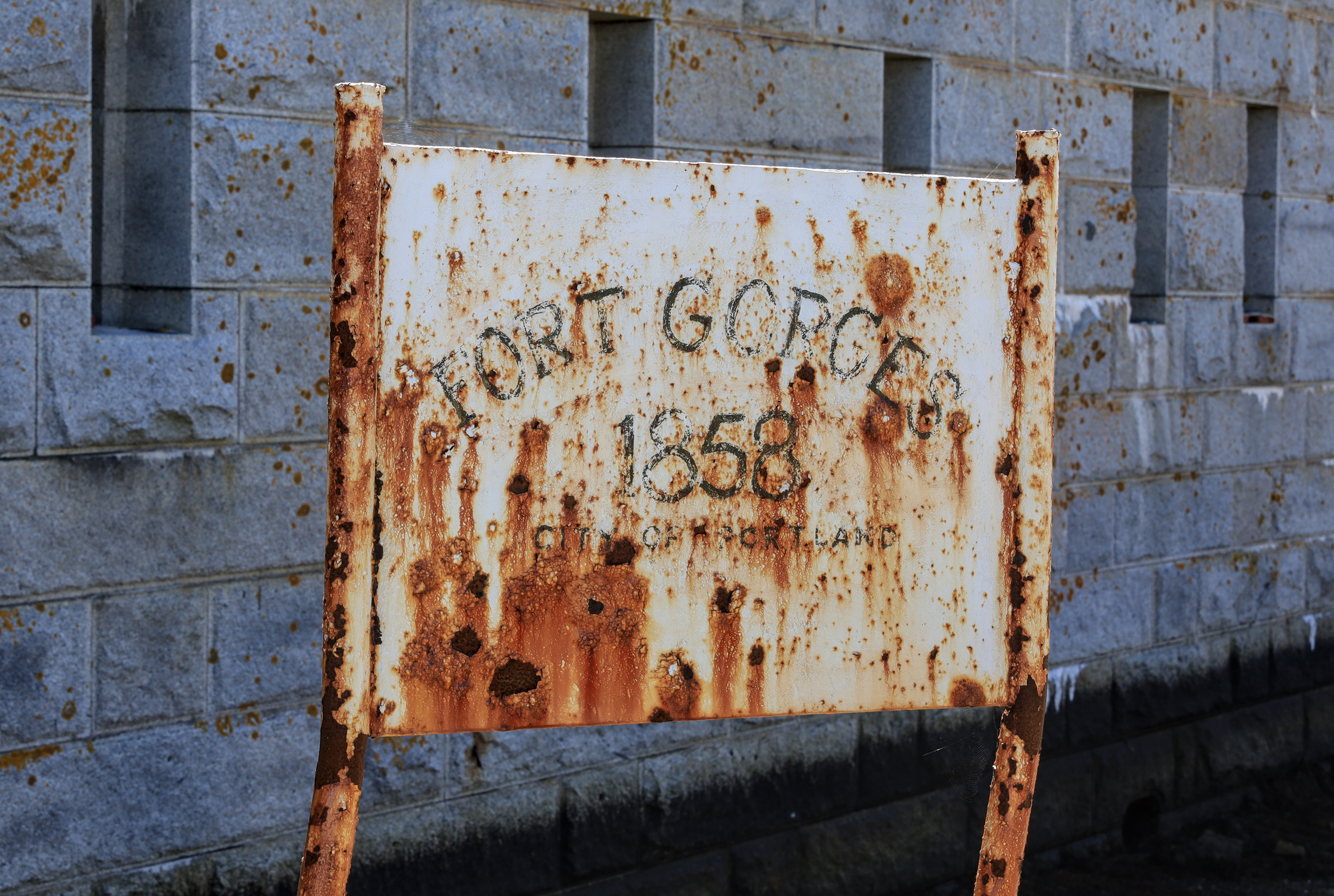
Once we had a chance to get some breakfast and pack a lunch, we packed the paddle boards on to the motor boat and headed to Fort Georges. The fort was built in the late 1800s in order to help defend Portland. It sits on a tiny rocky island right across the main shipping channel from Portland harbor. The ride down from Mere Point is about 15 miles, but it went by quickly. The perfectly calm water made it comfortable too. Once there we anchored and hopped on the paddle boards for the short trip to the fort.
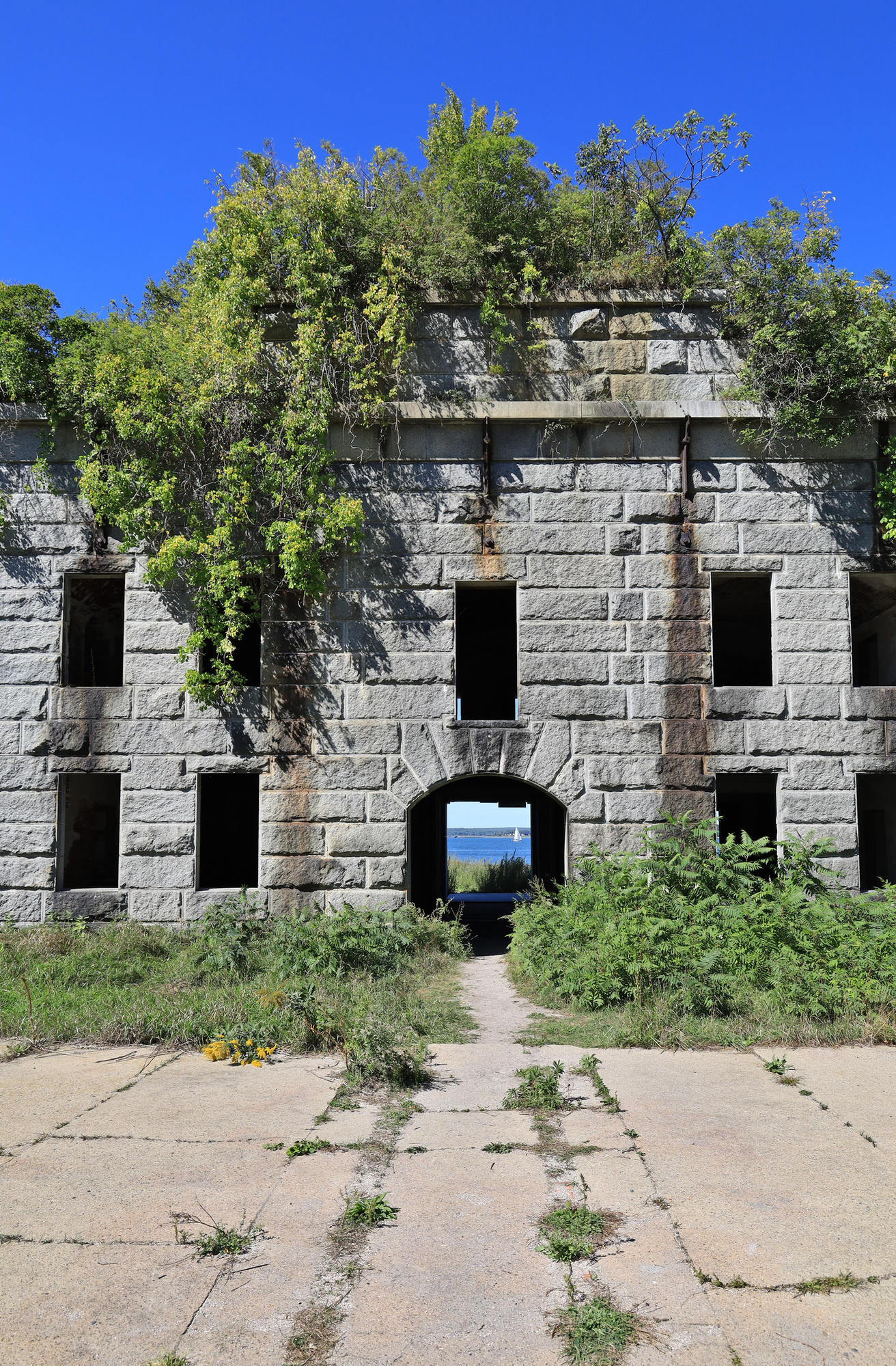
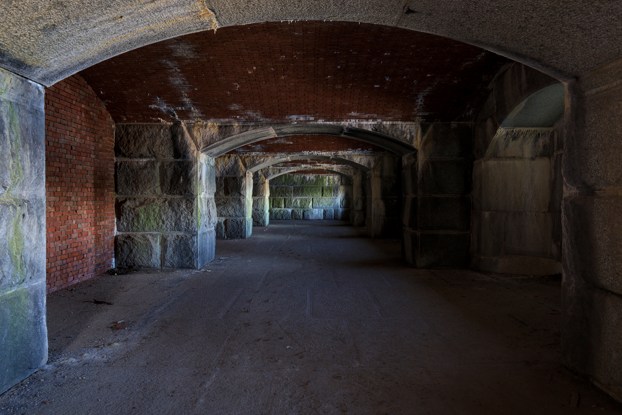
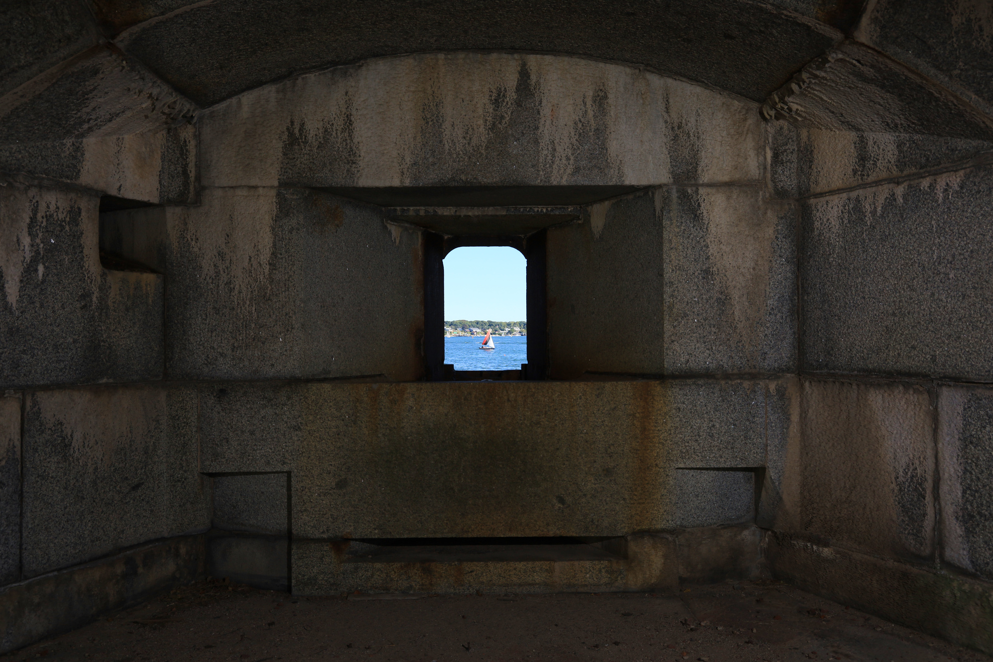
We spent about an hour wandering around the inside of the fort. The main structure is in surprisingly good shape for the age. Clearly solid granite makes a durable building material. Many parts of the fort were open to explore, including some of the living quarters, gun batteries, and powder magazine. The many tiny gun windows all had great views of the channels and boats around Portland.
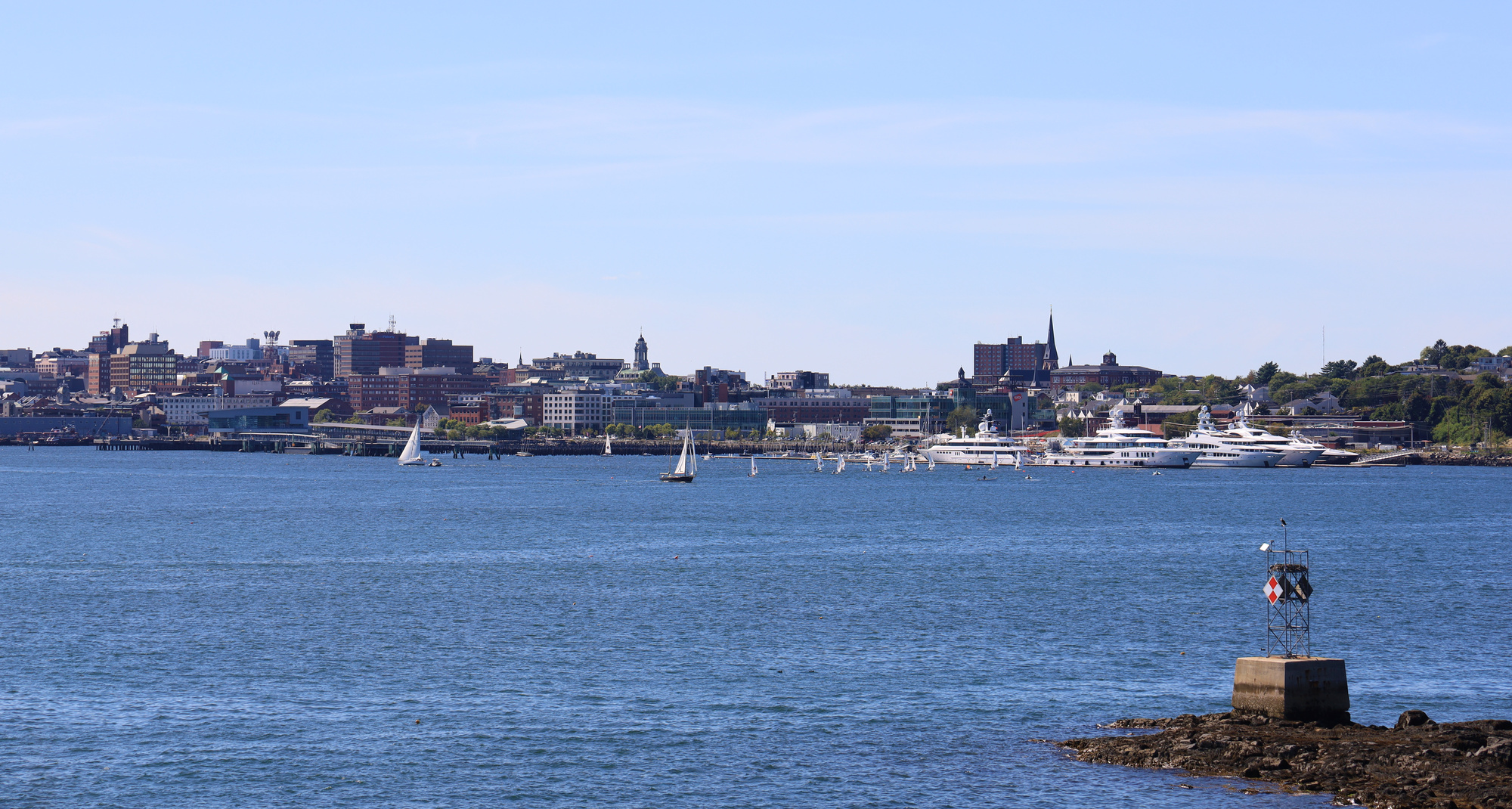
The highlight of the fort itself was probably the roof view. From here you had the perfect view of Portland itself, as well as the inside of the fort. This was also the home of the only remaining gun that we saw. Once we had our fill of the city view, it was back down the stairs and out of the fort.
At this point I wandered around the small portion of the island that was not part of the fort itself. Like most islands around here it is mostly rock and seaweed, but it was also home to a small sandbar. The sandbar is clearly the most popular place to hang out, and there were a couple of small motor boats pulled up on it while we were there. I had to pay attention though because the sandbar ended up completely under water while I took my photos. Fortunately it wasn’t too deep when I headed back to the paddle board.
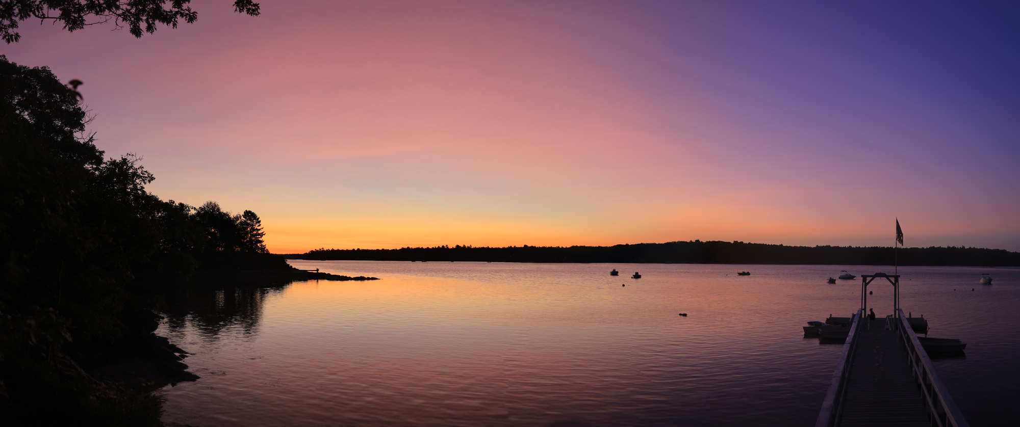
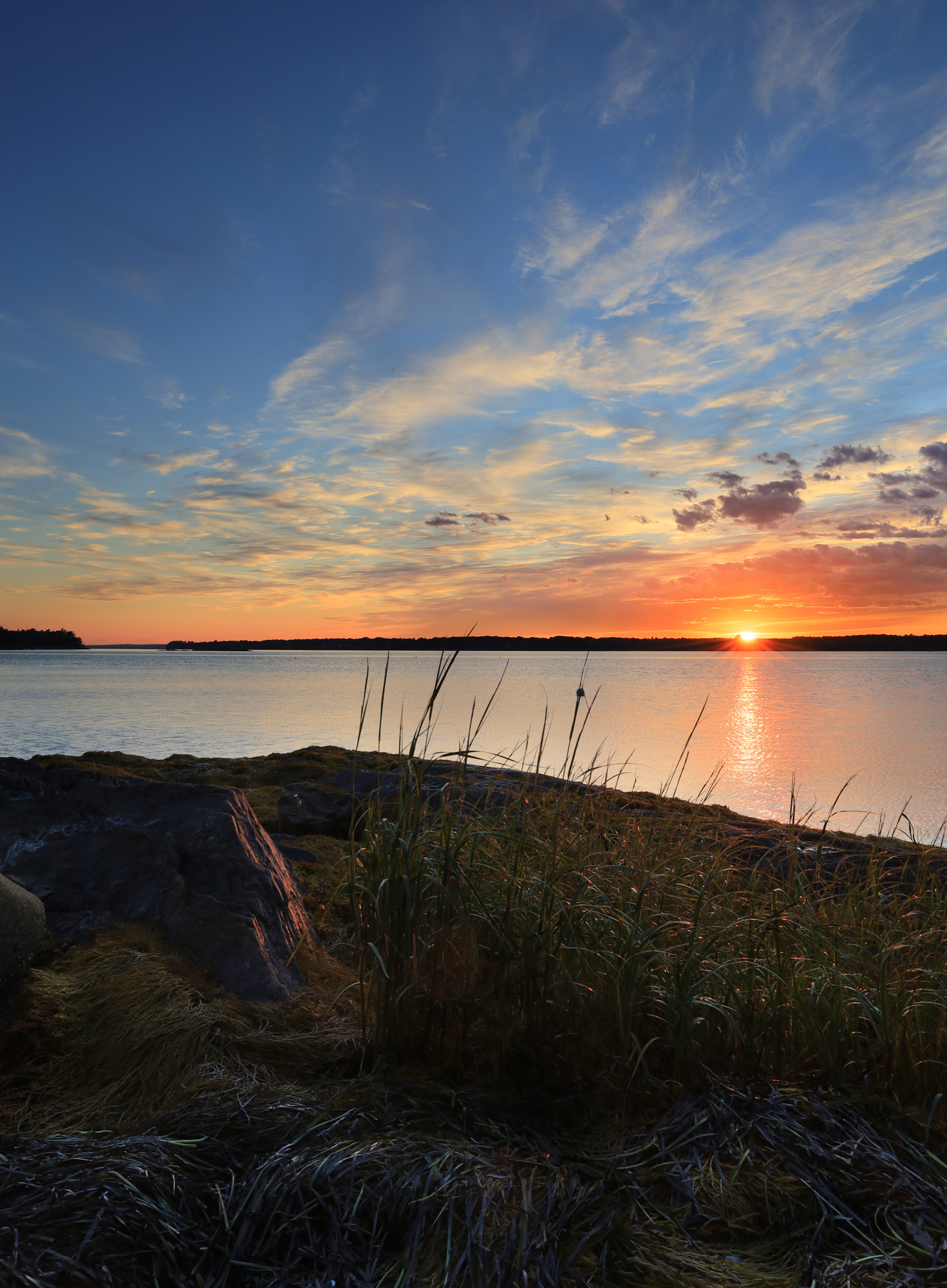
We ended up relaxing on the boat for a while and had a nice floating picknick lunch. With the wind starting to pick up a bit we made our way back towards Mere Point. Compared to the morning we had a low key afternoon, and even managed a nap to make up for the early morning. To close out the day we had a classic Mere Point sunset. All in all it was one of my favorite days of the summer.
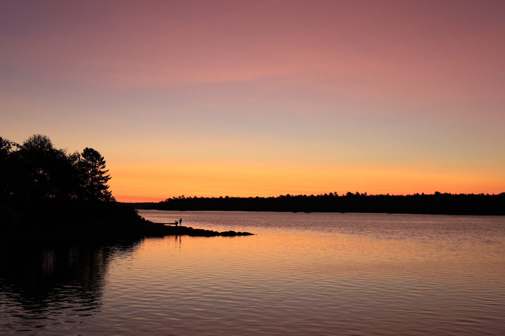
Today I have a batch of unrelated photos from our stay at Mere Point. As usual I spent plenty of time wandering around the point with my camera, so these are the odds and ends. As much of a pain as 2020 has been, the weather in Maine just kept delivering. The temperatures were very pleasant, the water was calm. This sunset summed up the days well.
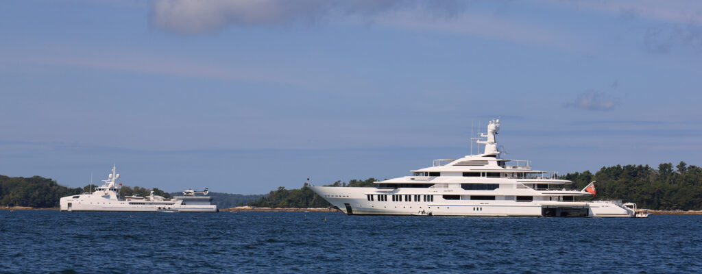
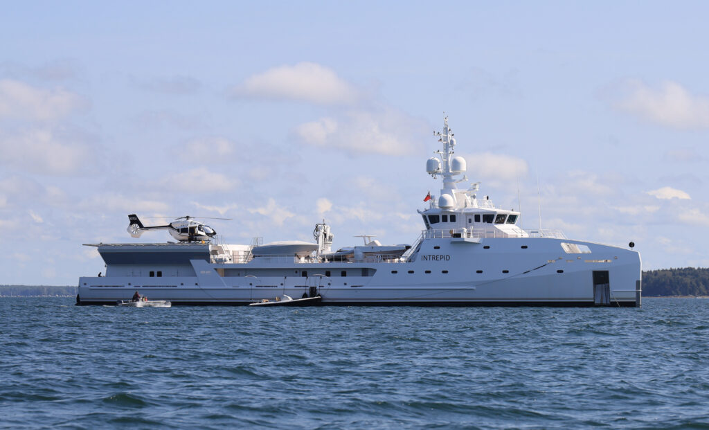
There were also some special guests on the bay while we were there. The Infinity and it’s tender ship, Intrepid, spent a couple days anchored between the islands within view of the shore. We took the boat out one morning to cruise around them a bit and get a closer look. These boats are shockingly large. It is hard to imagine having the means to own something like this. I guess I should just try founding a company like Harbor Freight…
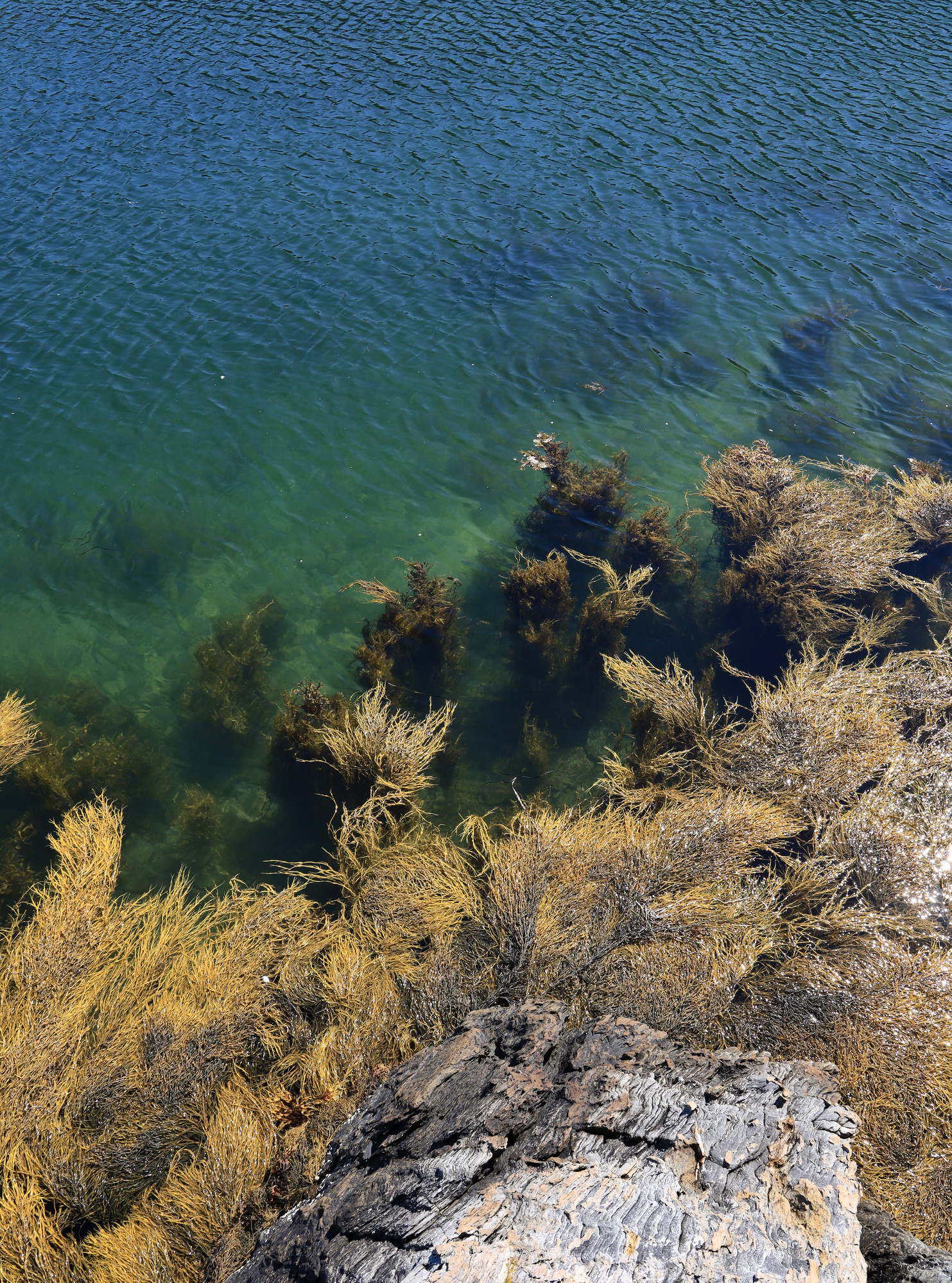
We returned to Mere Point late in the season this year to spend some more time away from home. To kick things off we headed out to a new destination we haven’t explored before, Little Whaleboat Island. We were fortunate enough to get a perfectly calm morning, so we put the paddle boards in the motor boat and cruised out. Once we got there we paddled around the shoals and rocks. It was a pretty interesting place for the paddle boards. You could easily see down into the water, and the rocks made for some interesting underwater sights. I couldn’t really get a good look at it from dry land though, so you will have to take my word for it.
After taking a snack break on the boat I paddled over to the island to do a bit of exploring and take some more photos. The island did not disappoint with some classic Maine coastal views. Once I had my fill it was back out to the boat so that we could head home for lunch.
charset=Ascii
charset=Ascii
Projection: Rectilinear (0)
FOV: 28 x 40
Ev: 14.21
Projection: Rectilinear (0)
FOV: 46 x 66
Ev: 13.21
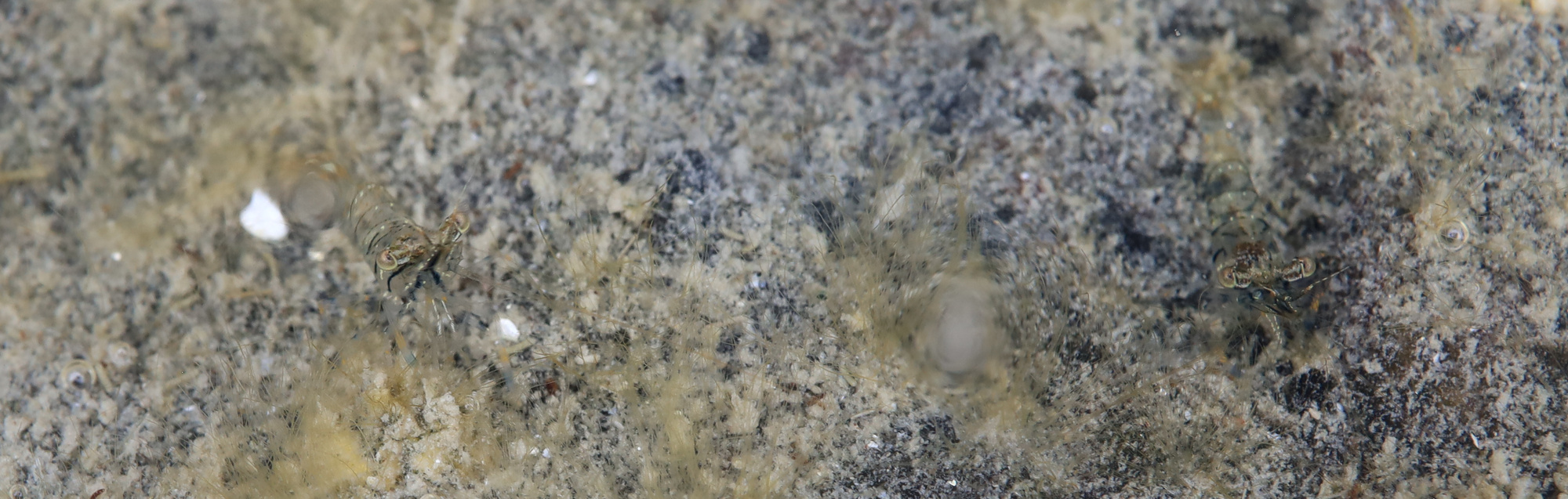
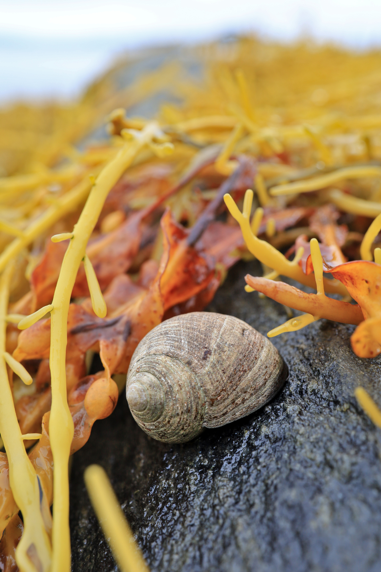
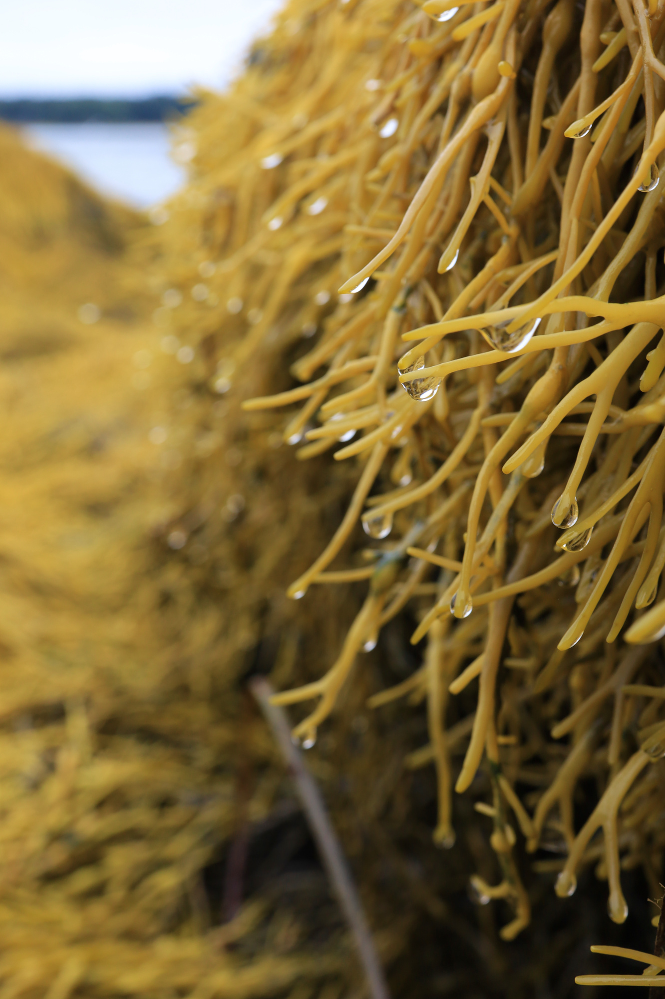
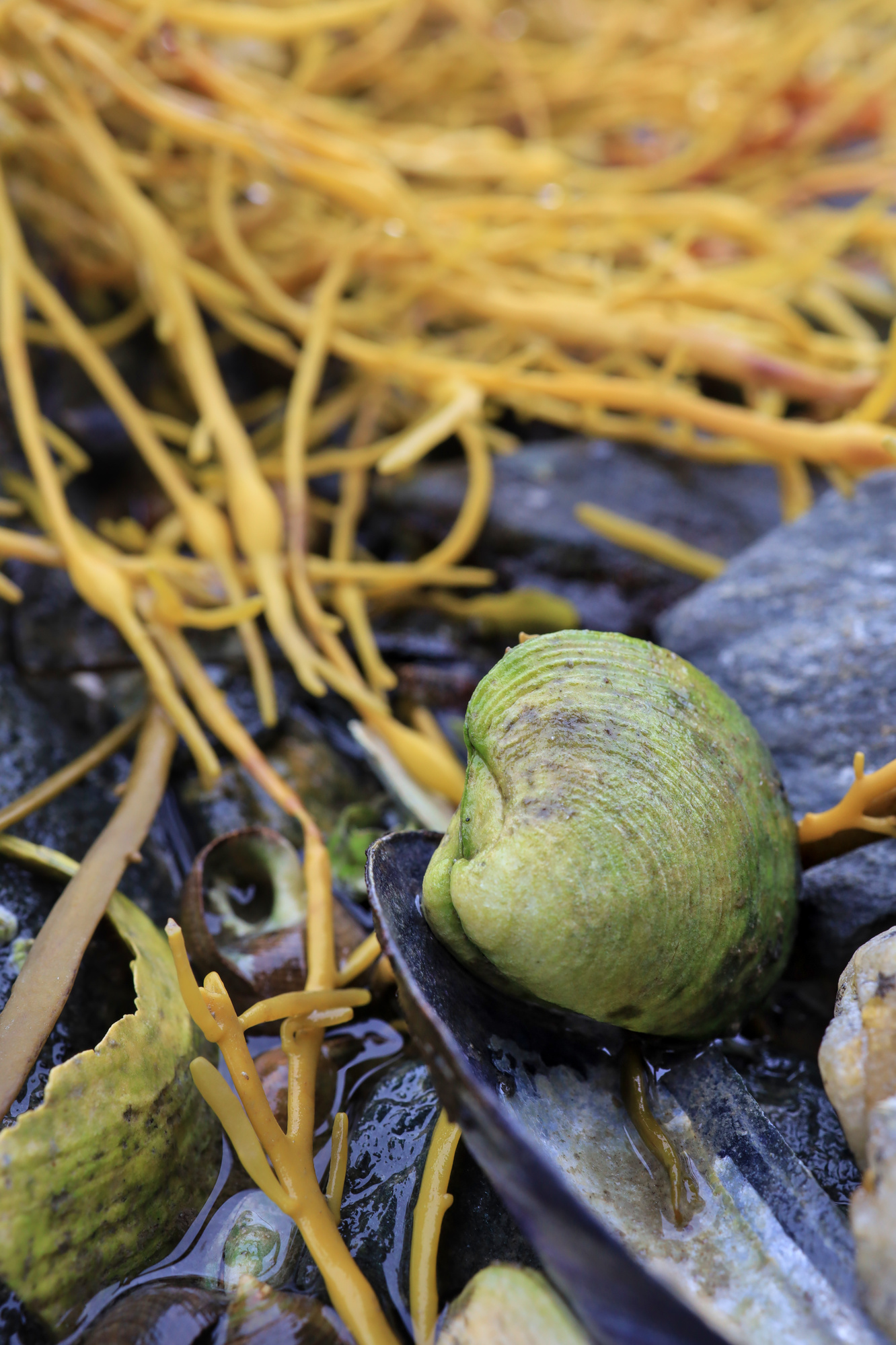
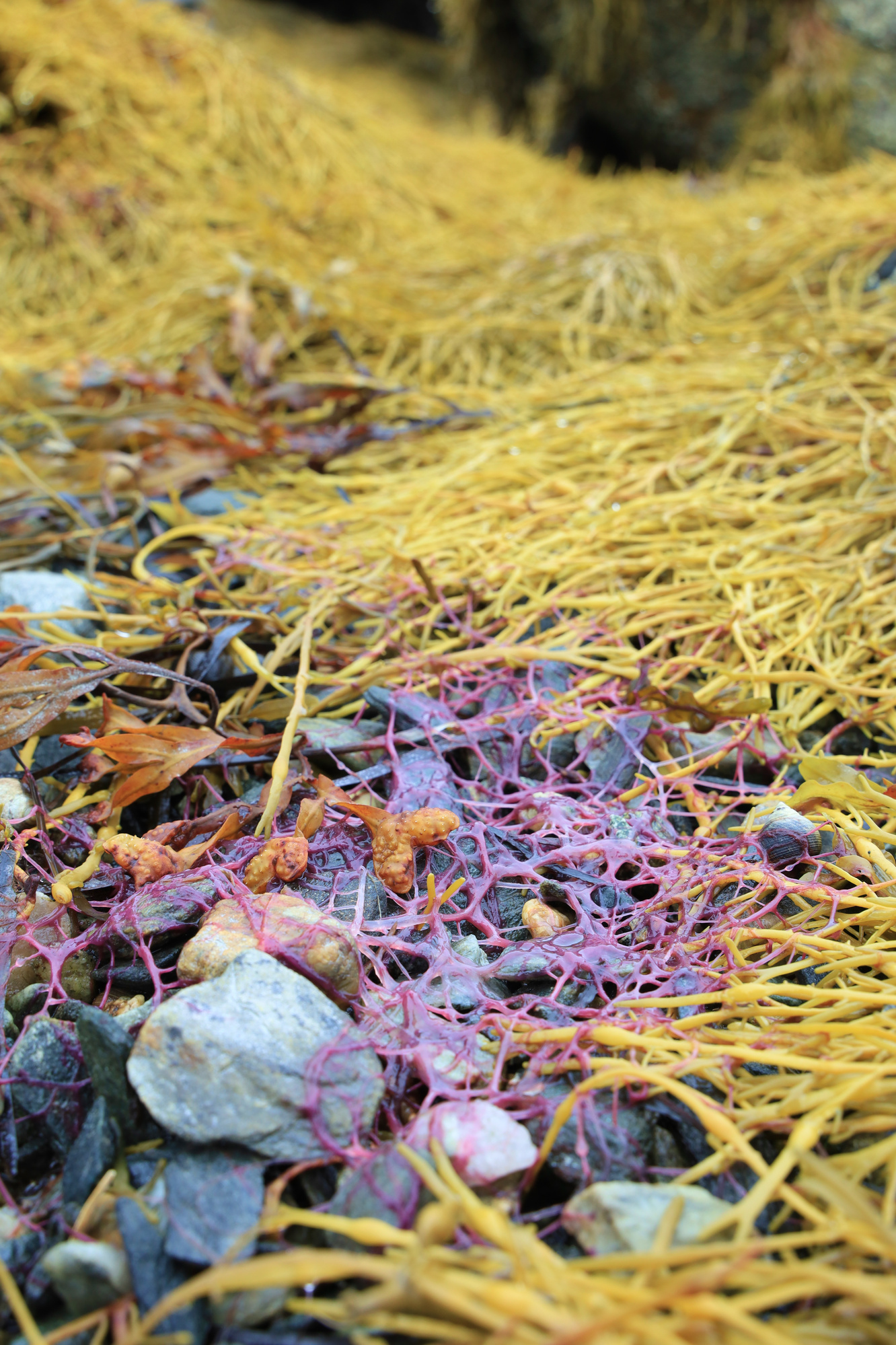
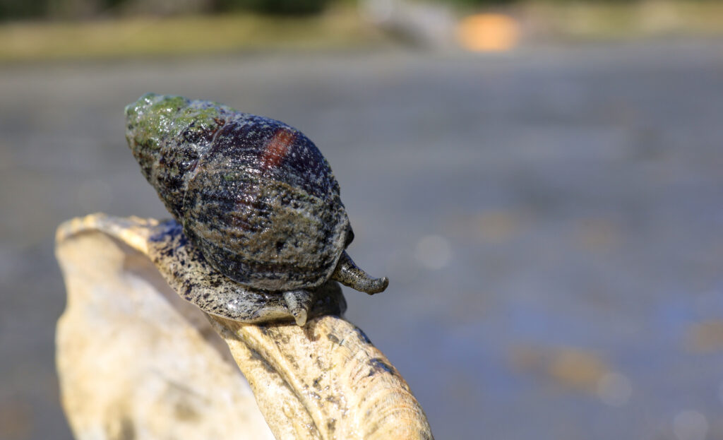
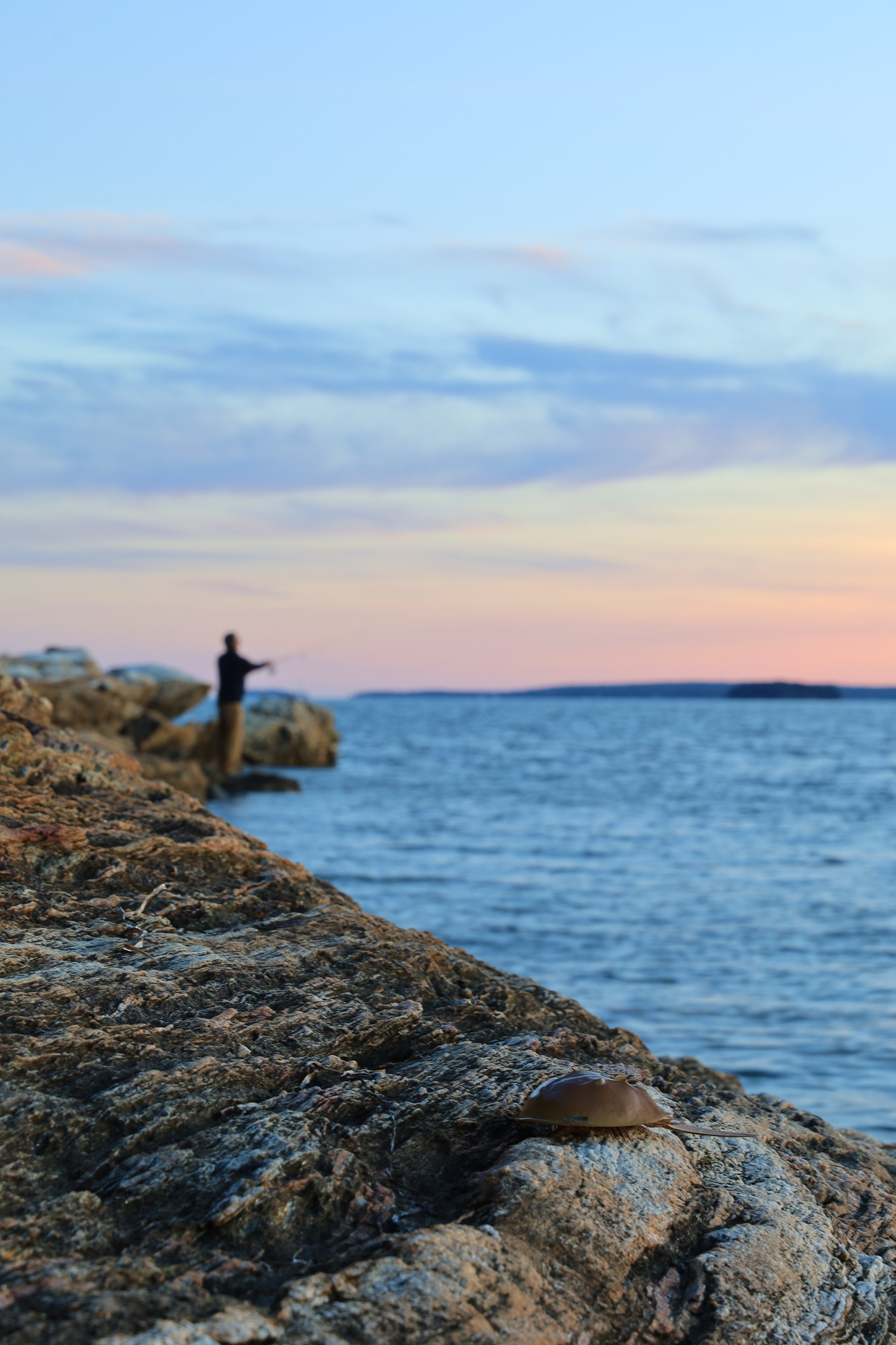
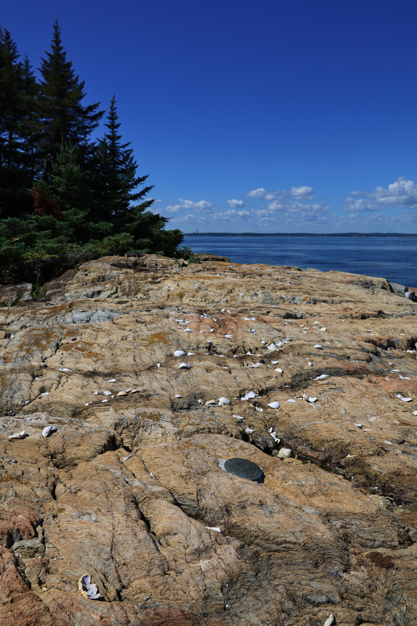
Given how much we enjoyed our first stay at Mere Point earlier in the summer, we decided we wanted to make a second trip up. We ended up staying for most of the month of September. One of the first weekends we were back up I went for a walk along the coast and took a number of pictures along the way. There were lots of classic sights along the way, including snails, clams, and seaweed. In addition though I saw a couple of more unusual sights. The one I found most interesting were some tiny translucent shrimp. They are incredibly hard to see, but there are actually two in this photo.
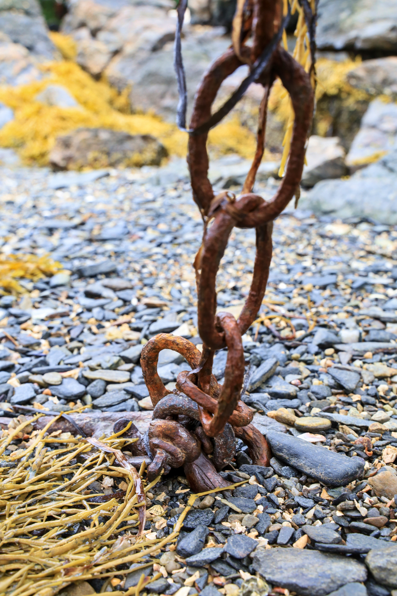
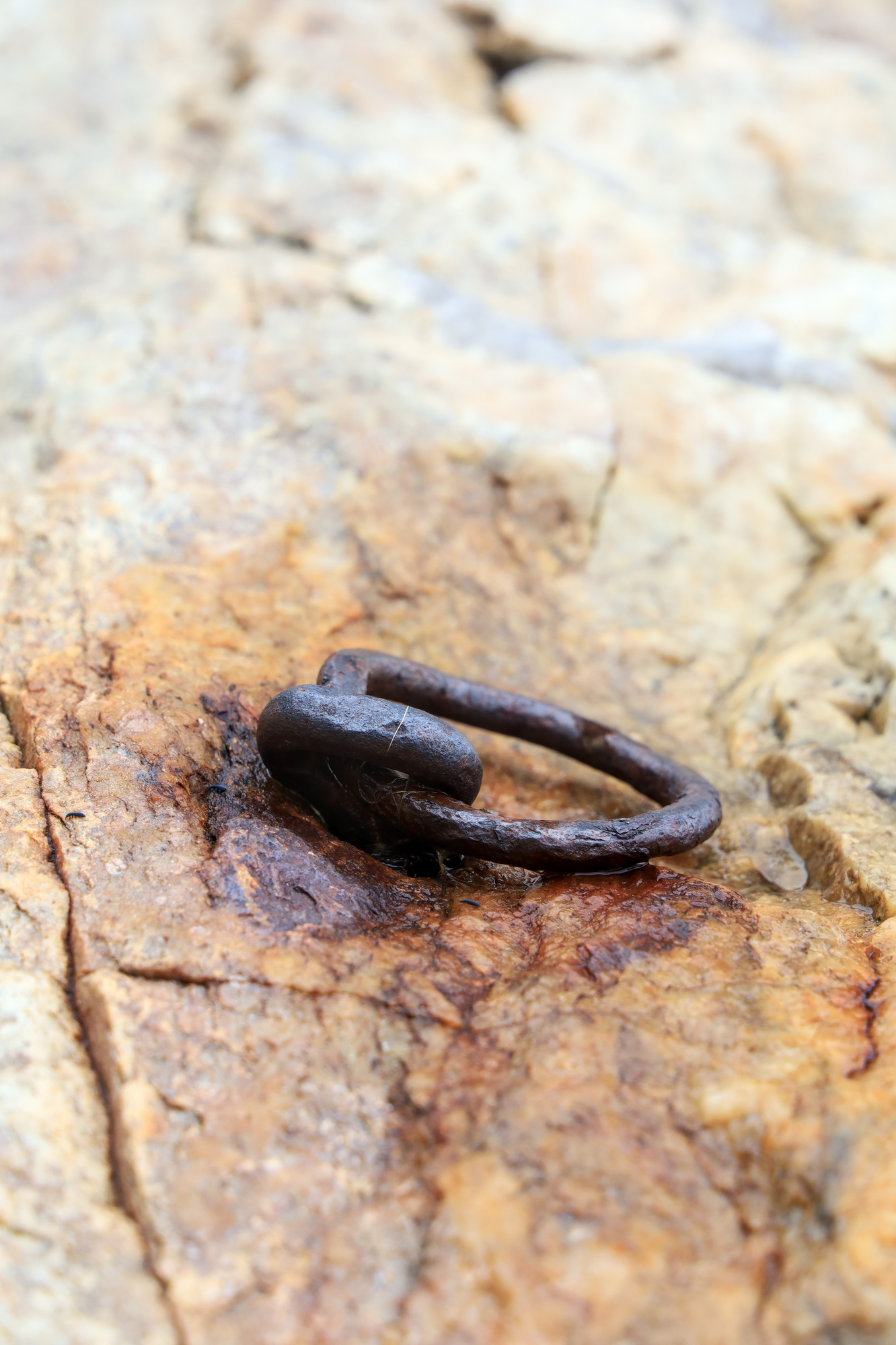
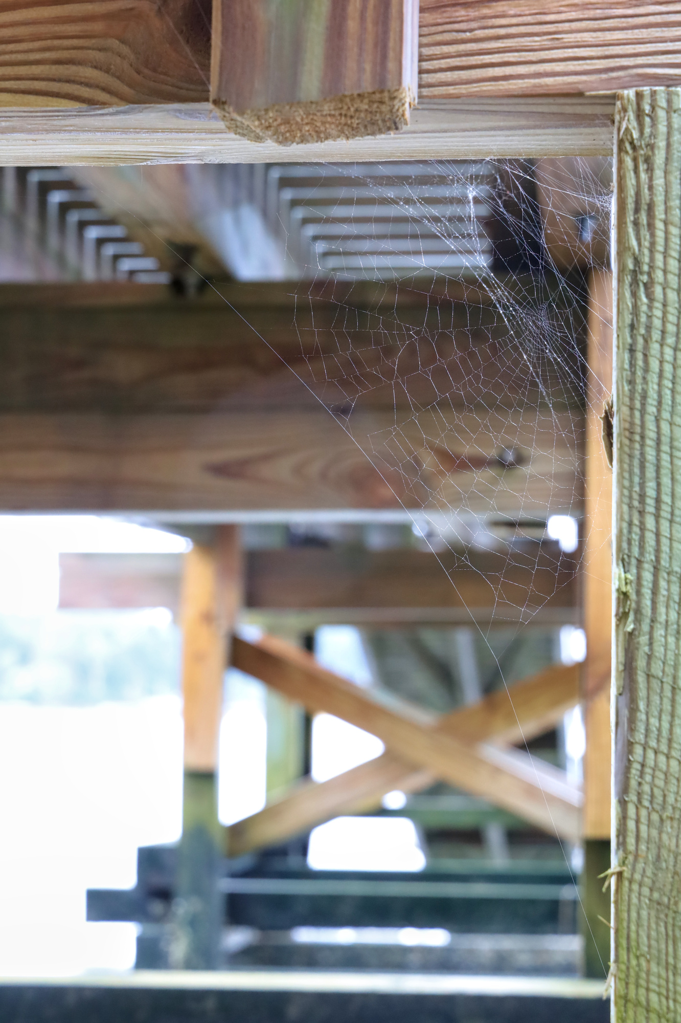
With the tide almost all the way out we also got to see the toll the waves and water take on the hardware holding the docks in place. I’m sure this chain used to be a lot more impressive looking, but these days it is pretty thin.
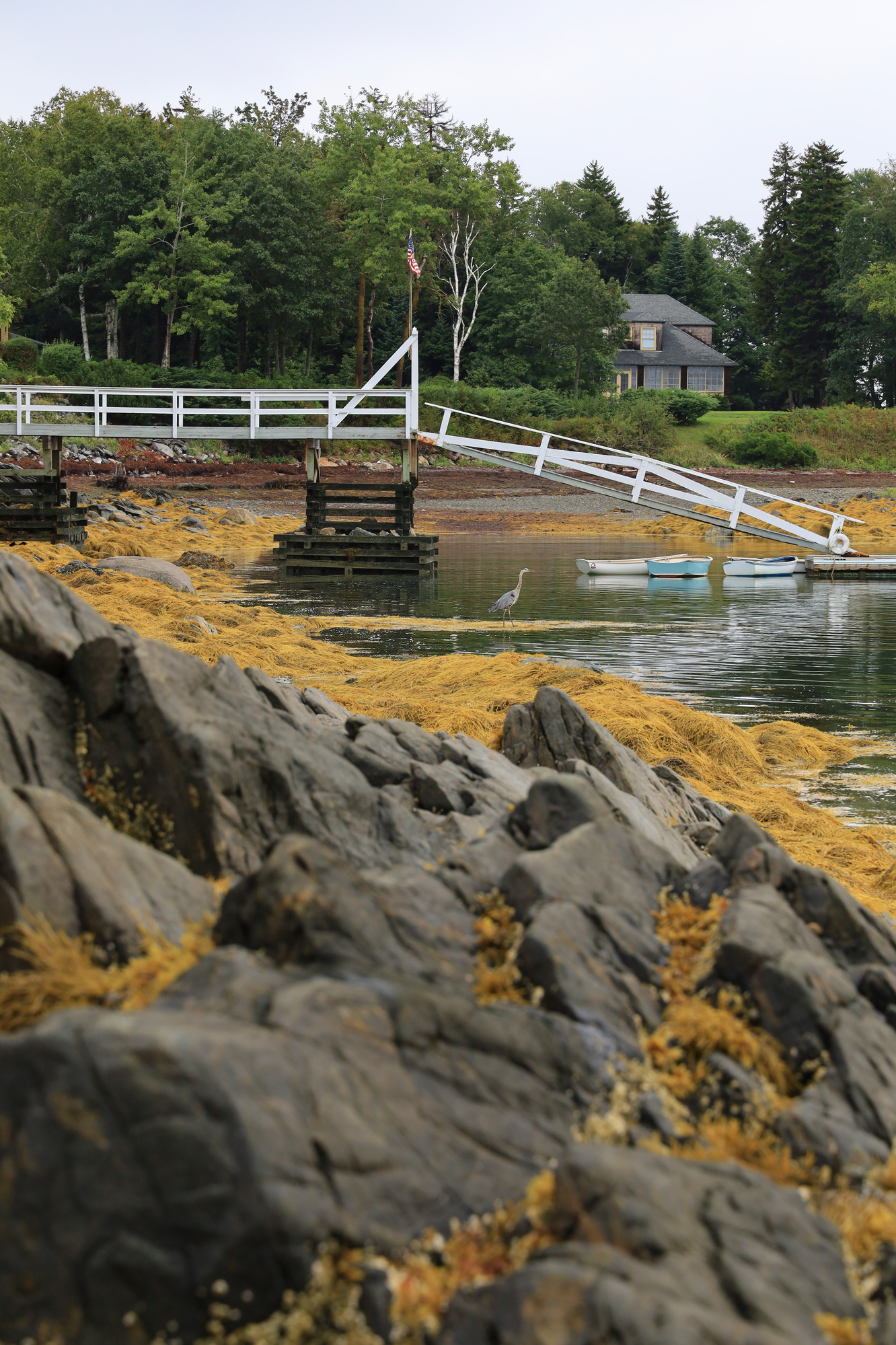
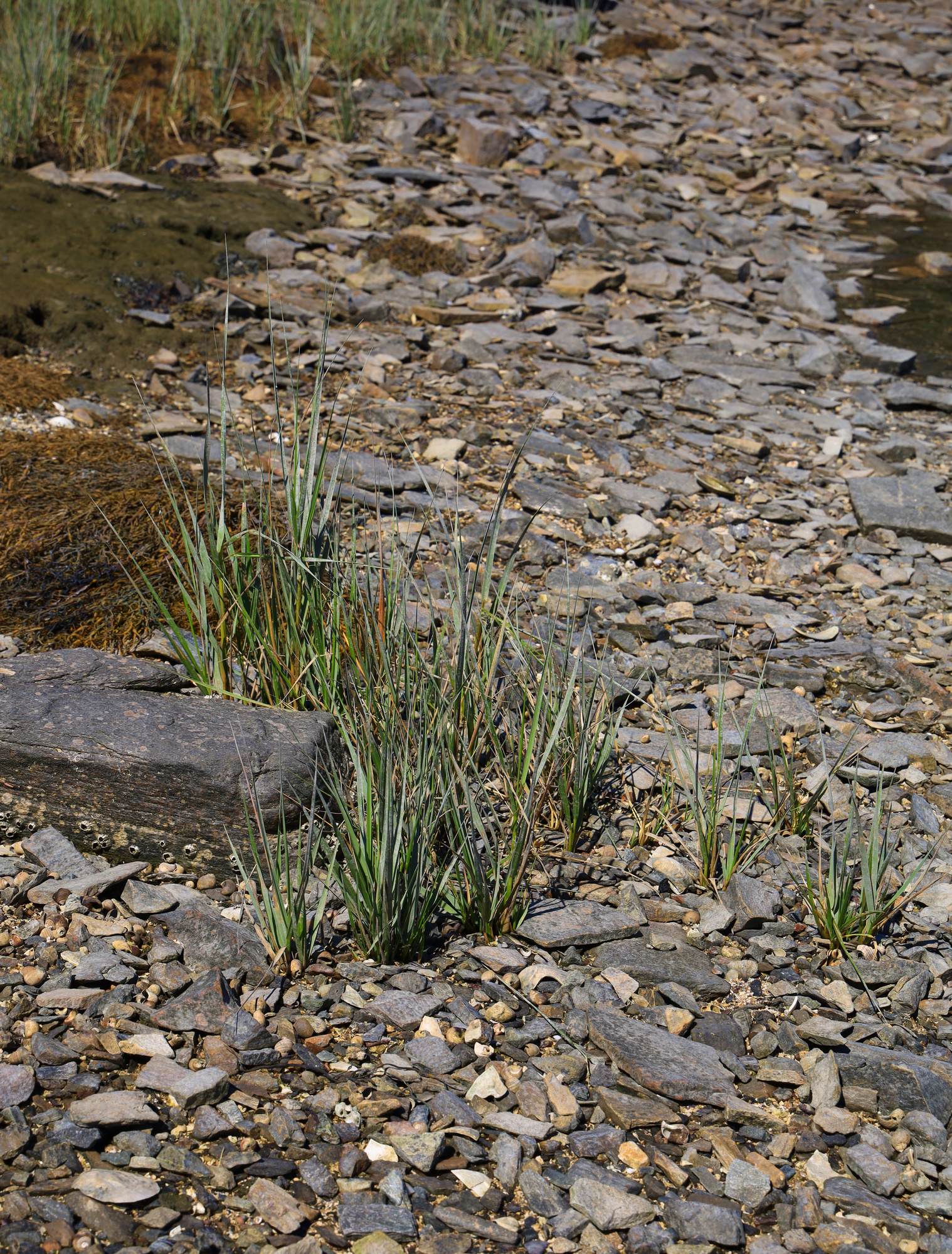
There will be plenty more rocky coast to come, but in the meantime, enjoy the rest of our walk!


FOV: 28 x 40
Ev: 14.21")

FOV: 46 x 66
Ev: 13.21")