At the beginning of day 4 we were 25 miles from our first camp and the magnitude of the canyon was starting to sink in. I spent the first couple of days on the river admiring how amazing the views were, but over time I became more and more impressed at how much they just kept coming. Day upon day of incredible scenery. Always changing, always a surprise, but never dull.
The group floating downstream on the morning of our third day with many layers of rock on display
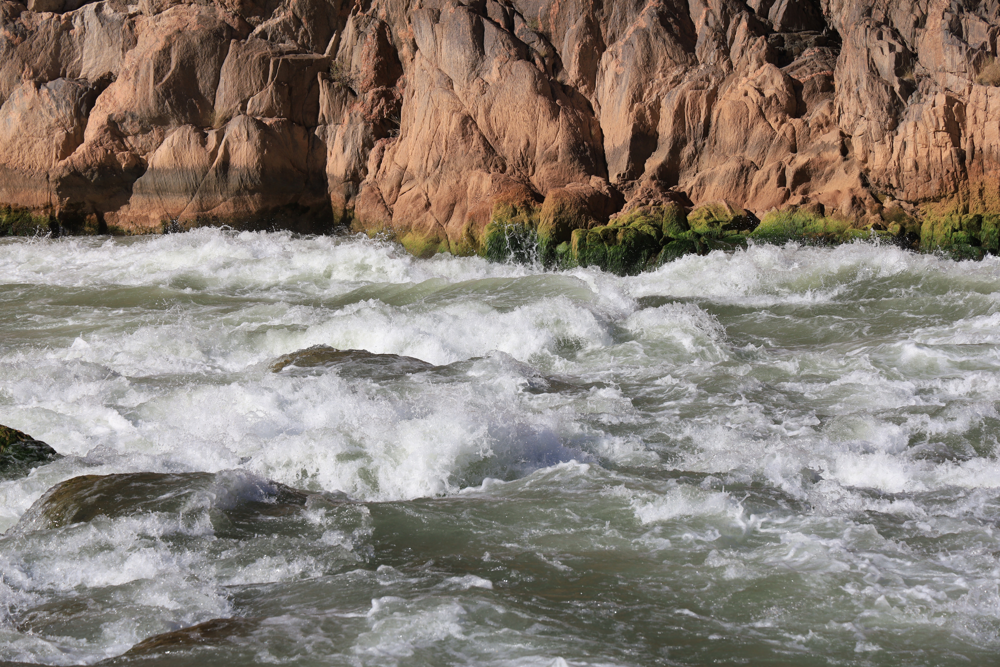
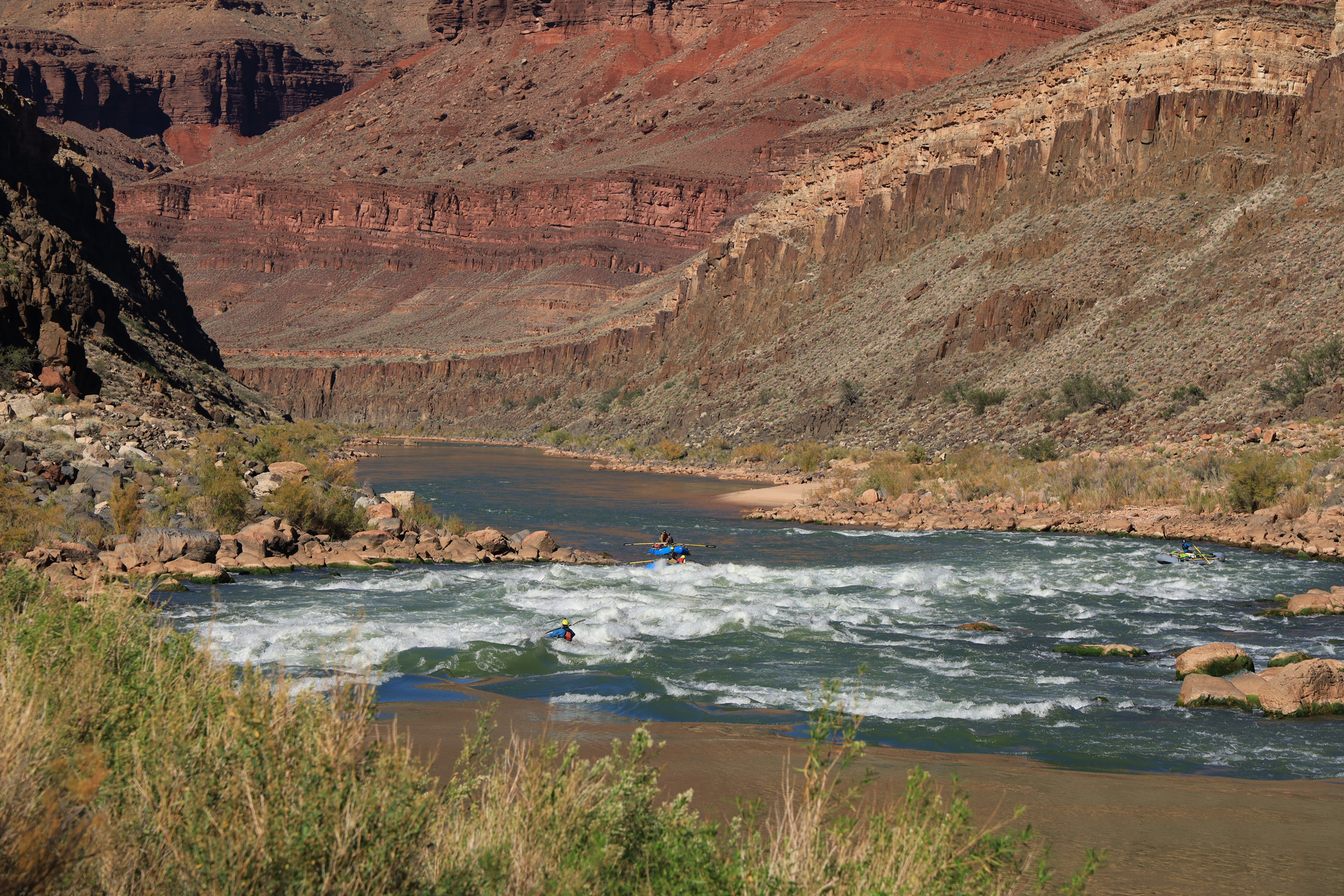
Day three was another great whitewater day, with 6 big rapids. The highlight for me was Deubendorff, a fairly long and more technical rapid. The line I took at the bottom was particularly fun, around some big holes. I later heard from the other rafters that I disappeared into the troughs of the waves a few times, only to pop back up as I crested the next one.
Dropping in to the upper section of Deubendorff Rapid
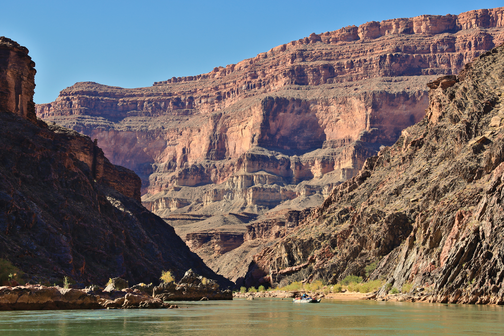
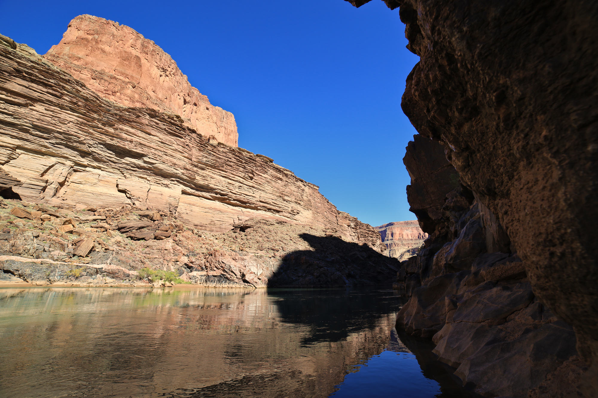
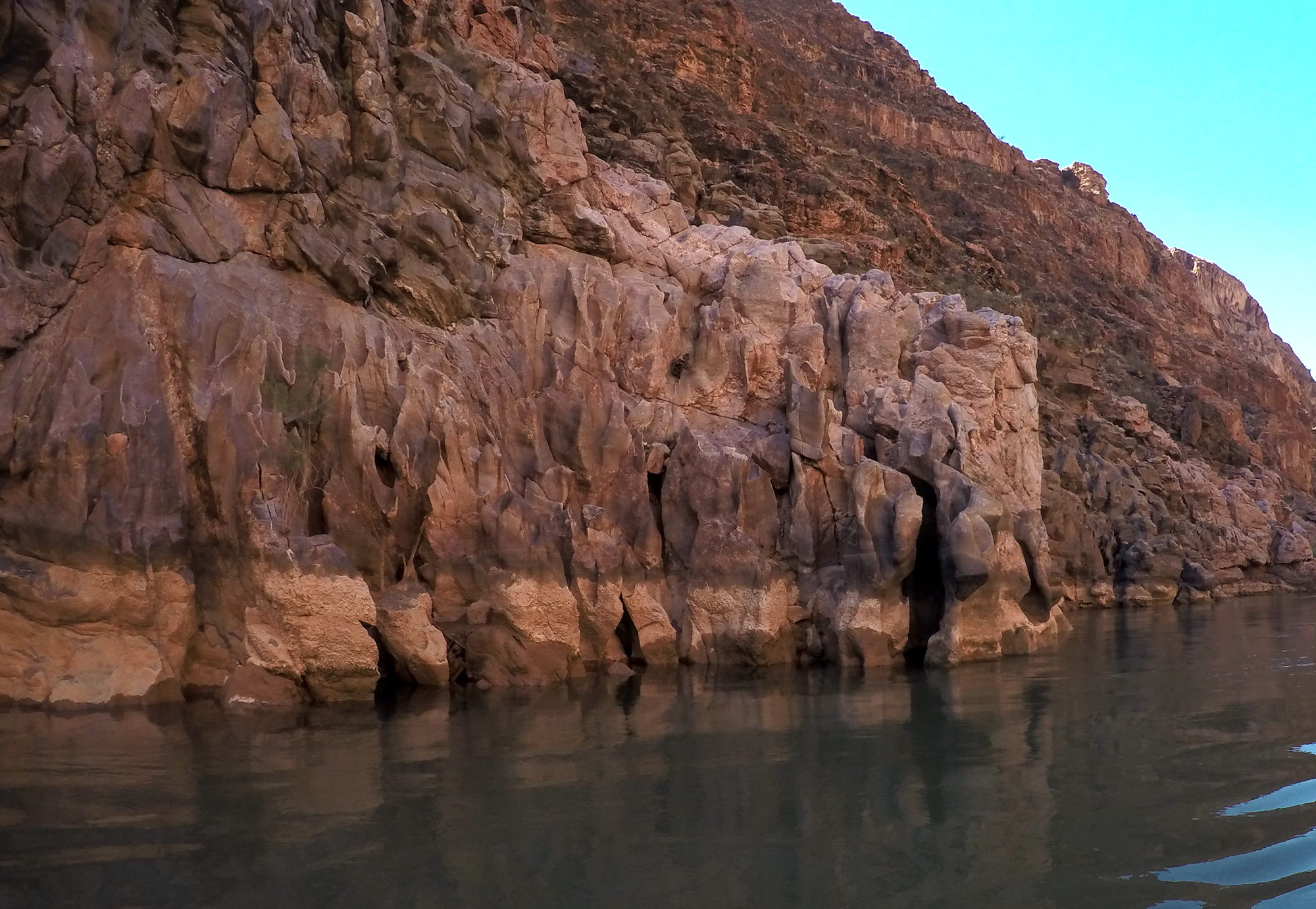
After 14 miles we stopped to drop off one of the rafts and my kayak to set up a shuttle for a big hike the next day. More about that next time. From there we floated on the remaining rafts through the granite narrows, the narrowest portion of the canyon. It was a very neat spot, with deep calm water and tight walls all around.
Looking upstream from the granite narrows
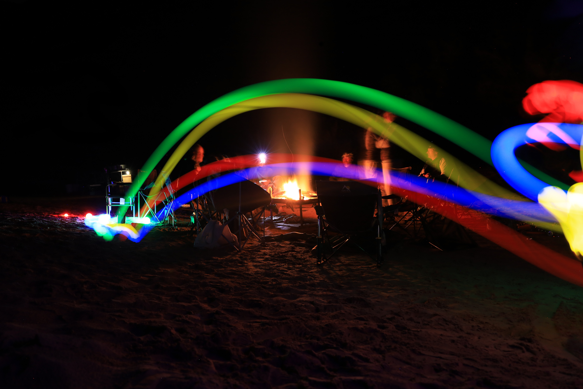
We stopped that evening just downstream of Deer Creek at OC Camp. It was a big sandy beach with tons of room for our kitchen, fire pit, sleeping areas, and a few games of bocce with some light up balls. Micky ran away with all the victories that evening, but I did get some cool photos along the way.
By my third day in the canyon I was starting to figure out some of the tricks to packing my gear and getting organized. I started putting more and more of the things I might want during the day into the kayak, and also moved a couple of things I would want after breakfast (like my toothbrush) into my ammo can that would be accessible all day. These optimizations let me get my big bags packed earlier so that I wouldn’t be holding up the group when packing the rafts.
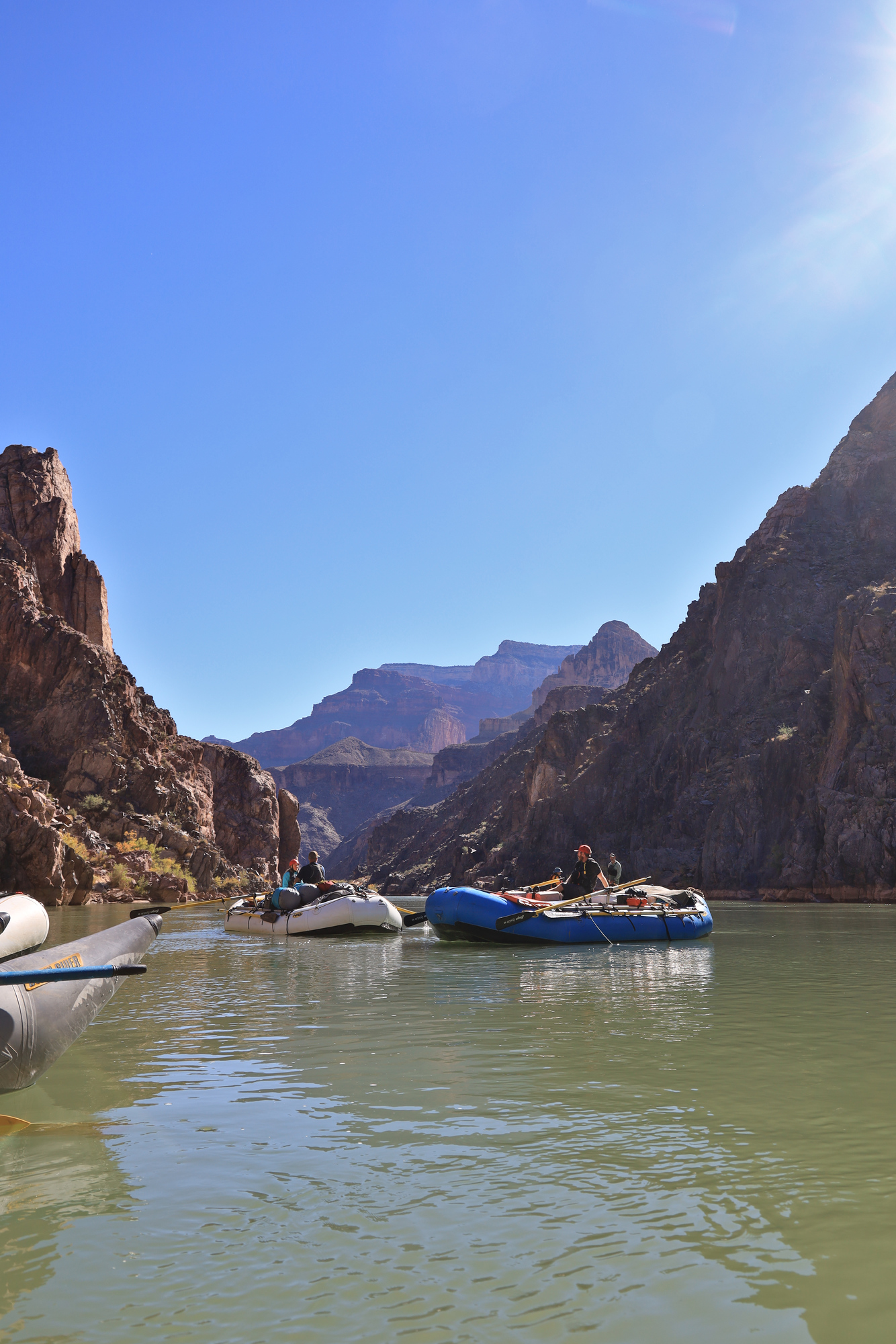
Watching one of our rafts float downstream
One of many rock pillars visible as we drifted by
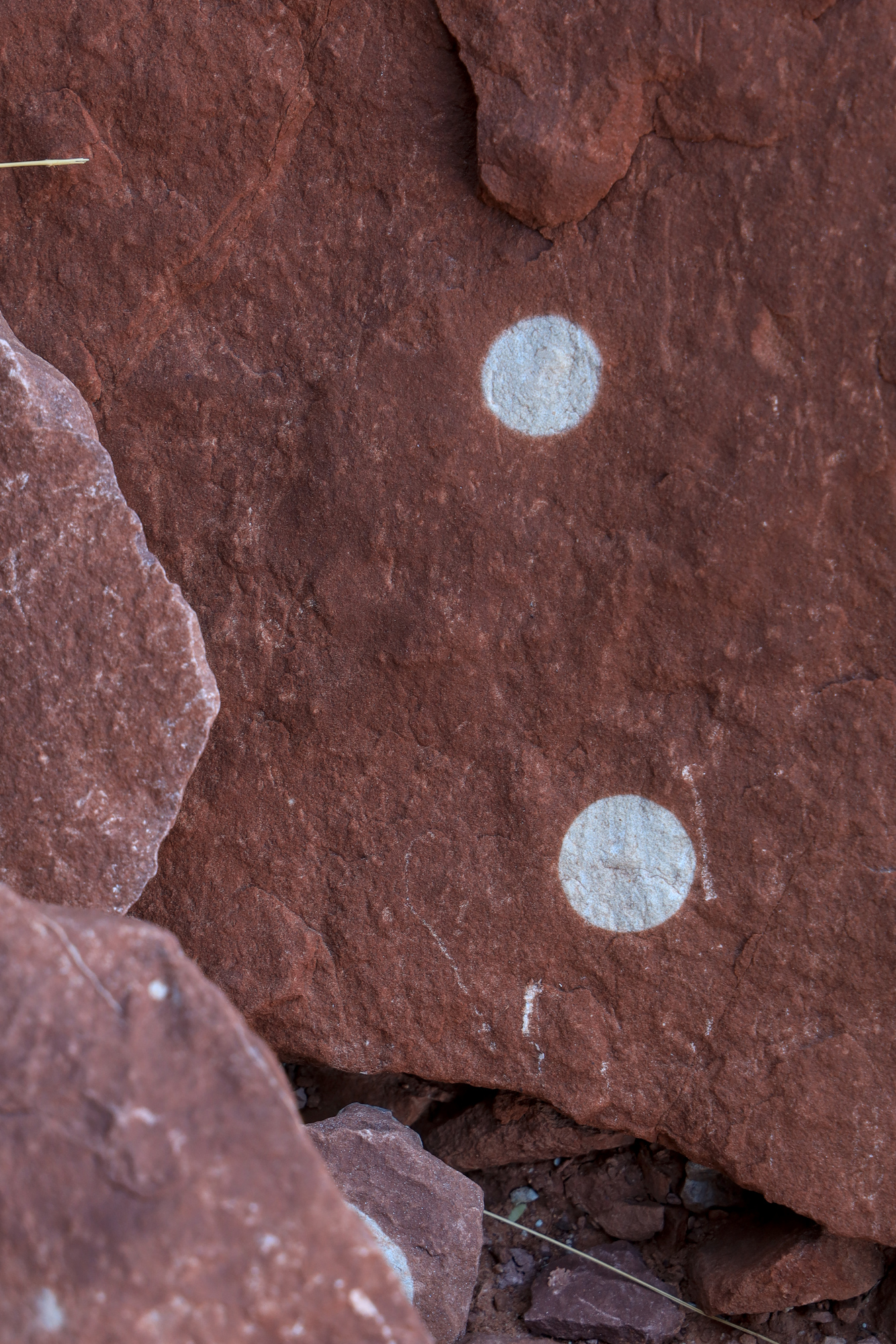
A new slot canyon in the making
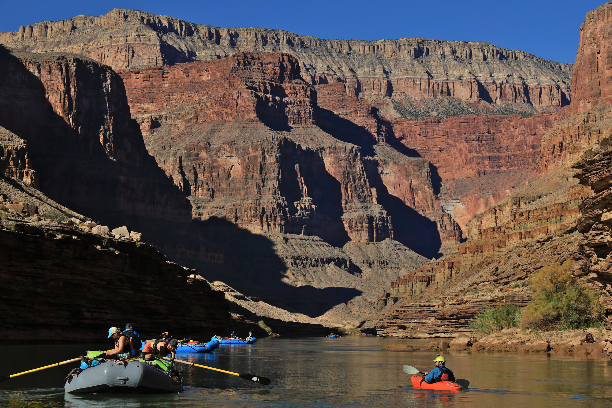
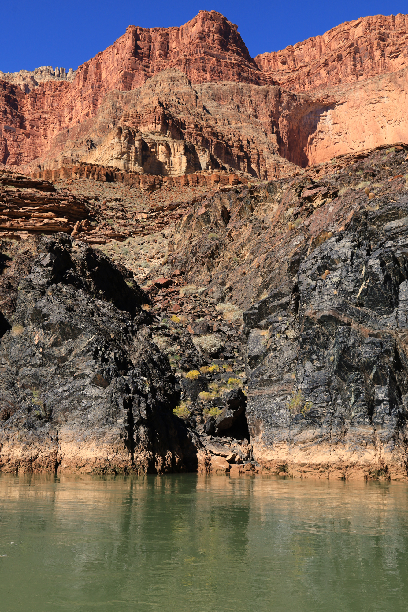
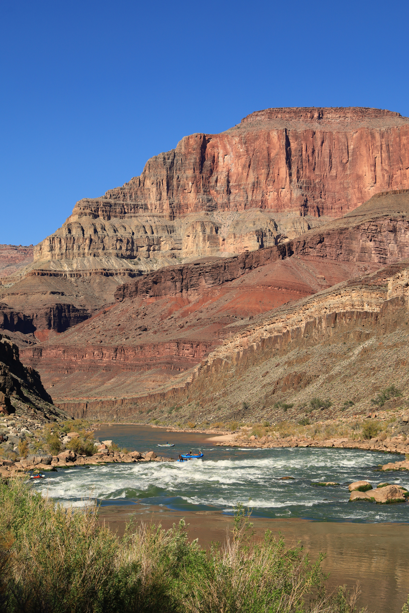
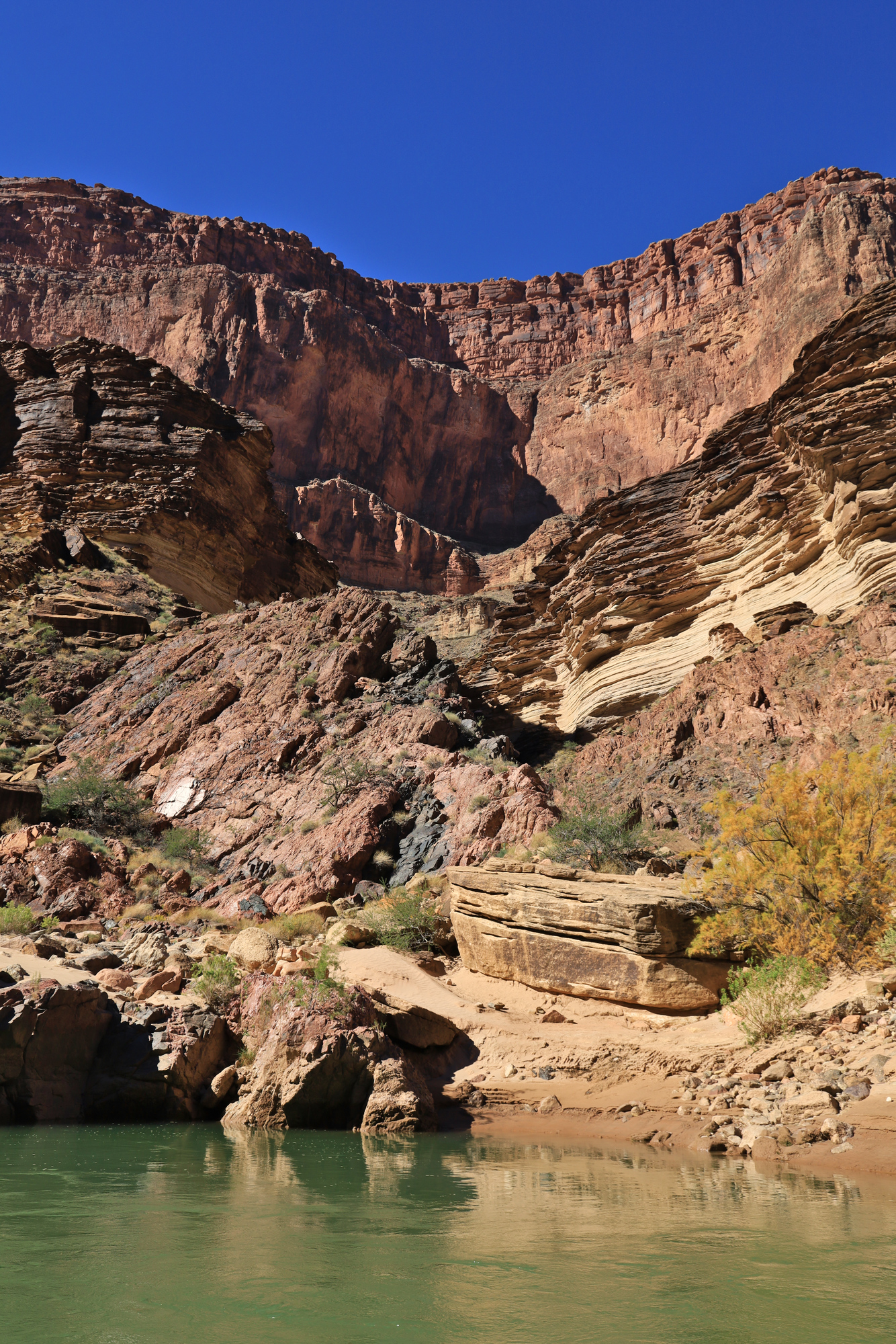
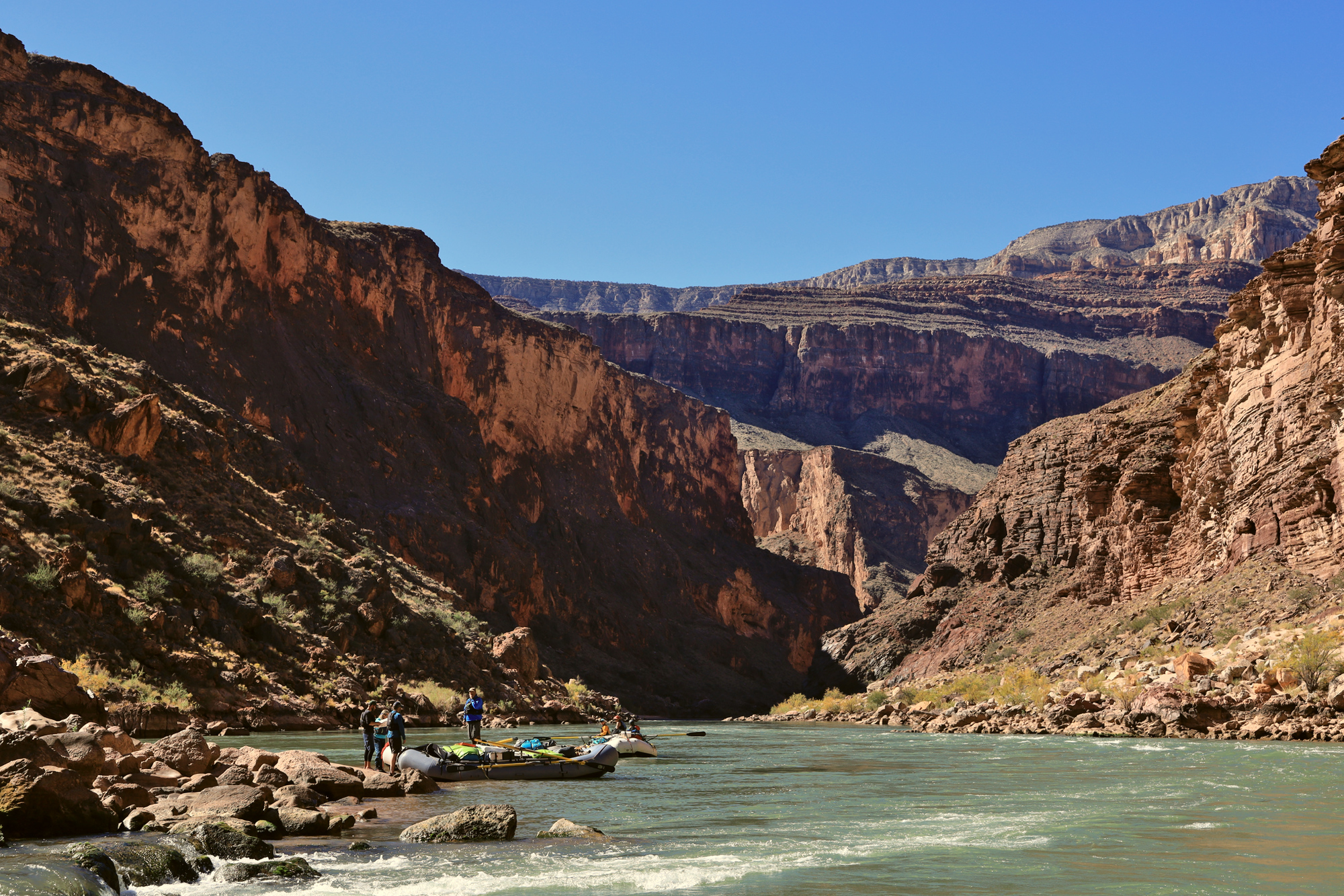
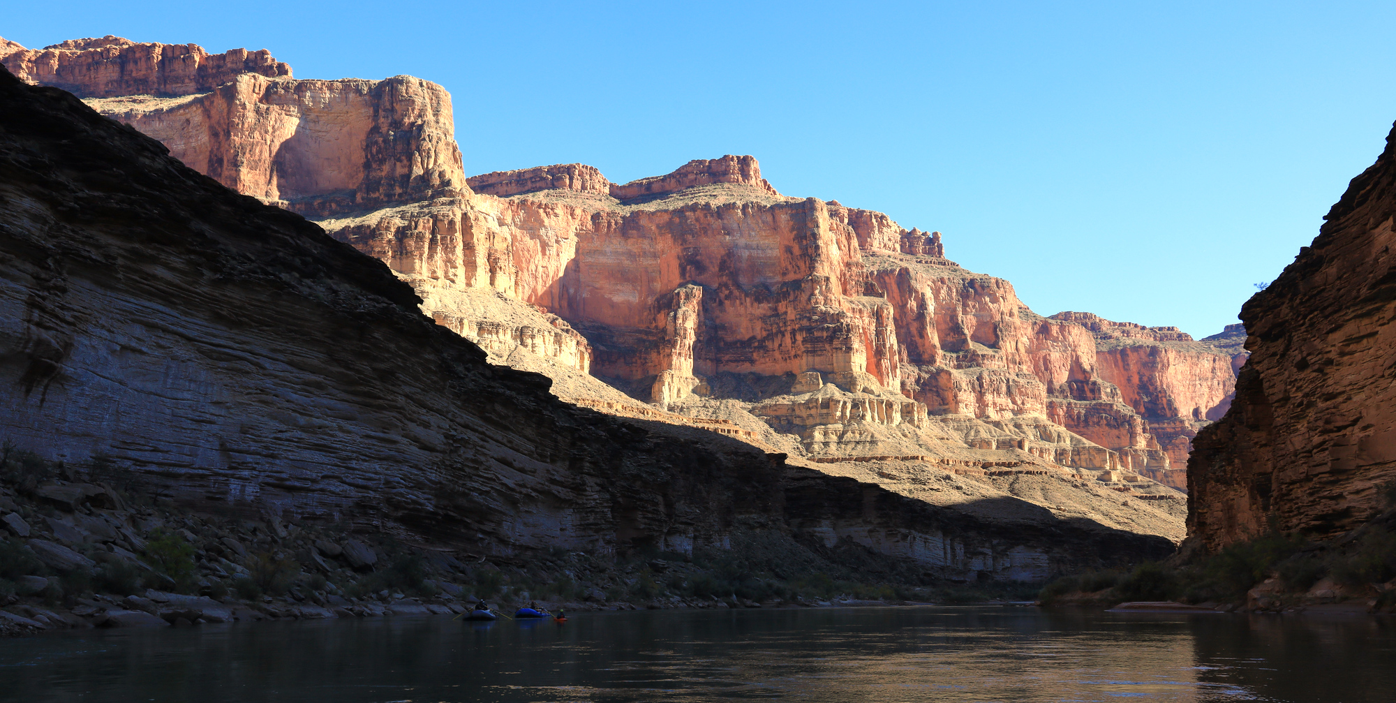
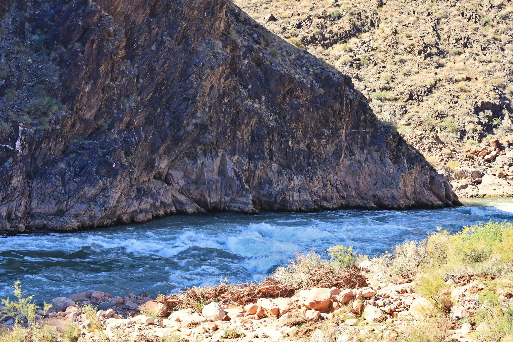
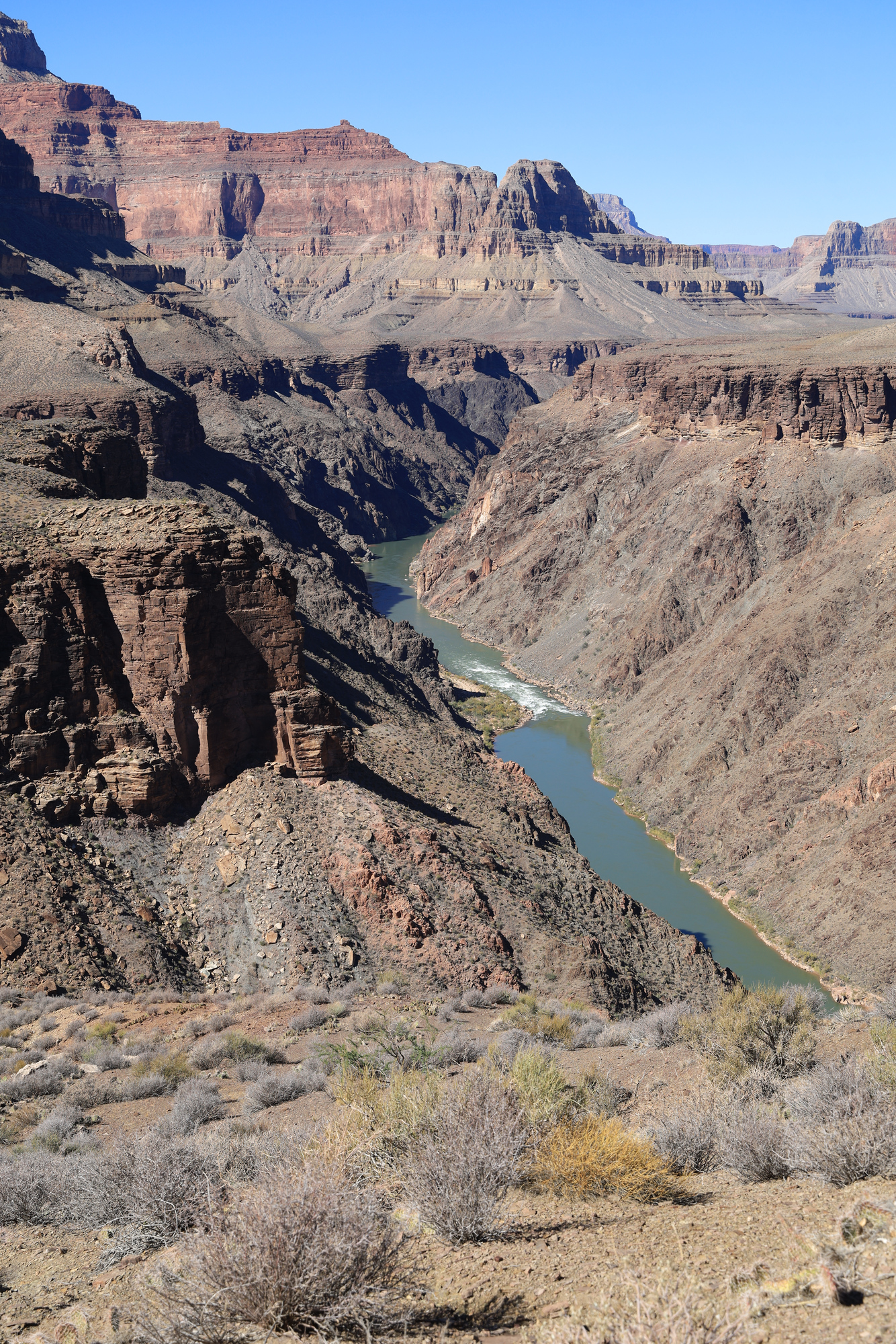
By 10 AM we had pushed off and were floating downstream. This section of the river is the end of the upper granite gorge that starts about 30 miles upstream. In this section the river cuts through all of the neat layers into the oldest rock. This layer of Schists and Granites is about 1.7 billion years old, making it some of the oldest exposed rock in North America. This layer of rock is also quite hard, making the canyon quite narrow here. However, in contrast to the previous day this day was relatively quiet in the whitewater sense. We only ran one rapid rated over 5 (Walthenberg), along with a few smaller drops.
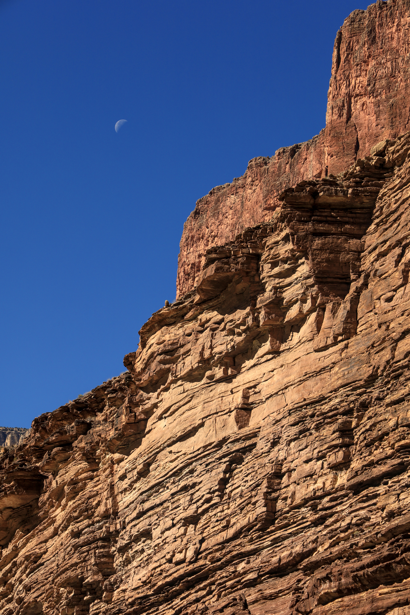
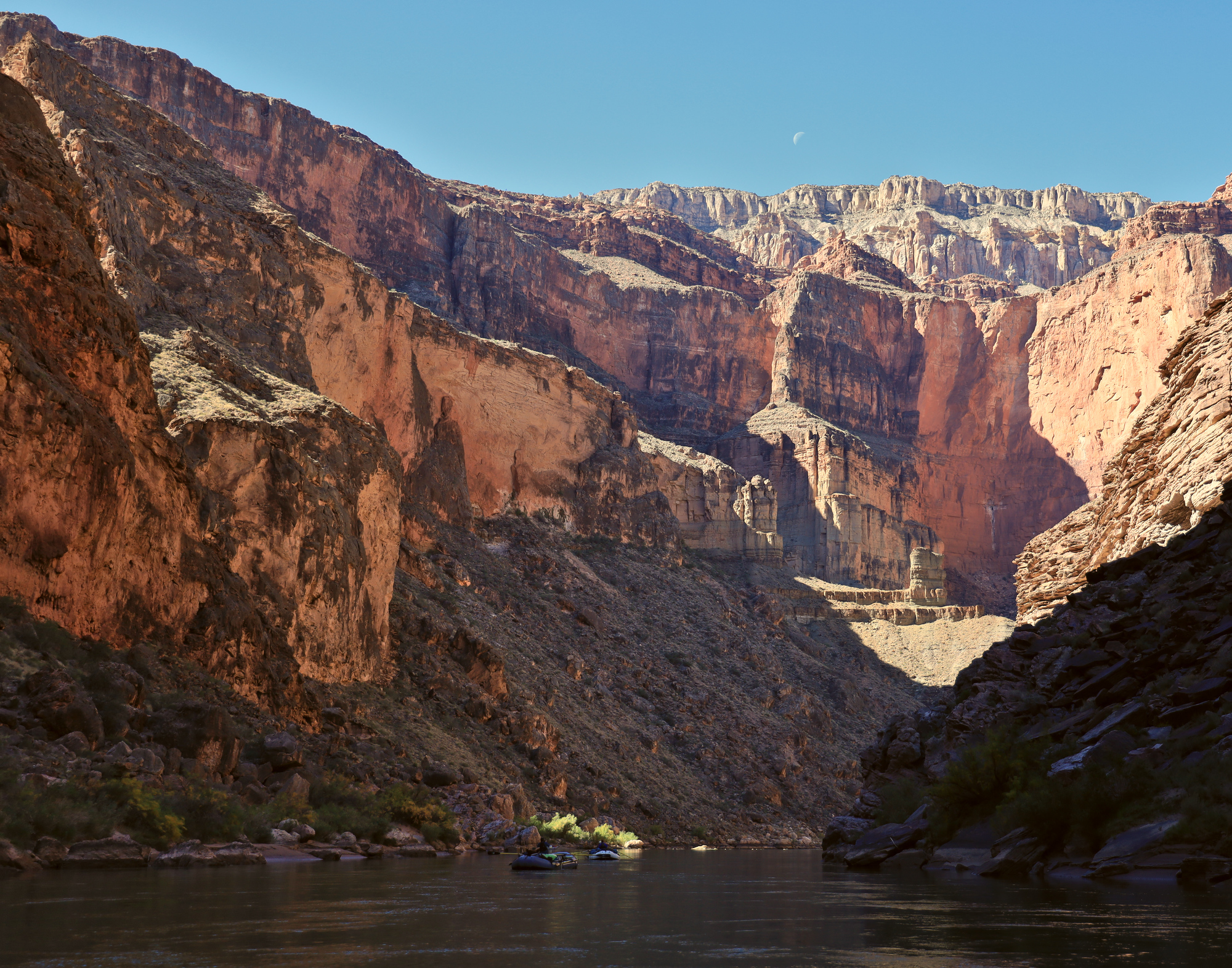
The moon sinking towards the rock shelf above us
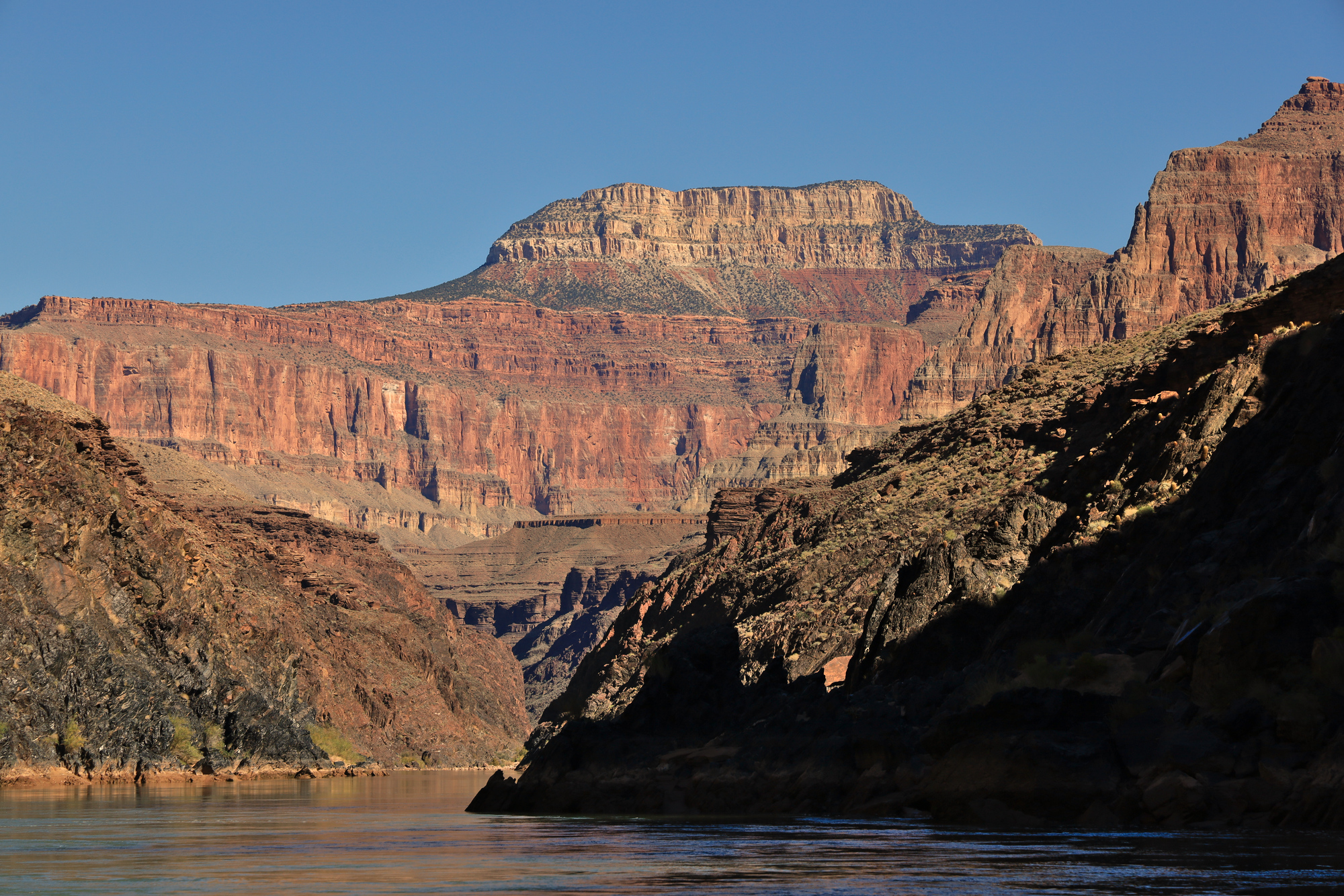
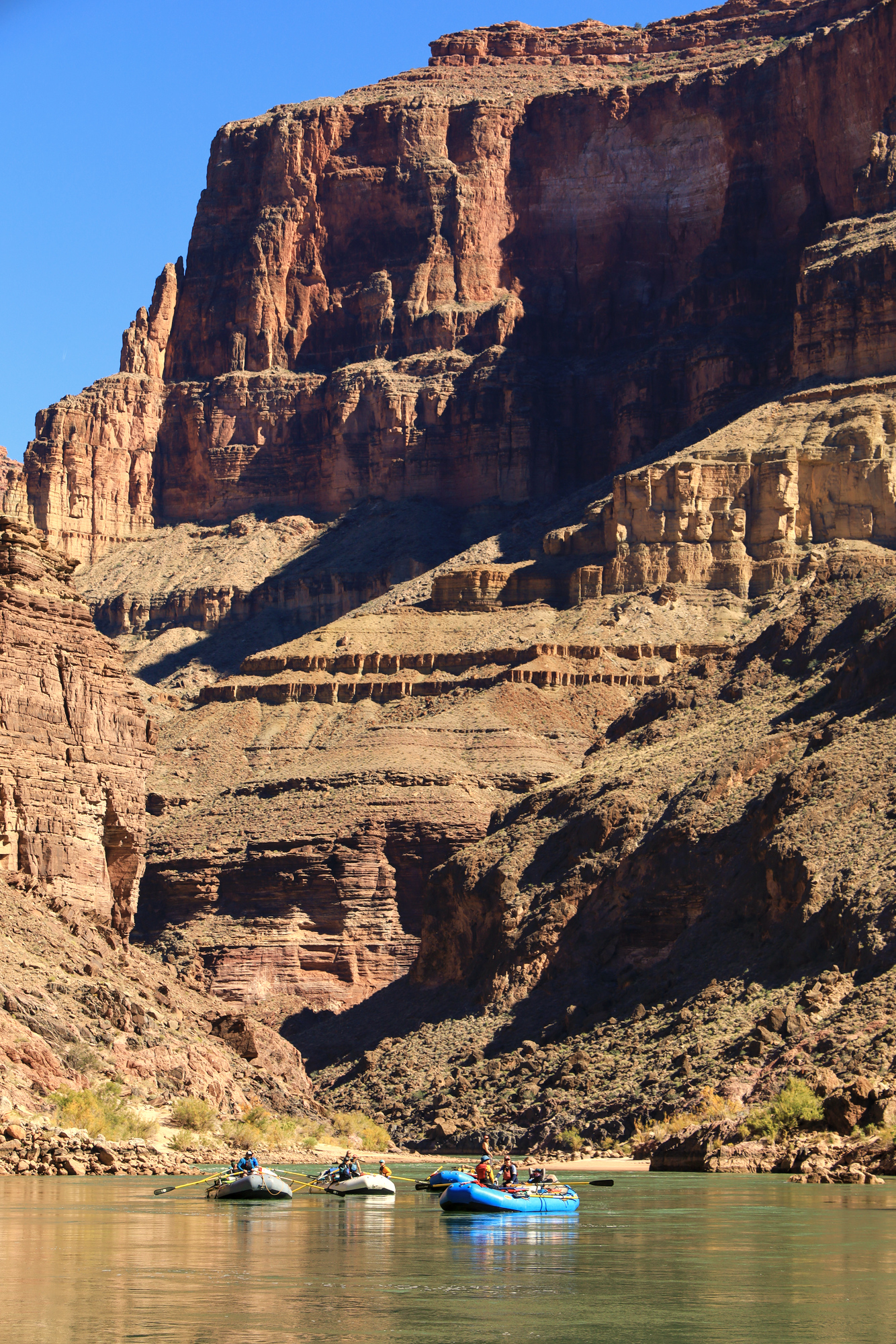
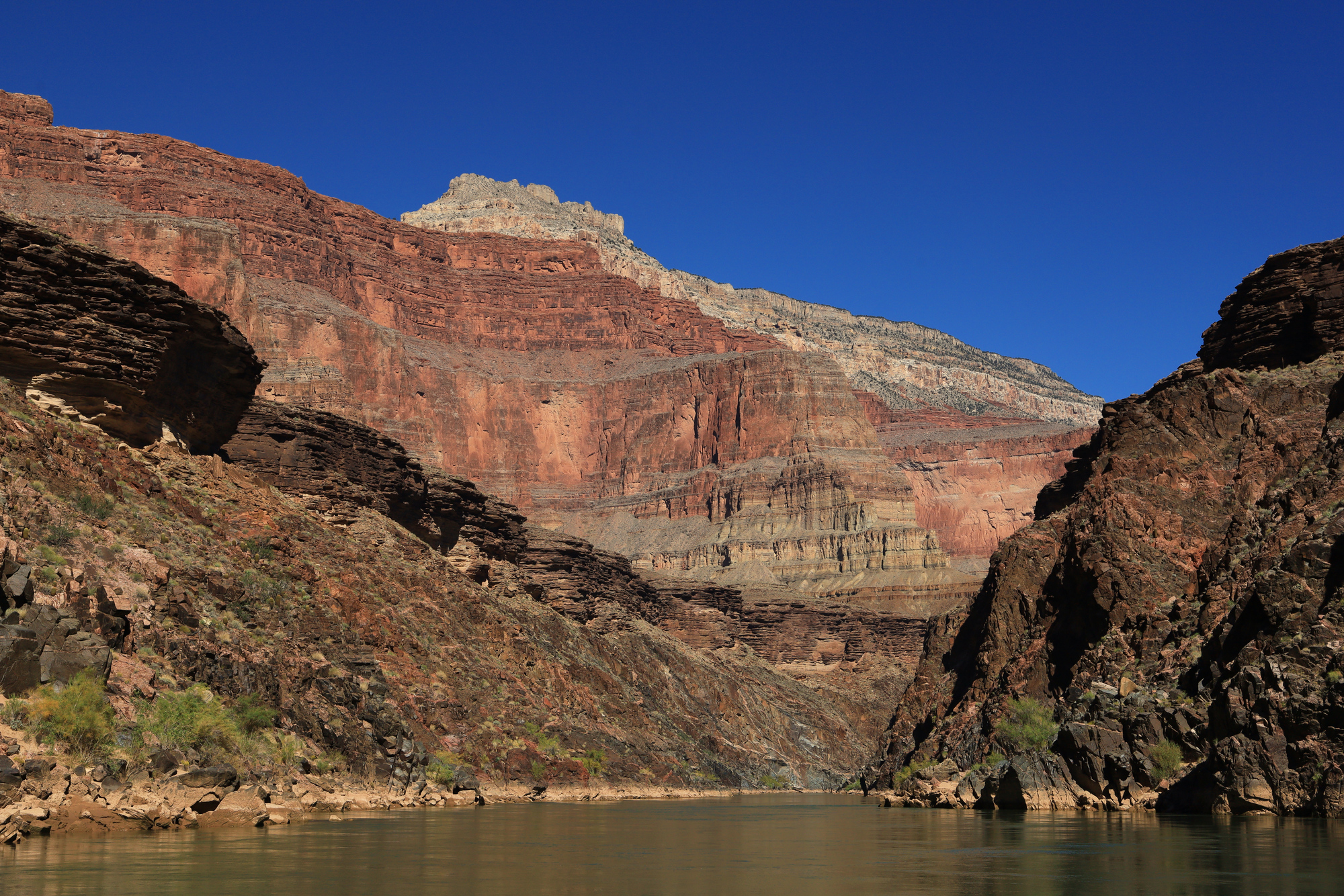
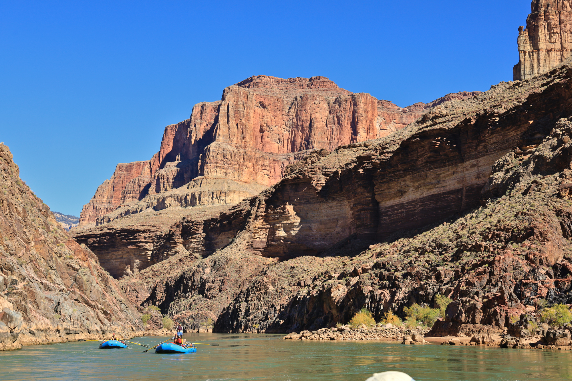
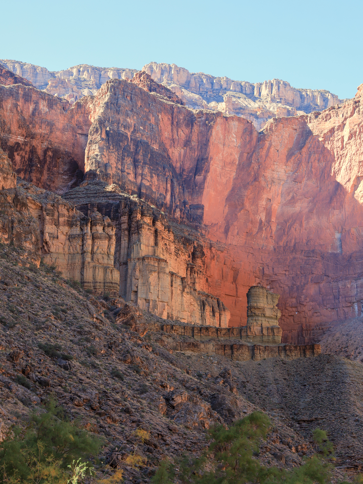
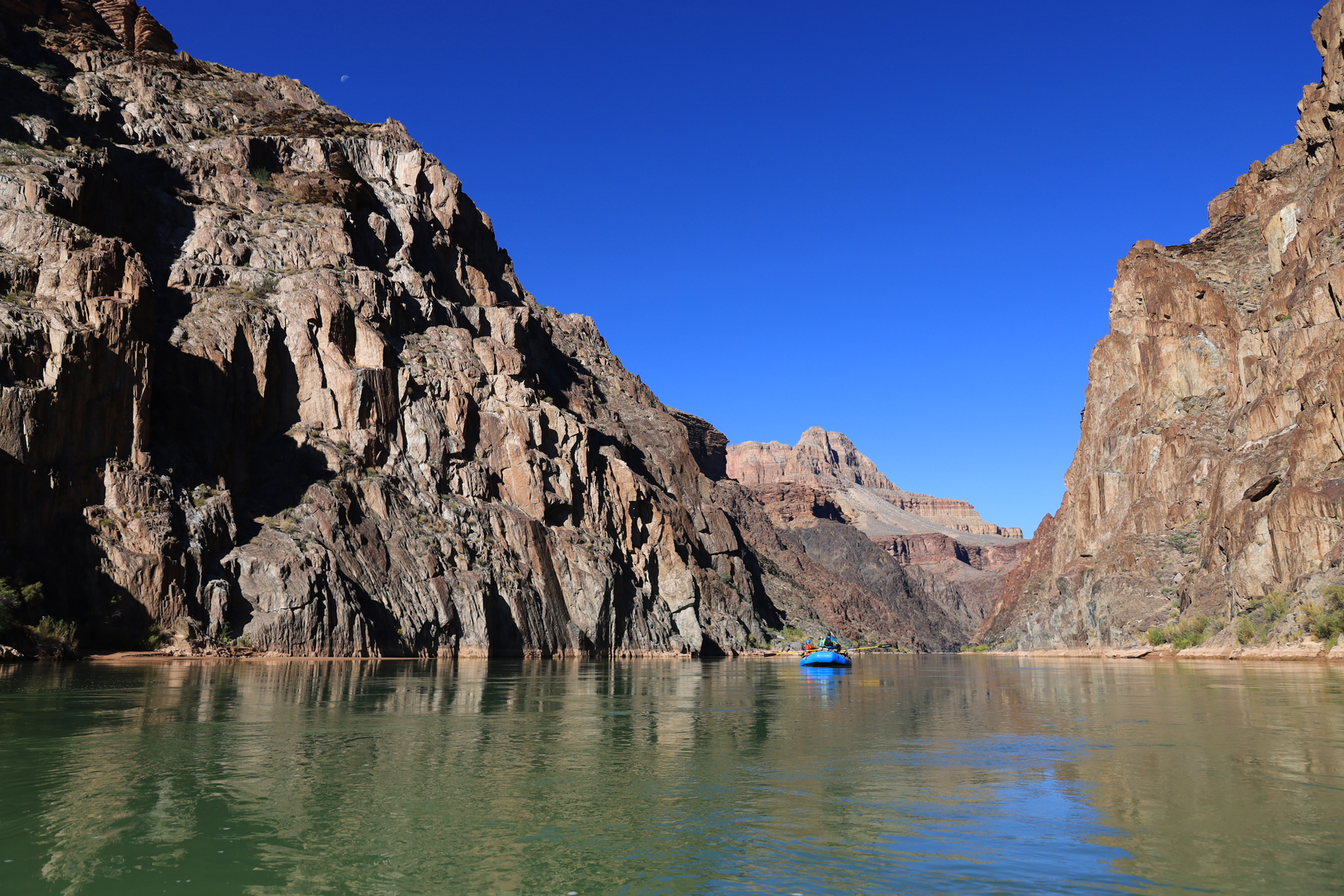
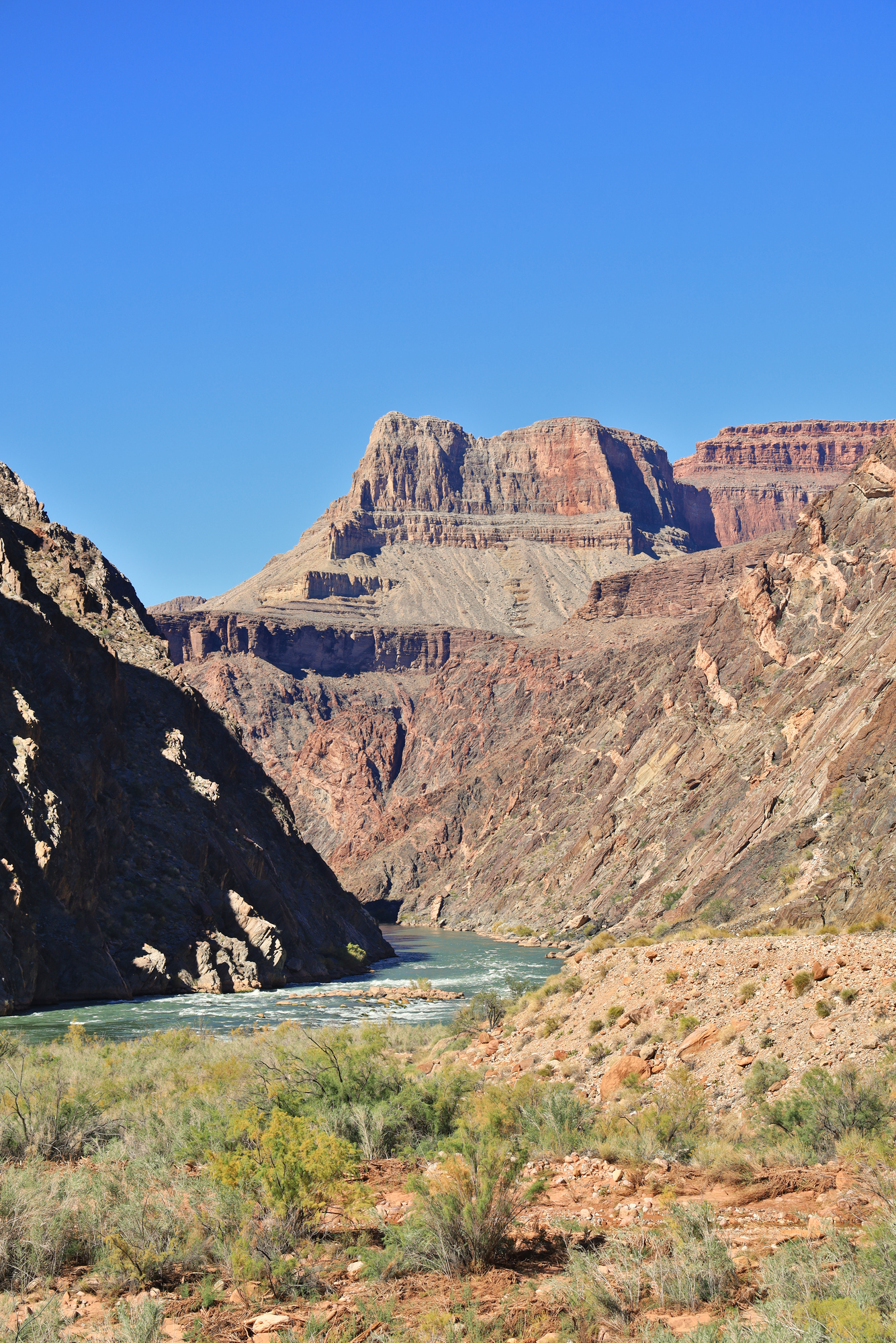
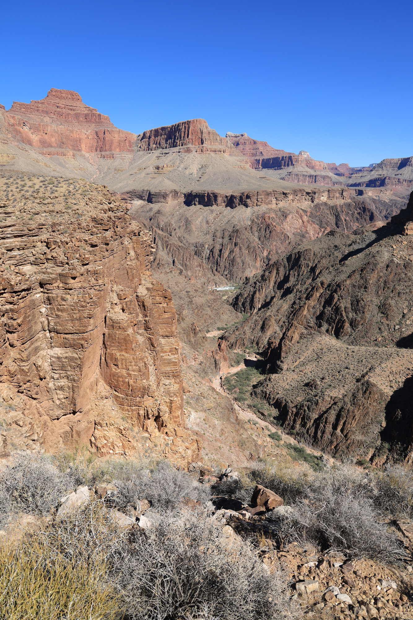
Still following those rafts downstream with incredible views of the towering Redwall
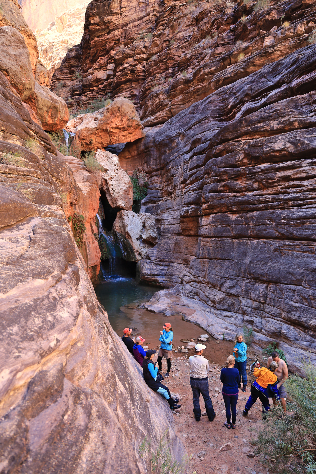
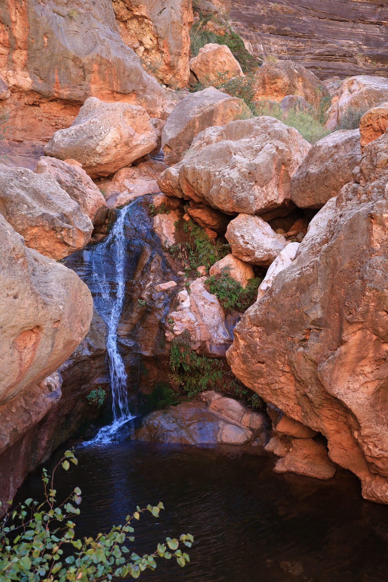
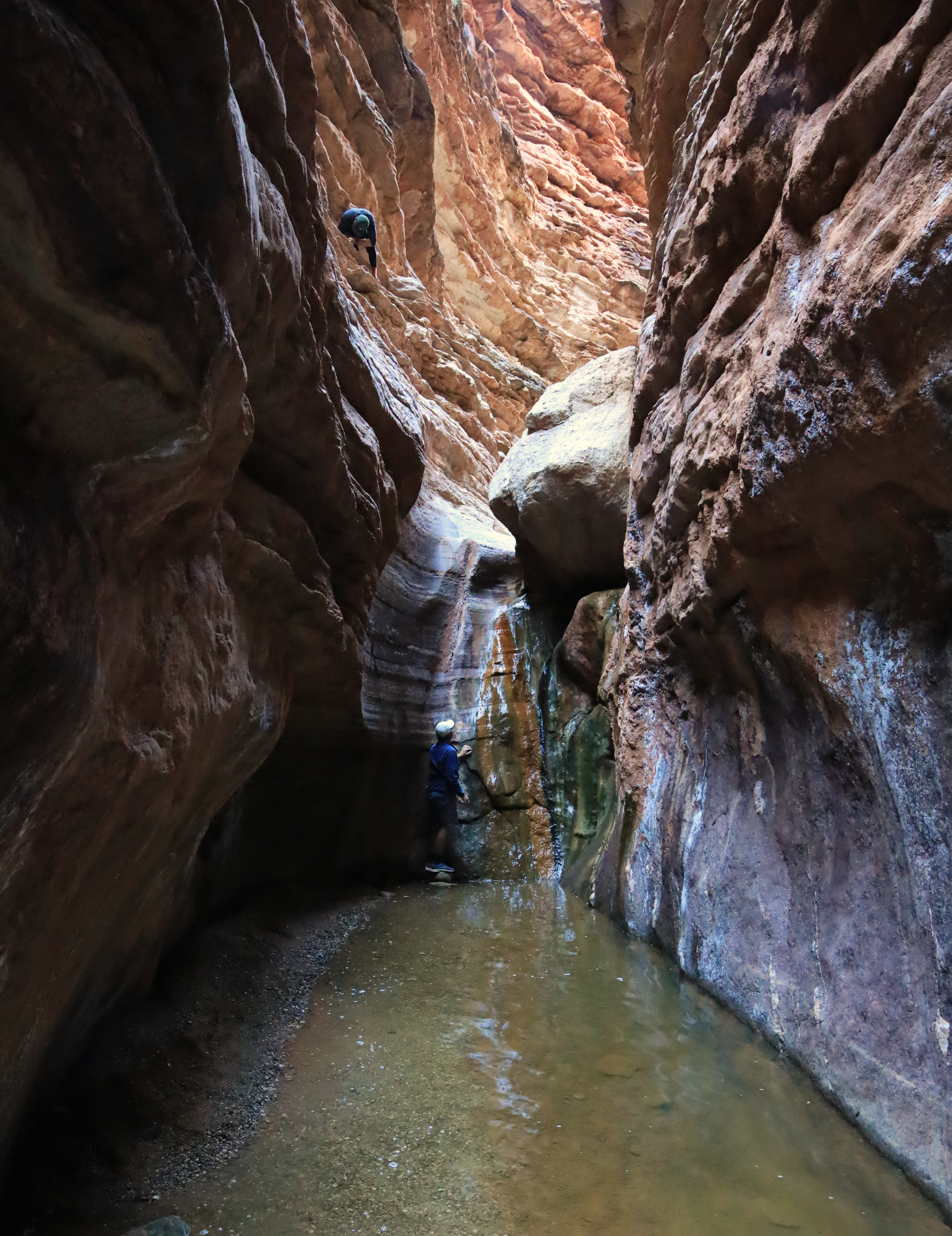
In the early afternoon we arrived at the day’s main attraction, Elves Chasm. After tying up the rafts we scrambled up the creek to a beautiful waterfall. This “hike” (if you can call it that) is a good example of the kinds of activities we did during the day. Lunch stops with short, rugged, and very rewarding walks or scrambles. I quickly learned that doing these hikes in my kayaking booties does not work well. We took some time at the falls to check out the chasm behind the curtain, climb around on the rocks, and watch a few people go for a swim. After that we made our way back down to the river for lunch.
The creek finds its way through a gap in the boulders piled everywhere
Relaxing by the pool – Grand Canyon style
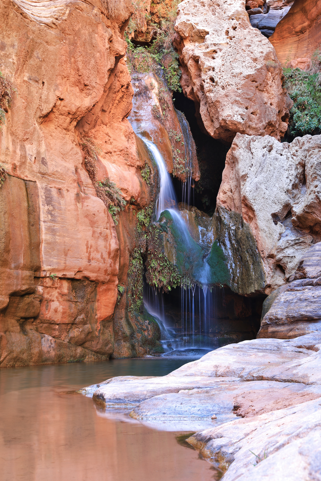
The falls at Elves Chasm
The Explorer’s Monument seen from a pool below the chasm
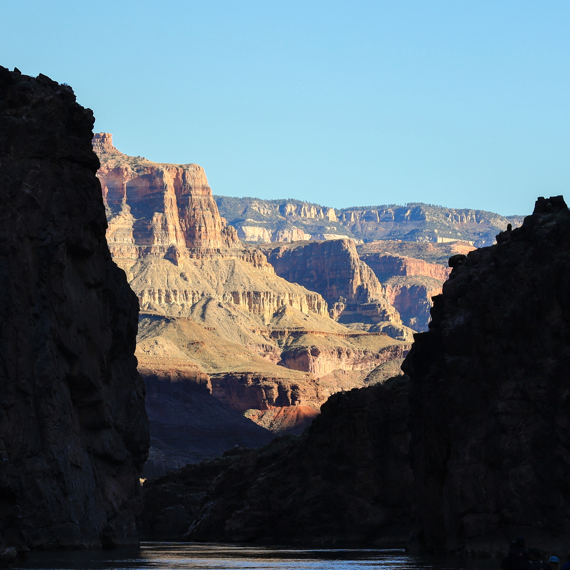
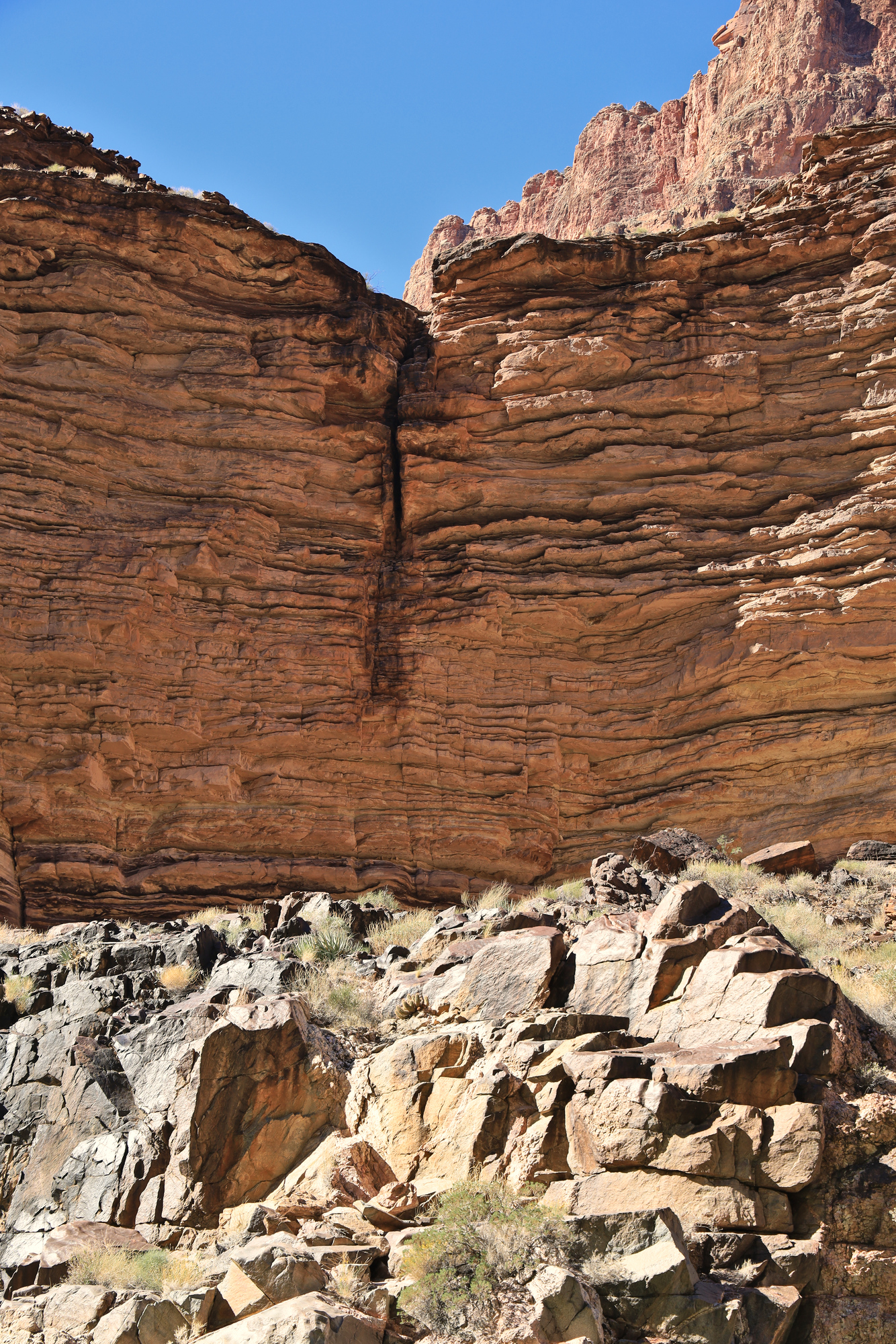
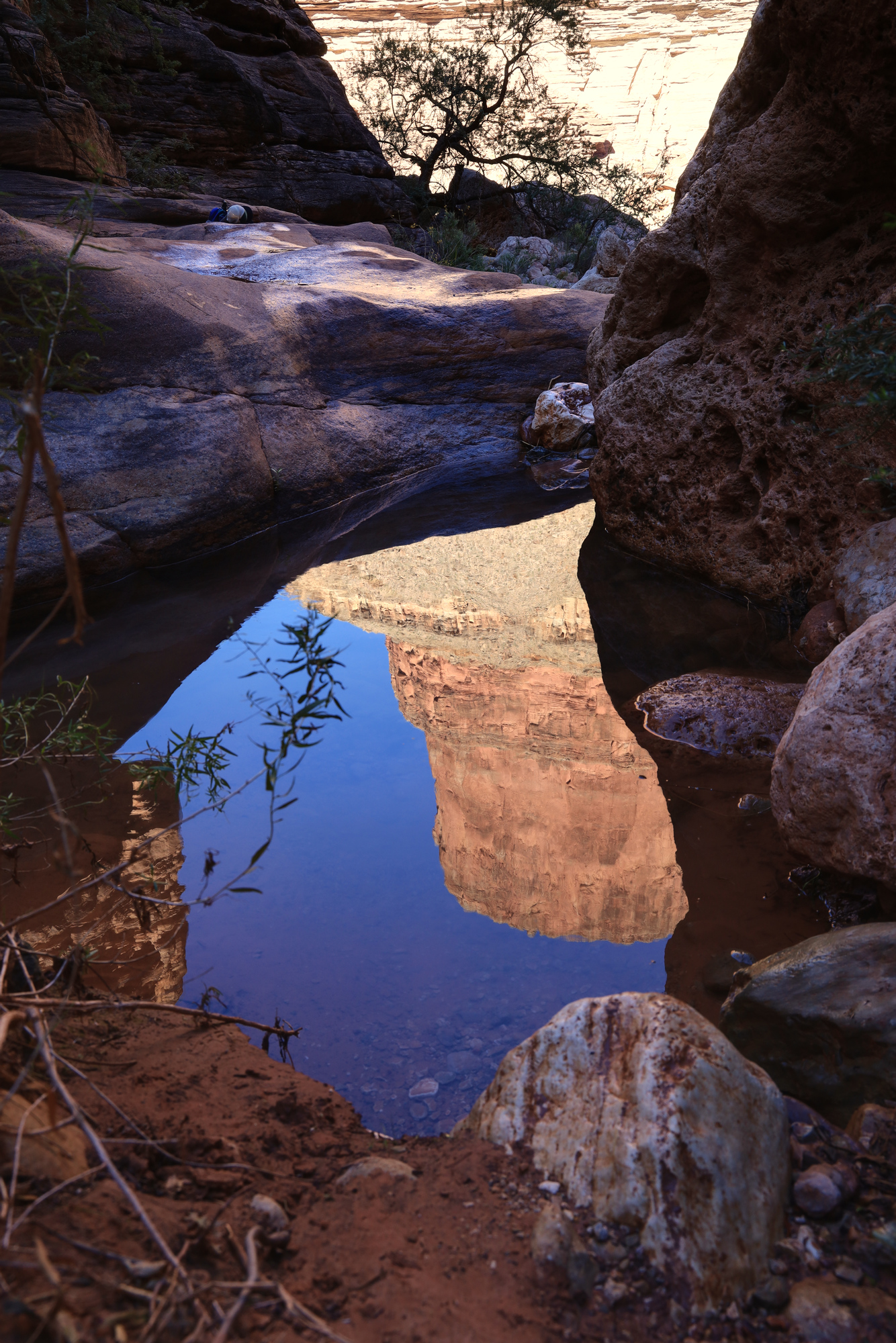
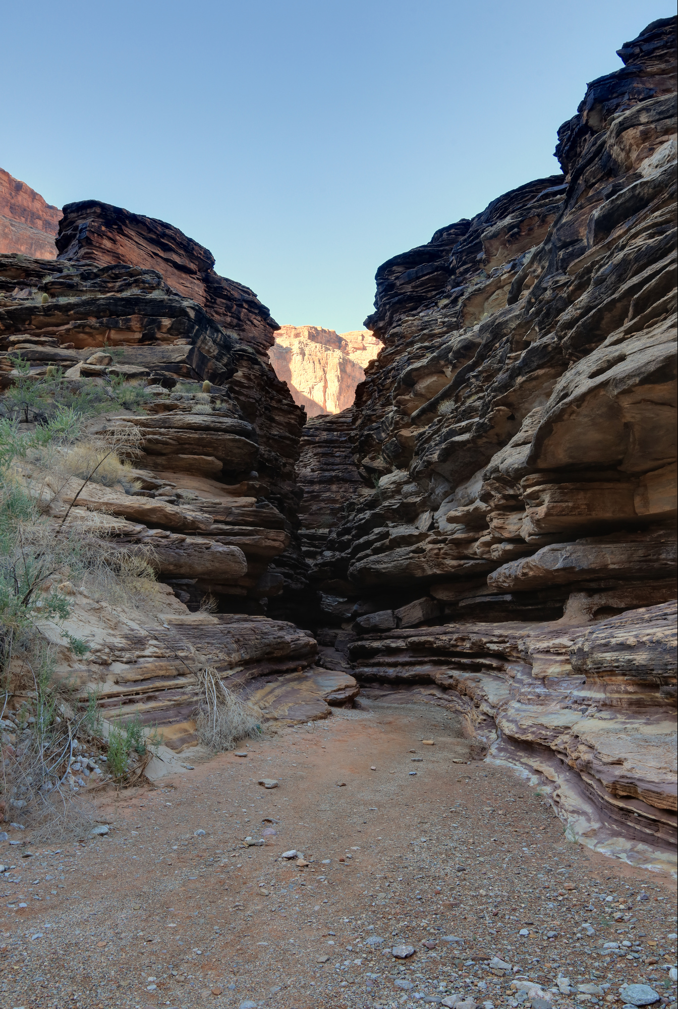
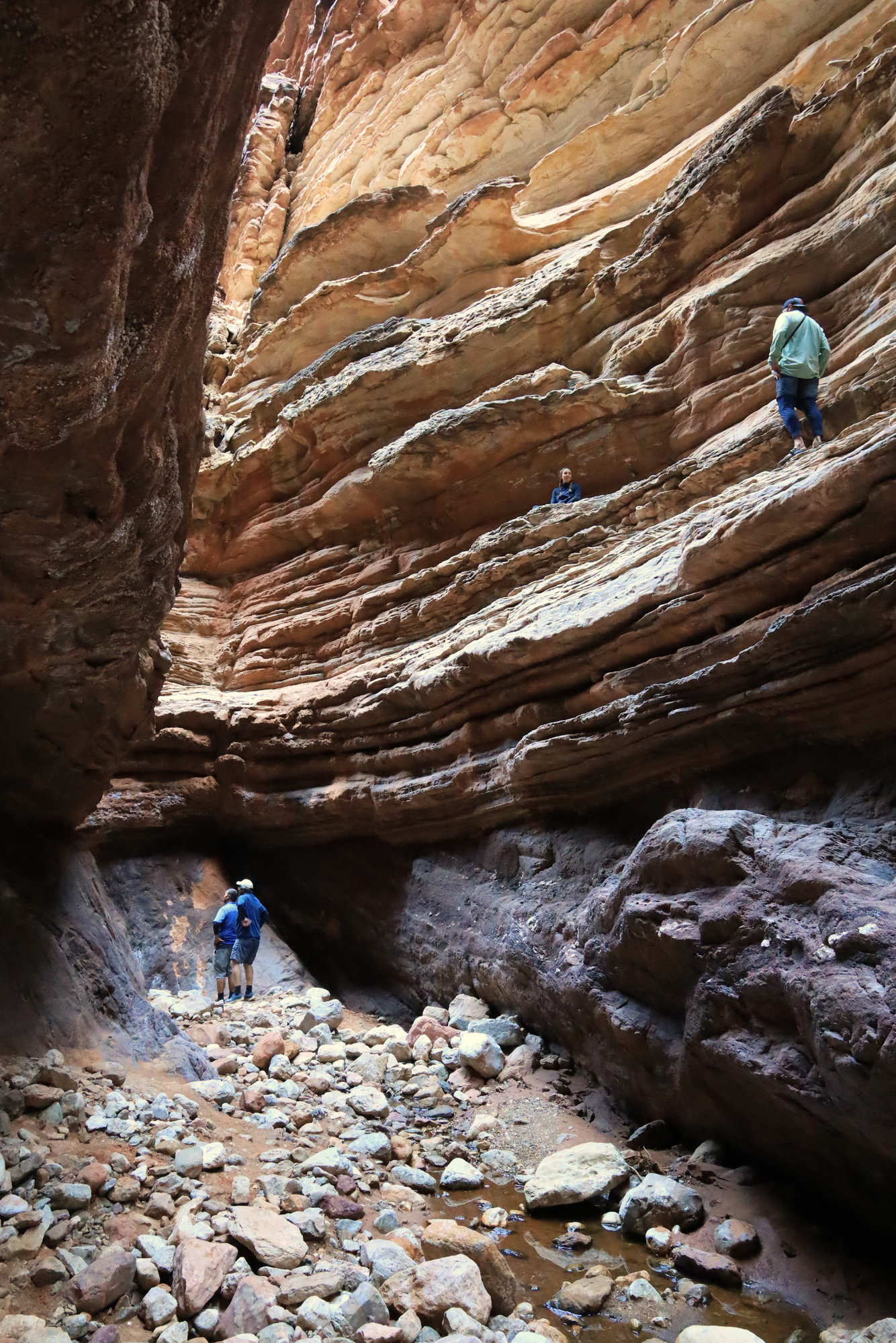
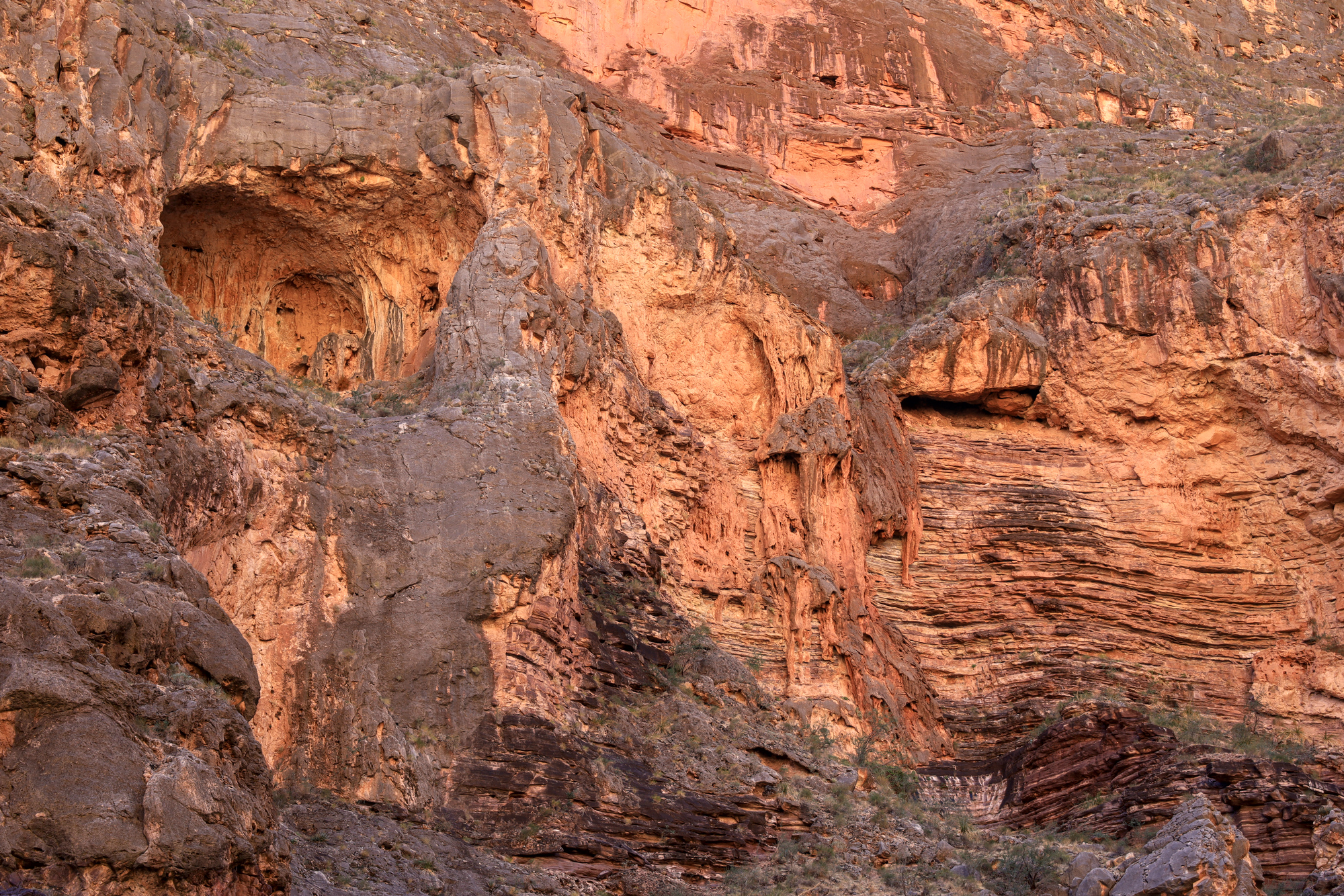
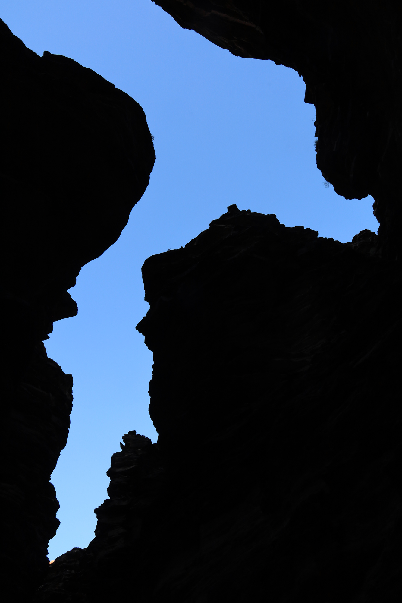
After lunch and filtering some water we pushed off to finish up the last few miles to camp for the evening. We pulled up to Above Blacktail Camp, just upstream of the mouth of Blacktail Canyon. After the usual unpacking and picking a spot to sleep, I grabbed the camera and headed up into the canyon to see what it was like. I was immediately impressed at the size of it, as well as the intricacies of the many layers that were exposed starting right at the mouth. It was a fun place to explore, at least until I ran up against a wet scramble that I could not conquer in the hiking shoes I wore.
Looking into the entrance of Blacktail Canyon
Some members of our group climbing on the rock terraces
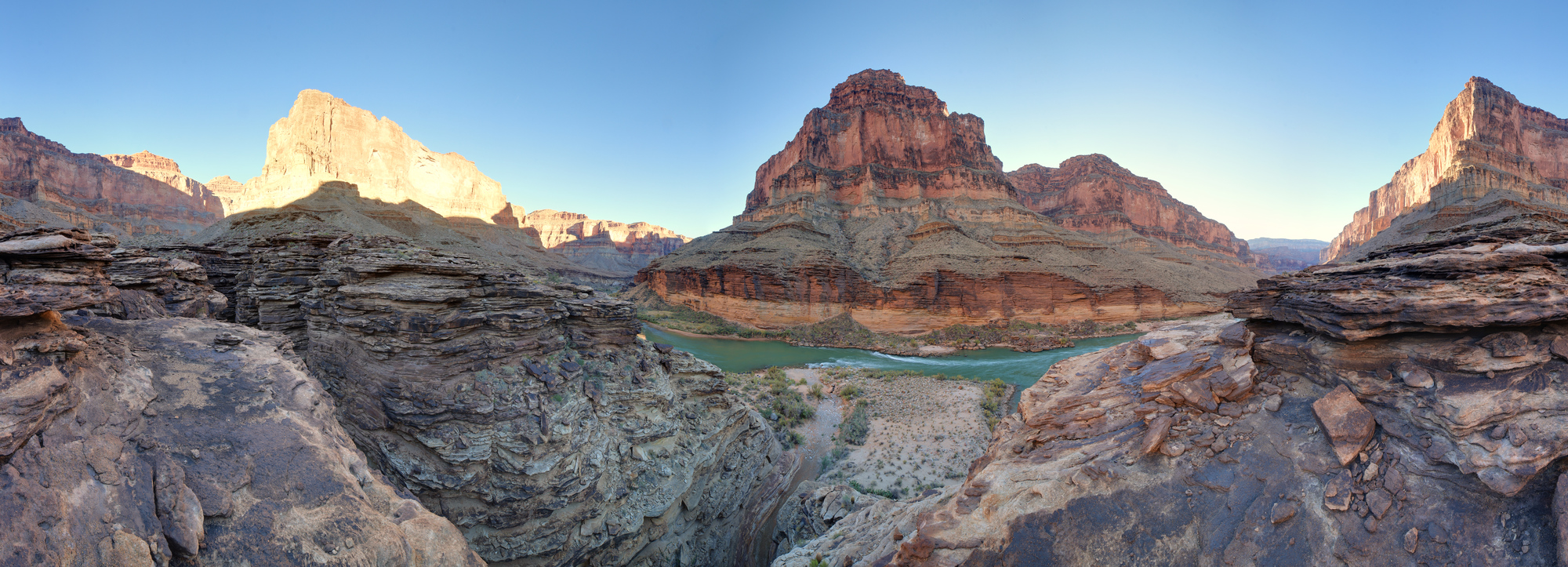
The Colorado and the mouth of Blacktail Canyon from above
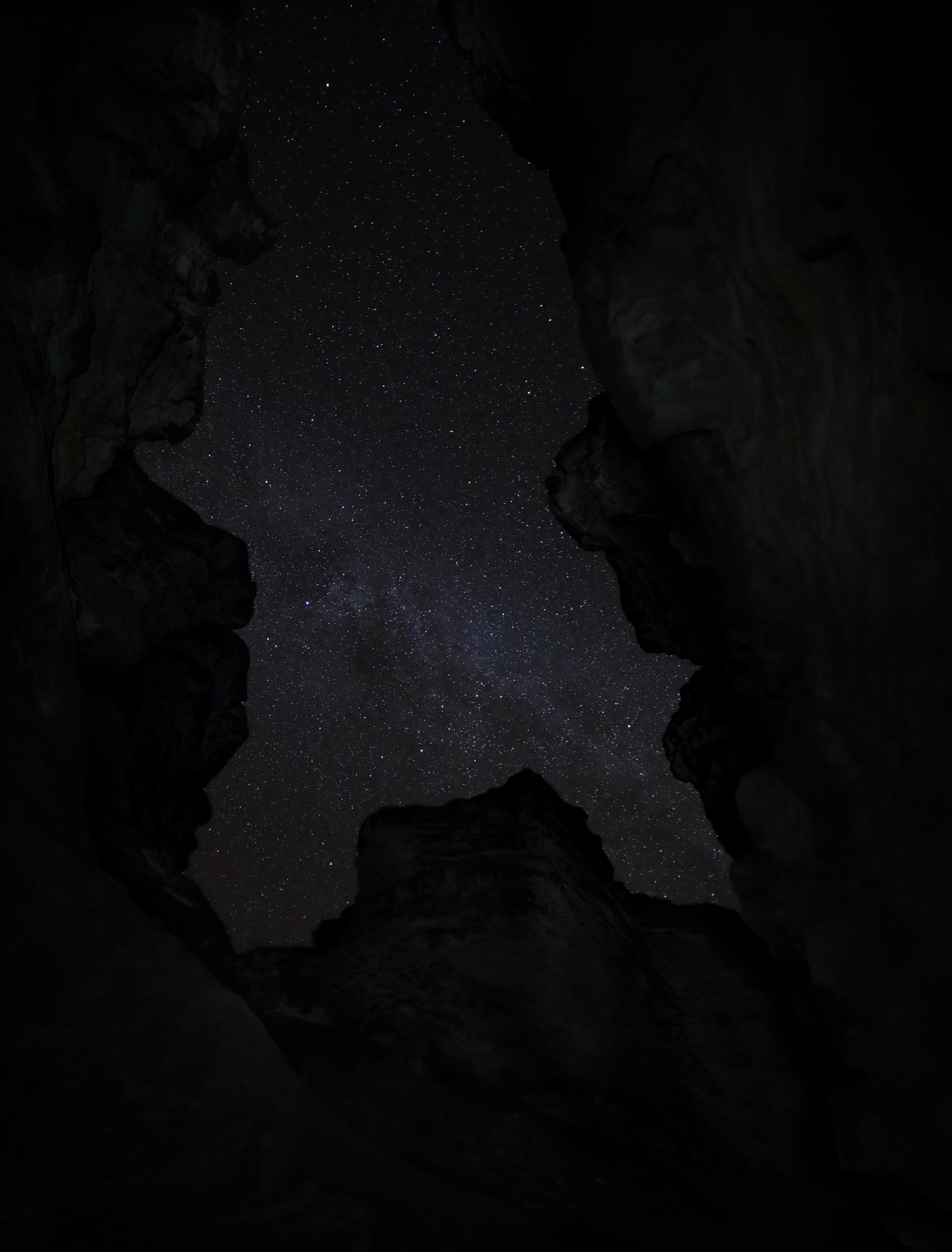
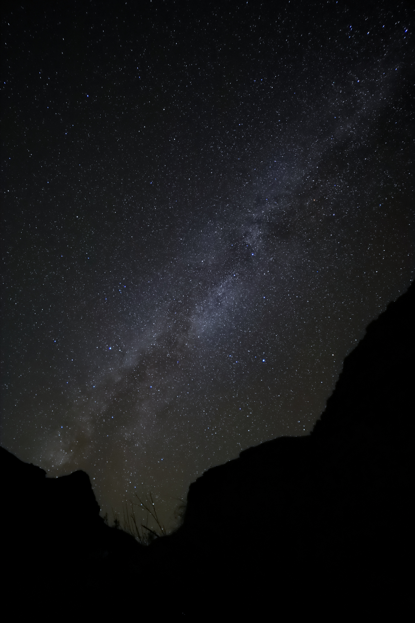
We spent the better part of an hour climbing around in the canyon and at it’s entrance. After dinner I even returned to the canyon to take some photos of the milky way with the canyon walls framing the shot. It was a pretty cool place to poke around at night, and added yet another memory that I won’t forget any time soon.
This is the day we really started the whitewater adventure. I quickly learned the unofficial motto of this trip: “Lots of learning.” I was not expecting it to be so true. The process of packing up the camp and getting my gear settled into the rafts and the kayak took a lot of time, and that was after I had done my best to prepare the night before. I was struggling to figure out what clothing and gear I would want while on the water and what was the best way to pack up everything else in my dry bags. It was quite a sight to see the rest of the group all working together to efficiently pack up their gear and the rafts. Clearly the extra 9 days of experience made a difference.
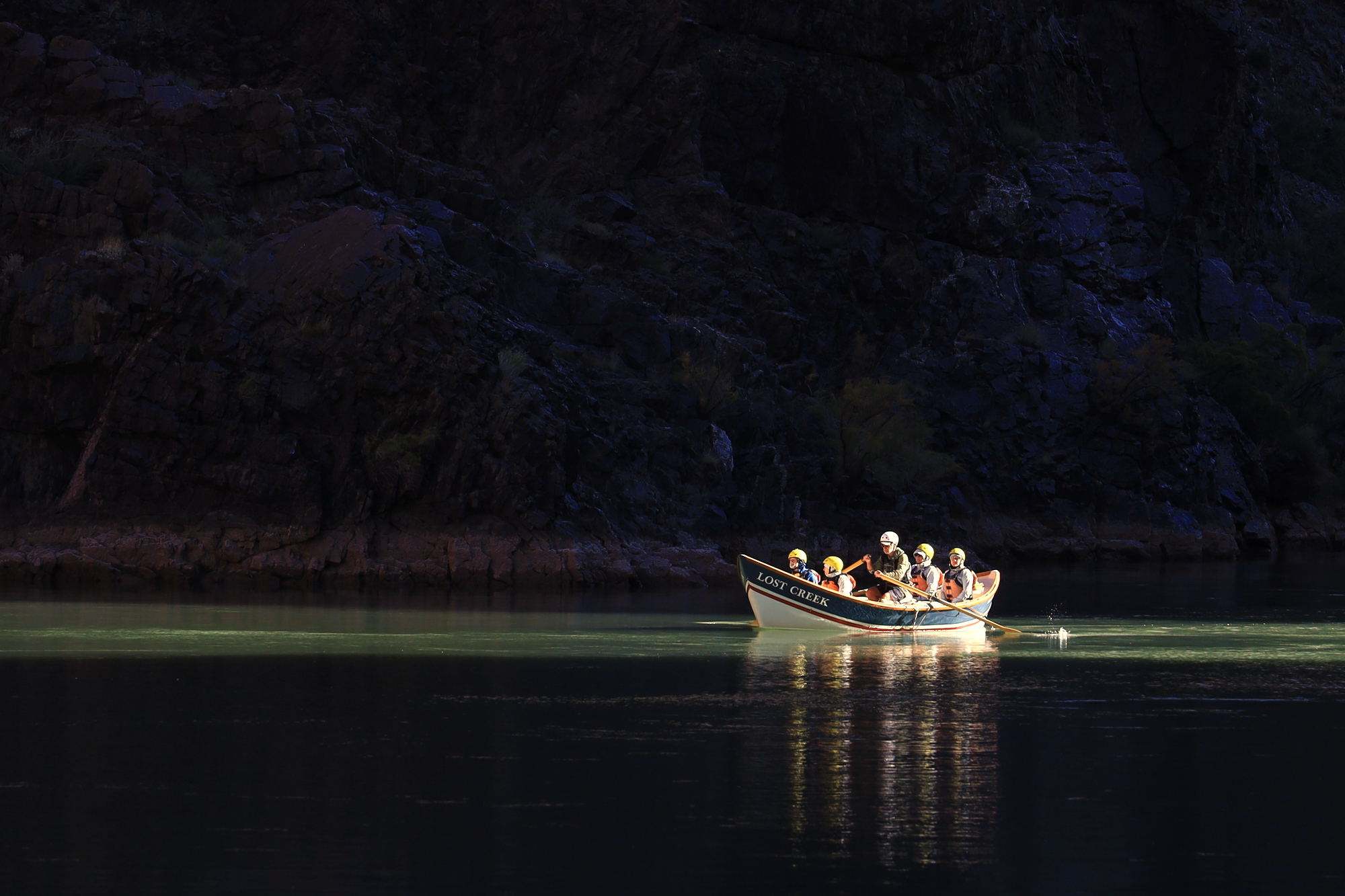
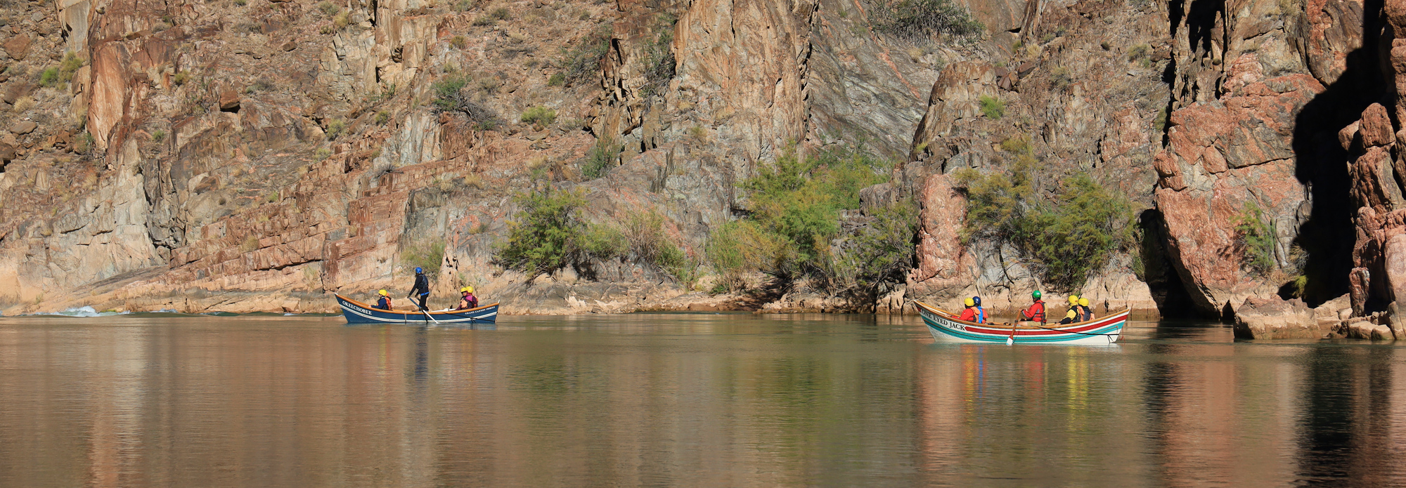
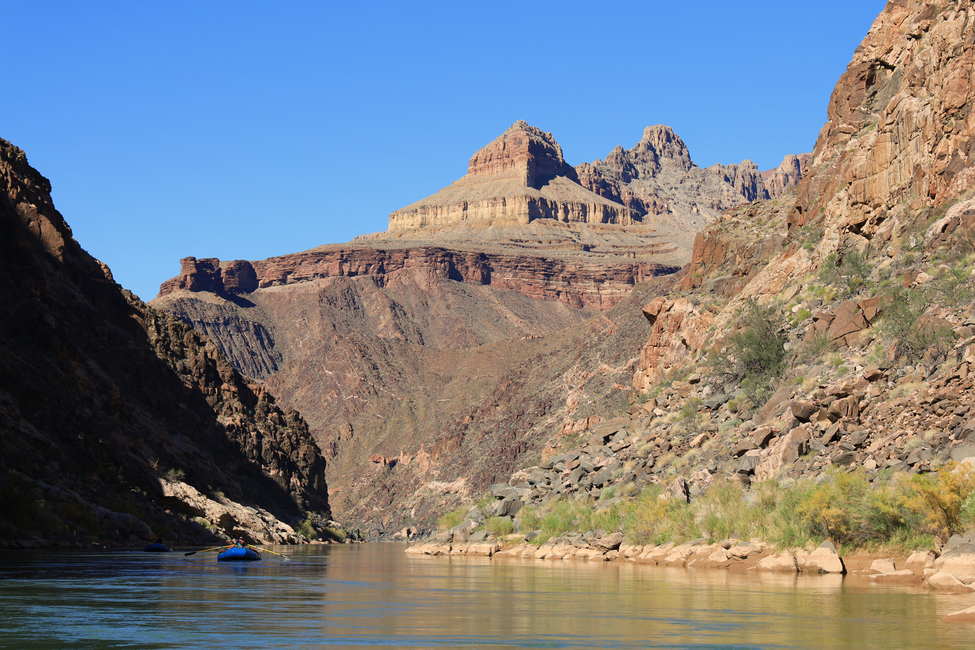
A commercial OARS dory crosses the light cutting through the canyon just above Granite
The first day on the river started off with a bang. We ran Granite and Hermit rapids right off the bat, and both were a blast. My line through Granite was a little sloppy, but I kept it upright. Hermit on the other hand felt like riding a roller coaster with huge waves. It was an action packed day all around with 8 rapids rated 5 or above, including one of the biggest, Crystal. Fortunately, all of the rapids went well and we did not have any swimmers. Crystal even ended up being pretty easy, as the lower flow allowed us to sneak by the worst of the holes. That did not take away from the excitement of the rest of the rapids though. There were a lot of really fun runs in this section.
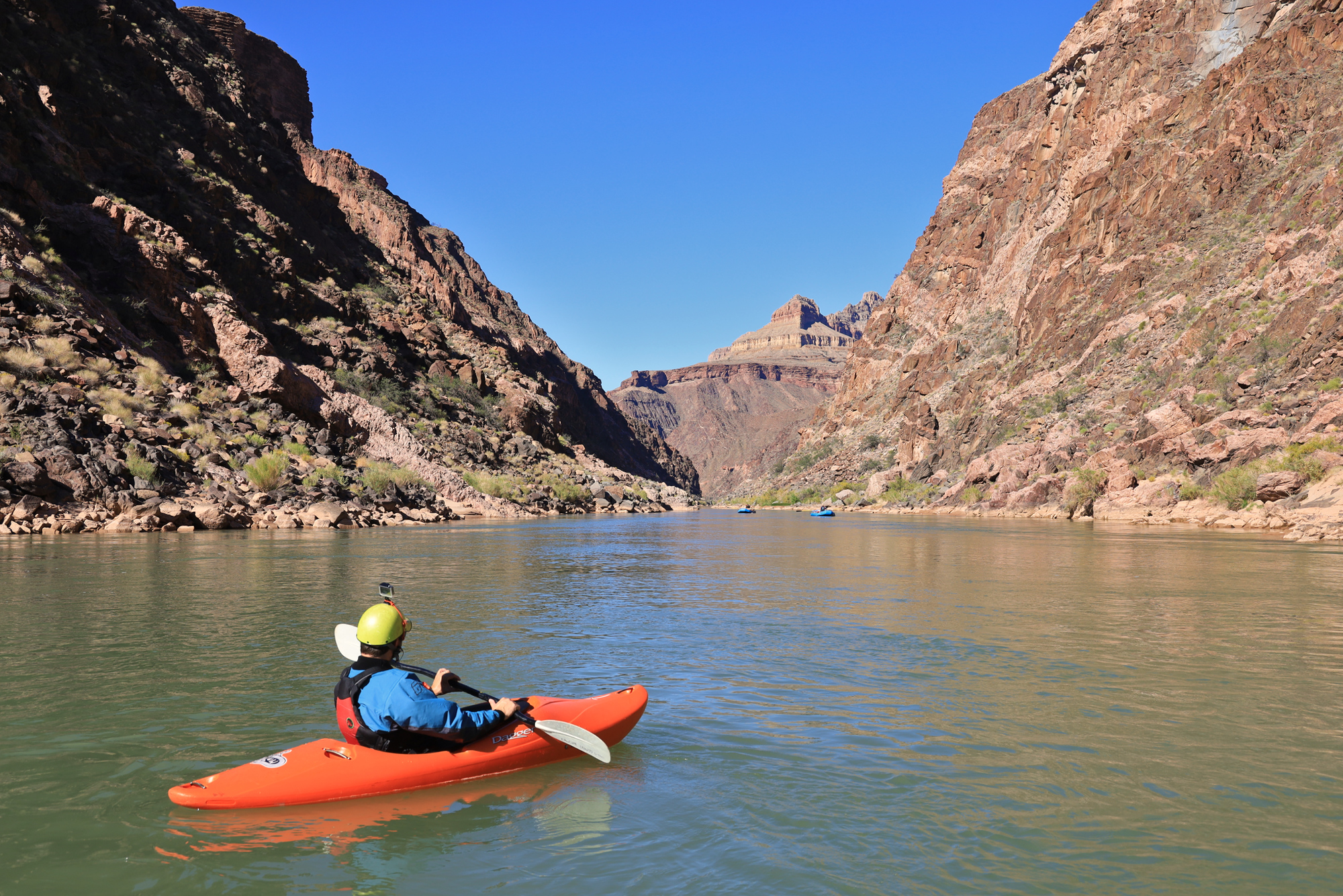
Me floating along a flat section of the Colorado
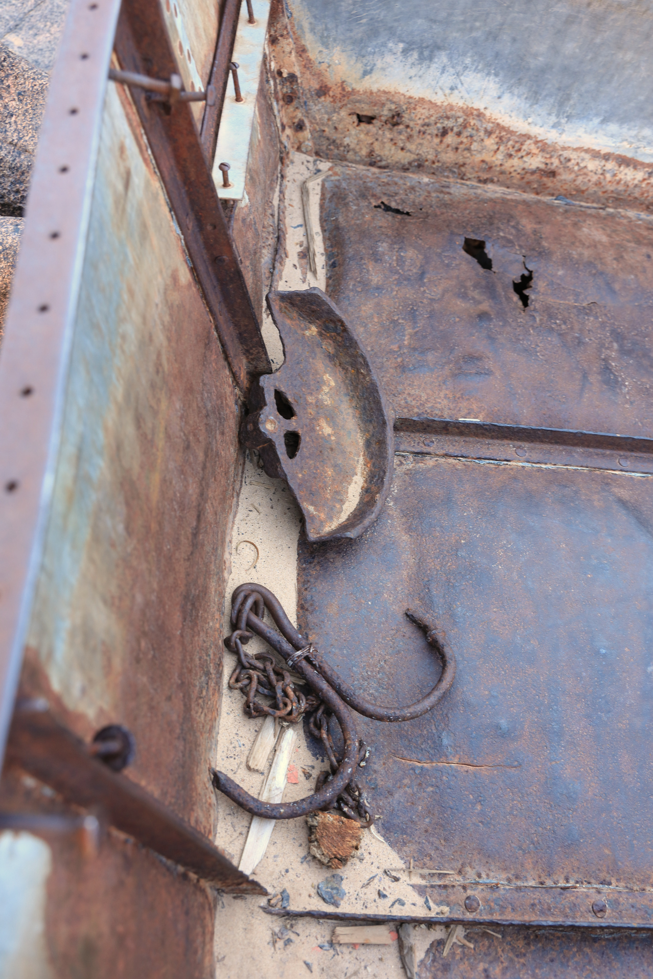
In addition to all the whitewater we also had some time to explore the Ross Wheeler. This boat was abandoned on the river in the 1915 by a group filming a run through the canyon. It has been sitting here on the side of this rapid ever since. It is pretty hard to imagine running the river in a boat like this these days. It’s both small and incredibly fragile compared to the rubber ones we were paddling.
The Ross Wheeler chained up above the high water line
The view of the inner canyon from the Ross Wheeler
After covering about 15 miles we arrived at our second camp, Below Bass. Once again the group sprang into action and unpacked the boats. I tried to help where I could, but also went to find myself a spot where I could lay my wet clothes out to dry. I set up my at the back of camp near the wall of the canyon. By the time we had arrived the sun was already below the rim of the canyon, but I still climbed up the wall a bit to capture a panorama of our camp.
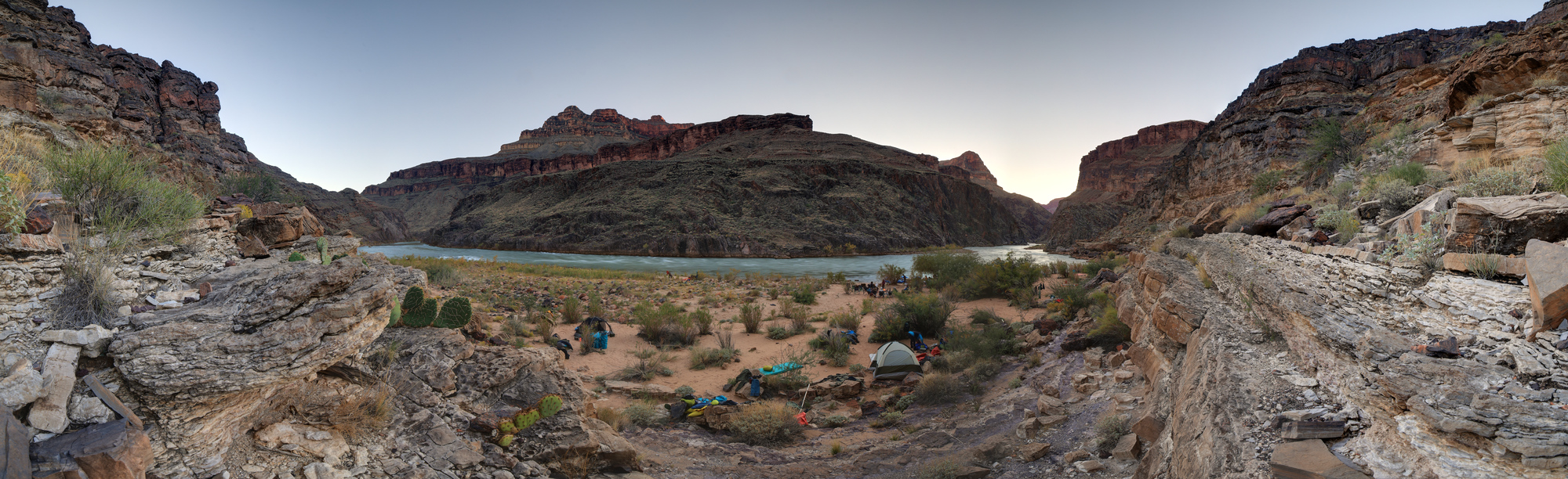
Looking down at Below Bass Camp just before sunset
After a great pasta dinner I headed off to bed. I was feeling a little sore from the paddling, so I was ready to lay down and get some rest. Camping in the Grand Canyon is a little different than what I’m used to at home. Given the consistent weather I ended up spending every night sleeping under the stars. By the time I was headed to bed, the clear blue skies had transformed into an incredible display of the Milky Way. The stars were simply spectacular, and the light pollution was non-existent. It was pretty magical to watch that sea of starts move across the sky over the course of the night. Every time I woke up they had shifted, revealing new constellations, and in the early morning the moon rose and changed it all again.
I know it has been a while since I posted some updates here, so I’m going to kick it back off with a big one! I recently got back from a 17 day trip through the Grand Canyon, kayaking and rafting on the Colorado River. It was a spectacular journey, but before we get ahead of ourselves we have to get down to the river…
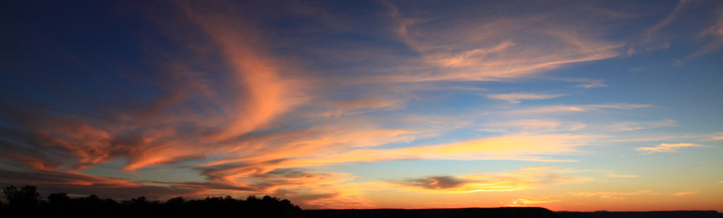
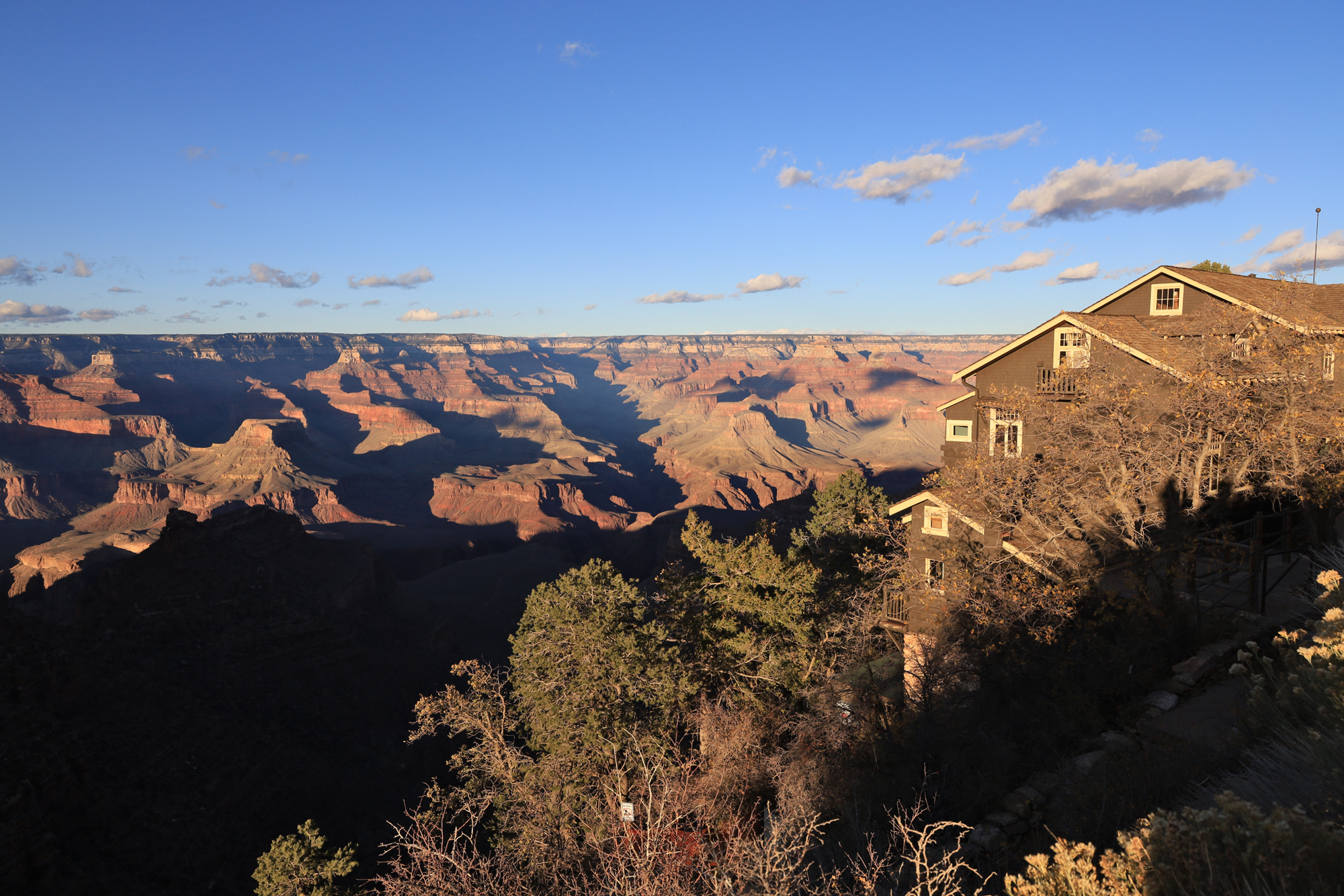
Sunset over the canyon and Kolb Studio
Looking down into the canyon from the rim towards the river
We started the trip by driving up to the national park from my parent’s house outside of Tucson. We were staying at a hotel at the rim that night, so after checking in we went for a walk out to see the sun go down. The view was beautiful (as always), but we were also immediately surprised at how cold it was up there in October! Unfortunately, most of our equipment and clothing was waiting for us on the rafts at the bottom of the canyon. After the sun went down we got some dinner and then headed to our room nice and early so we would be ready for our departure first thing in the morning.
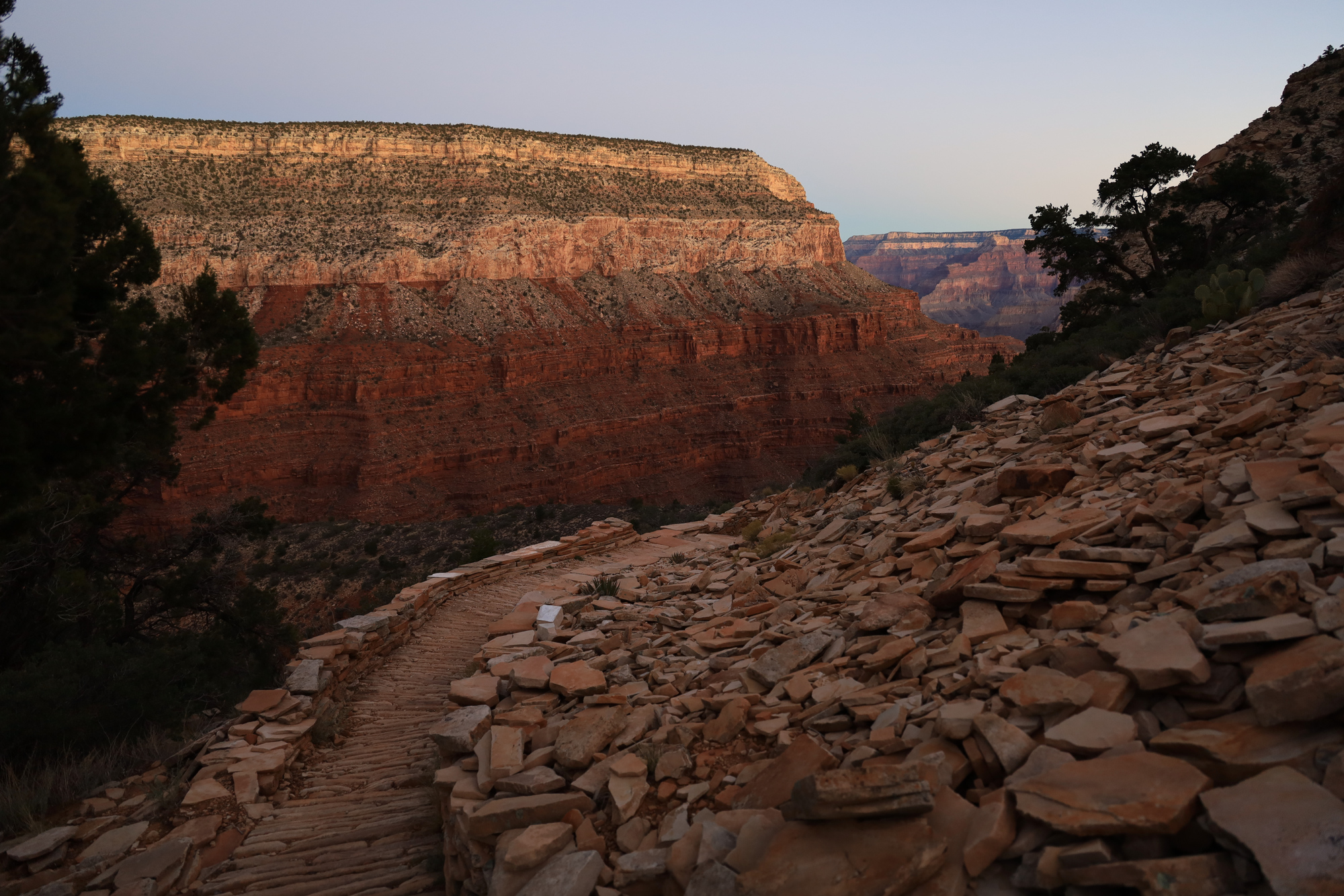
We crossed some very impressive trail work as the sun started to light up the sky
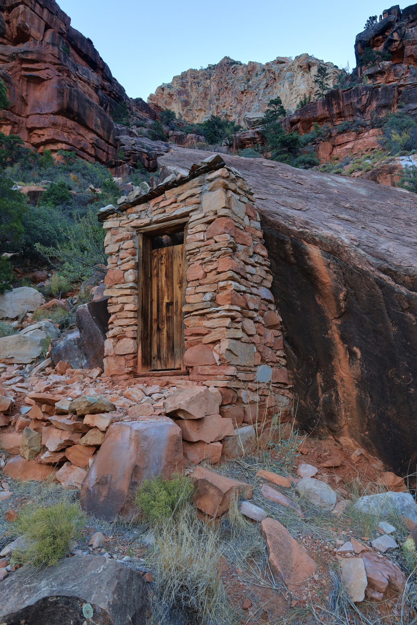
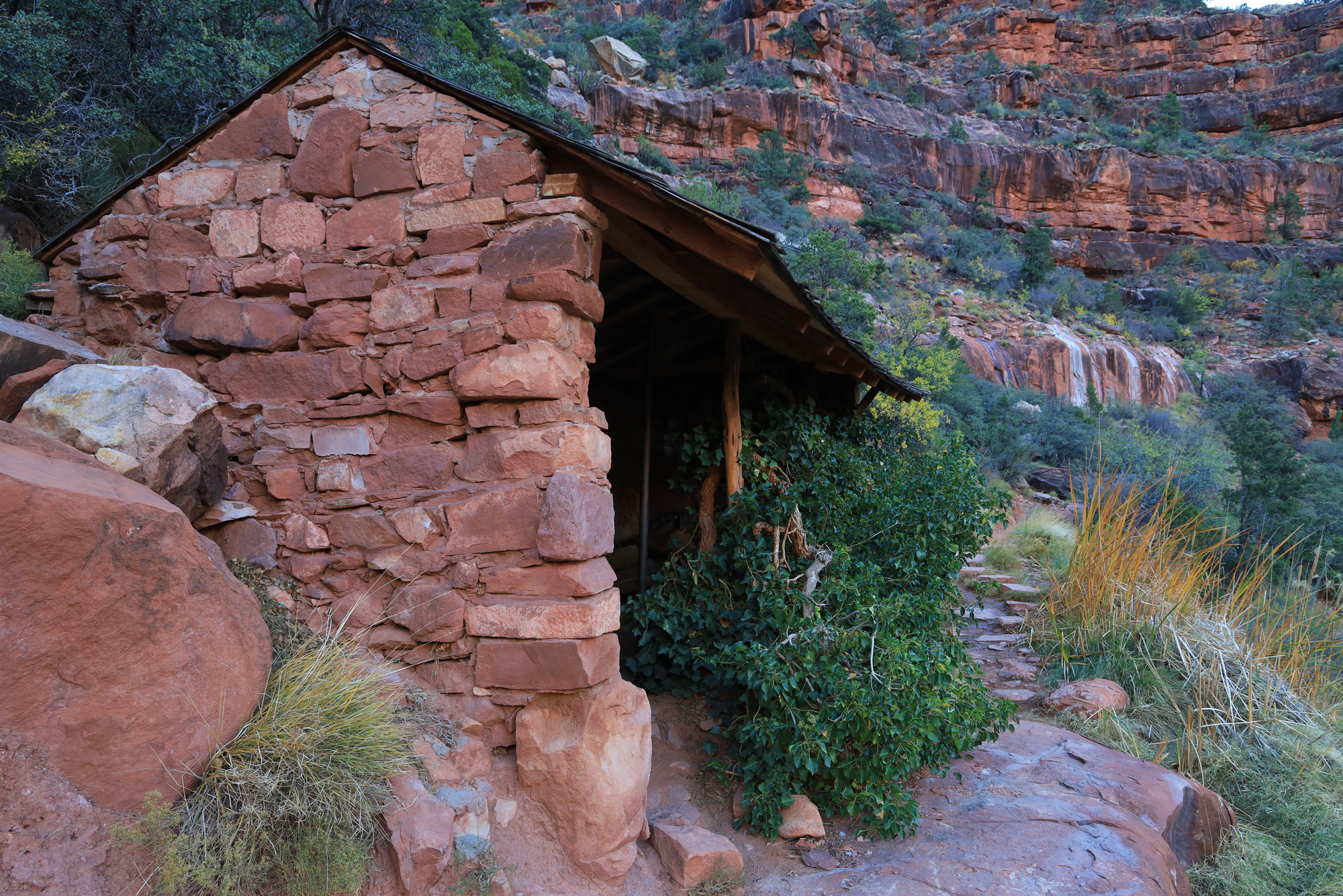
We woke up at 4:15 AM, put on as much clothing as we could manage and headed over to the tram stop that would take us out to Hermit’s Rest. We caught the first shuttle at 5 AM and by 5:45 we were headed below the rim with the trail lit only by our headlamps. It was a cold start to the day, but fortunately it started to warm up more and more as the sun came up. We made quick progress down the first layers of the canyon and stopped for a break at a shelter near Santa Maria Spring.
A small shelter near the trail
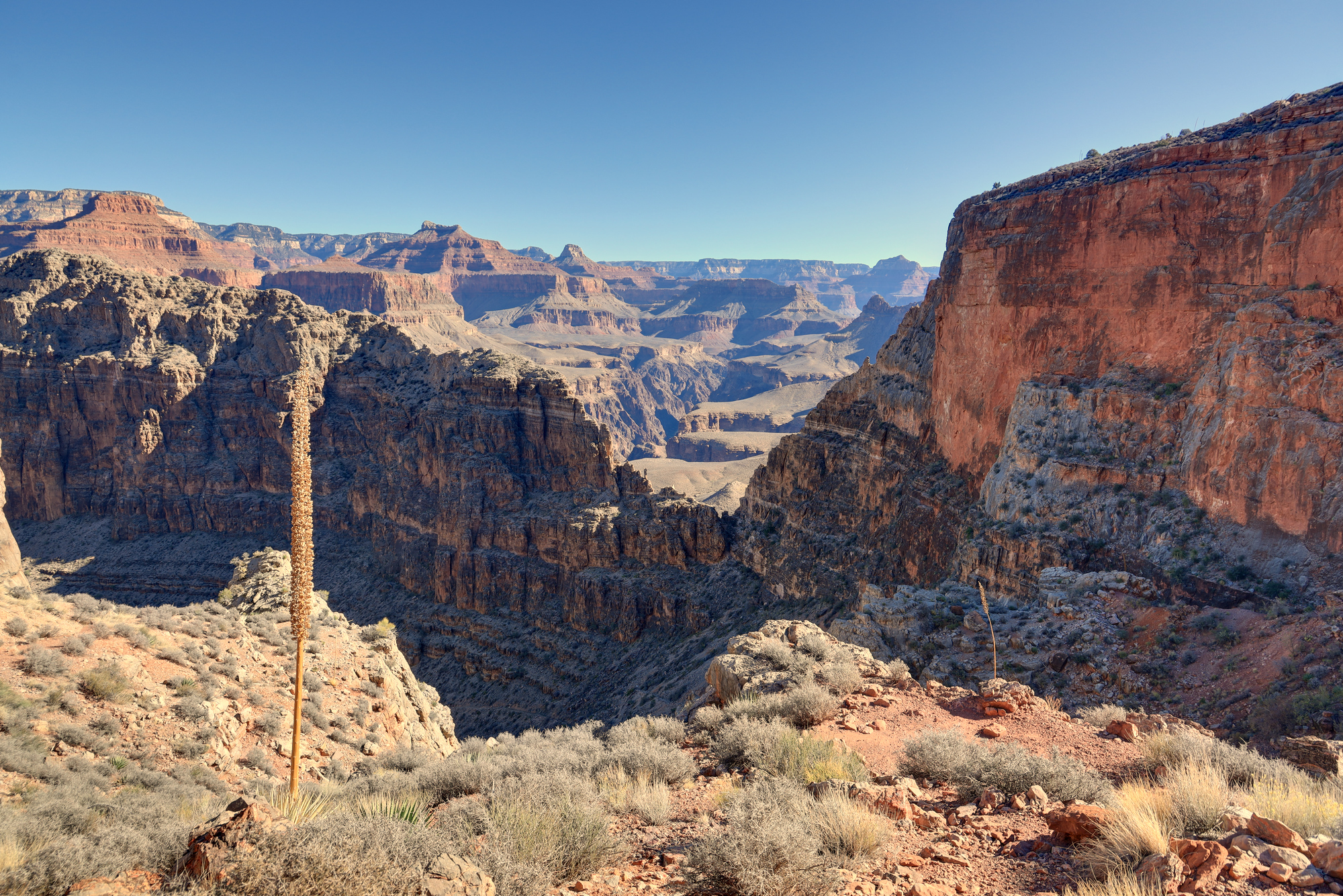
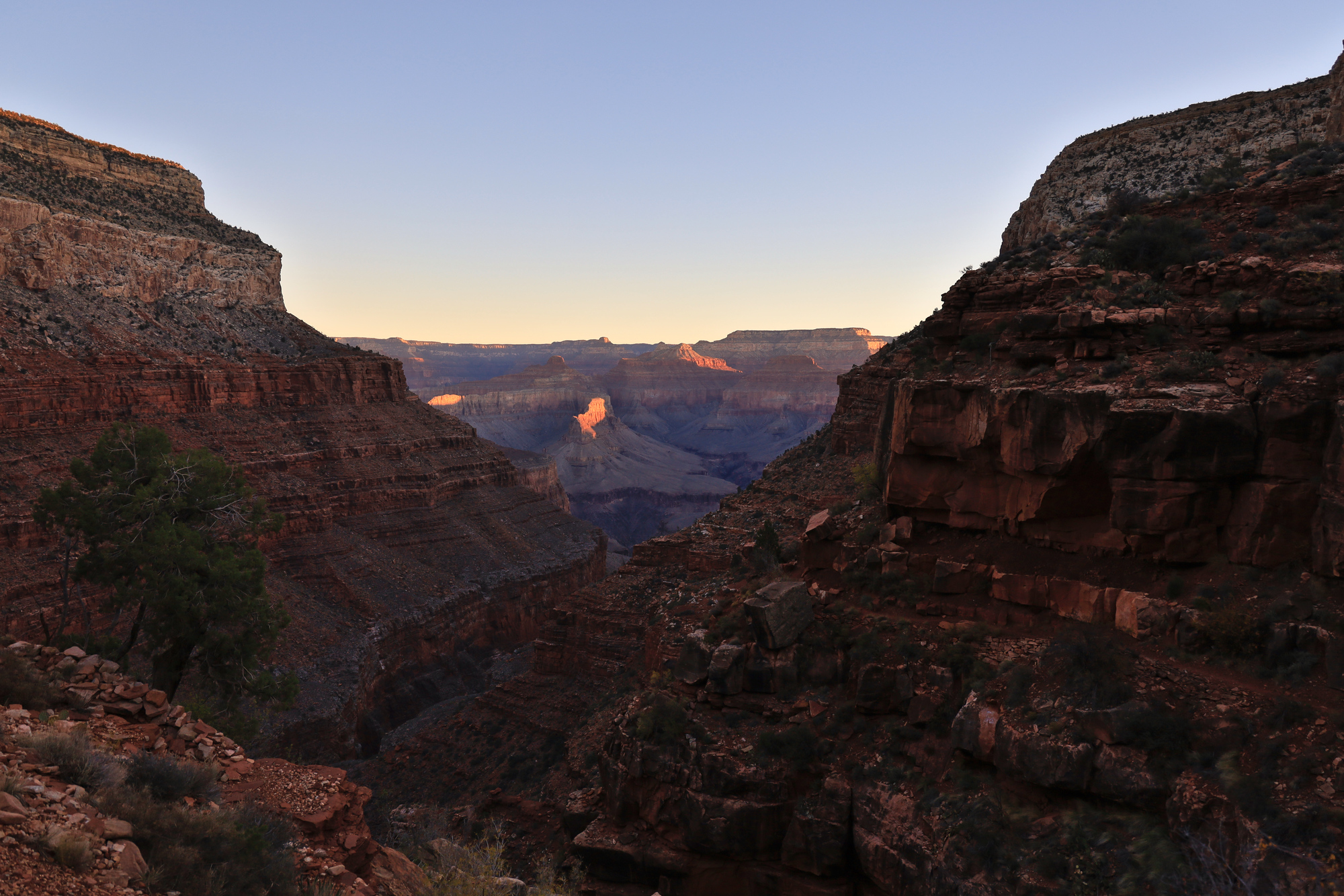
Looking out into the center of the canyon as the sun starts to touch the mesas
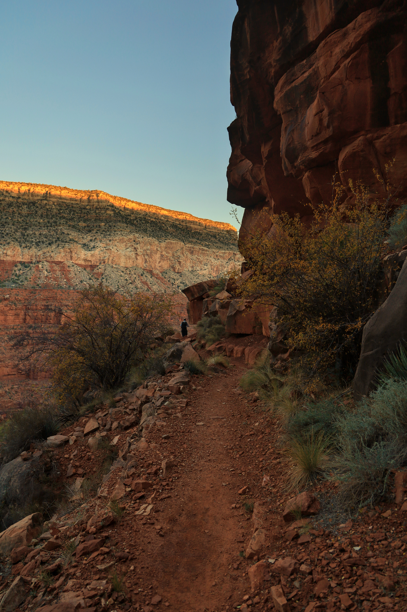
After a steep initial descent the trail leveled out a bit and traversed it’s way out towards the main canyon. We passed a couple of impressive overlooks, saw a few other groups backpacking, and admired the massive cliffs that towered above and below us. As we progressed the sun slowly climbed higher and higher, but it still took many hours for us to emerge into full sun. After about 6 miles we came to the second steep descent. The trail through this section was noticeably more rough, with a lot more signs of erosion and fewer signs of use.
Looking down into the cut where our second steep descent brought us through the Muav Limestone
Looking west across Hermit Canyon as we descended the Bright Angel Shale
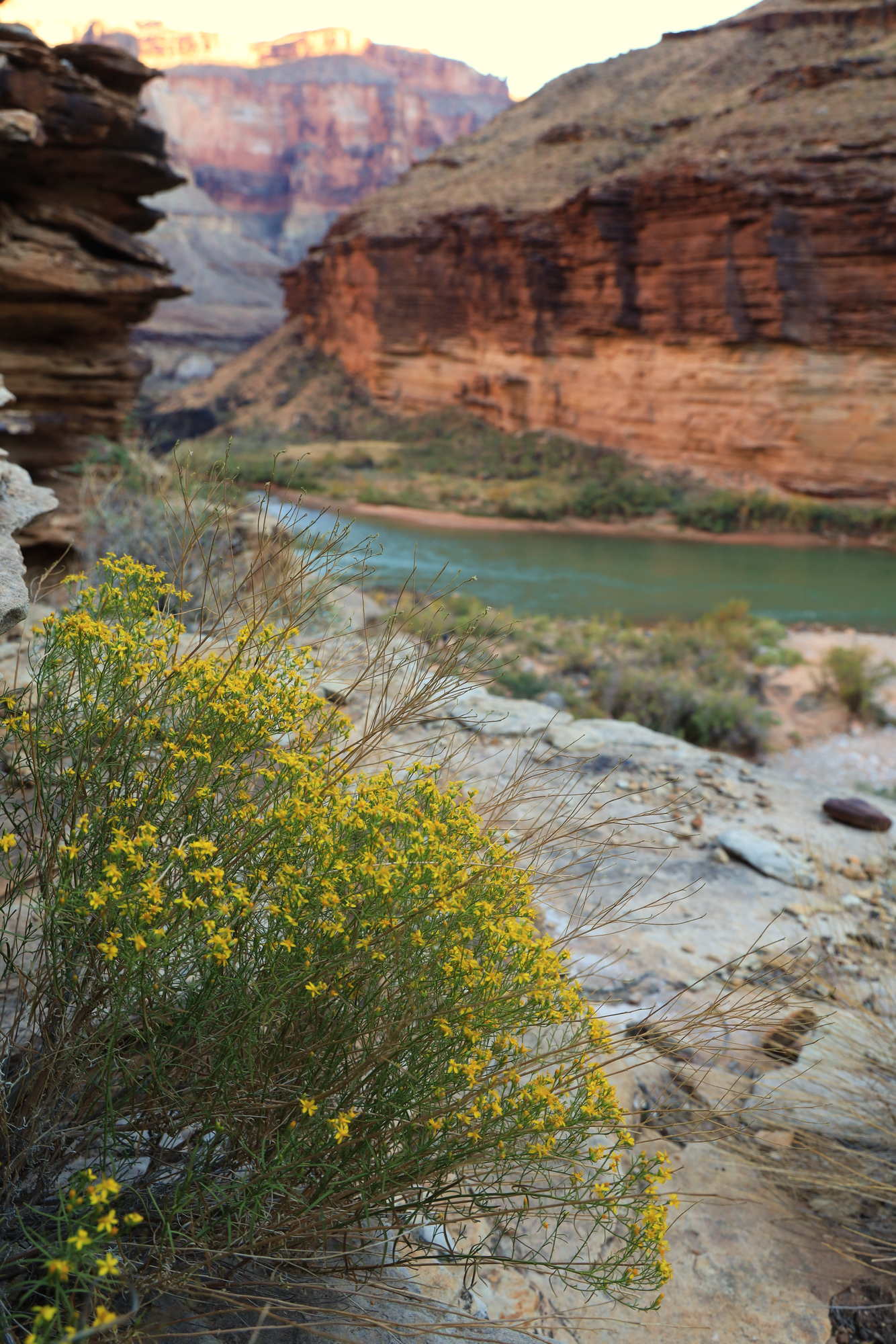
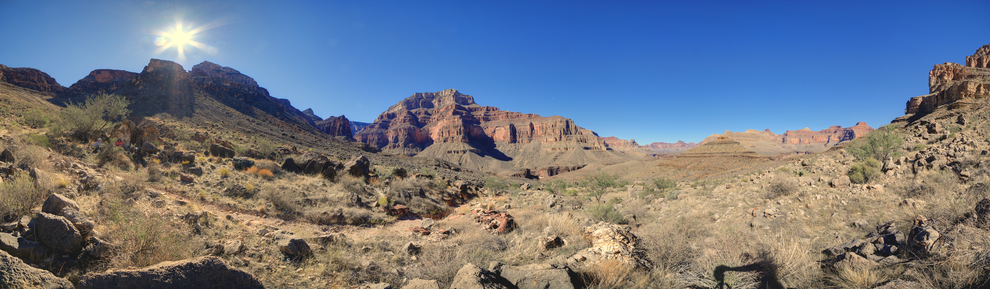
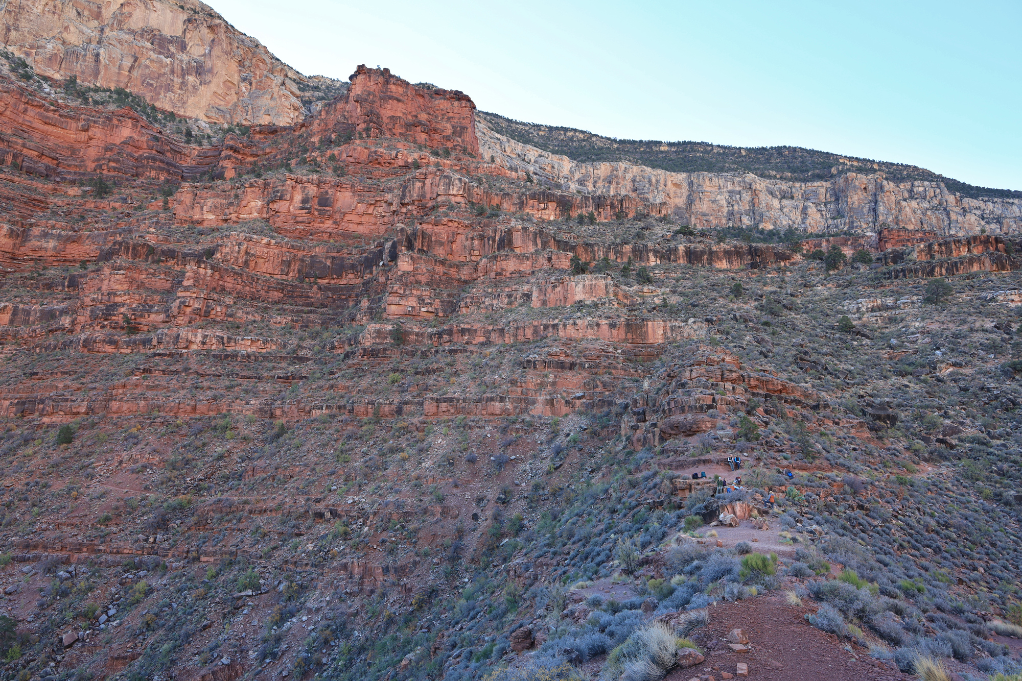
At this point we were all feeling the thousands of feet we had descended in our knees, so we took another break and then started the traverse over to Monument Creek along the Tonto Trail. Fortunately this section was pretty flat and we made good time in full sun. This is also where we caught our first real glimpses of the river that we would be riding for the next couple of weeks. It was great to have the end in sight.
The view from our second rest stop near the turn towards Granite Canyon
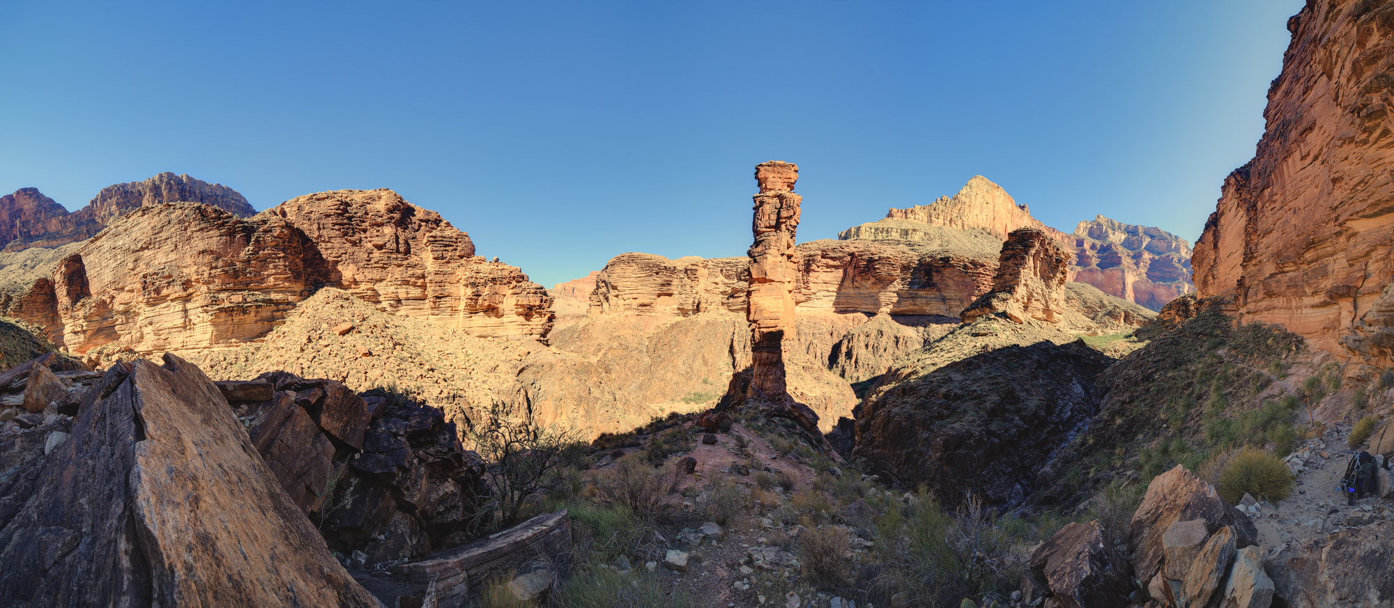
As we started the final descent down to the level of the river we were surprised to find the monument that gave the trail it’s name. It’s a tower of rock sitting above the creek bed. The trail winds it’s way right past it, so it really dominates your view for a bit. In retrospect this tower was a sign of things to come. A destination worthy in it’s own right that is of no particular importance because of it’s location deep in the canyon. It was still a sight to take in, so we took one last break here and then headed out the wash to meet up with the rest of the group that had paddled in.
The monument tower as seen from the trail
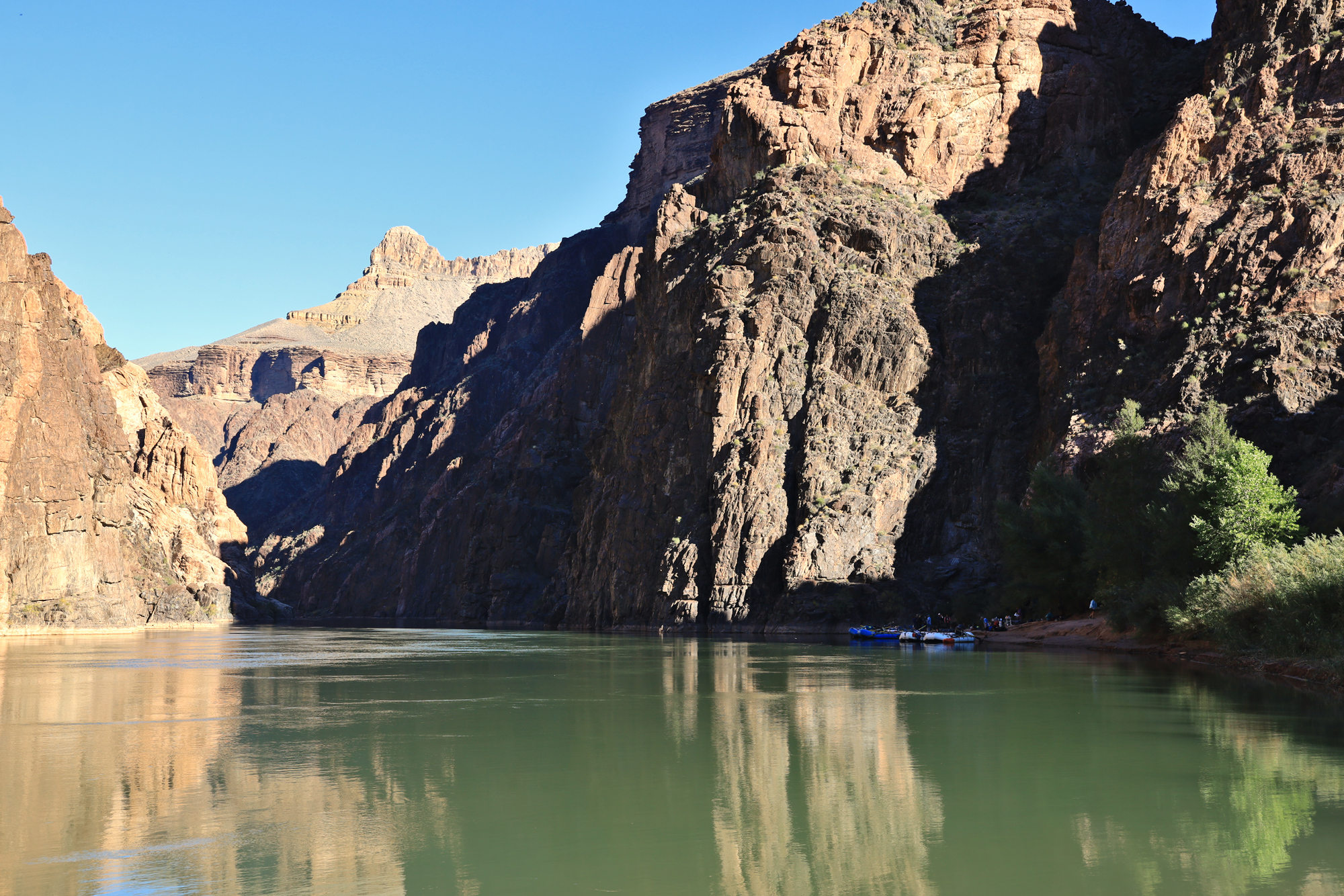
In the end the hike was around 11 miles, descended 5000 feet, and took us 7 hours. We were all very happy that we didn’t have to hike back up, and instead sat down for a cocktail at camp. I was eager to check out the whitewater, so I ran down the rapid to take it in. It only took a minute to realize that the whitewater on this trip was going to be a blast as well, so I came back to camp excited and ready for the next day. Though it was the end of our first big day and our big hike, this was just the start of the adventure to come.
Granite Camp with the boats tied up for the evening
Looking upstream at Granite Rapid with a fellow paddler for scale
My dad and I were so impressed by our hike the previous day that we had to return the following day to do the echo canyon loop with my mom as well. This time we took a shorter loop. First down the Echo Canyon trail, then up the Hailstone Trail. The hike down Echo Canyon did not disappoint, just like the day before.
A hoodoo with some interesting erosion towering over the trail
Looking down through a gap in the rocks at the trail below
A pair of lizards watch us hike by
We took our time on the downhill and enjoyed the view, but before we knew it the trail leveled out and we started to traverse back towards the start. All in all it was a much shorter hike than the day before, but quite spectacular. After making our way back up to the trail head it was time to drive down and out of the park towards home.
The main reason we traveled out to Arizona at this time was to get a chance to spend some time with my parents. Given the airline travel and our quarantine requirements, we were keen to find as many ways as we could to spend time together in a safe way. One idea that immediately got traction was a camping trip to Chiricahua National Monument. It has been a recent favorite for my parents, and high on my list as well. I took a couple of days off of work and drove down to the mountains to set up camp.
Approaching the Chiricahua Mountains
The drive out was only a few hours, and took me through a range of classic Arizona scenery, with mountains separated by large dry valleys. After arriving at the mountains I found a back country camp site in the national forest and set up camp to wait for my parents to arrive. Though I ended up being more complicated than expected to find, we eventually met up, had dinner and relaxed by the camp fire to make plans for the next day.
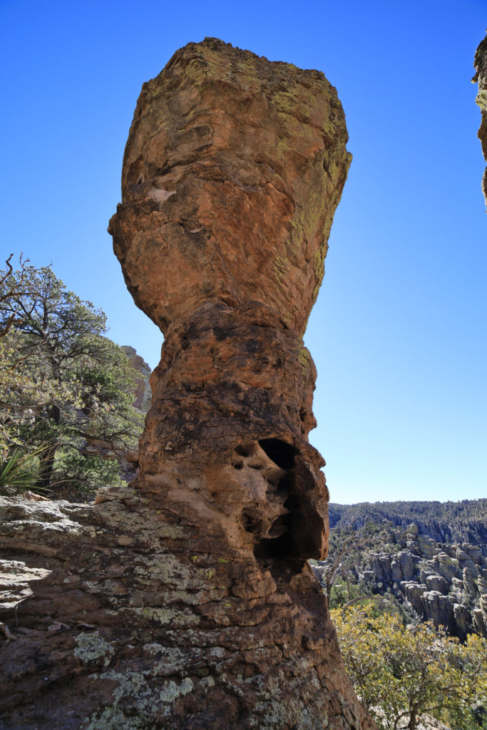
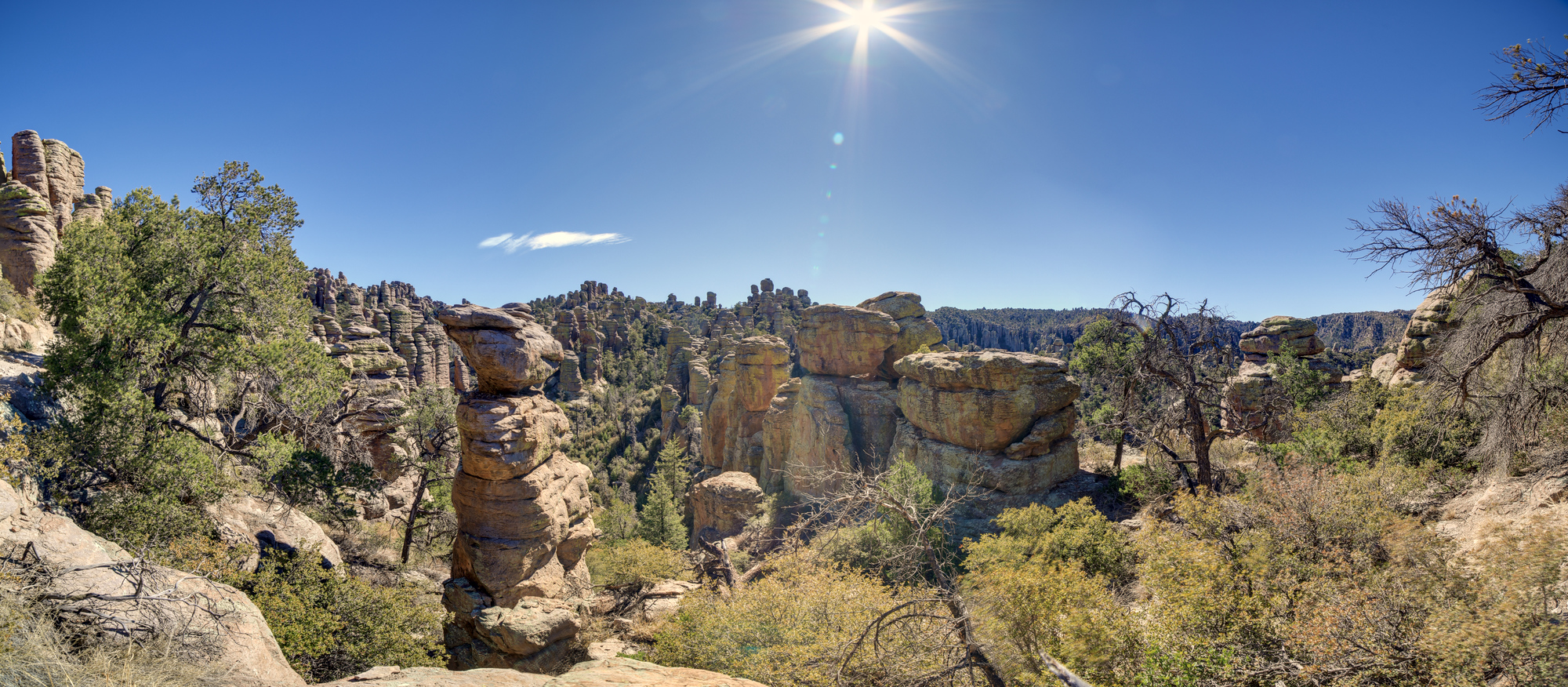
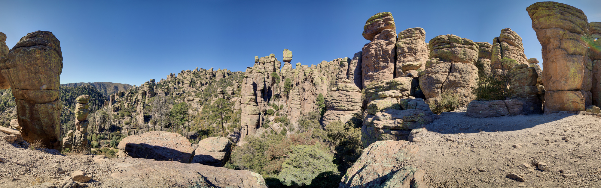
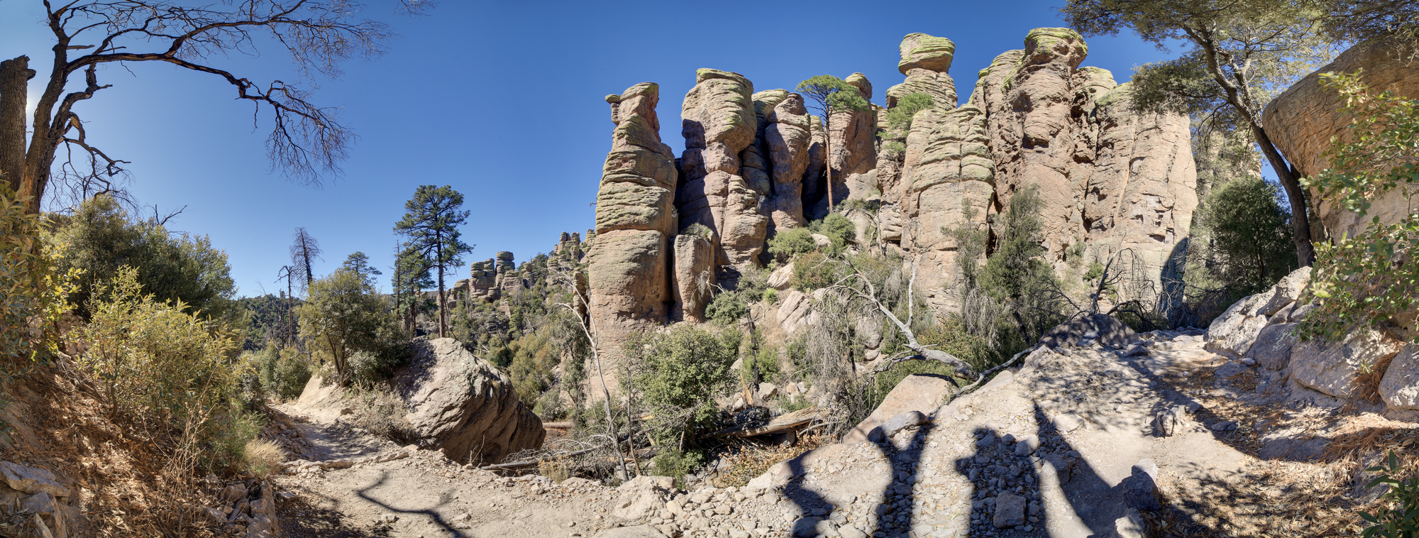
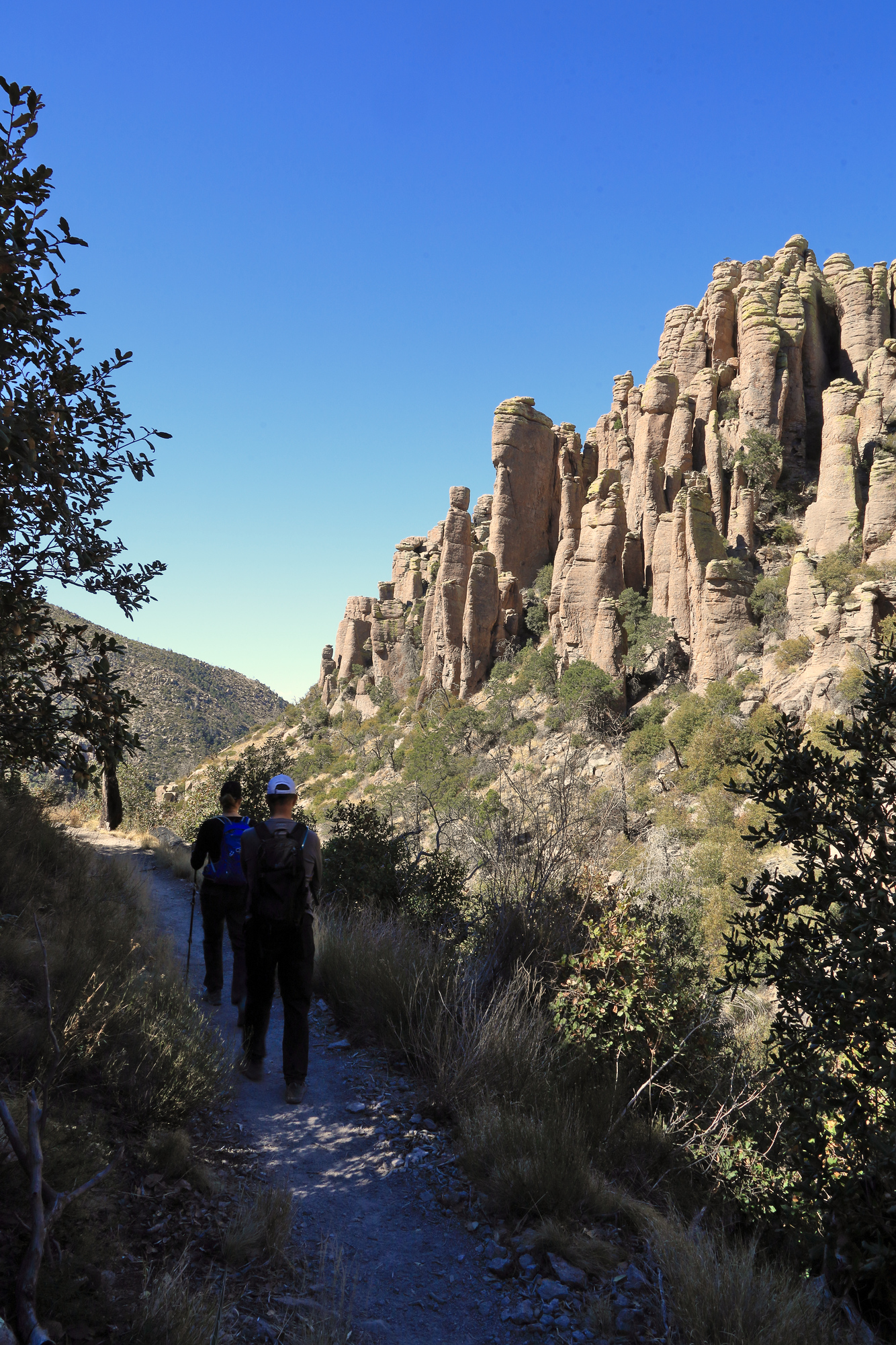
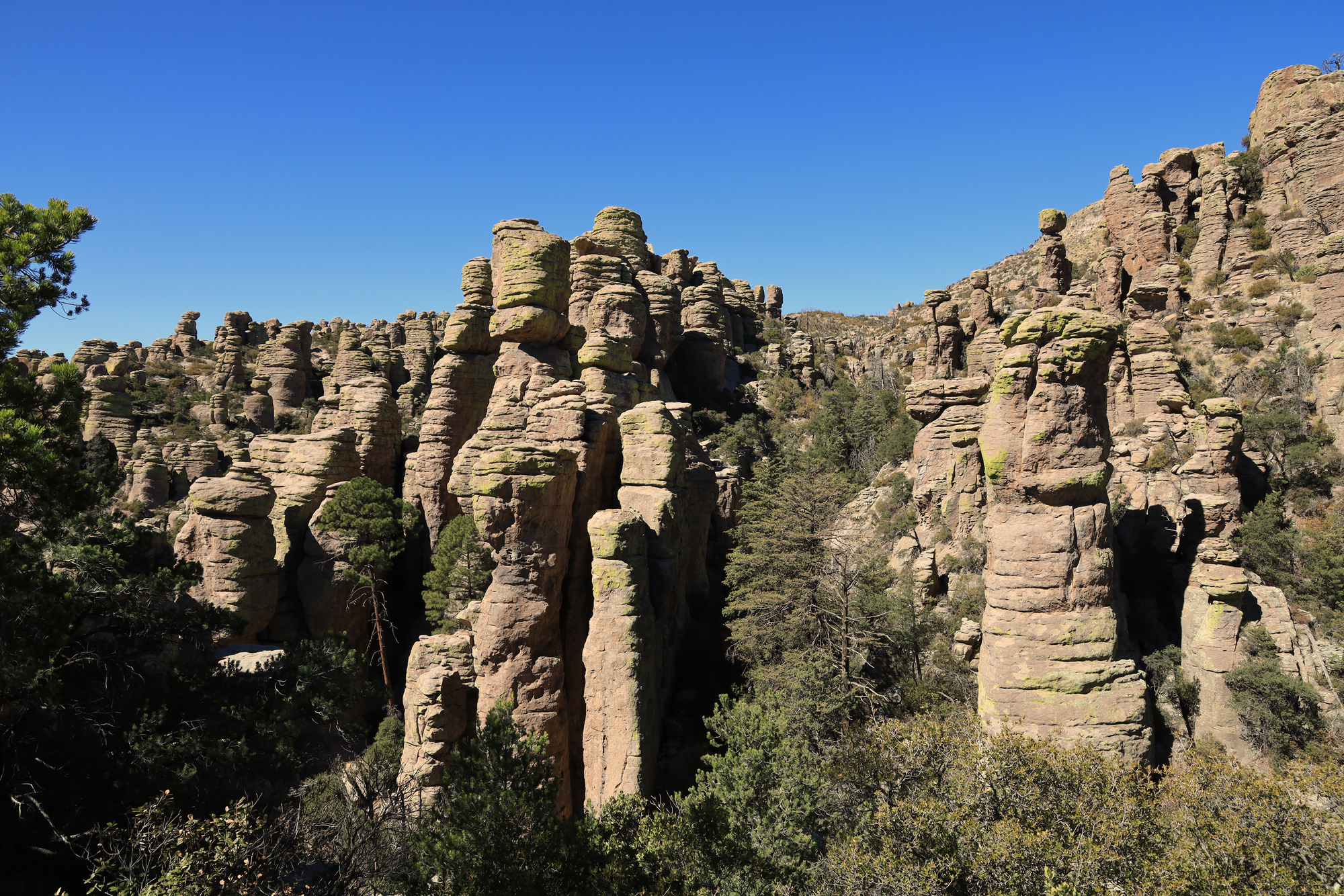
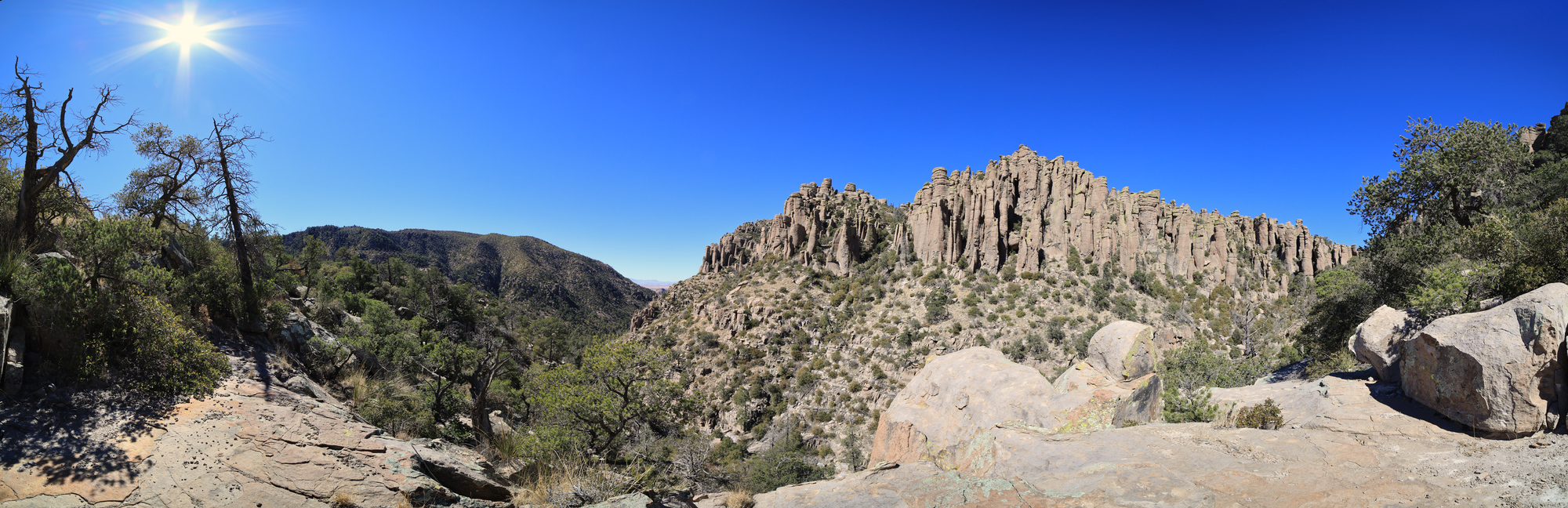
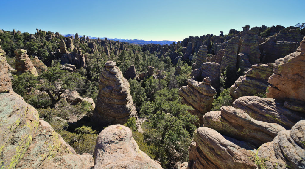
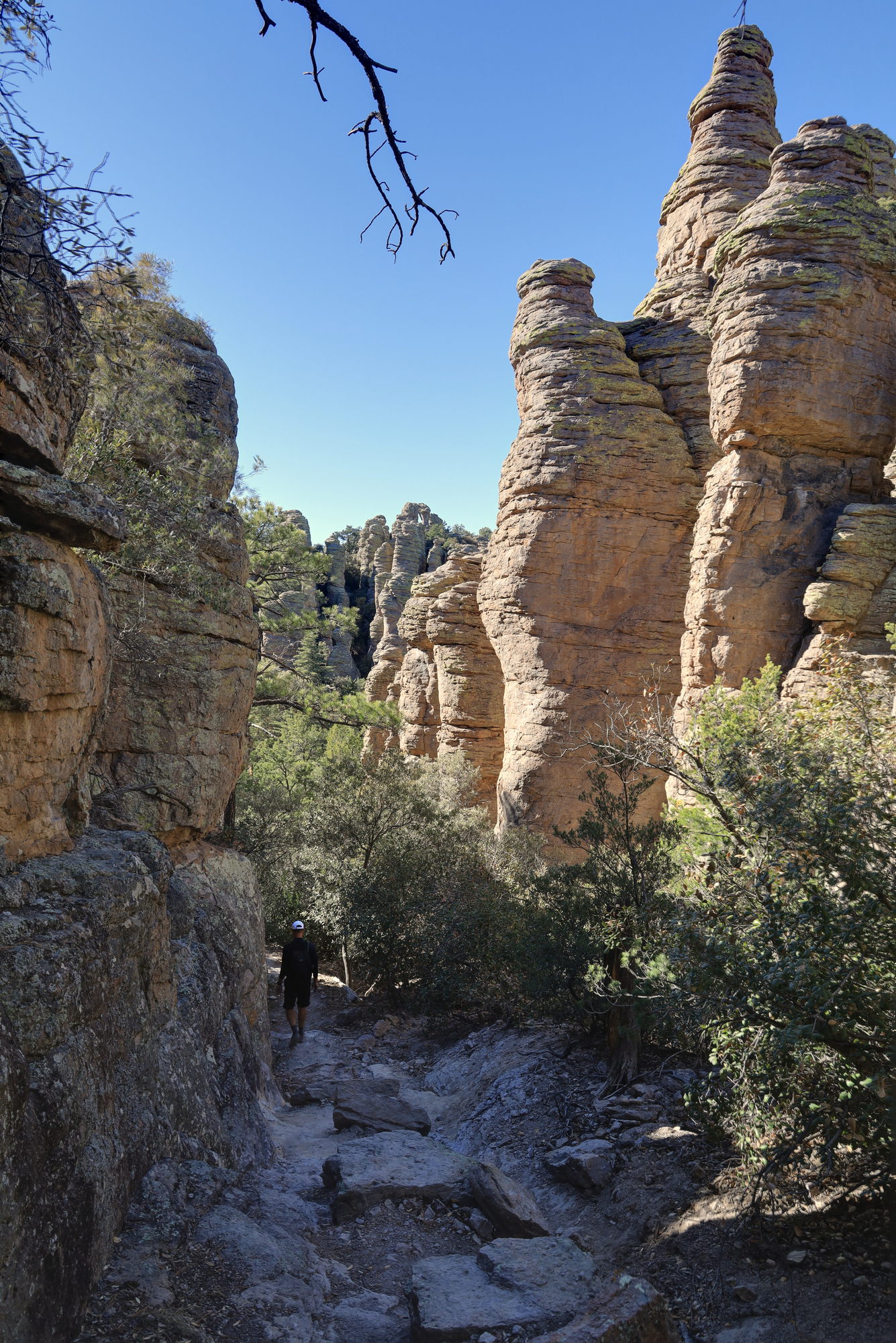
The next morning my dad and I headed up into the park to go for a nice long hike through the hoodoos. Our goal was to do a long loop to the Heart Of Rocks loop. From everything we had heard and from my parent’s previous experience this part of the park had the best views of the rock formation. We started off at the Massai Point trail head and hiked out along the Echo Canyon Trail. It did not take long for me to be impressed by this landscape. As we started to descend into the canyon the hoodoos rose all around us. They came in a wide variety of shapes and sizes. It was all reminiscent of more famous destinations like Bryce Canyon, but without all the crowds.
A view of the hoodoos from inside Echo Canyon
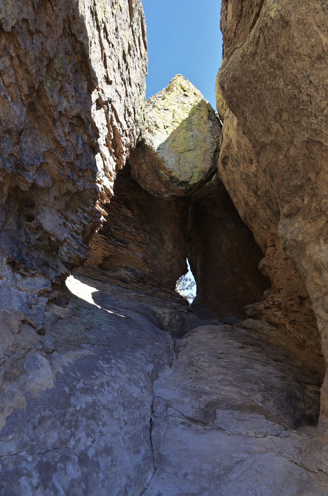
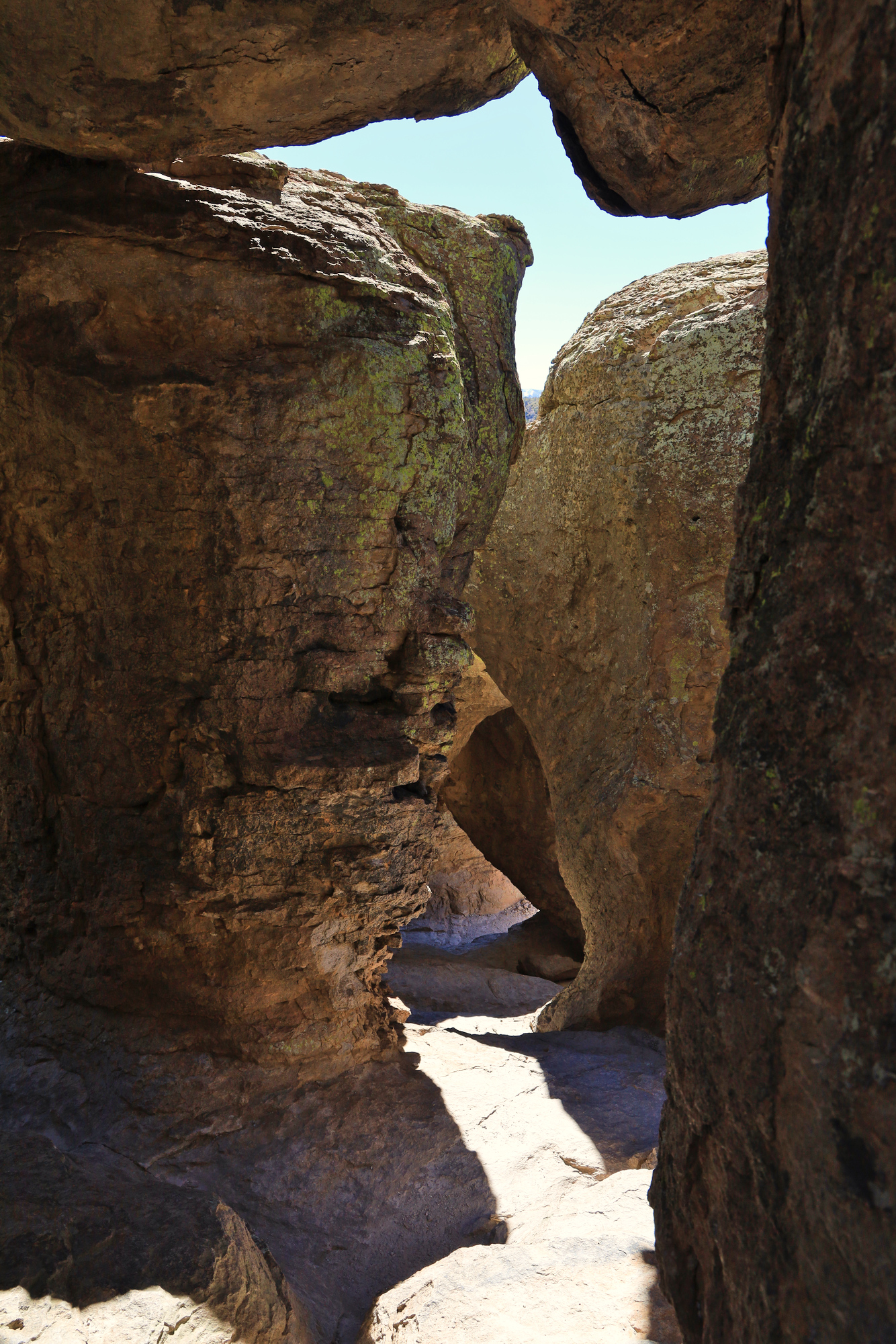
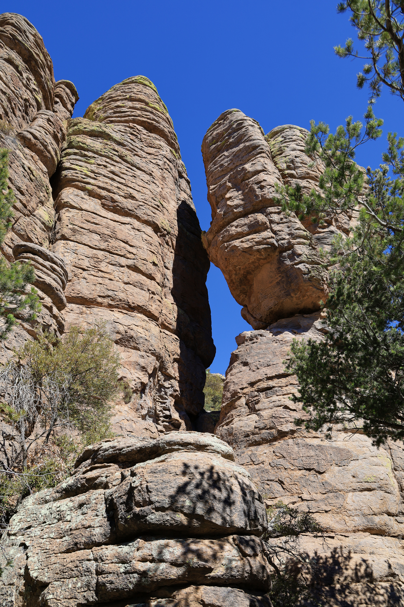
The trail had more than just views of hoodoos though. Right off the bat you are treated to a formation called the Grotto, which consists of a number of stone arches, and boulders stuck between the hoodoos forming a system of small caves. The trail goes right past the Grotto, so its easy to climb around in the middle of it exploring the different passages. By the time we made it down into the main descent it was clear that this would be a spectacular hike.
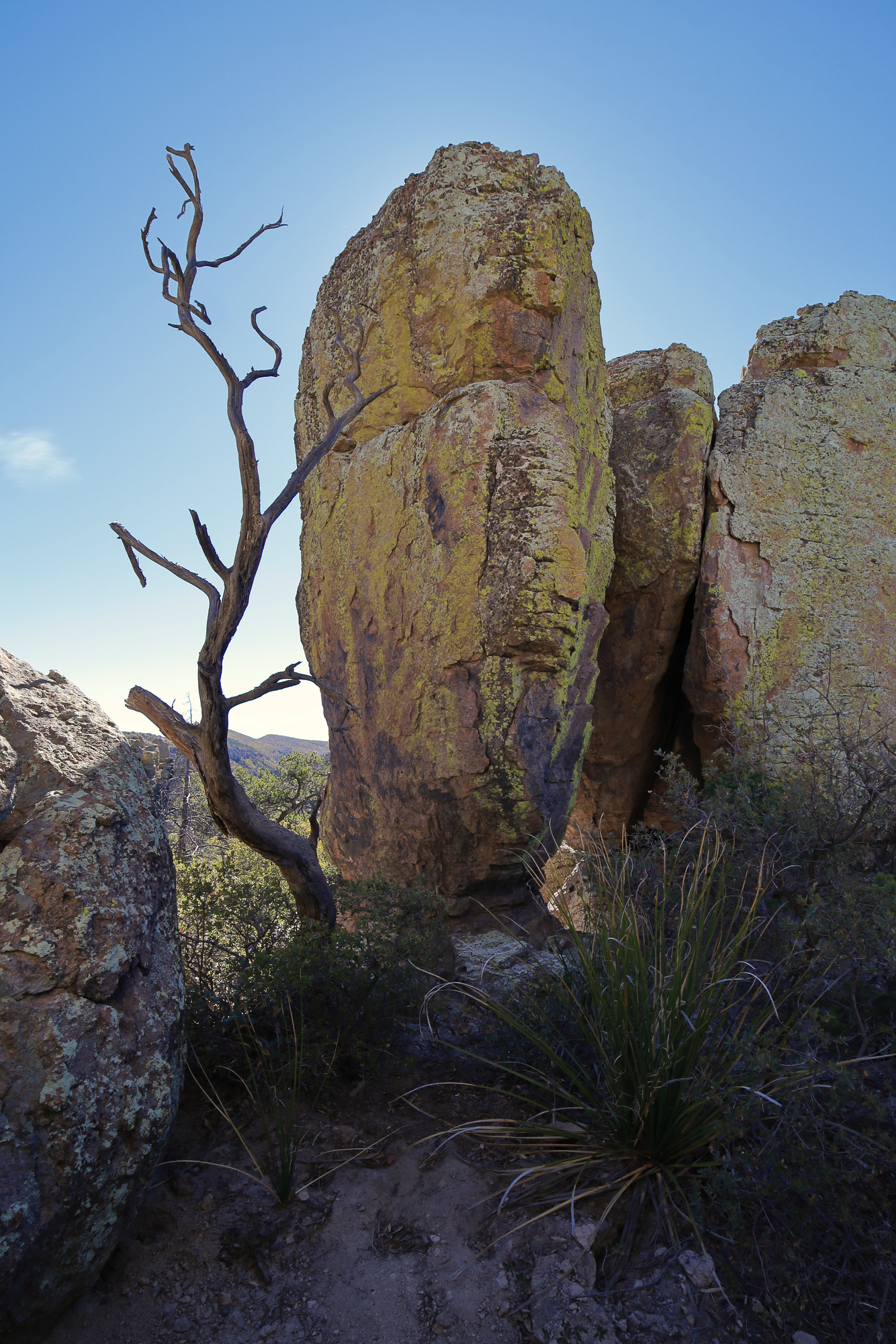
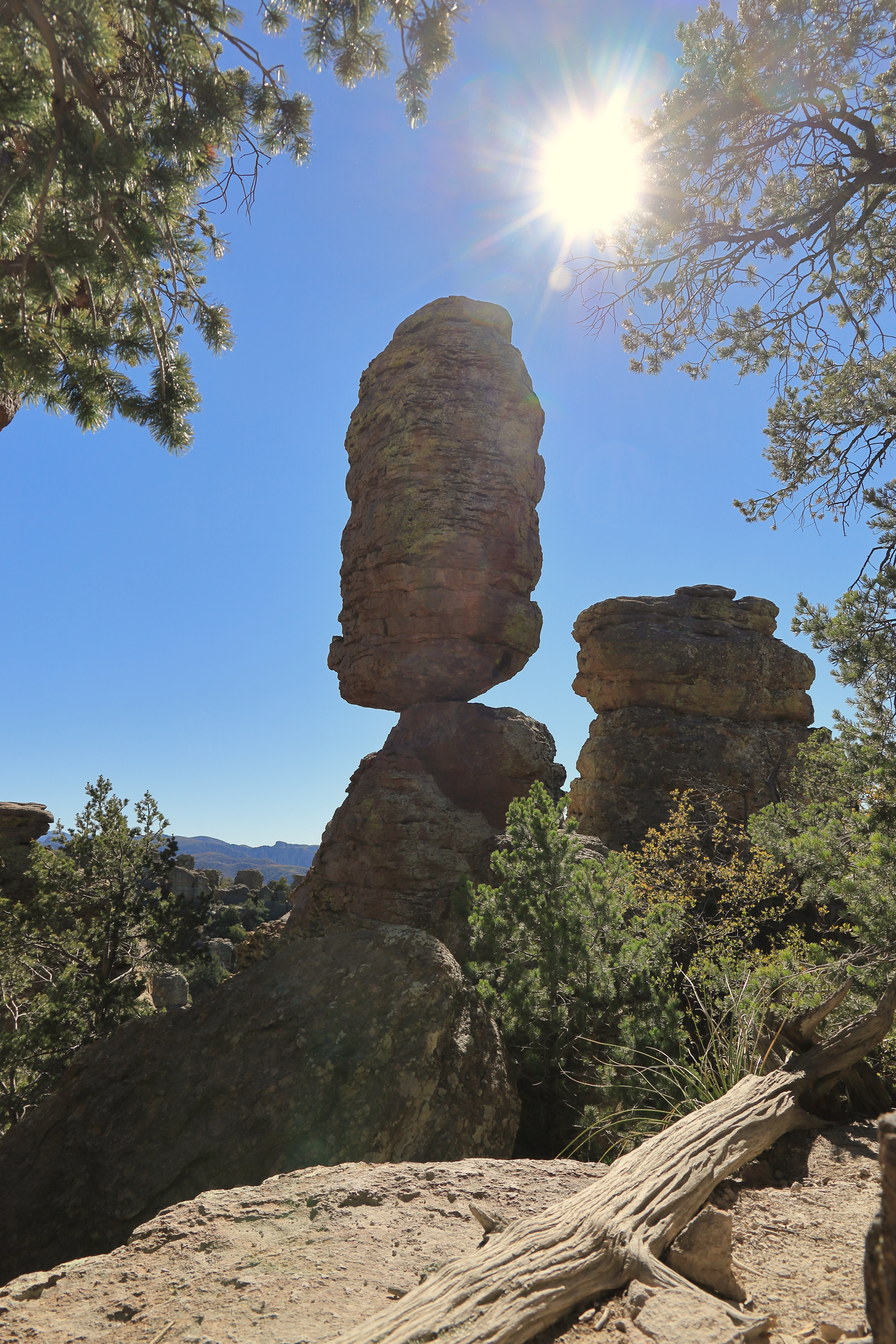
This boulder hardly looks like there is anything holding it up
Looking down through the arches of the grotto
After descending to the bottom of the canyon the trail flattened out a bit and we started traversing across the valley to the Sarah Deming Trail. It was a long gradual descent, followed by a long gradual ascent up the other side as we made our way over to the Heart of Rocks. This portion of the trail was still very pretty, though in a different way. There were far more trees and undergrowth. It felt more alpine, even though we were lower than when we started.
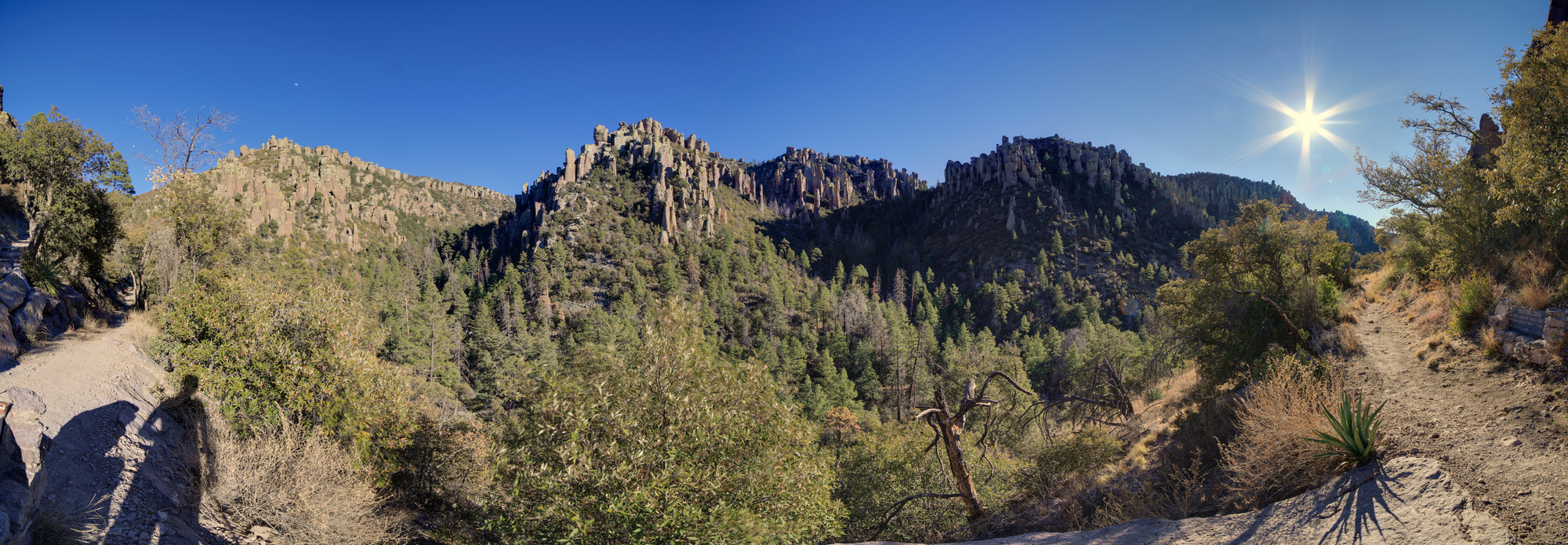
Echo Canyon on the right, with Rhyolite Canyon on the left
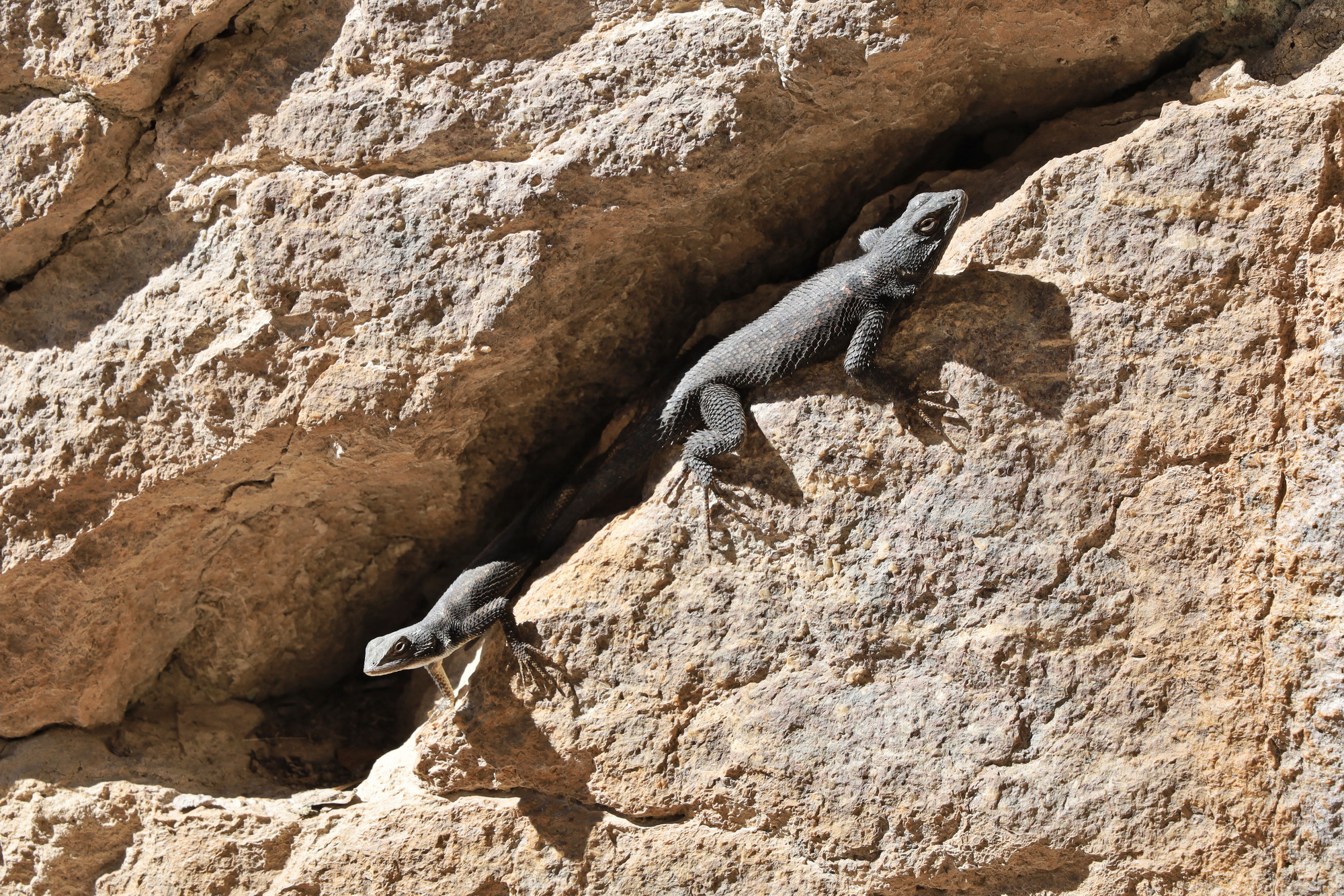
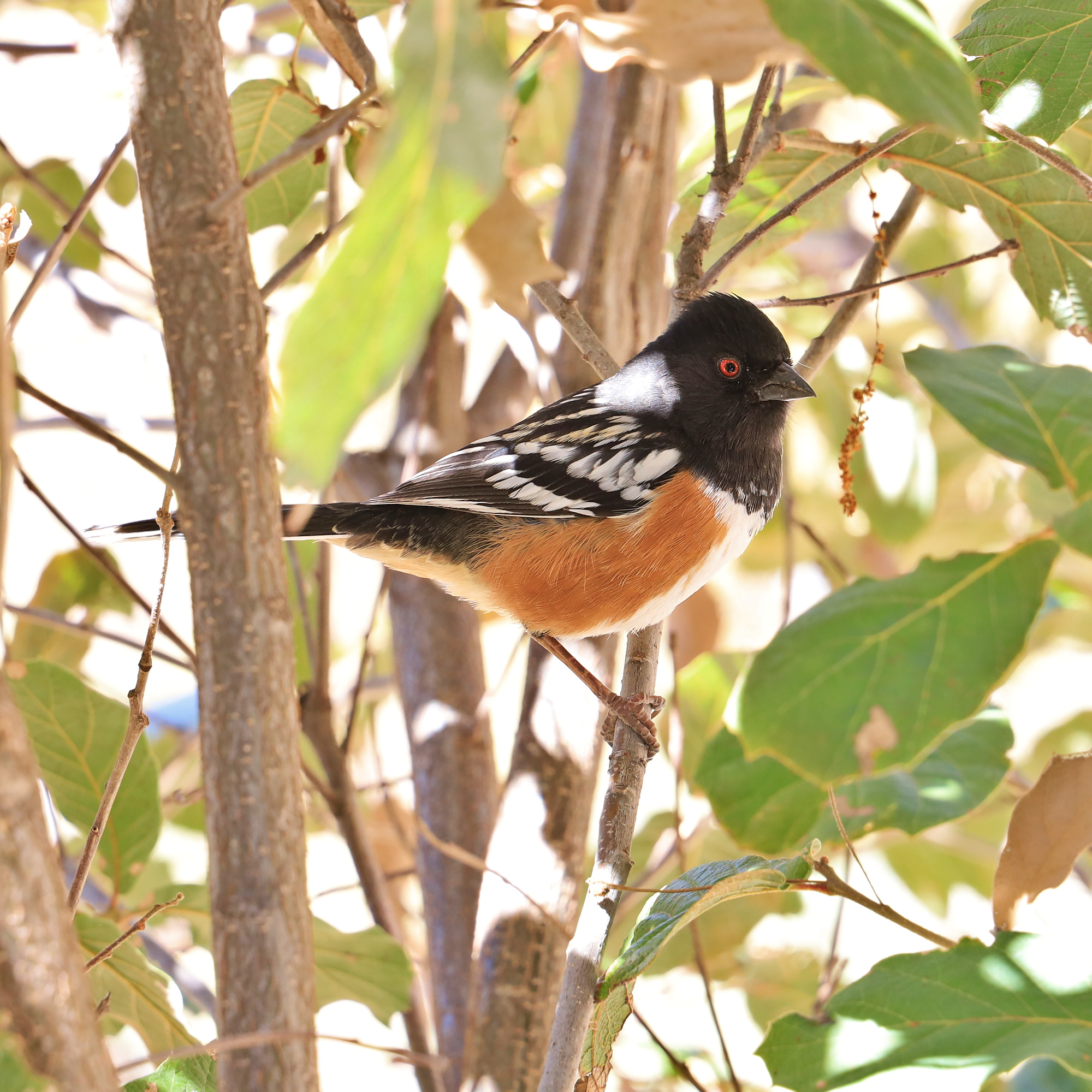
A very friendly Spotted Towhee that lives at the bottom of Echo Canyon
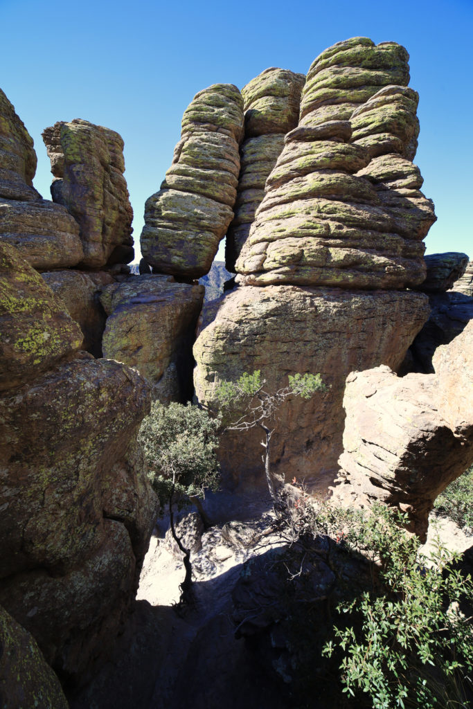
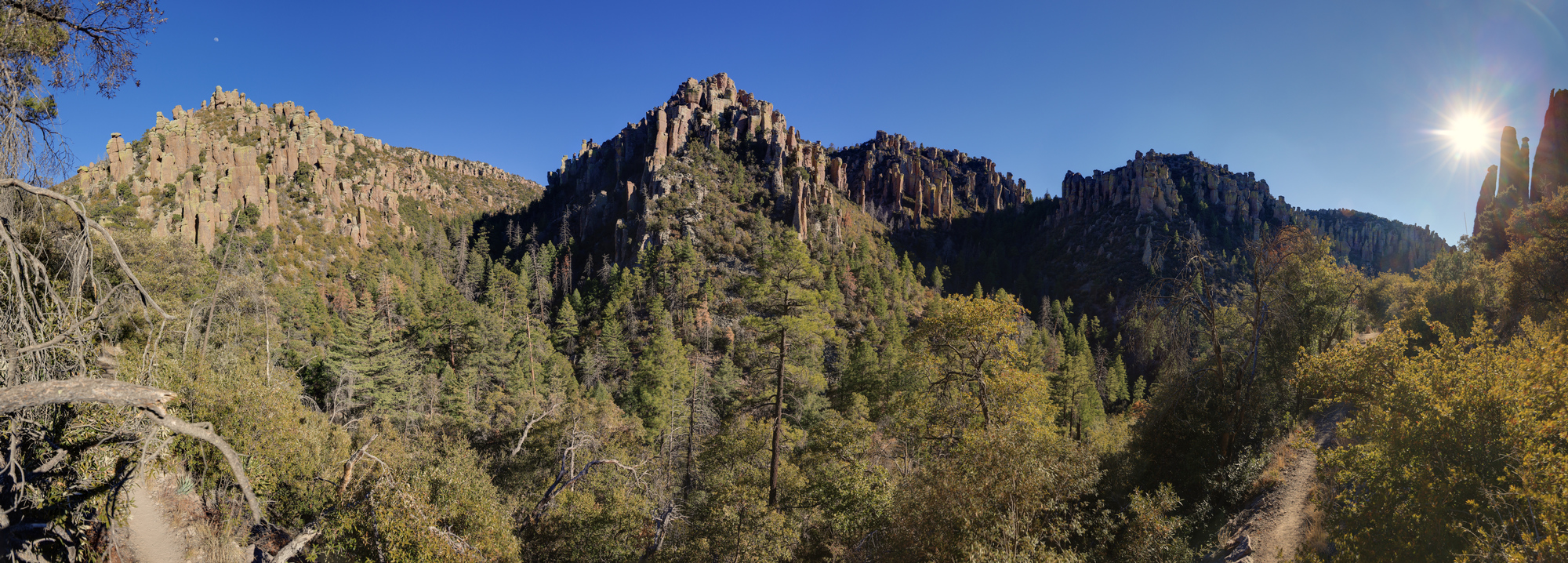
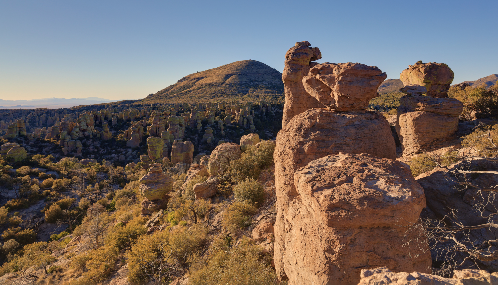
We soon arrived at the Heart of Rocks loop and took a short break for some water and a snack. This is clearly a popular destination, and we quickly started seeing many more people than we had earlier on our hike. We made our way slowly around the loop taking in the many different rock formations, many of which had names (though some were more clever than others). Though it is a short loop, it’s packed with hoodoos of various shapes and sizes, and is definitely a sight to see.
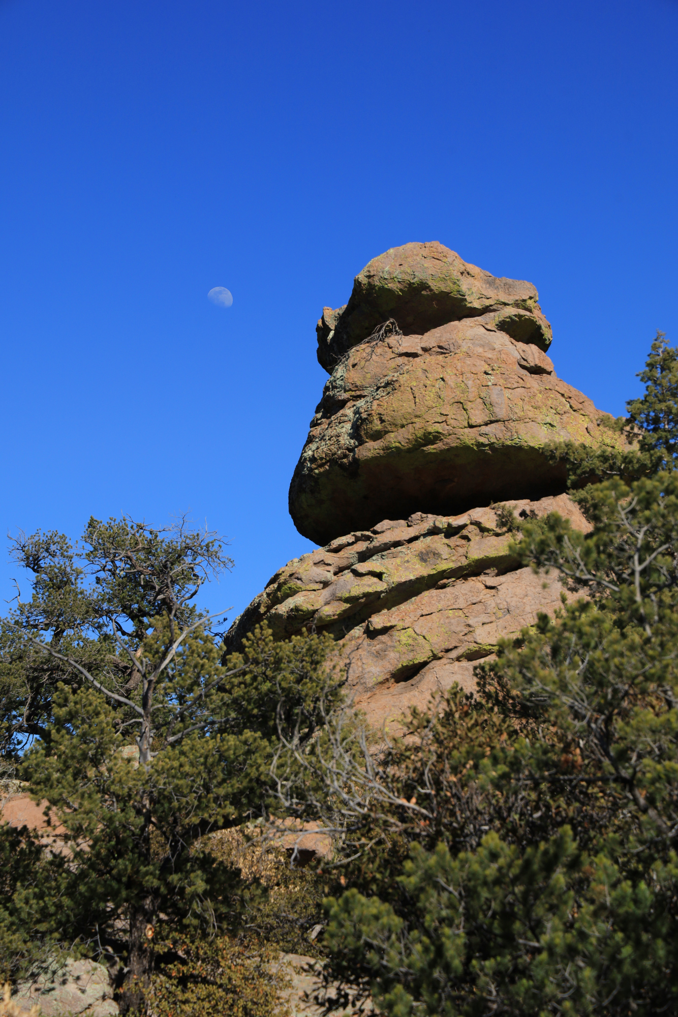
The moon hanging over the top of a hoodoo
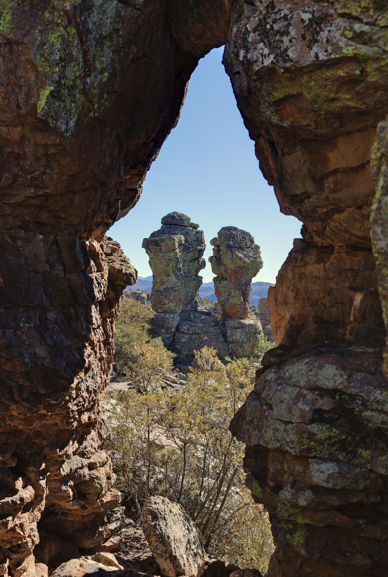
Punch and Judy arguing away
The heart of rocks
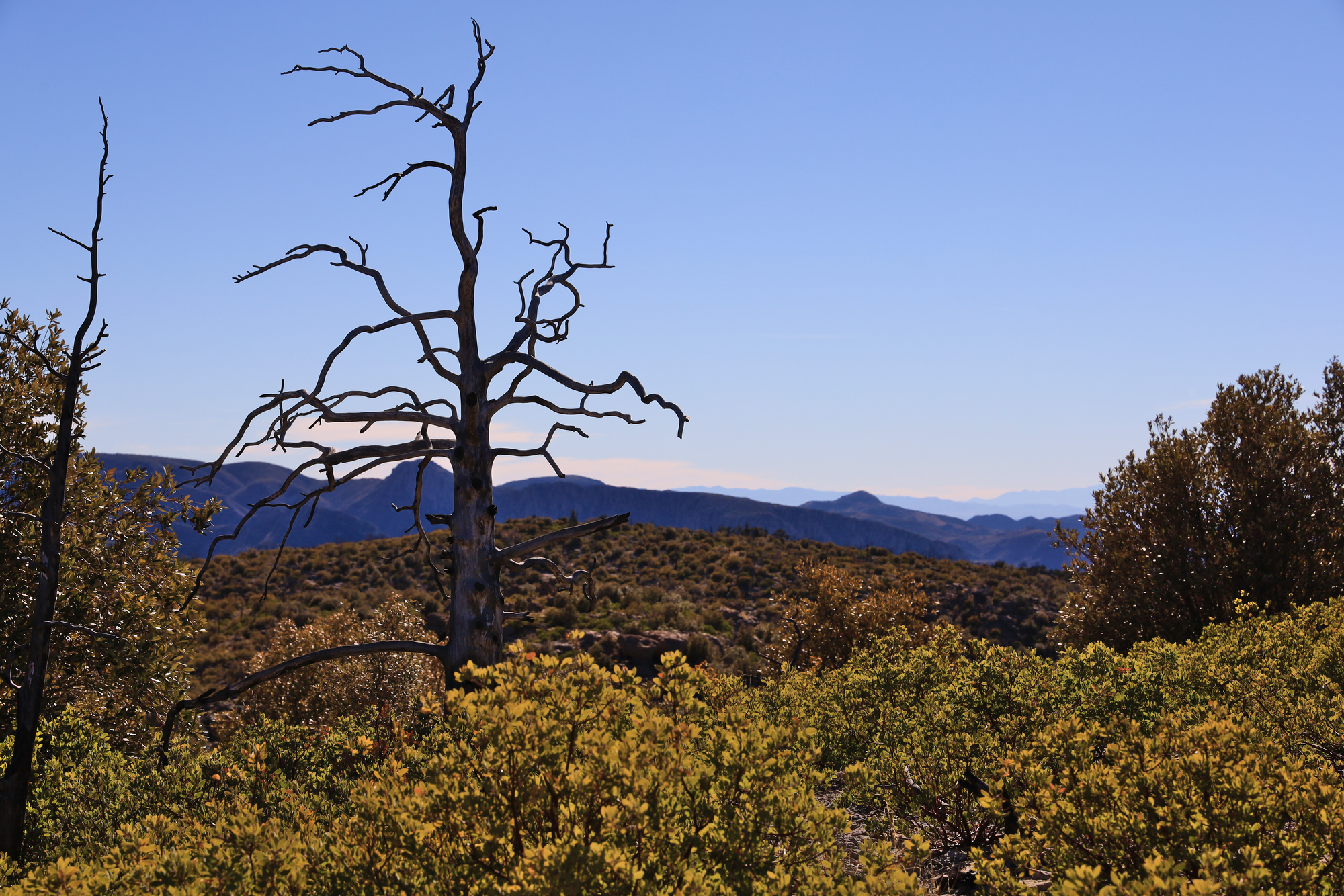
From there it was up along the ridge towards the trailhead. As we made our way back up we passed through areas where a fire burned in 2011. The difference between this area of the park and the canyon below was marked, with some areas nearly devoid of vegetation. As we continued up towards the trail head we started to see more large trees that had survived, but they stood among a number of blackened trunks as well. It was an interesting sight, that likely shows what the Catalina Mountains will look like in 10 years as they recover from the Bighorn Fire.
A lone burned out treeThis part of the canyon clearly escaped the worst of the fire
The last leg of the hike went quickly, and we soon arrived back at the cars. It was a fantastic introduction to Chiricahua National Monument.
Looking over to Sugarloaf Mountain from Masai Point
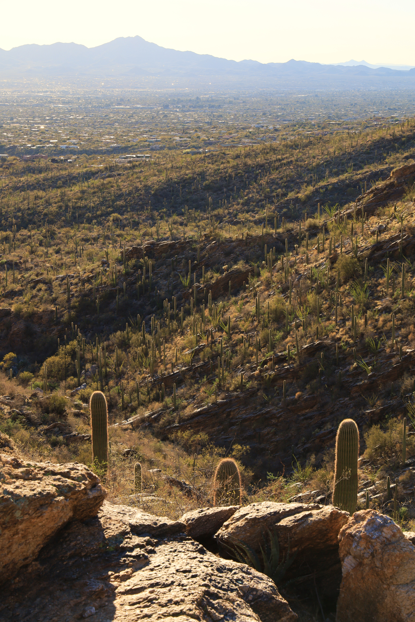
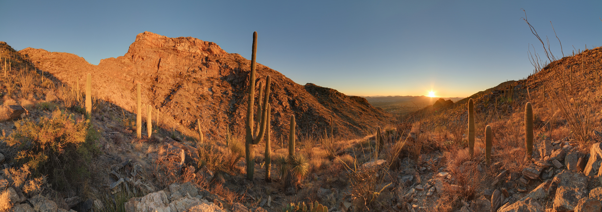
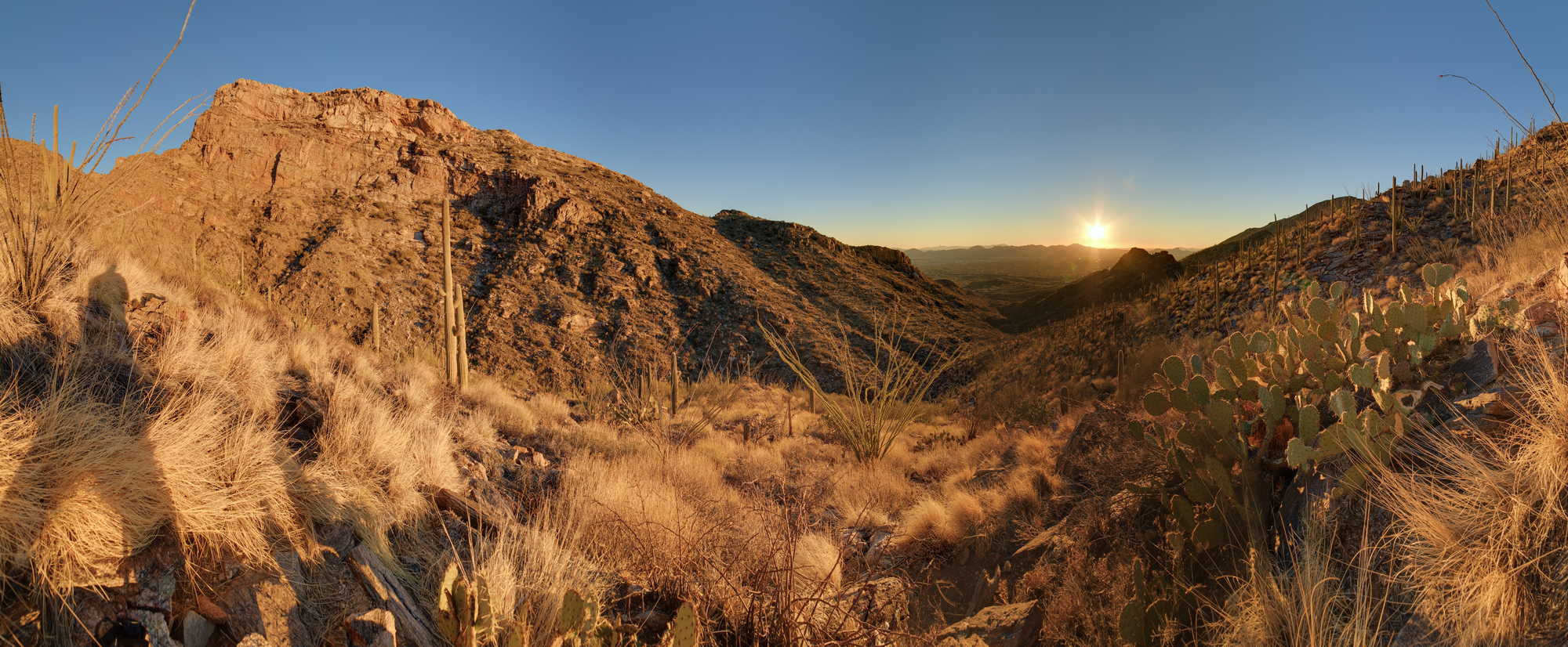
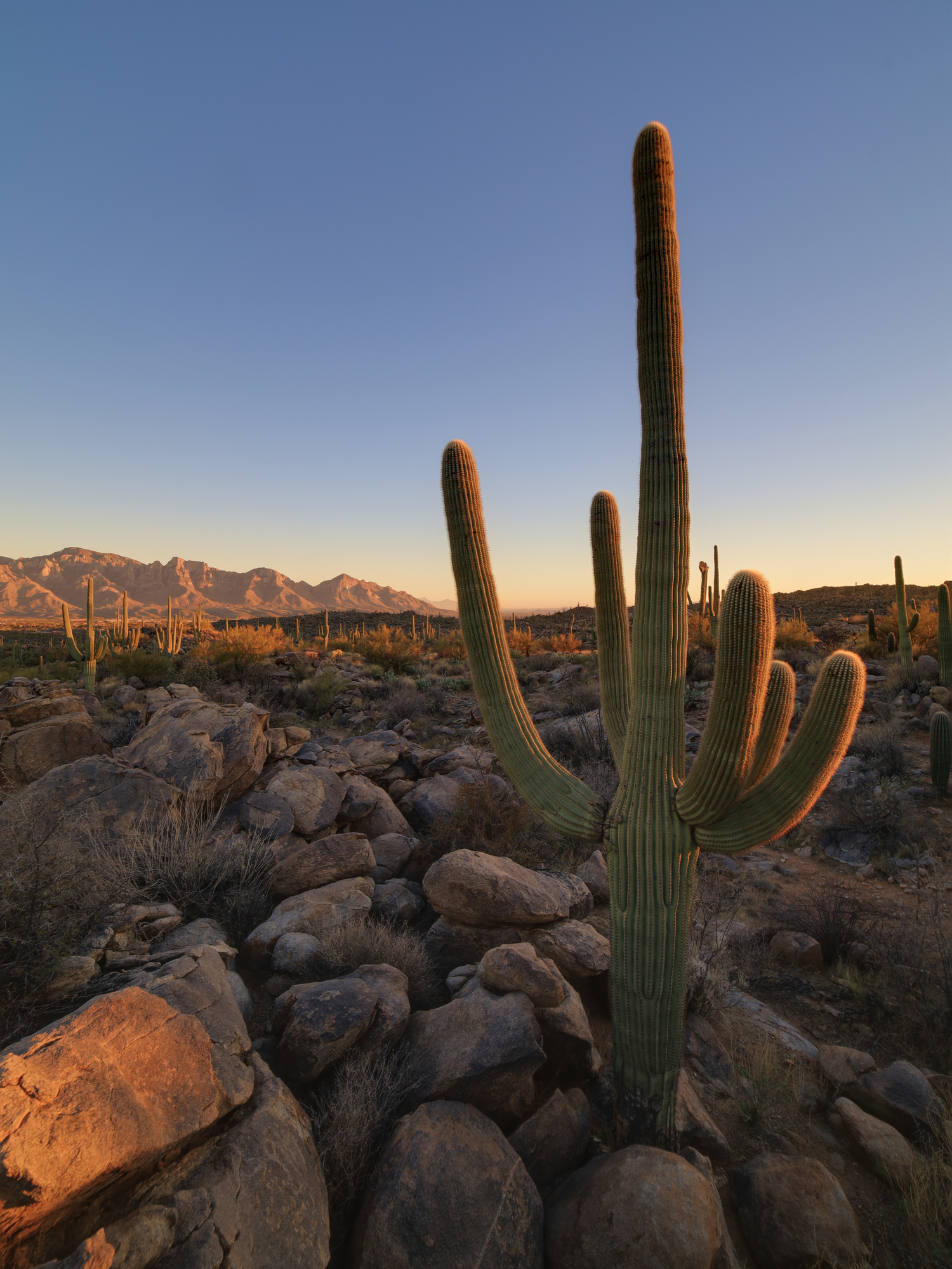
Sunsets in Arizona are some of the best I have seen anywhere. The combination of consistently great weather, open views, and some interesting topography means that they rarely disappoint. As we wrapped up the first couple days of work from “home” at our Airbnb, I decided to go for an evening hike to enjoy one of those sunsets. I started up the Pontatoc Canyon Trail about an hour before the sun set with the goal of climbing up far enough to see the sun set in the valley behind me. As soon as I started there were great views up the sides of the canyon, as well as out across the foothills towards Tucson.
Looking up towards the top of Pusch Ridge
Looking down the trail to the west
As I continued up I started to get further and further into the canyon I got more and more worried that I was going to end up without a good view of the sunset. I kept picking up the pace, hoping to get to where the trail climbed up out of the bottom of the canyon. It turns out my planning was correct though, and I soon started heading up the left side of the canyon and into the setting sun. Once I found a nice spot it was time to get out the camera and enjoy the view.
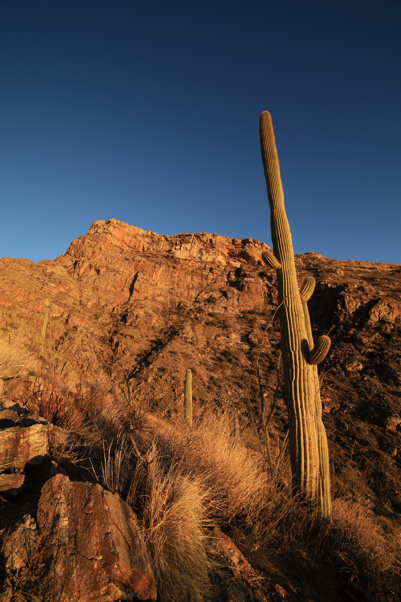
Looking up at the Pontatoc Cliffs
As I sat enjoying the view the sun lowered down into the valley, lighting up everything around me in an orange glow. The Pontatoc Cliffs just across the canyon were particularly bright and impressive. The colors were so intense that some of the phots just looked fake.
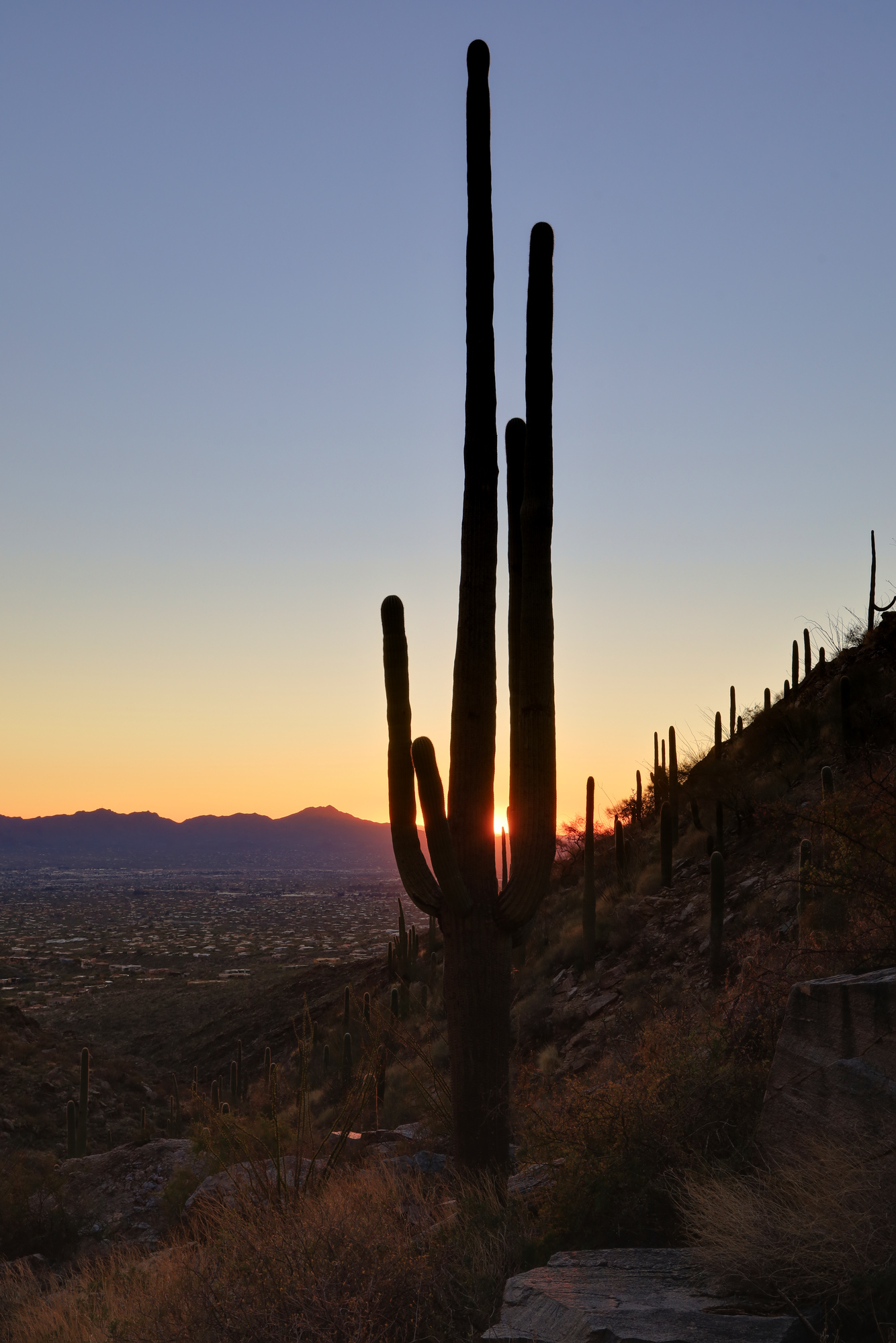
Shortly before the sun fully set I started back down the trail. I didn’t really want to hike out in the dark, so I rapidly worked my way back down the trail. As I did the color deepened, and the sun sank below the horizon. I snapped a couple quick photos before continuing down the trail.
A saguaro silhouetted in the setting sun
I made it back to the trailhead just as it was getting too dark to see clearly. The last bits of light were still lighting up the ridge, but the stars had started to come out. Another great hike in the desert.
I could just barely see the stars from this view to the east as I finished the hike
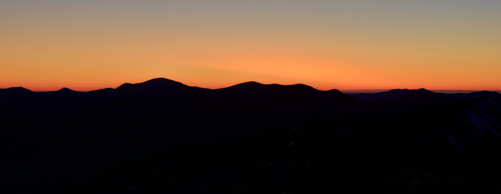
You know what is both a great and terrible idea? Climbing a 4459′ mountain to watch the sun rise. On the one hand, you are guaranteed to get an unobstructed view of the horizon. On the other hand, you need to get up at 3:30 AM to leave enough time to get to the trail head and climb to the summit before the sun is up. Despite the early wake up though, I enjoyed it the whole time. It started off bitterly cold (-3 degrees Fahrenheit) from the trail head. It didn’t take long though for the trail to start heading up hill and I quickly warmed up a bit. The trail was pretty much straight up the hill, so it was just steady climbing for 3 hours to get to the ridge and my first glimpse of the pre-dawn sky.
My first hint of the color to come
From there is was just a short walk up to the summit itself. I quickly discovered that I had gotten extremely lucky, because even though it was only about 5 or 10 degrees out, there was no wind. As a result I was able to get set up right on the summit rock and take my time capturing the early light as it started to spill over the ridges around me.
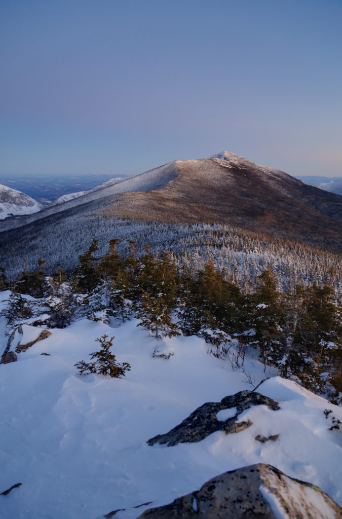
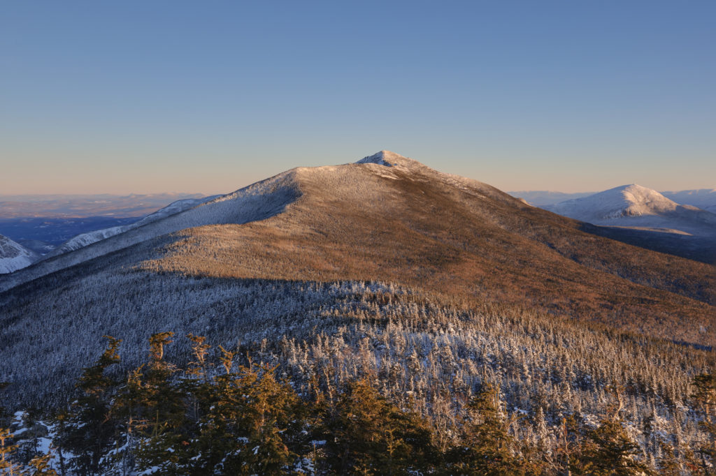
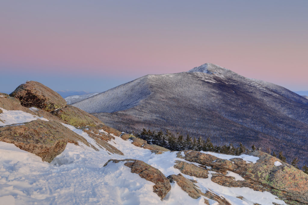
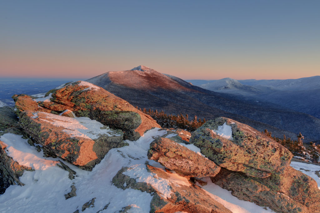
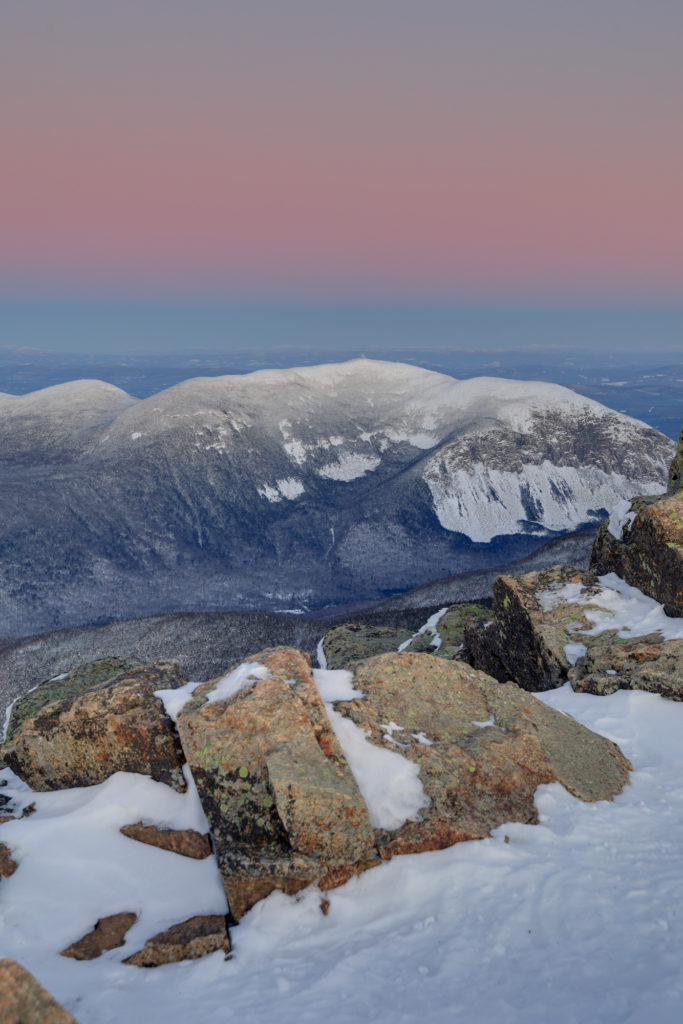
The first view I took in was looking up the ridge to Mt. Lafayette. It hung over me as I climbed the last half mile to the summit, and was the closest peak around. It was neat to watch it change color, gain new shadows, and start to really glow in the morning light as the sun came up.
Mt. Lafayette just before I reached the summit. Not much color yet hereThe summit in full light just before I headed back down
The not quite risen sun projects a ribbon of pink above the summitThe first hint of light
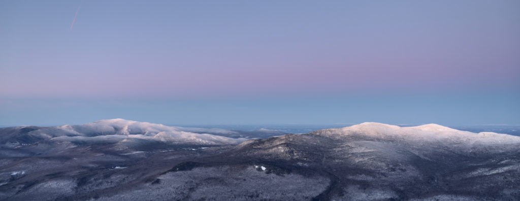
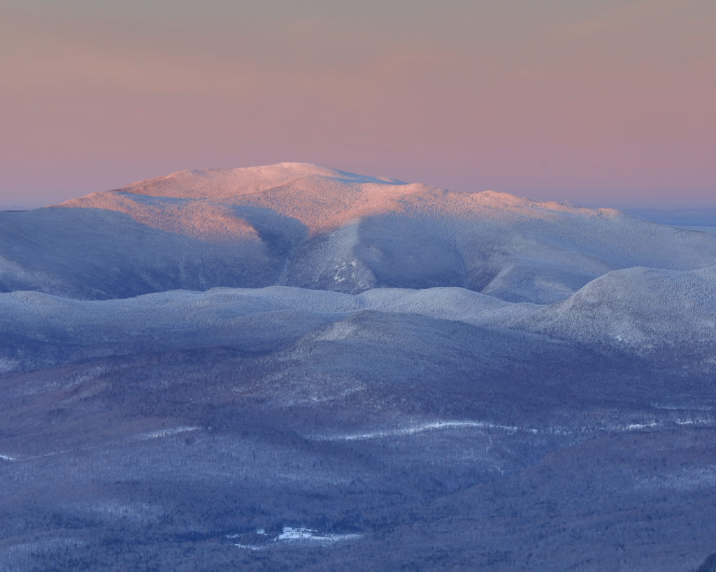
The second area to catch my attention was the view out to the west. Given how steep the descent back into Franconia Notch is, the mountains on the other side look so close, but also so separate from Mt. Liberty. The view was divided into two groups, with Mt. Moosilauke on the left, and the Kinsman and Cannon range on the right.
Both ranges with a purple band of color above them
The summit of Moosilauke touched by the sun, with the valley in the early morning blue glow
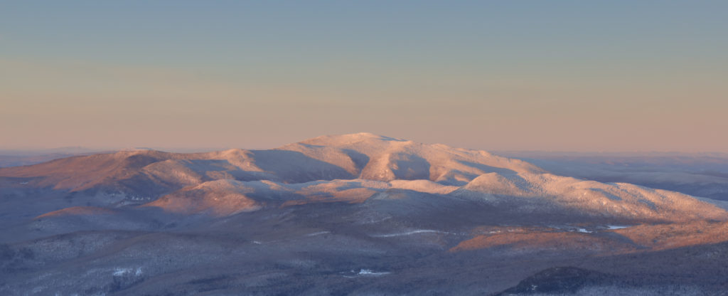
Mt. Cannon just before the sun hits the ridge
Mt. Moosilauke as I headed back towards the valley
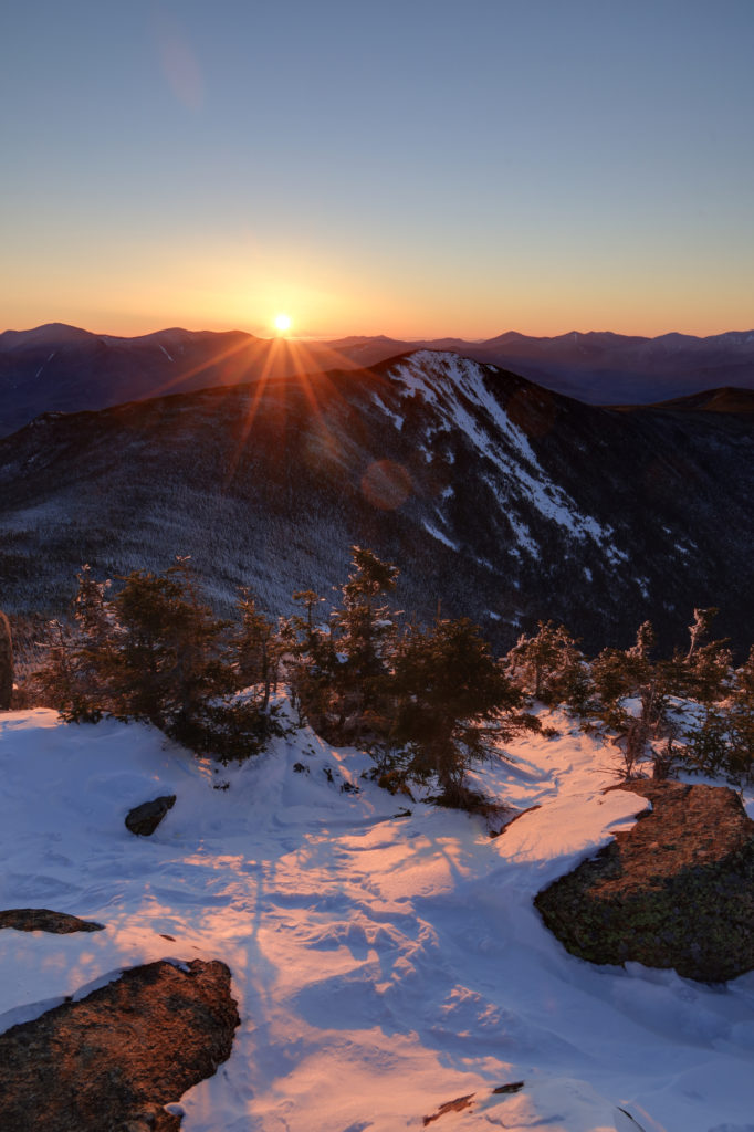
The most spectacular views though had to be to the east, where the rising sun created an incredible contrast between the dark and shadowed valleys, with the warm sun climbing into the sky. There were no clouds to light up, but seeing the ridges, snow, and rocks glowing with the first light was enough for me.
The moment of sunrise and the first light on the summit
The valley starts to brighten up as the sun gets higher
After spending a half an hour running around the summit with my camera, I took some time to appreciate the solitude and quiet of this place. The combination of the still air, piercing sun, and snow all around really made it feel like I had the entire mountain to myself. It made the early start completely worth it. Unfortunately, it had to come to an end at some point though, and I soon started back down the mountain. It was a quick and relatively easy descent with a mix of fast hiking and a bit of glissading. I started to pass more and more people the lower I got on the mountain, end even got a few puzzled looks as they thought about the timing of my descent.
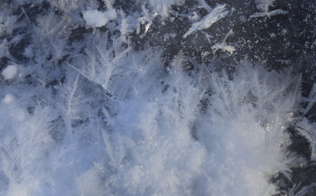
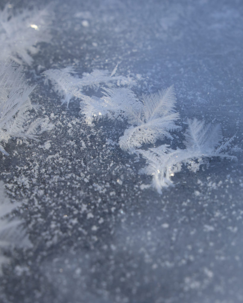
Frost crystals on a frozen puddle
Don’t these look like mini ice ferns?
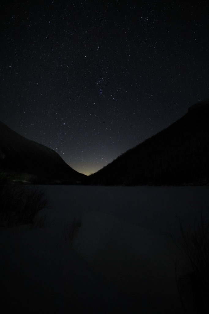
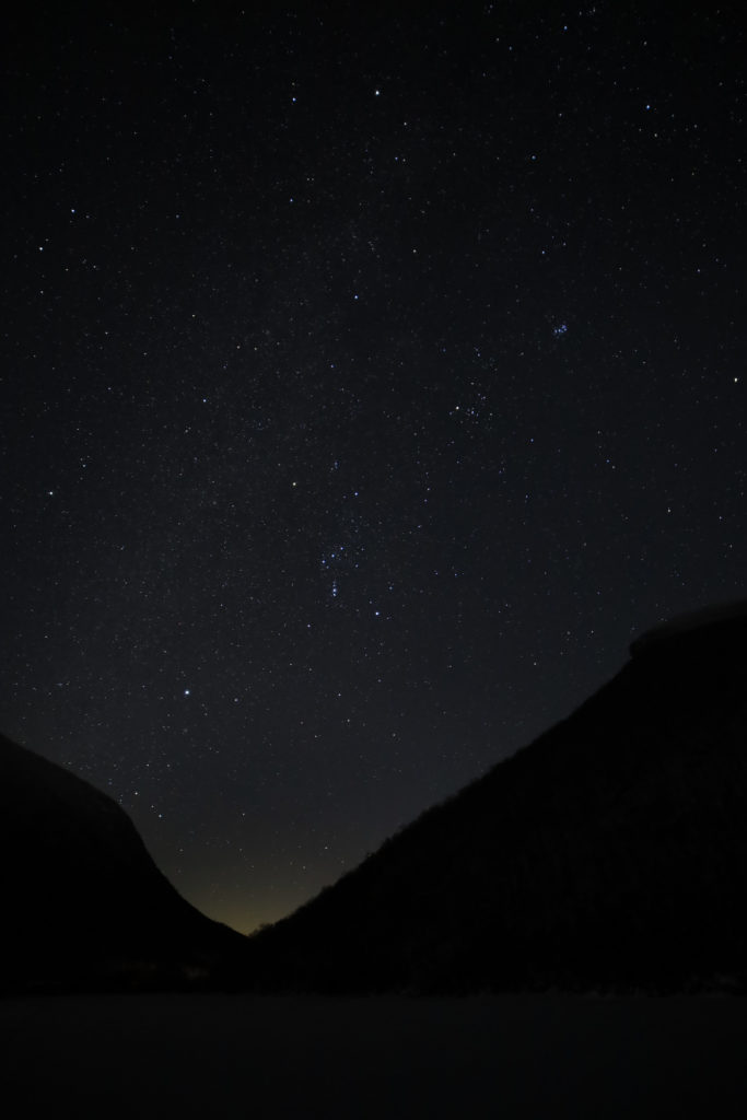
Once I arrived at the trail head again it was back to our cabin for the morning to catch up on my sleep and relax for the day. We went out again in the afternoon for another hike and also went into town for a nice dinner again. Always a glutton for punishment though, I decided to head back out for a couple of photos of the stars at the Old Man of the Mountain historical site. Let’s just say I didn’t get up very early the next morning.
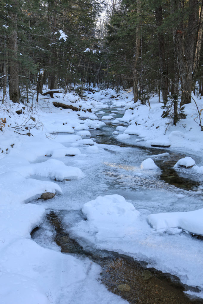
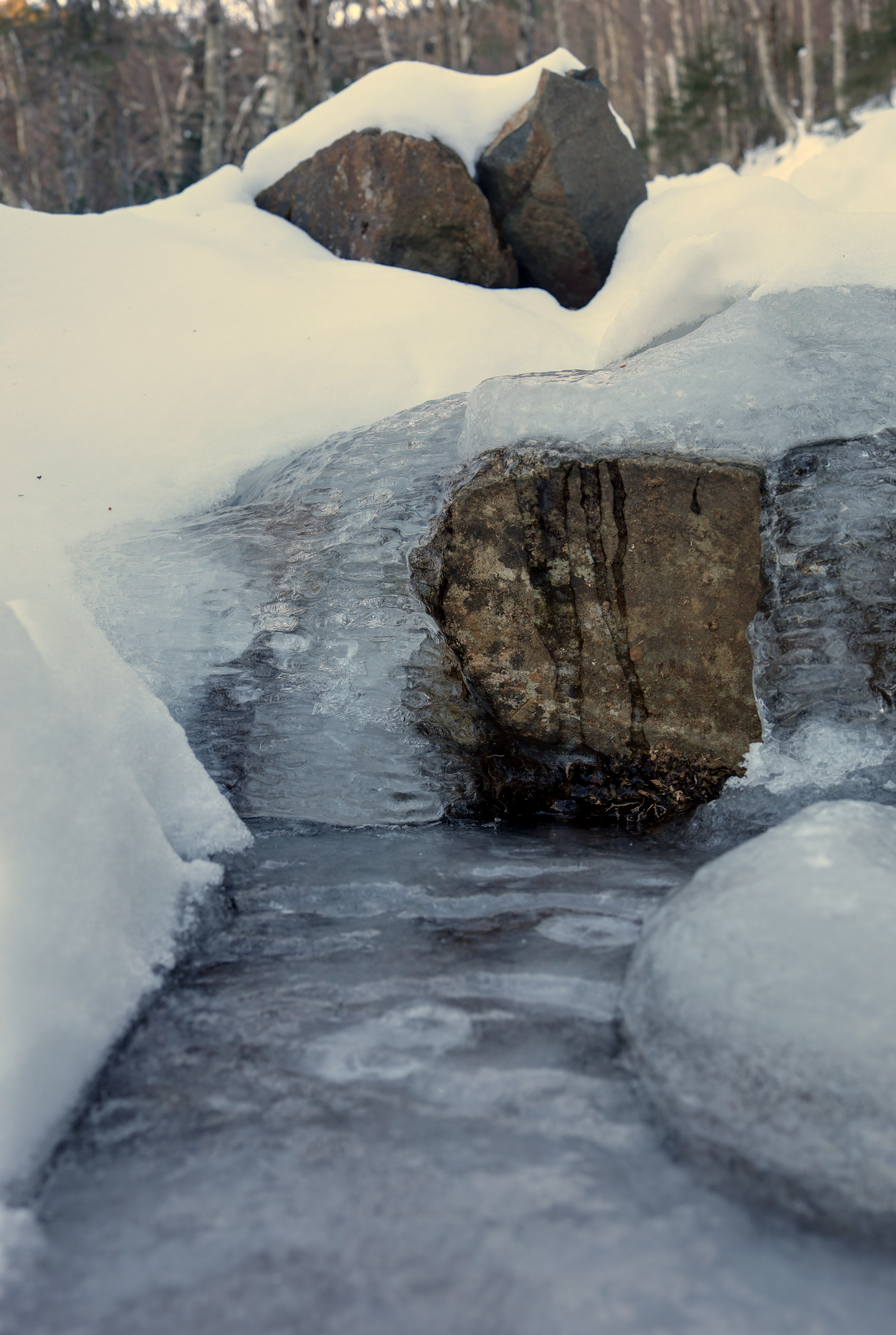
Today’s post has a bit of a theme: Ice. I went up to Mt Chocorua on a beautiful Saturday to get a taste of real snow cover and solitude. I hiked up via the Champney falls trail so I could get a look at the frozen falls on the way, but I ended up seeing a lot more ice than I had expected. It started early with a couple of stream crossings right near the start of the trail.
The first stream was the most treacherous
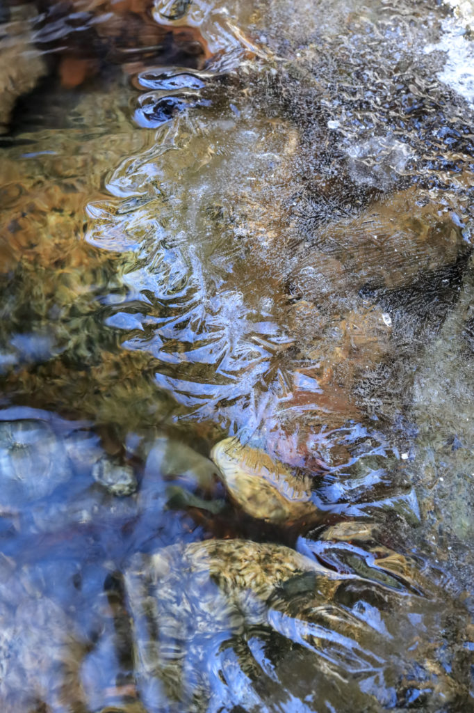
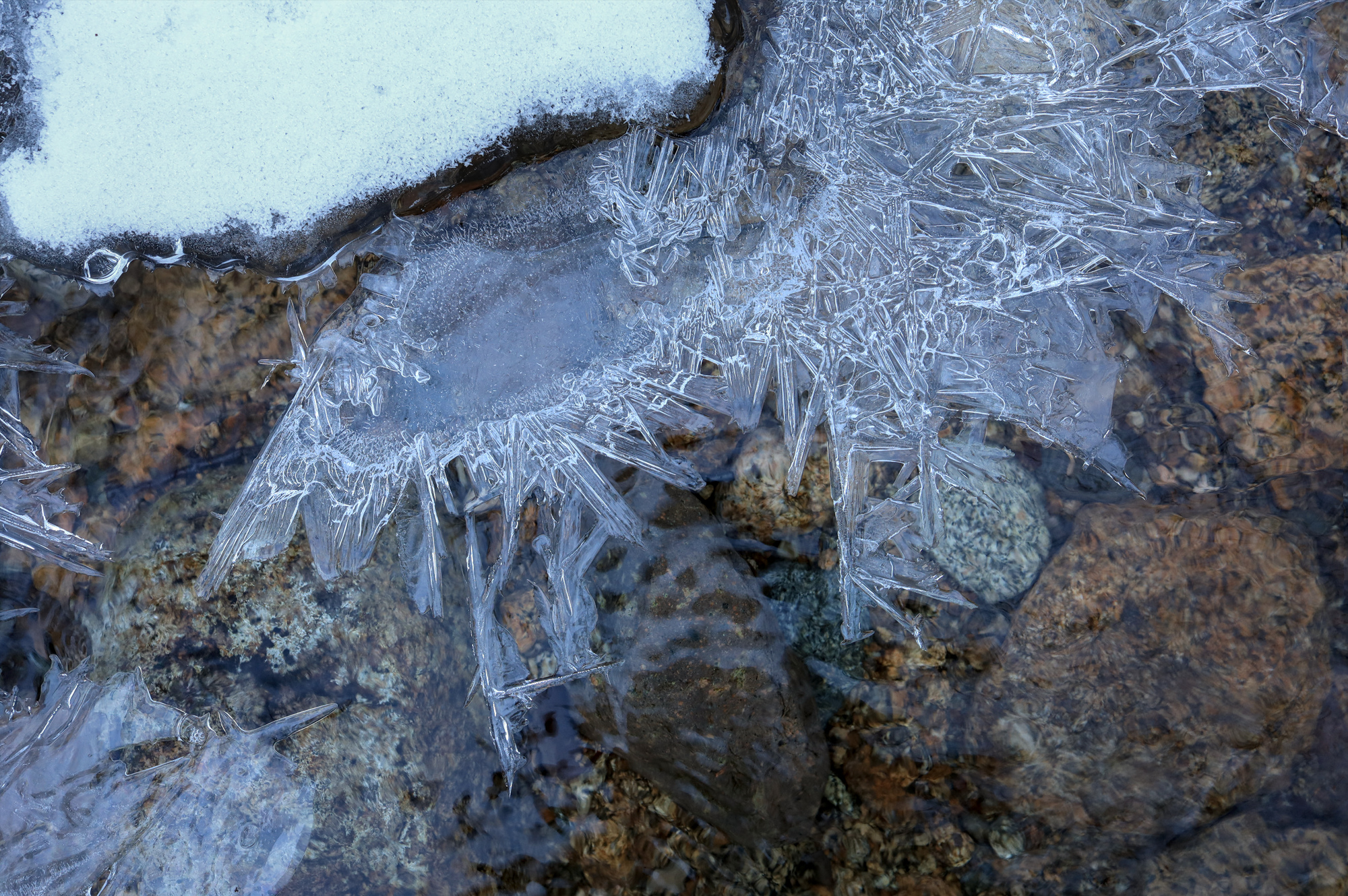
The streams had all kinds of interesting shelves and crystals at the water’s edge
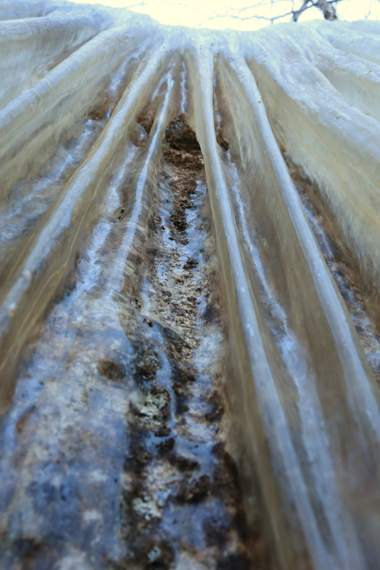
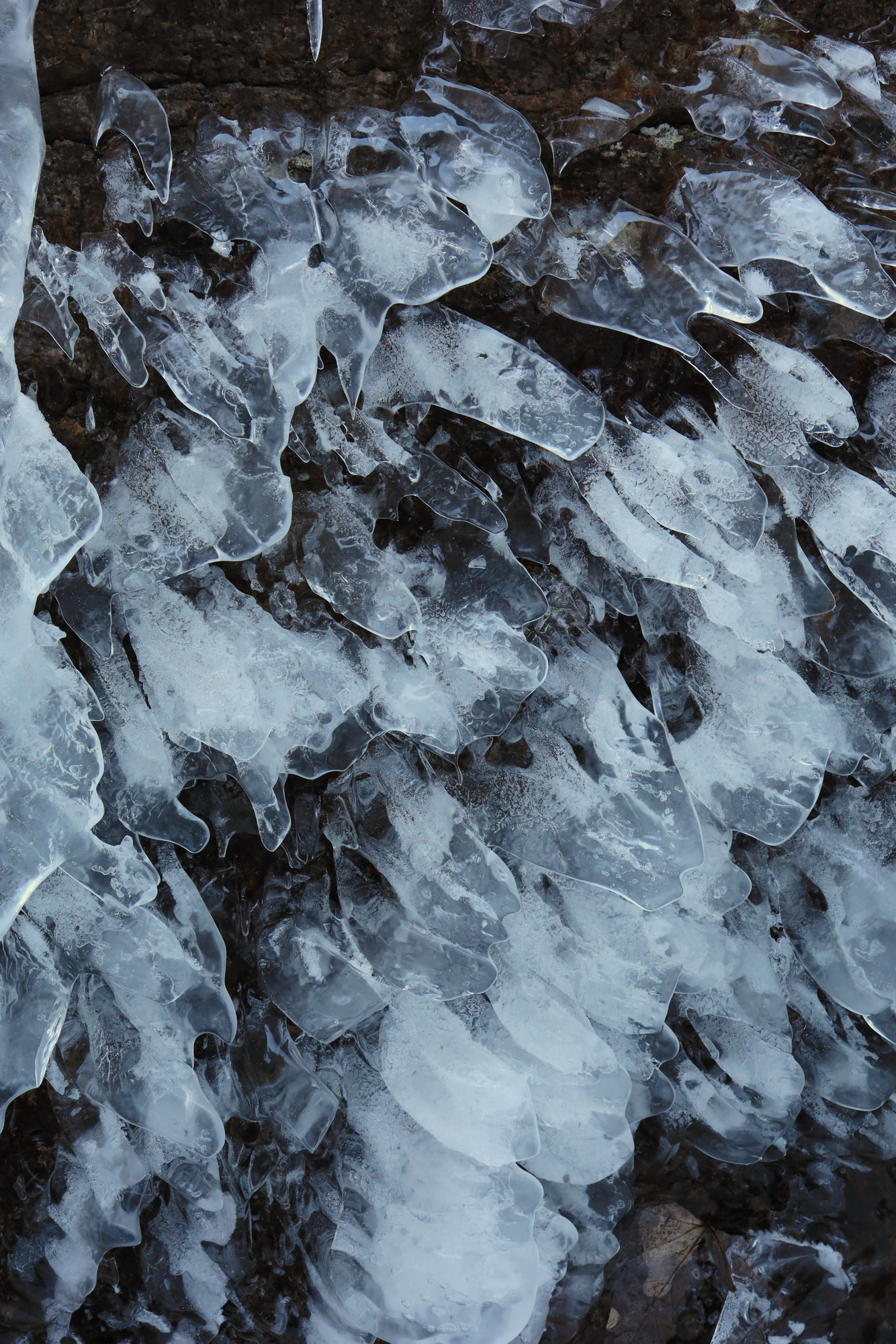
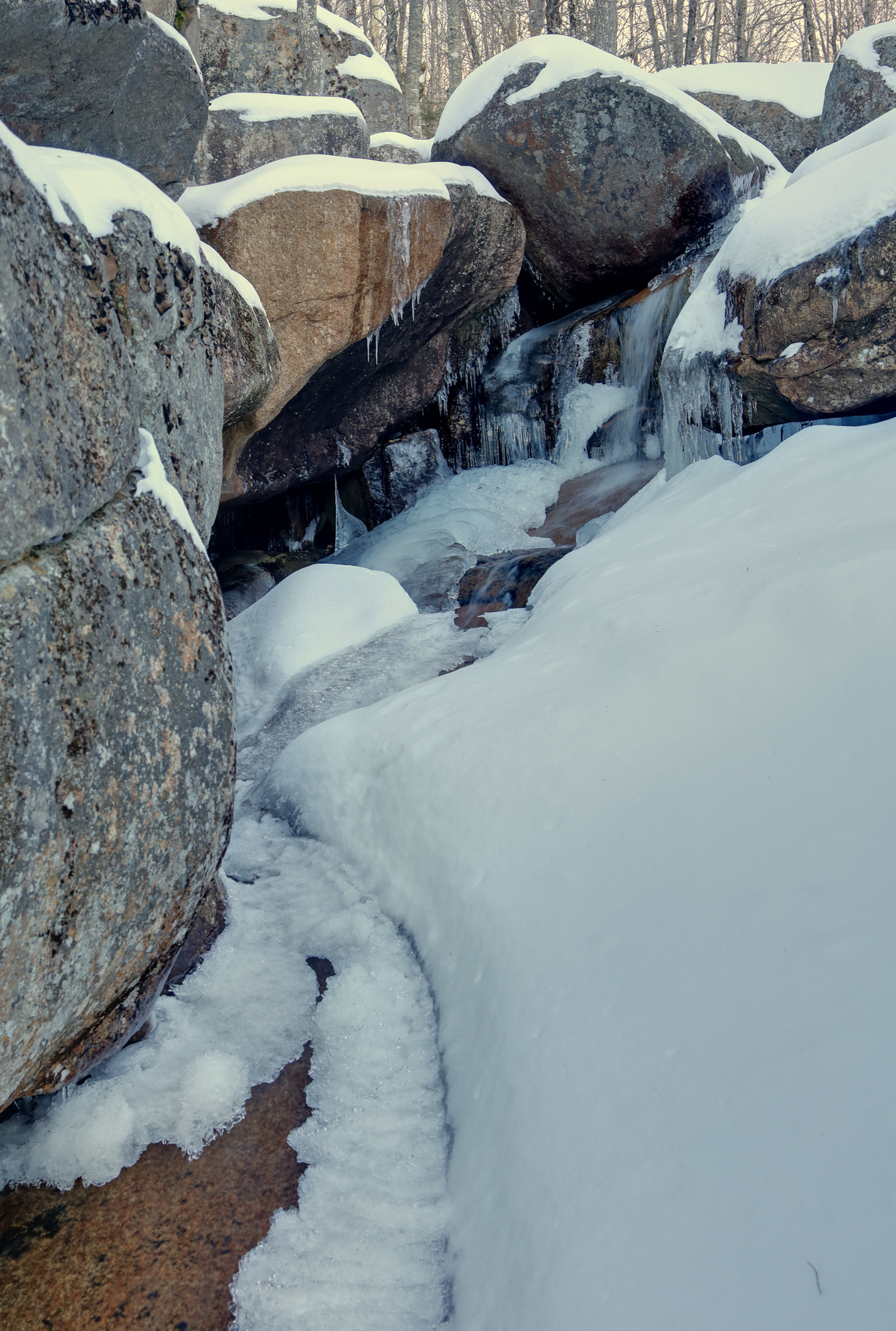
After some steady climbing I arrived at the falls I had been looking for. As expected, the small gorge had massive sheets of ice forming on the uphill side. In addition though there were an assortment of intricate ice formations across the area. I spent quite a while poking around in the early morning quiet to check them all out.
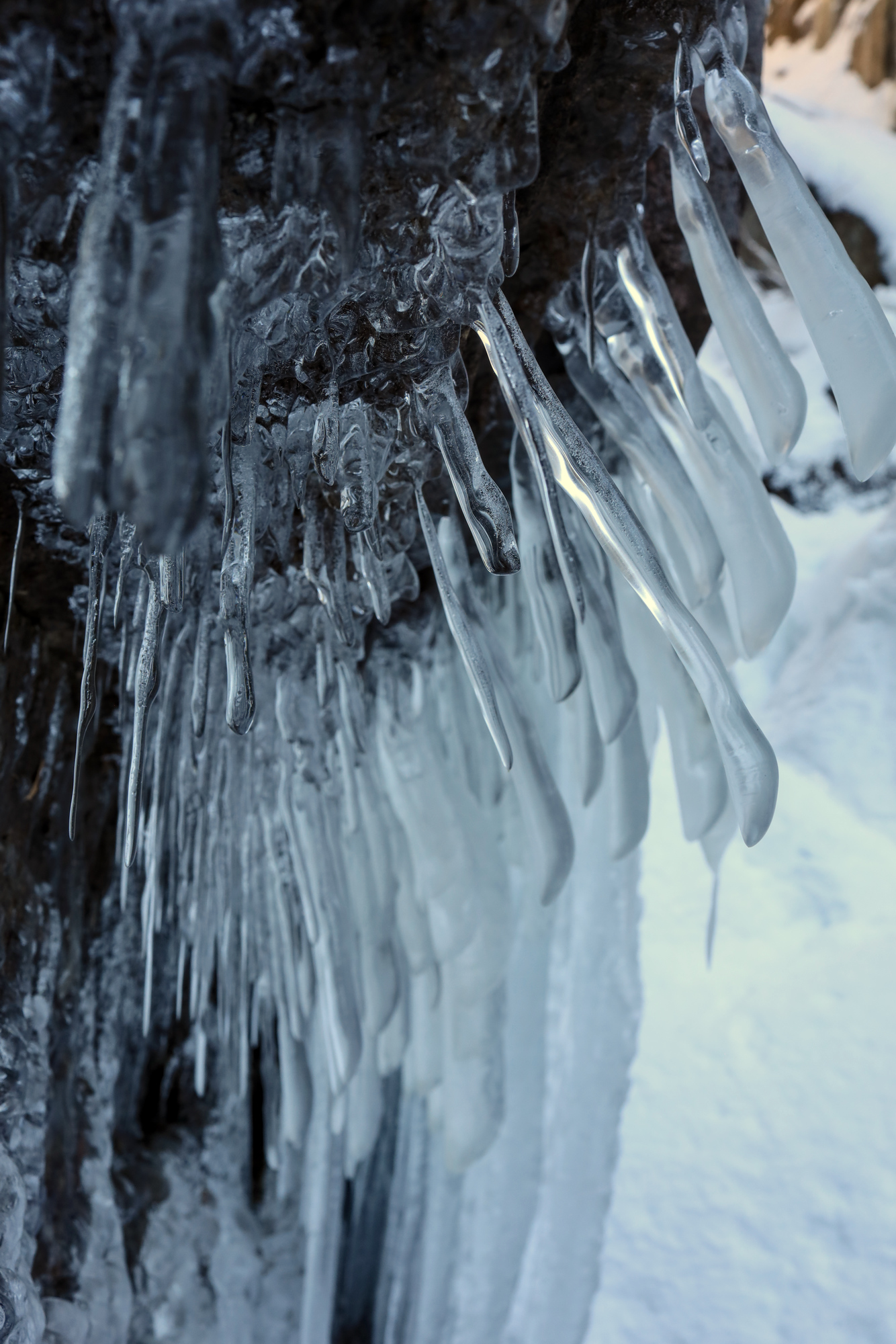
Ice curtains
The main view of the falls on the way in
These icicles somehow grew in multiple directions
Flat icicles
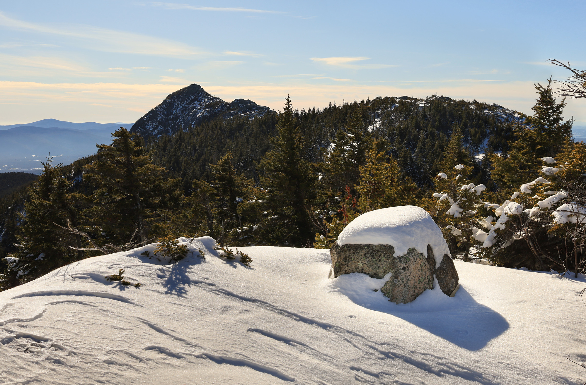
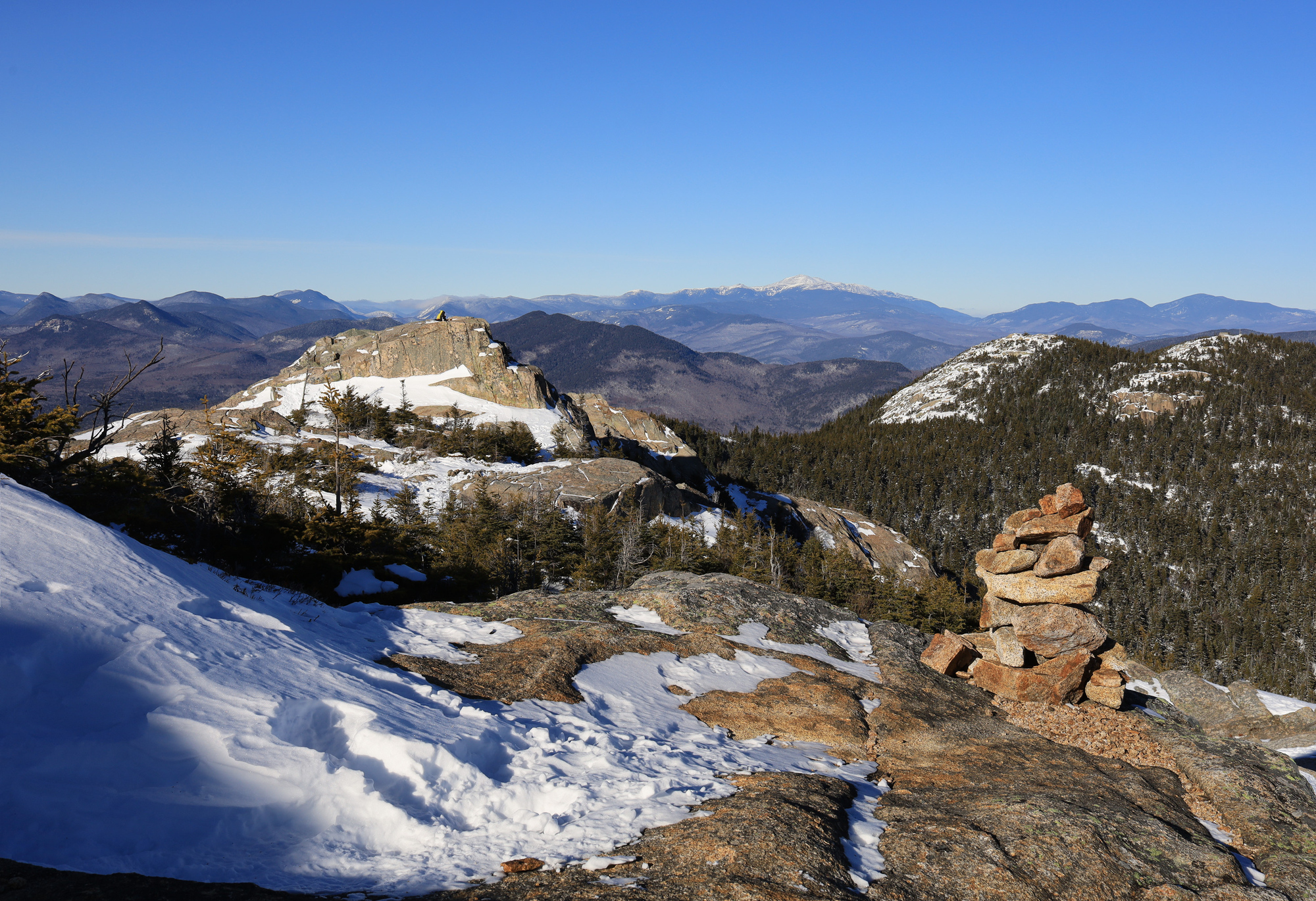
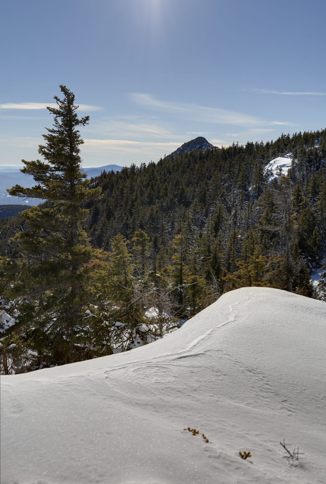
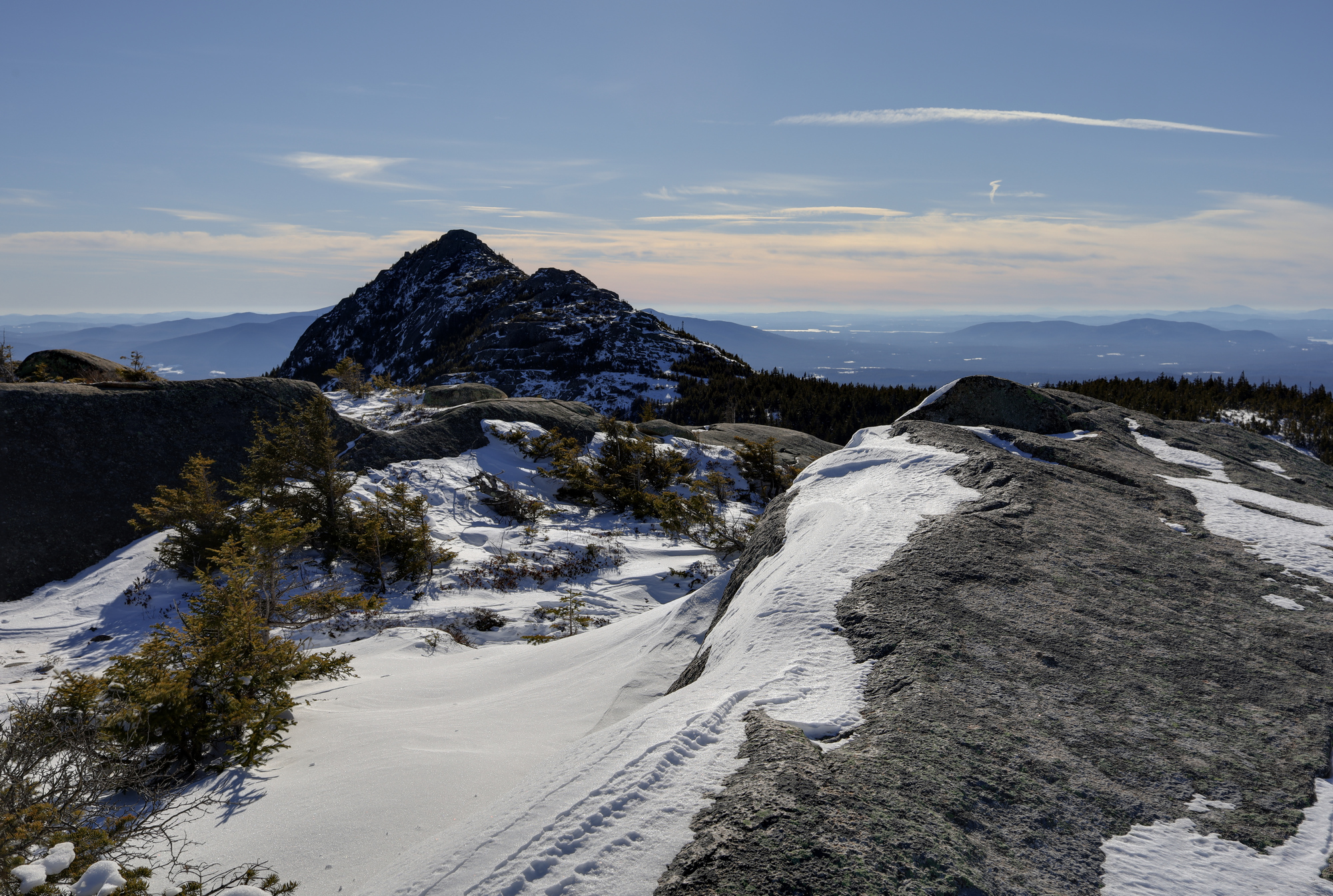
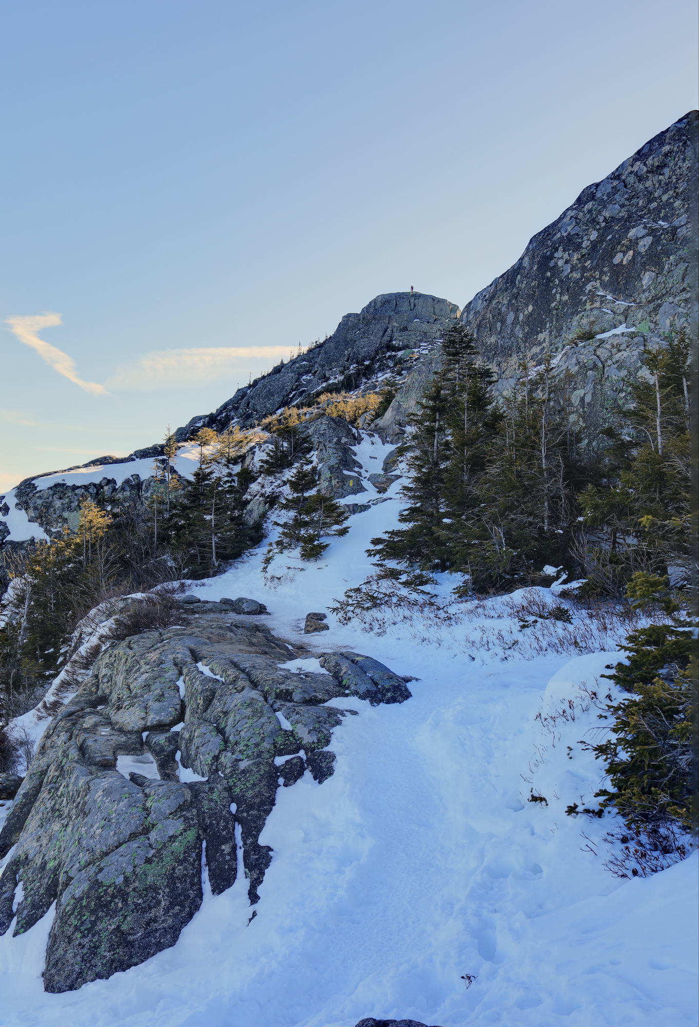
Eventually other people started to show up and I continued on up the mountain. Though most of the climb was not noteworthy, once I emerged onto the ridge between the summits, I was surrounded by incredible views. To the north was the heart of the pemi wildterness and presidential range, including a clear view of Mt. Washington. To the south were miles of hill country dotted with small lakes, many featuring some ice fishing. Most impressive though was the jagged summit of Chocorua which was clearly visible just over the ridge.
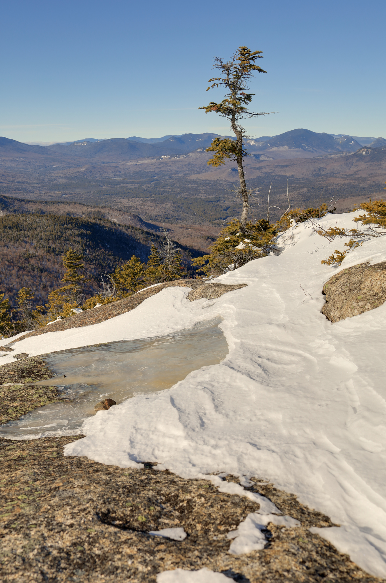
The summit of Mt Chocorua over and undisturbed layer of snow on the ridge
Some critter calls this spot home
A tree hanging on to the edge
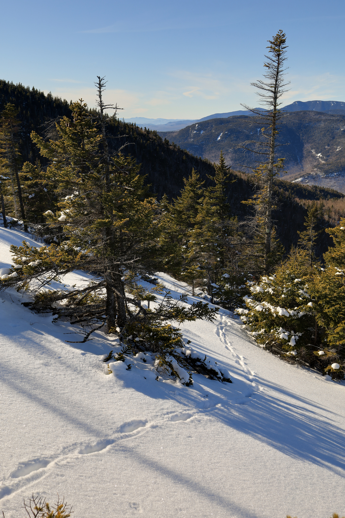
I climbed to Middle Sister, one of the minor summits and then across the ridge to Chocorua itself. On the traverse I saw even more examples of different kinds of ice. It was definitely a photographic journey, with many stops along the way.
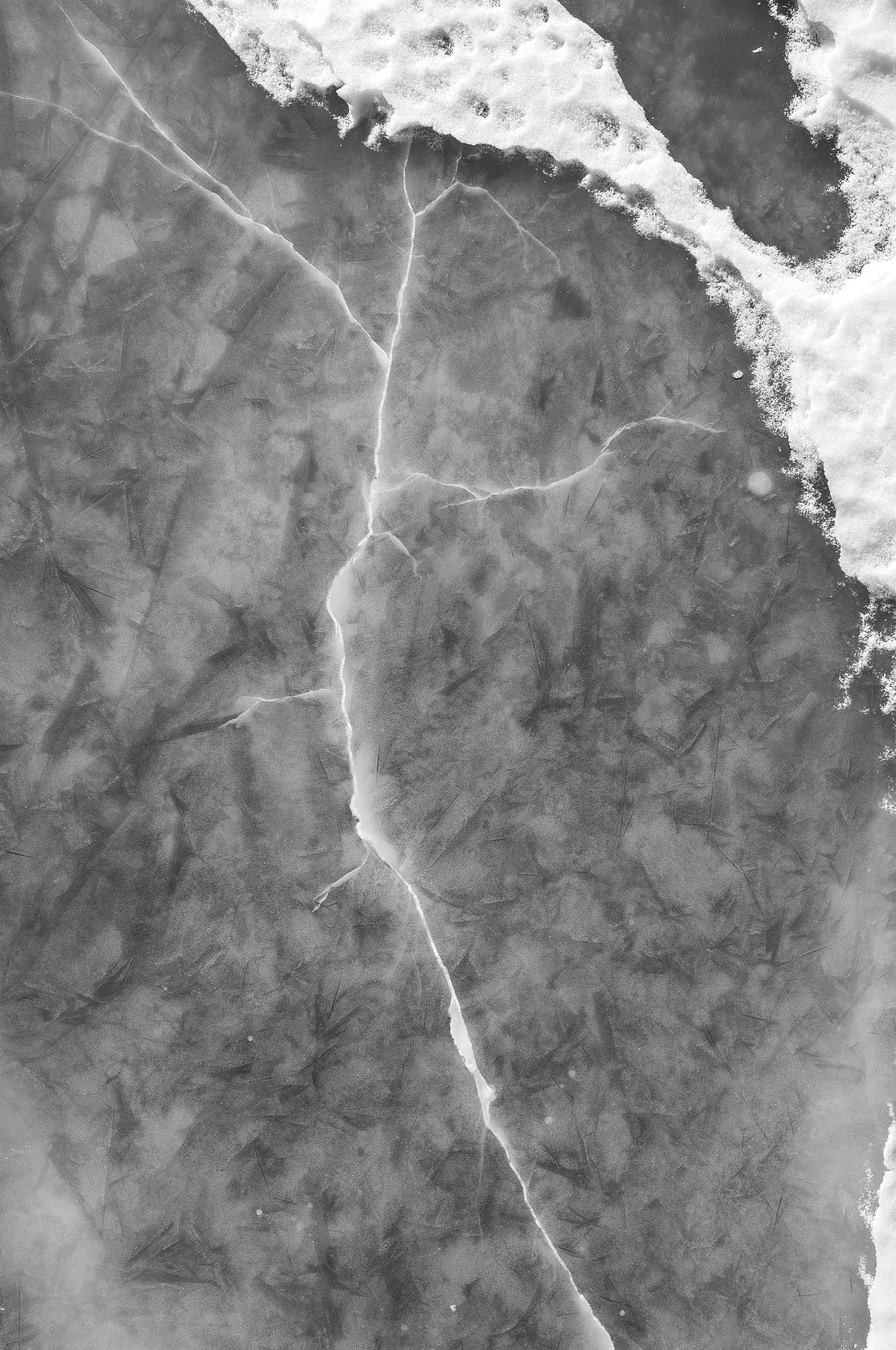
I thick sheet of ice on the trail marked with one large crack
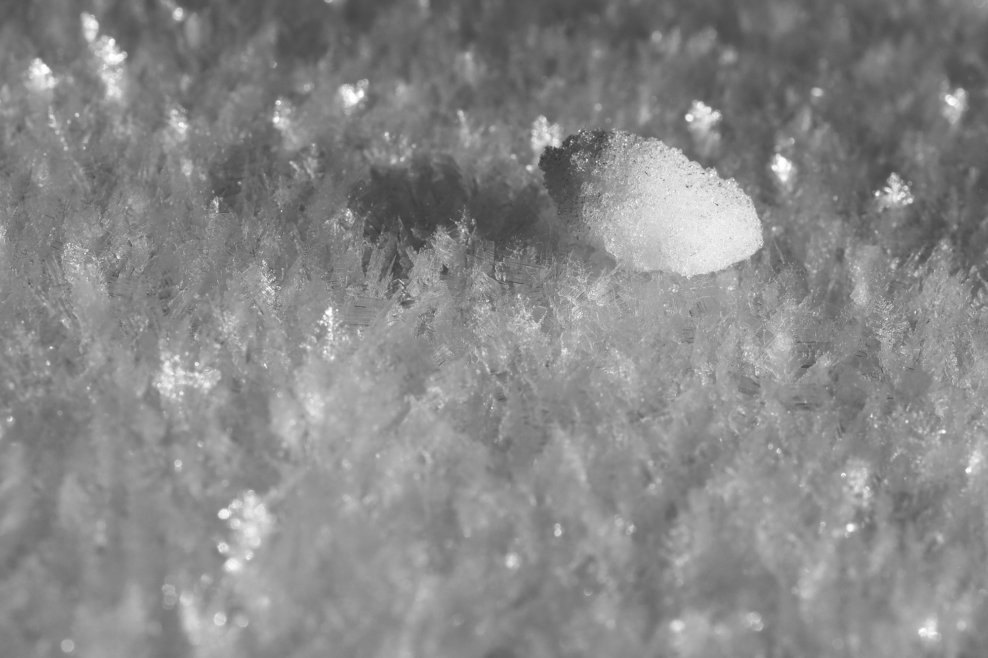
A lone tiny ice chunk laying on fresh snow
After taking some time at the summit, it was back down the mountain along the same trail. The mountain continued to impress with more incredible views (and more ice formations) along the way, but much of it was familiar at this point. Though it certainly was not crowded, there were a number of people out on the trail this day. Clearly I was not the only one who came up this this idea. Great minds think alike.
Two people enjoying the view of Mt Washington from just below the summitSome wild ice crystals hovering just above the water at one of the creek crossings on the way down
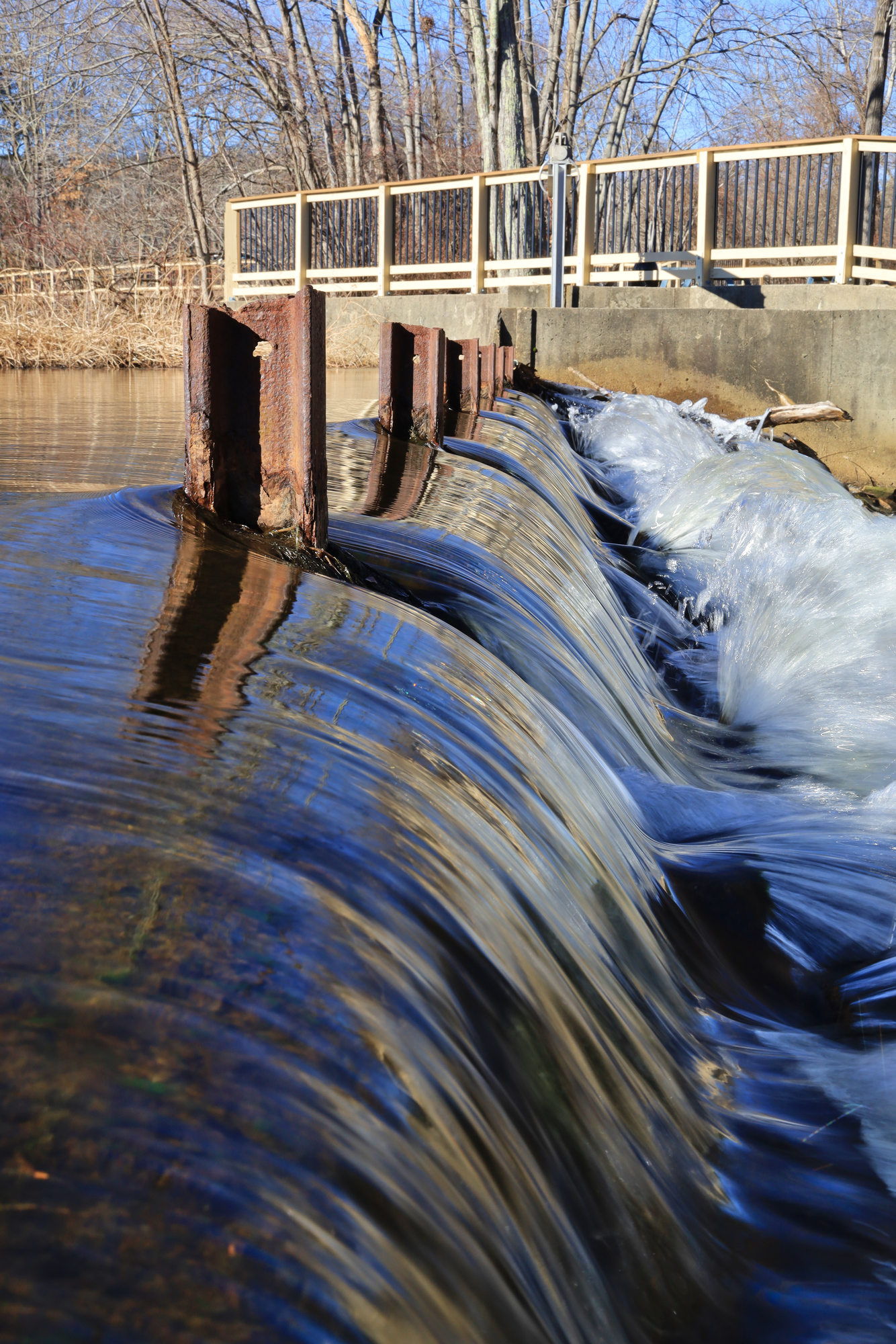
These photos are from a quick trip I took down to Ashland State Park. I had never been here before and decided to check it out. I ended up stopping at a small roadside dam along the way down and took a couple photos there.
The water looked smooth, but cold
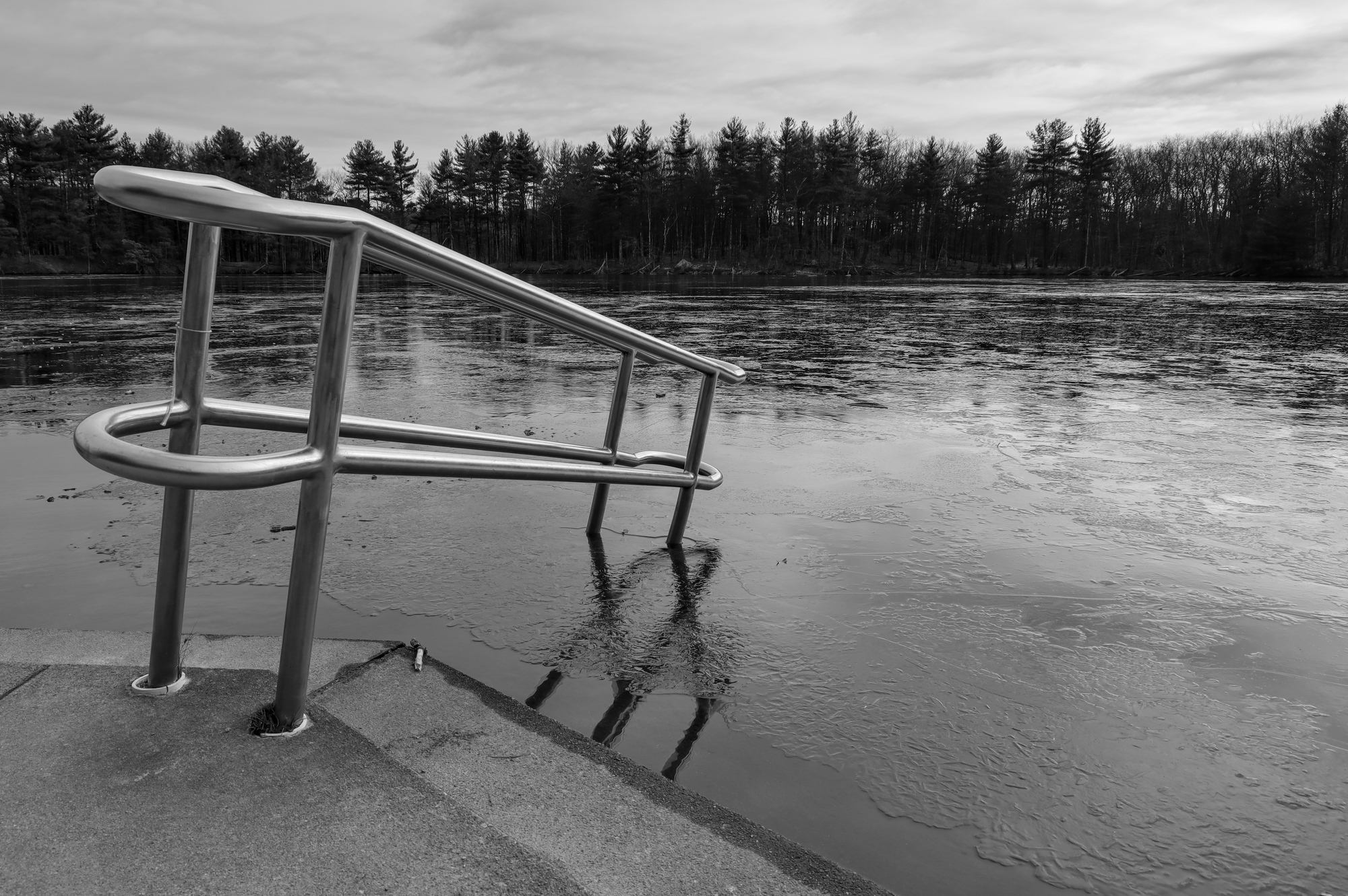
Once at the park I started exploring the trails, and ended up hiking all of the way around the reservoir. It was a nice walk, even though I didn’t end up capturing too many photos of it. After that I took the long way home with a quick stop at Hopkinton State Park.


FOV: 14 x 21
Ev: 13.01")

FOV: 47 x 66
Ev: 11.05")

FOV: 50 x 36
Ev: 7.56")

FOV: 51 x 71
Ev: 7.00")

FOV: 52 x 37
Ev: 13.36")

FOV: 52 x 71
Ev: 9.07")

FOV: 112 x 86
Ev: 10.43")


FOV: 40 x 57
Ev: 12.32")

FOV: 360 x 109
Ev: 10.11")

FOV: 18 x 27
Ev: 11.60")

FOV: 51 x 72
Ev: 11.59")

FOV: 21 x 14
Ev: 13.95")

FOV: 23 x 16
Ev: 11.95")

FOV: 51 x 71
Ev: 12.64")

FOV: 50 x 70
Ev: 13.31")