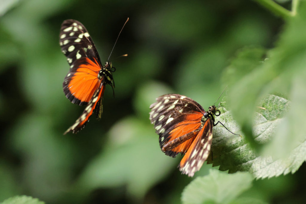
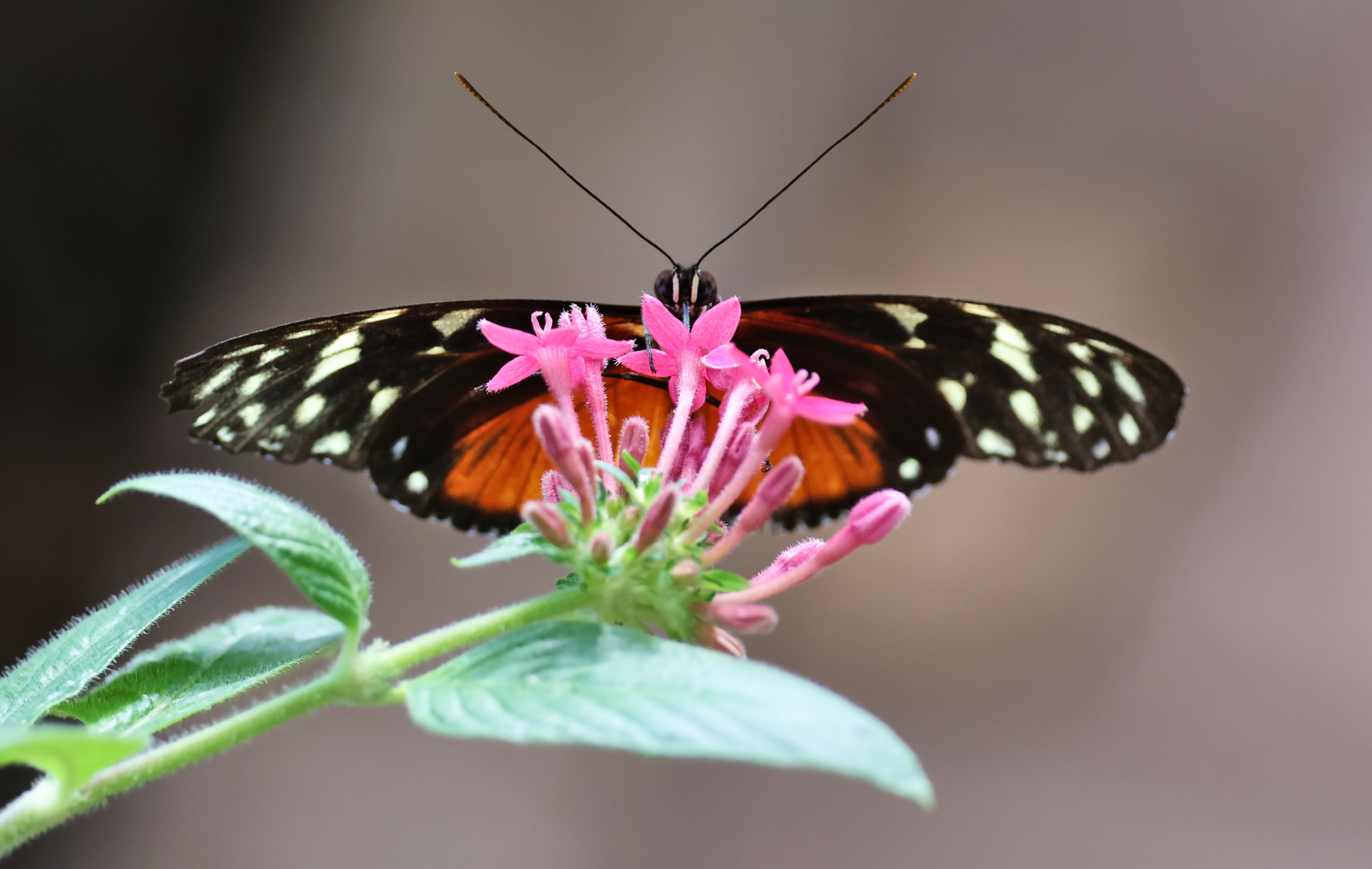
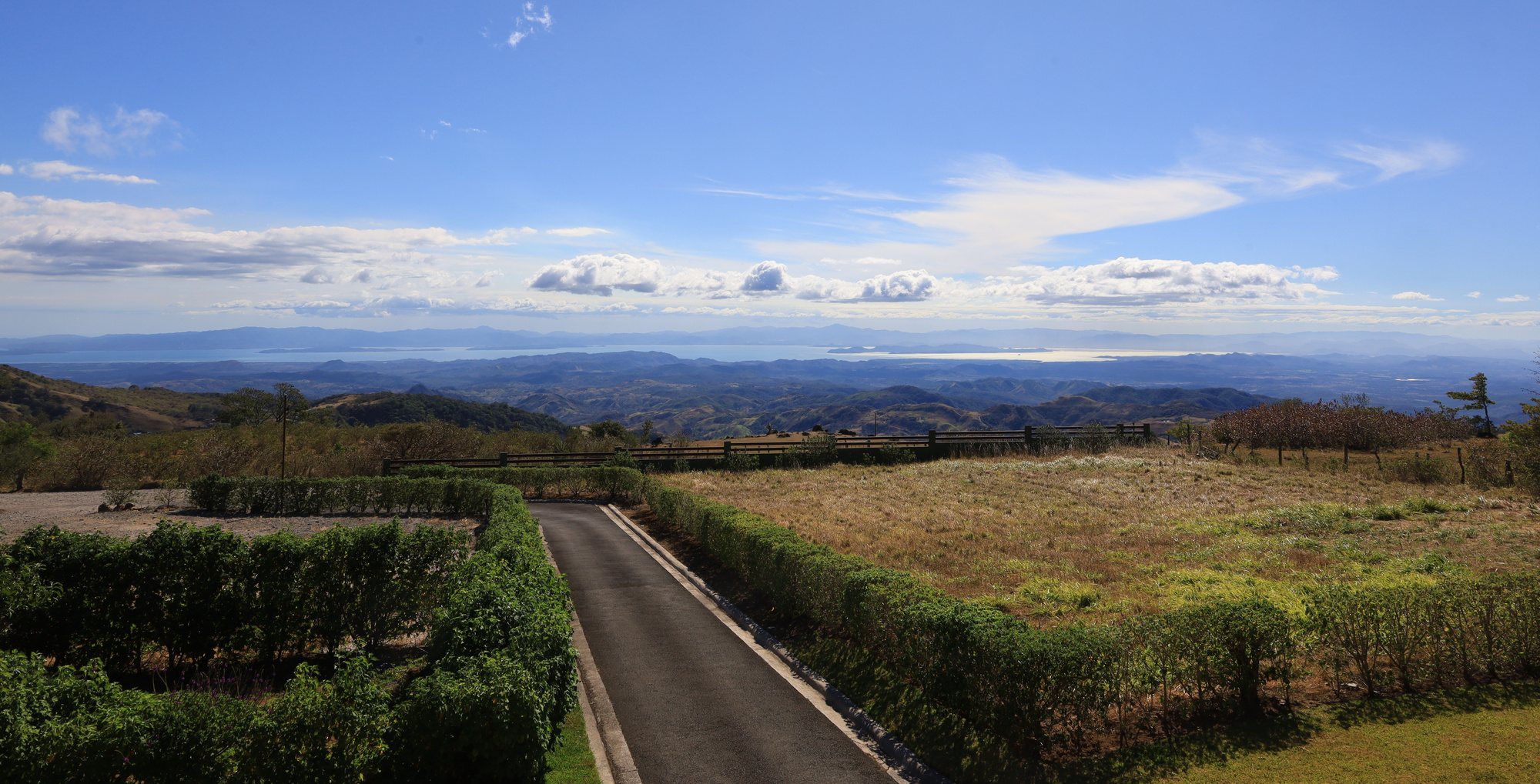
Welcome to Santa Elena – and the second part of our trip! While the arenal area is known for the volcano, activities, and rain forests, Santa Elena and its neighbor, Monteverde, are known for their cloud forests. This area is much higher elevation, so the climate and wildlife is quite different. After getting settled in we decided to start by spending some time exploring the town. We started off by visiting the butterfly gardens.
This is one of the few photos that I managed to catch of one flying. They are fast!
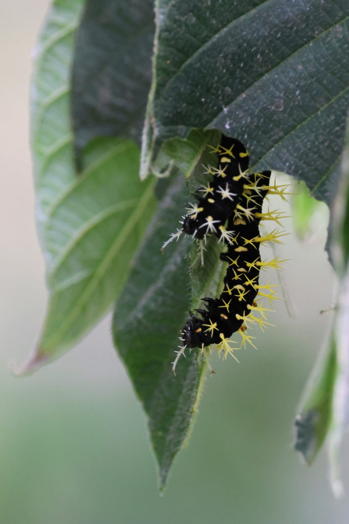
Not sure what this caterpillar is, but it sure is interesting looking!
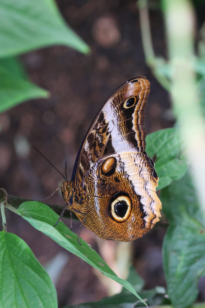
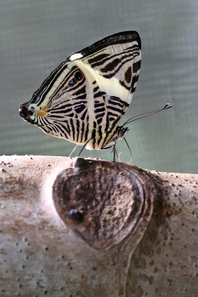
I believe this is a type of owl butterfly
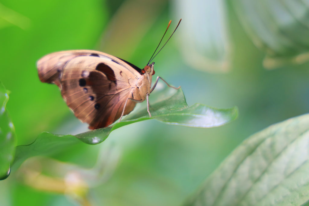
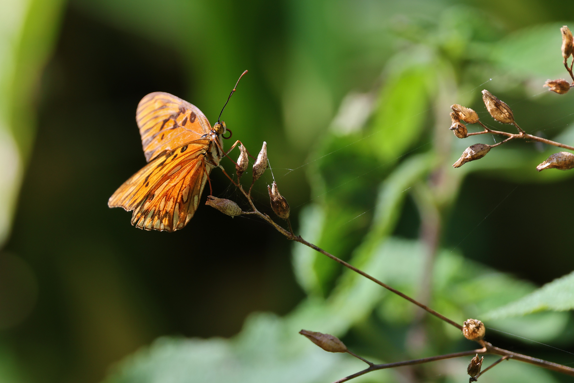
The gardens were quite impressive. There were a wide variety of butterflies, as well as fascinating caterpillars and flowers. I would definitely recommend it to anyone staying in town for a few days.
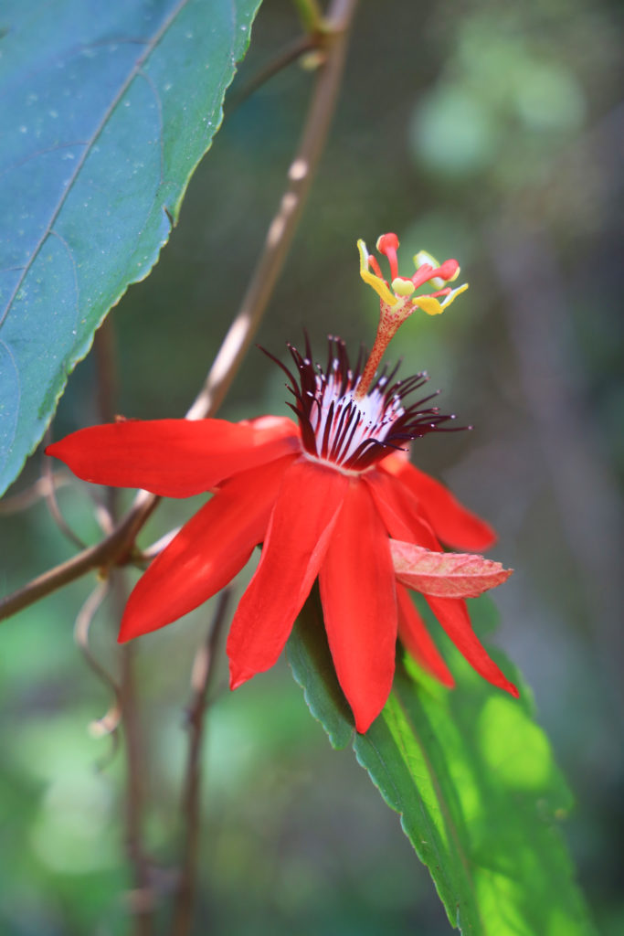
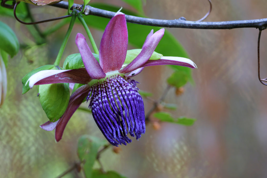
A passion flower
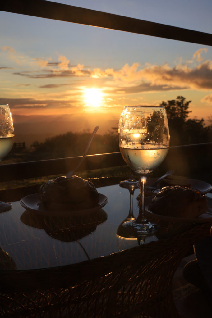
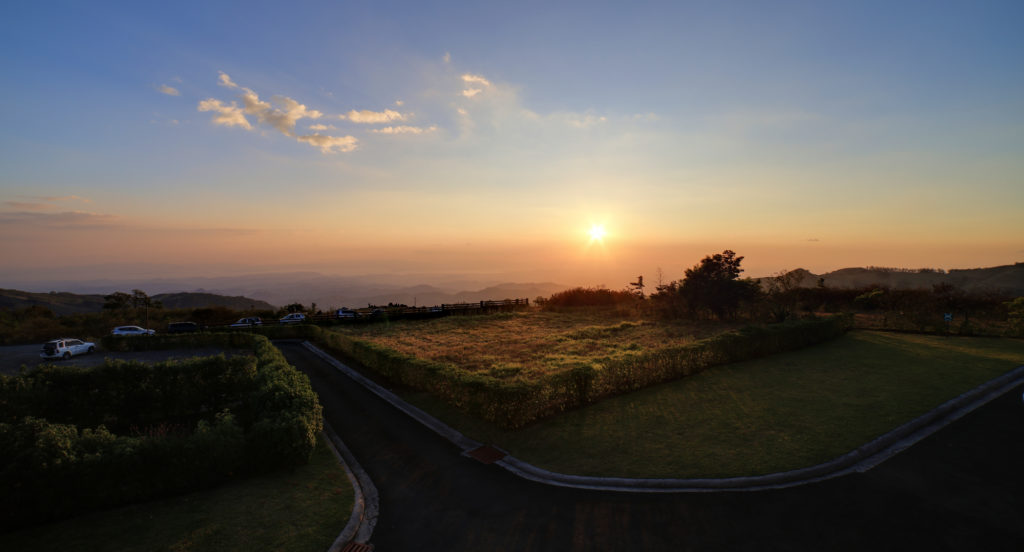
After about an hour we headed back to our room to freshen up for dinner. We decided to spend some time watching the sun set from our room, which had an incredible view of the western sky. We could see all the way to the pacific ocean from our room. This turned out to be a daily activity for us, and the sunset was consistently beautiful.
Chilled wine and a sunset. An excellent pairing
The sunset over our pacific view
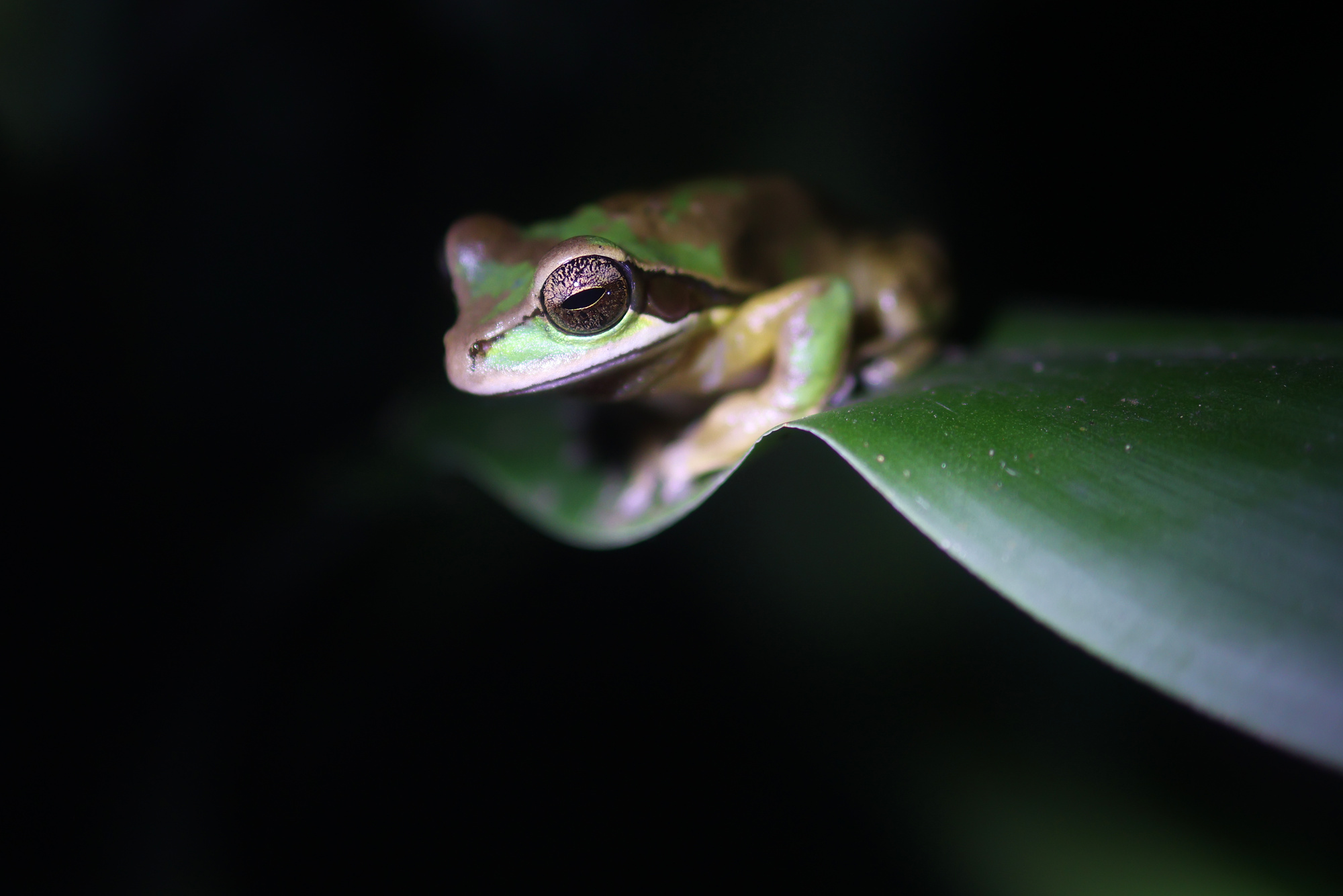
After our meal (it was great, as usual) we visited the frog pond. Its a small attraction right in town, so it seemed like an easy spot to visit that sounded interesting. Unfortunately our expectations were too high. It turned out to consist of a series of terrariums with different frog species. We did get a tour, but it was so rushed that it was practically a satire of itself. This one you could do without. At least we got to see a pretty cat?
A friendly stray cat that lives among the frogs tanks
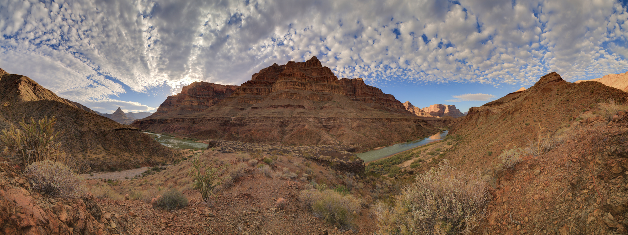
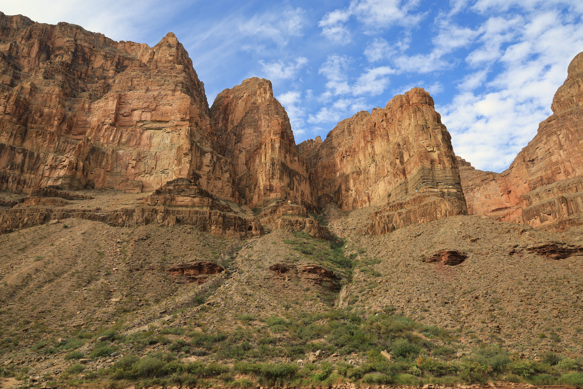
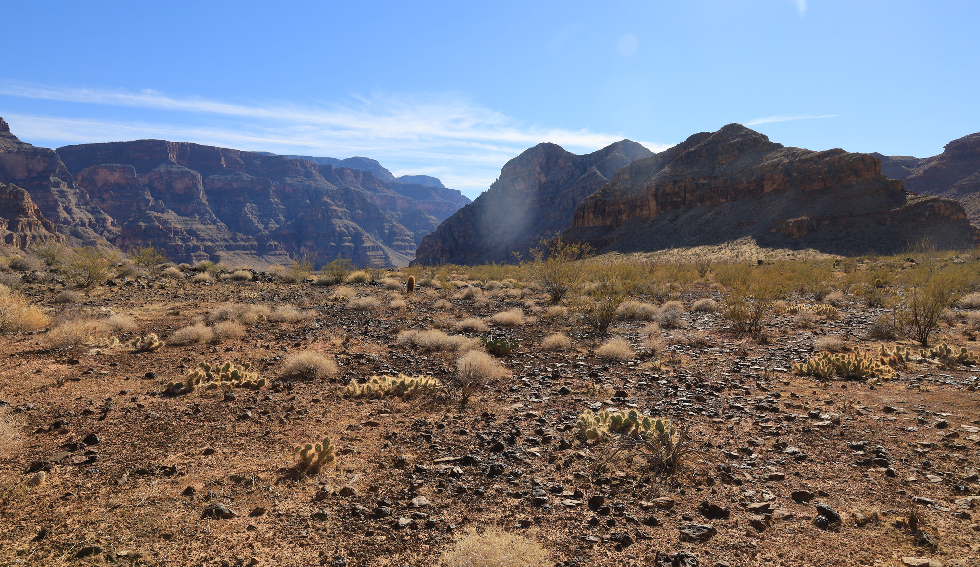
Now that we were nearly two weeks in, the daily routine was getting close to feeling routine. This day in particular didn’t hold too many surprises on the river map, and the canyon was starting to feel more and more open around us. It really was starting to feel like the canyon was petering out.
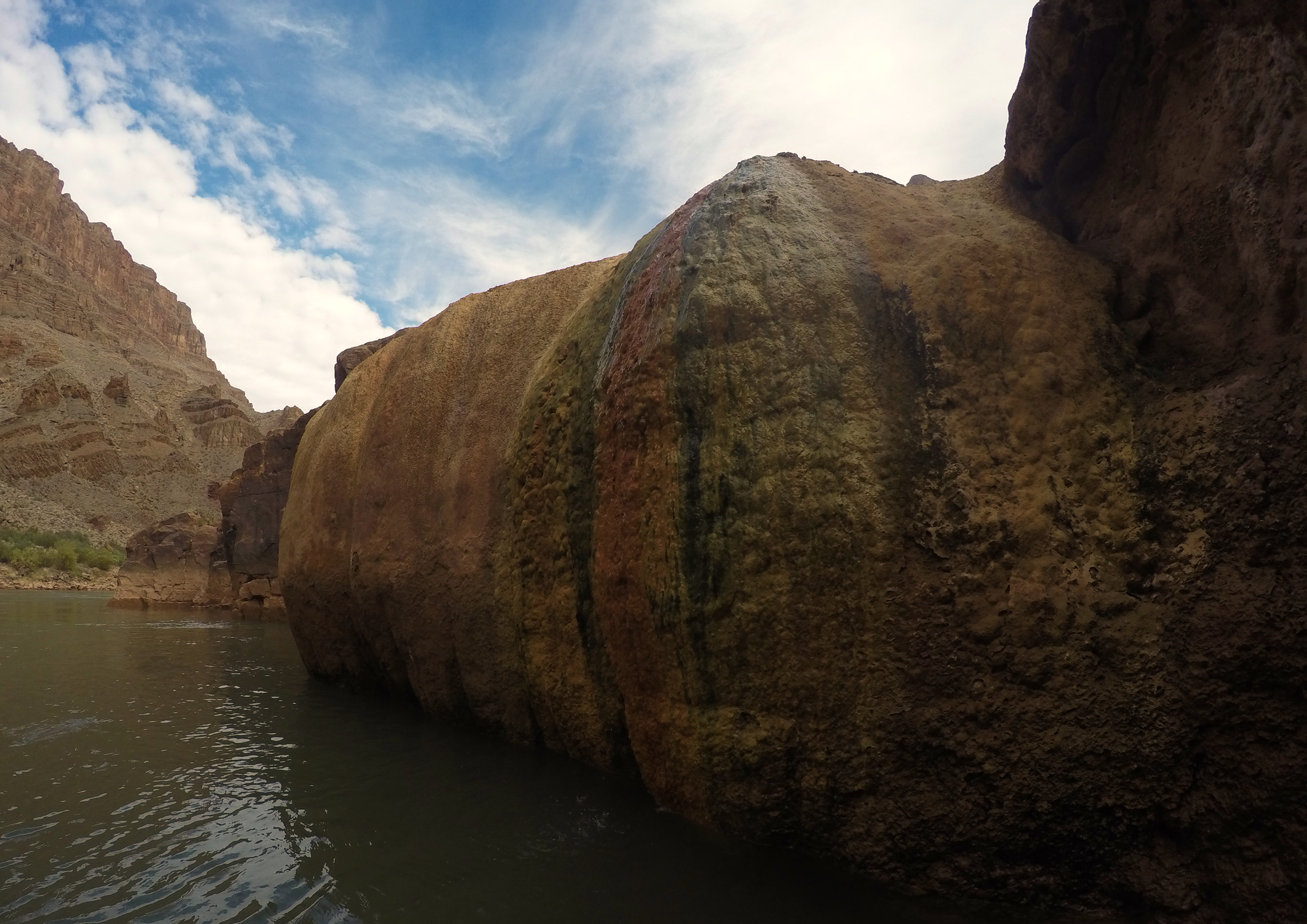
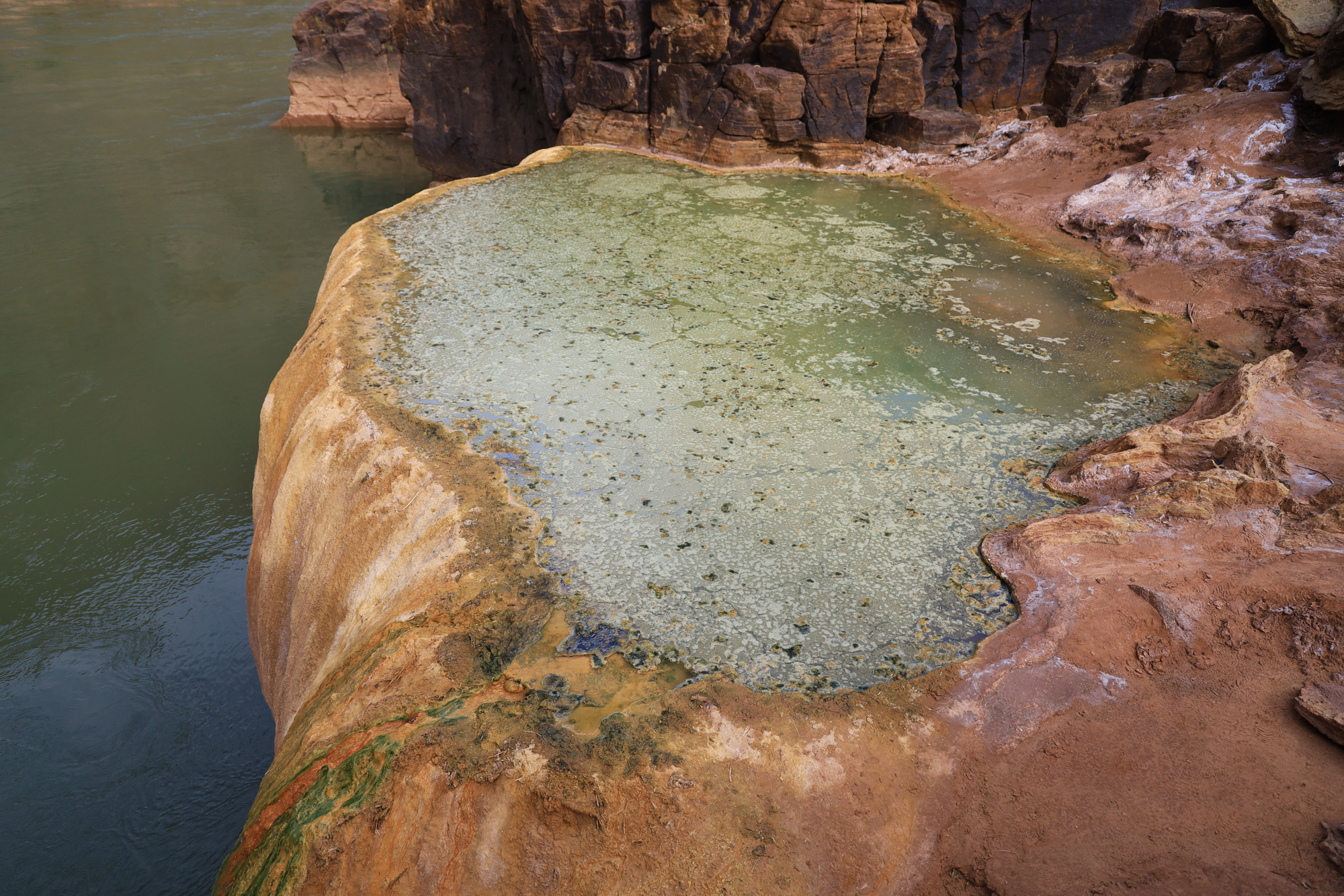
The Colorado didn’t let that feeling last long though, and we came across the Pumpkin Spring shortly after we left camp that morning. The spring is quite unique, with water slowly seeping over the walls to form the distinctive pumpkin shape with colorful mineral deposits. It briefly seemed like a neat spot to take a dip, until we saw the water that was covered in a nasty green algae, and then heard that it has a notoriously high arsenic content. No one even touched it.
Pumpkin spring from river level
The “inviting” waters of the pumpkin spring
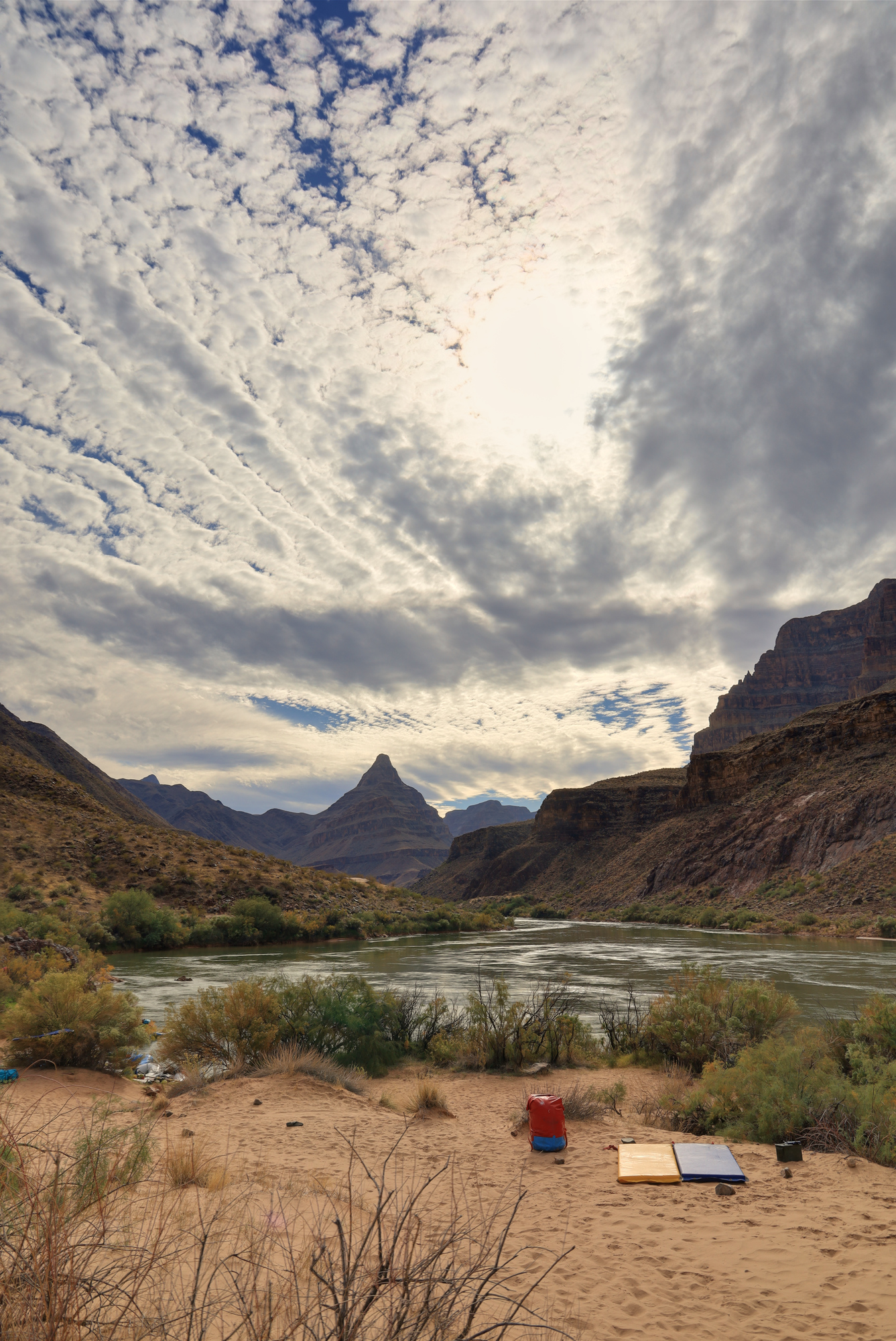
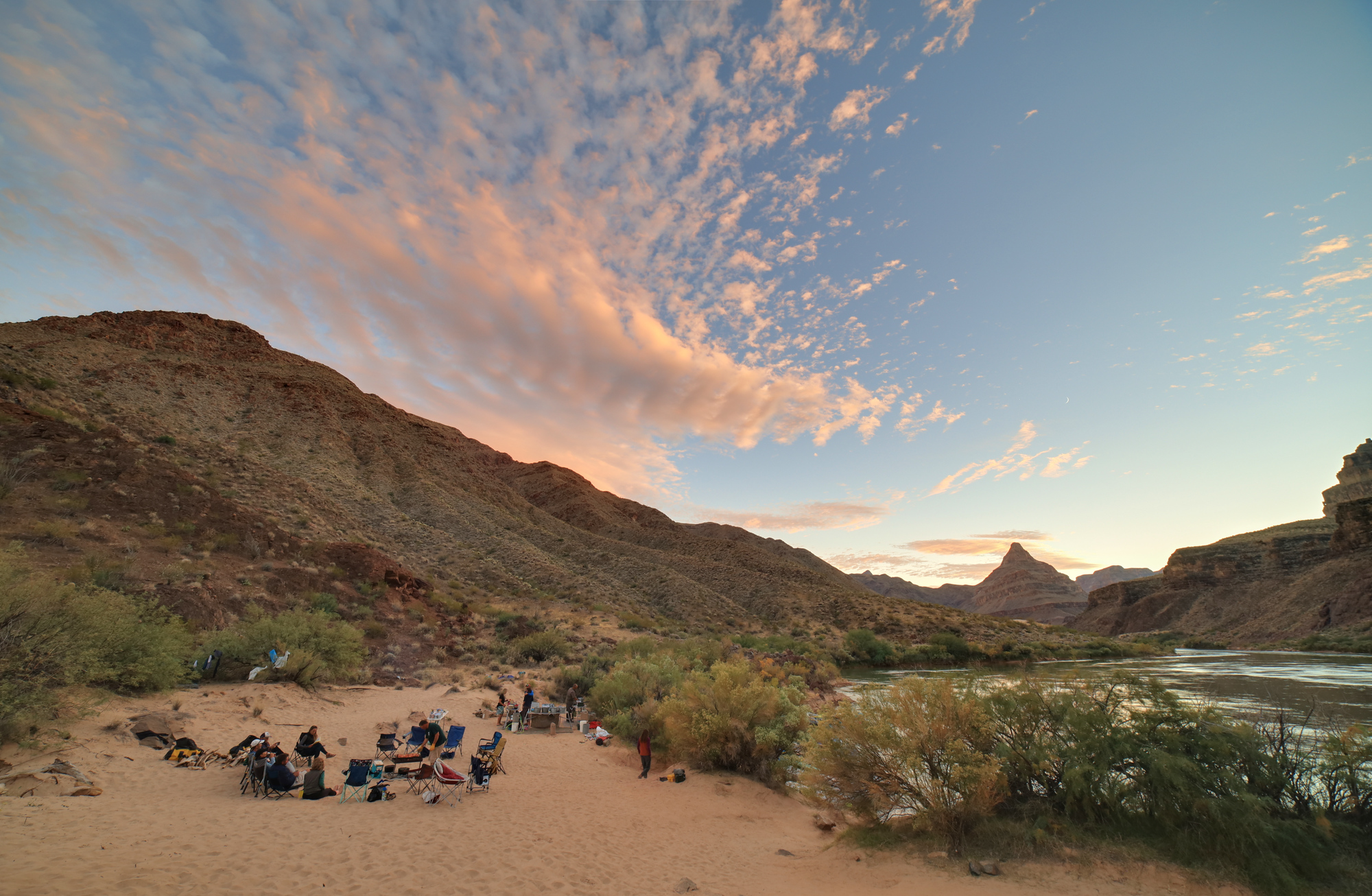
From there the float continued more uneventfully to 222 Camp. Apparently the camp naming scheme get’s less creative as you go. We arrived fairly early with plenty of time to explore and enjoy the evening. As usual I started by setting up my sleeping area. This camp had many great options, with great views of Diamond Peak to the west.
The view from my sleeping arrangements
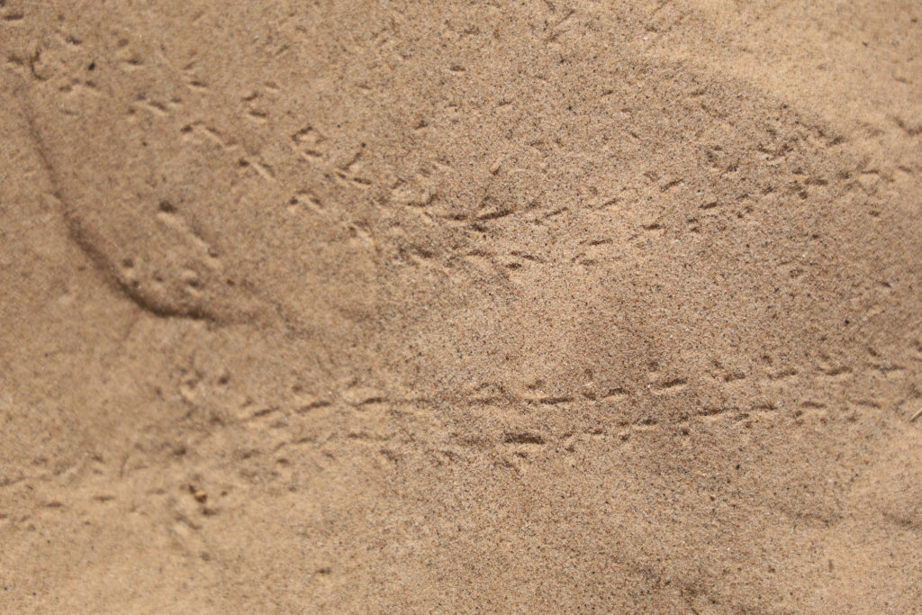
The camp was covered in tracks from various kinds of wildlife. I never saw any sign of them after I set up here though
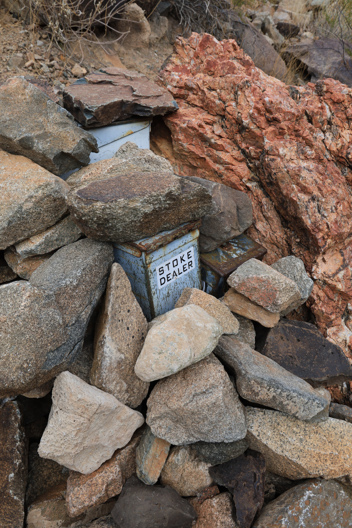
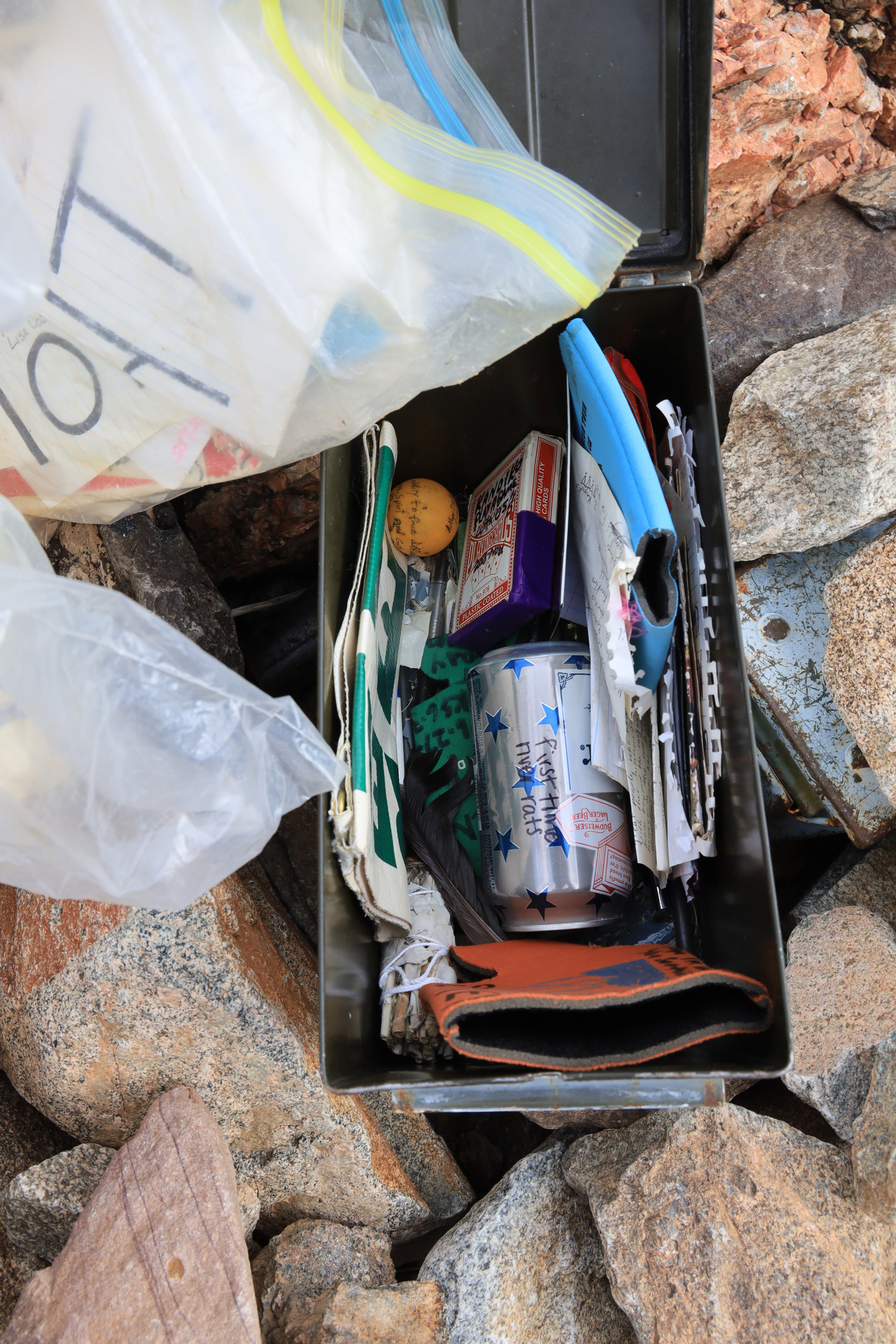
I decided to go for a short hike up the wash behind camp to get a better view of the canyon around camp. It was a short, but pretty hike with some interesting bushwhacking up to the ridge for an impressive view. On the way back down the ridge I came across a couple of ammo cans hiding a cache of notes and trinkets. Apparently this is a way for raft guides to pass messages and jokes between groups. It was a pretty neat find that I never would have found if I hadn’t essentially stepped on it on my way down the hill.
The view from the ridge above camp. We were set up on the little sandy area to the left of the ridge
A cache of trinkets and messages behind a rock on the side of the hill
A little taste of what was inside. Lots of the stuff was surprisingly old
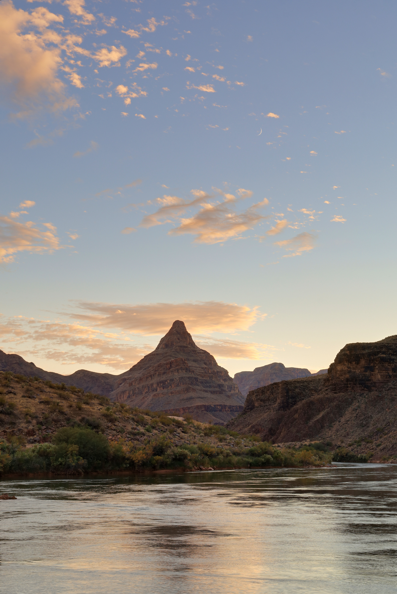
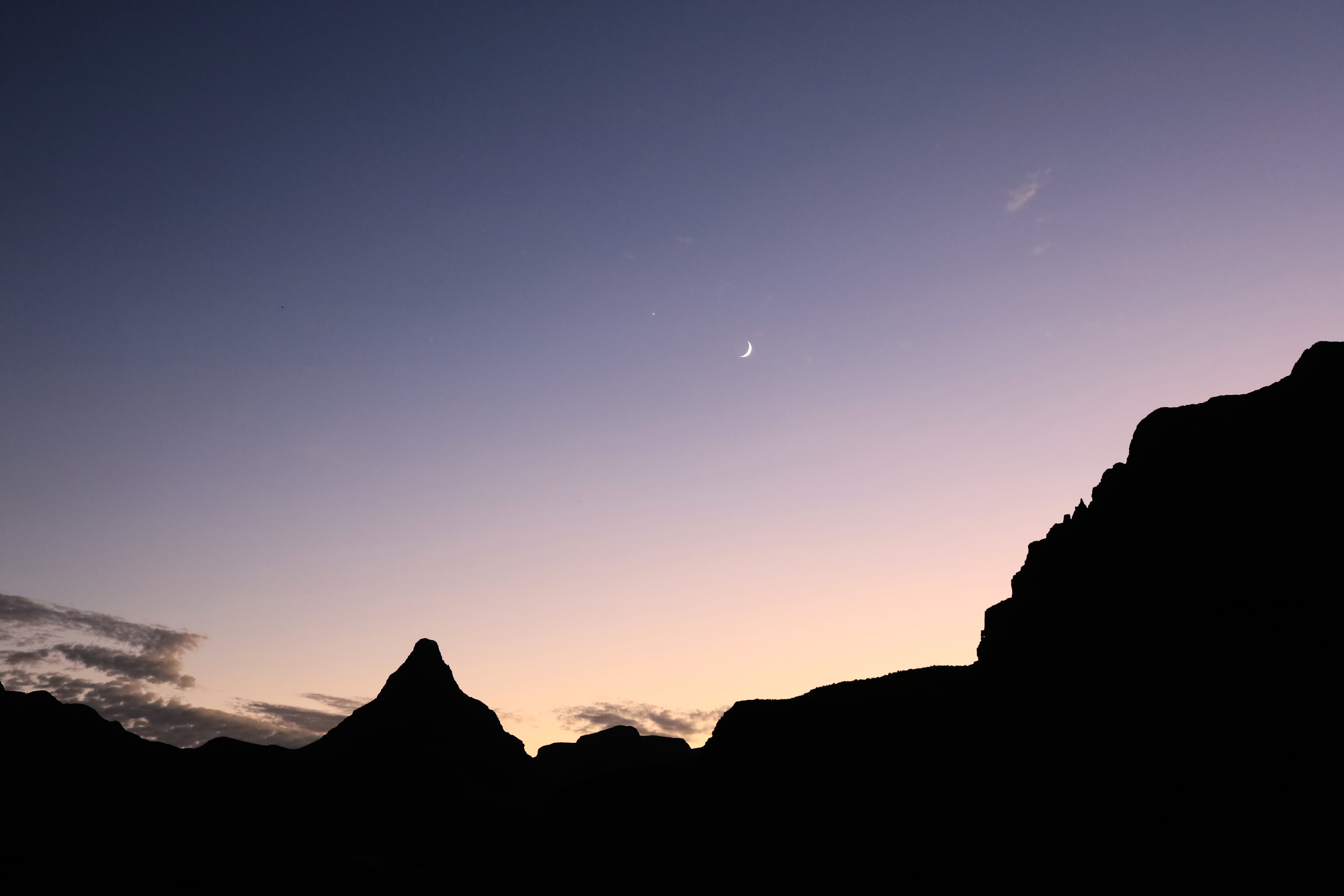
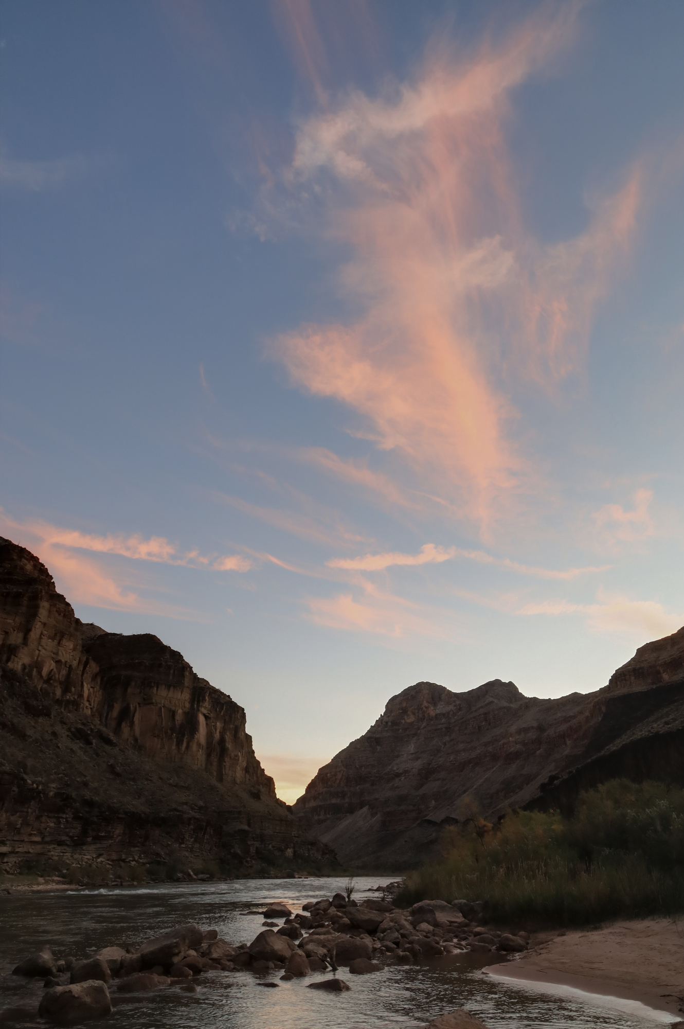
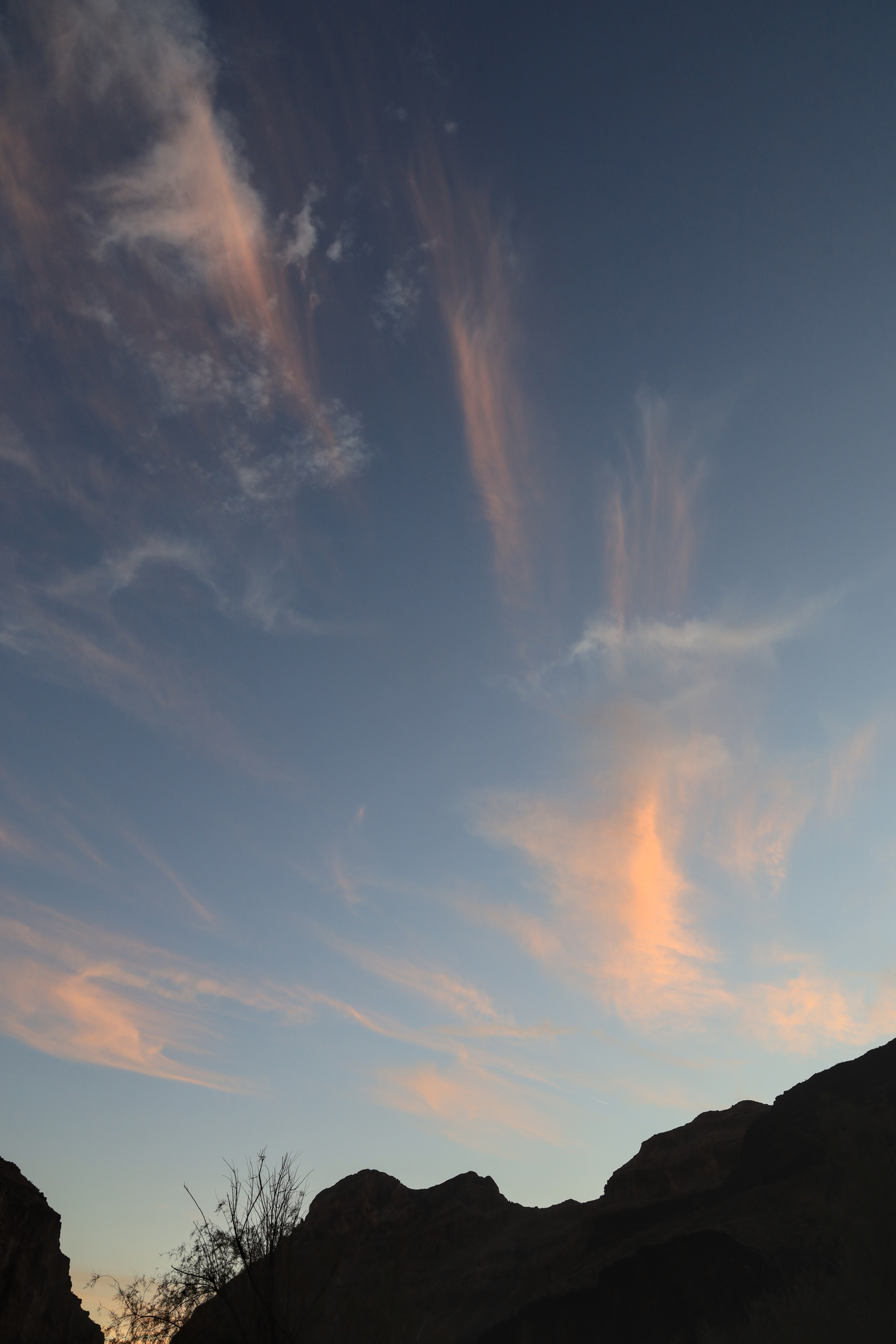
222 Camp may not be a very memorable name, but the camp has a good reason to be definitively burned into my memory. It had the best sunset we saw in the entire trip. Over the course of about an hour we all sat around the fire and watched the clouds slowly thin out, start to glow pink, orange, reds, and purples. The view is impossible to convey in words, so I’ll let my photos do the talking on this one. What an end to the day!
The view around camp as the clouds were putting on their show
Looking downstream to diamond peak framed by the sunset
The colors continued after the sun was down and the moon was lighting up the sky
Given that we had comparatively little time to explore the canyon on land, both of the layover days that we had were a special treat. This one had a very different feel than the previous layover at Deer Creek. Instead of a big organized hike, we had a number of smaller activities going on with people coming and going throughout the day. Once again, I started my day early. I got up about an hour before sunrise and hiked upriver towards the Whitmore Trail. I ended up hiking part way up and then stopping to watch the sunrise. The colors weren’t anything spectacular, but the scenery more than made up for it.
Looking upriver from the Whitmore trail at dawn
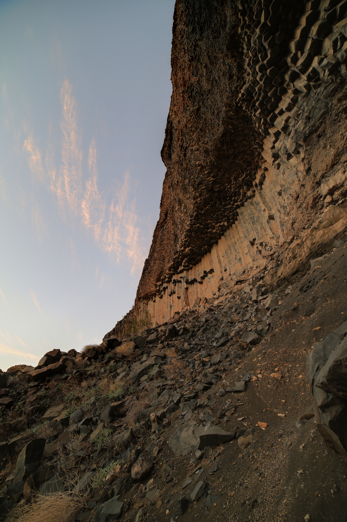
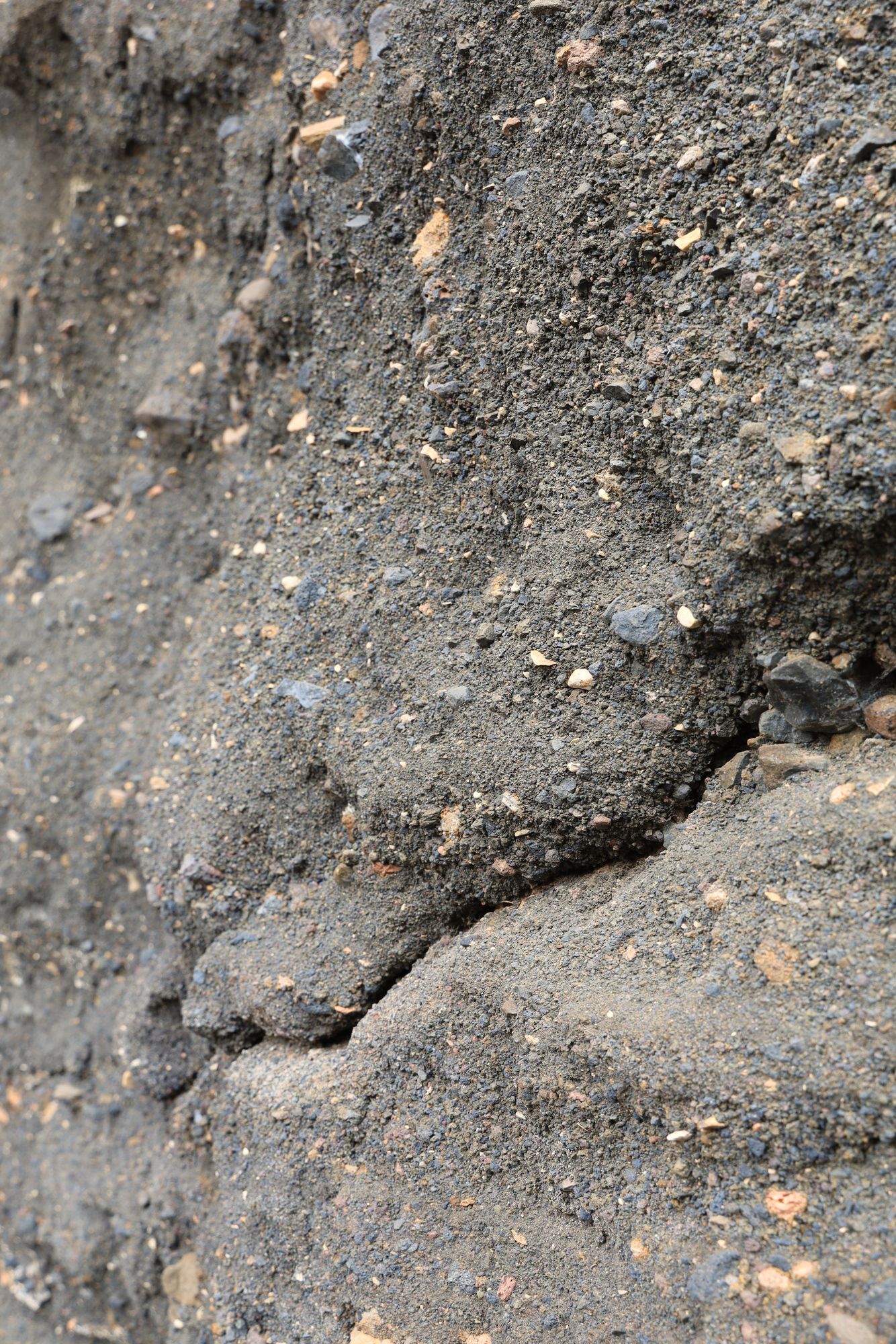
The Whitmore Trail was well maintained and meandered through some old lava flows. I got an up close look at one of the walls of basalt columns that we had admired from the river the day before. It was also interesting to see the hillsides made of ash that crumbled as you touched them. I even heard a few small rockfalls across the river as I hiked. The river never sleeps.
Looking up at a wall of basalt
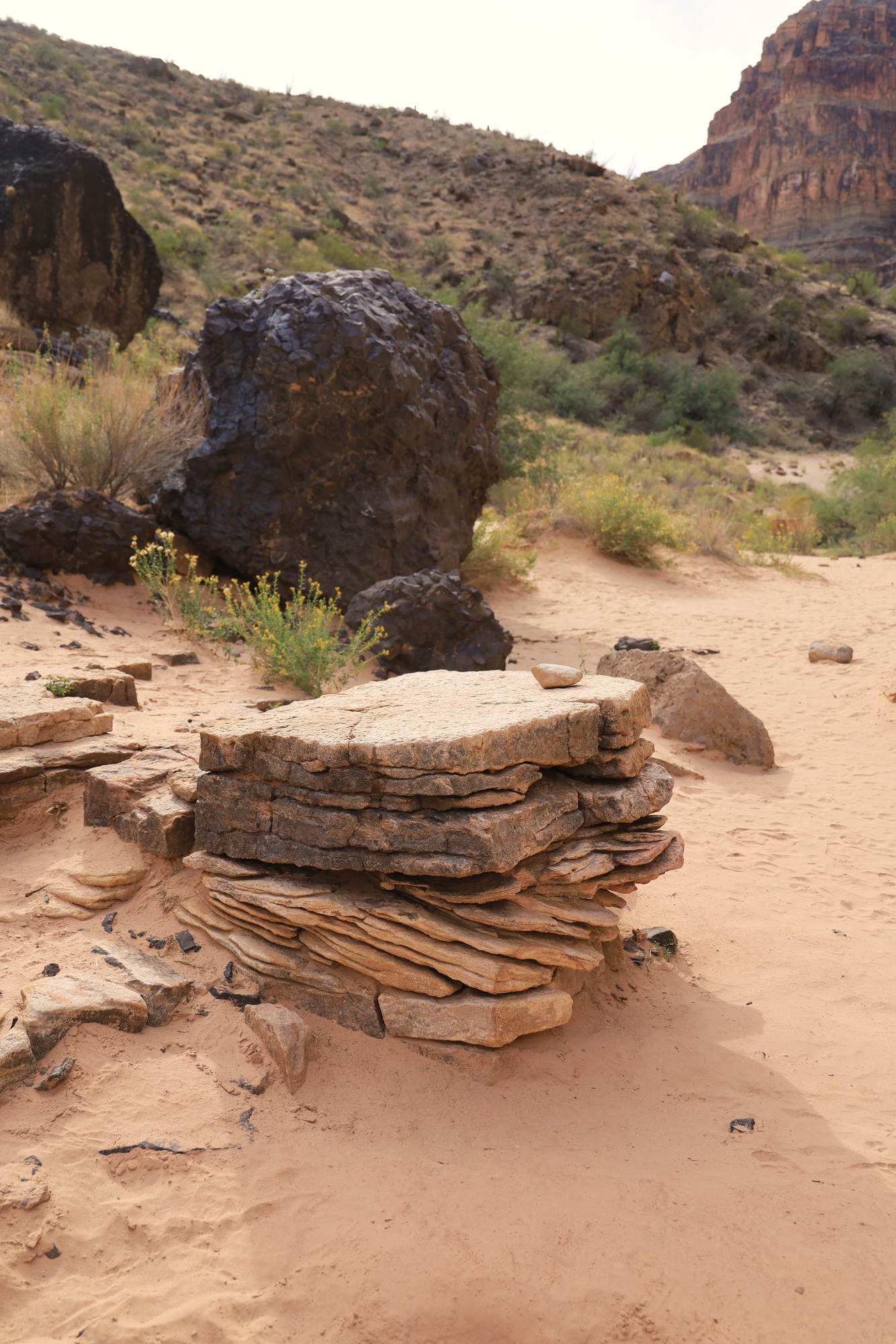
The trail was cut through this layer of compressed ash and gravel
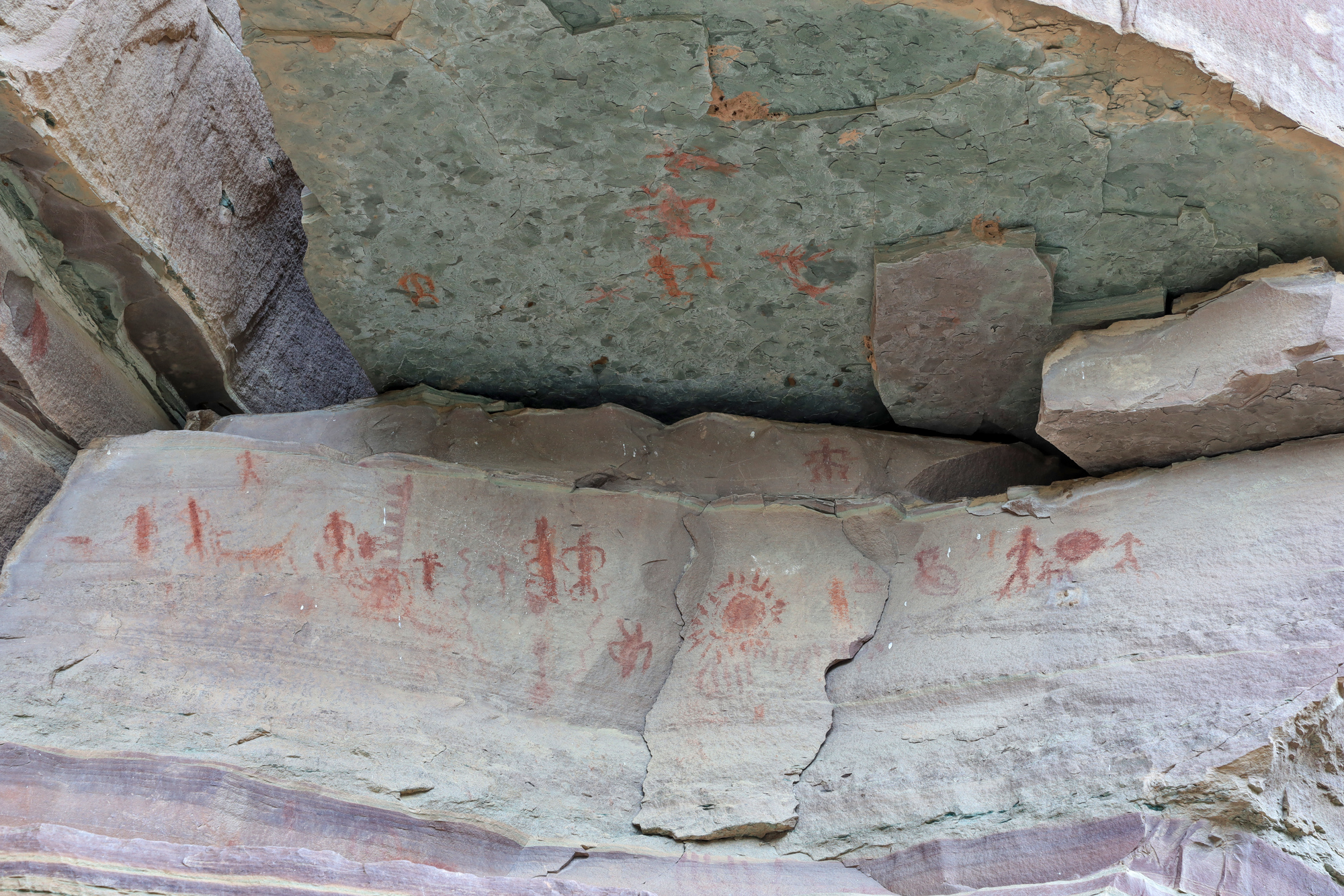
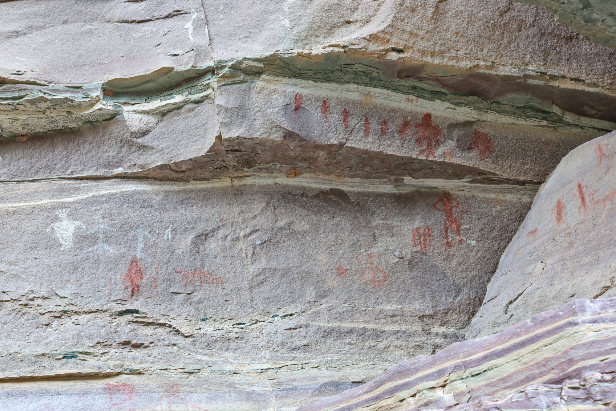
On the way back to camp I spent about 20 minutes trying to interpret the guidebooks instructions and low detail topographic map to find some pictographs. It turns out I was looking too far upstream at first, and once I made it to the right area they were pretty easy to find. The pictographs were some of the most distinctive I have ever seen. The red color really stood out against the rock, and there were quite a few as well. It was a little puzzling how they got them up there though, as the wall that was painted was quite far off the ground.
Another piece of history in the canyon
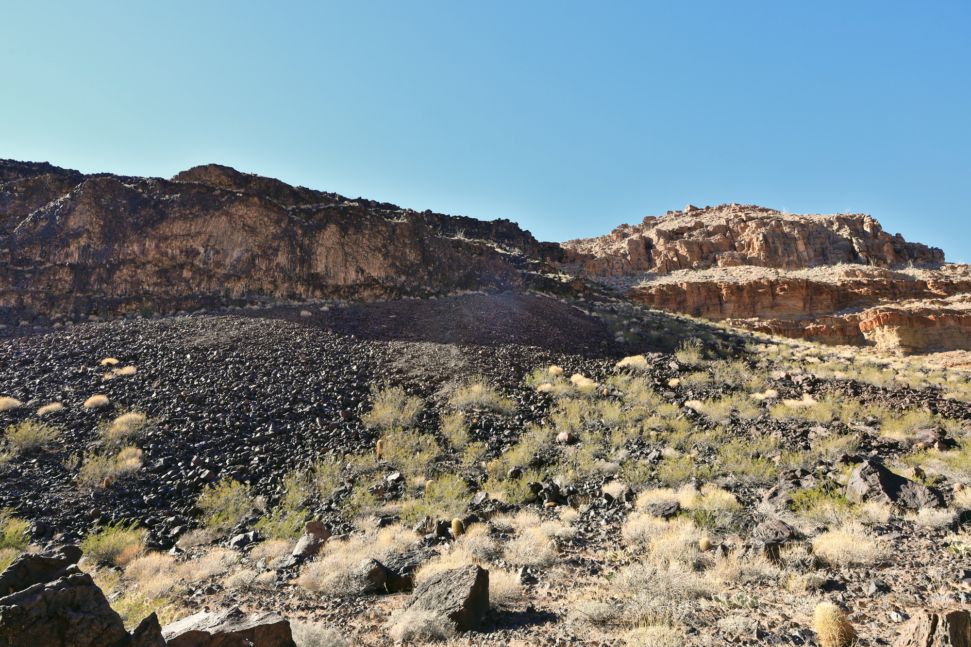
From the pictographs it didn’t take long to get back to camp, have a cup of tea, and enjoy breakfast. By this time most people were awake, so I got to hear about the whole variety of plans for the day. There was going to be a yoga class, some beach time, another hike to the pictographs, a hike up Whitmore Canyon, and more. I decided to go another route, and go for a solo hike up to the top of Whitmore Canyon. I gathered by gear and set off just downstream to start climbing up through the bands of cliffs. It quickly became clear that though the route was in the guidebook, this was not a trail. I was soon scrambling up a hillside of basalt boulders towards a cut in the cliffs above. As promised by the book, there was a path through the cliffs, but it was about half climbing, half scrambling at the end.
This field of basalt is the “trail” up. It’s hard to tell from the photo but this was a very steep slope
After the steep climb through the cliff, it was a bit of a surprise to find a completely flat plateau above
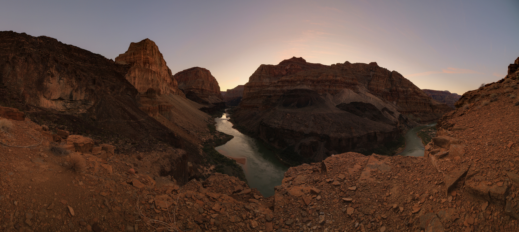
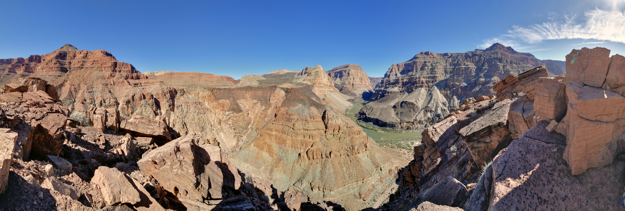
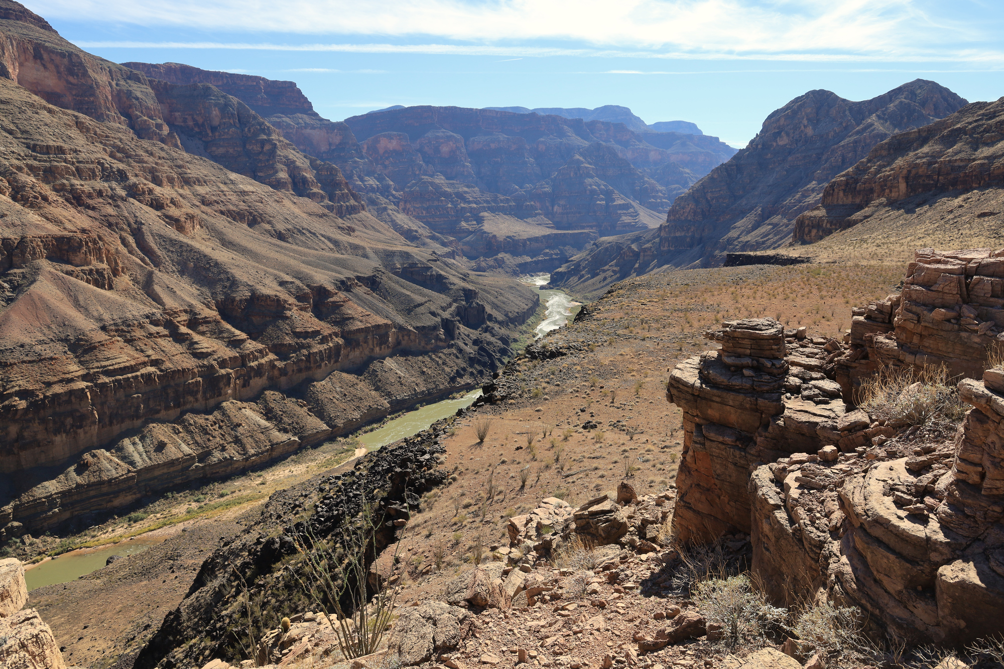
Once I had made it through the first band of cliffs the going got much easier. The terrain flattened out and I was able to quickly make my way up to the first point of rock that I had seen from camp. This point is right at the mouth of the canyon, and had an impressive view of the river, the Canyon, and the next layer of cliffs that had appeared above me.
Looking down into Whitmore Canyon. The colors on the opposite hillside were very interesting here
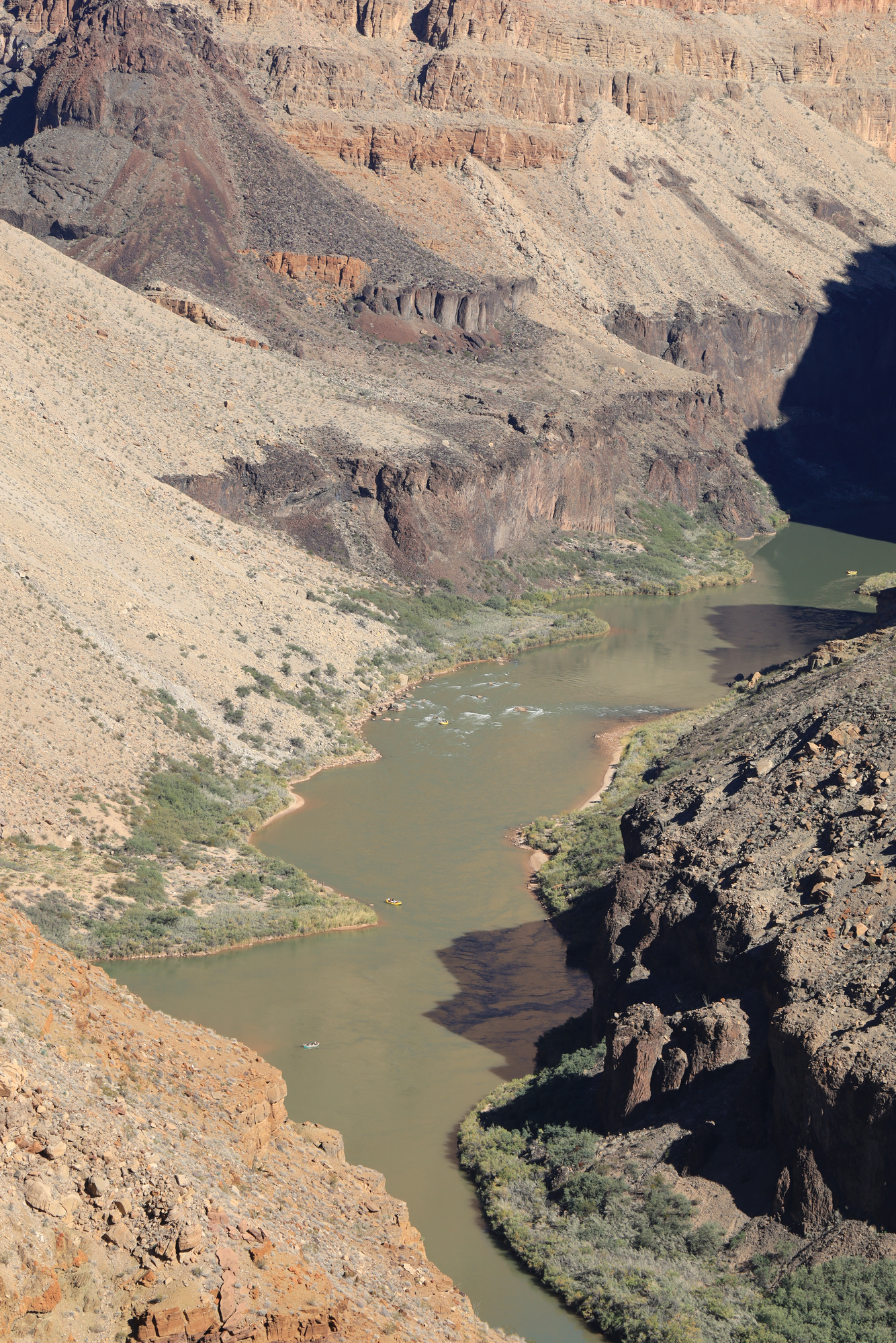
I caught another look at the dorys we had seen earlier in the trip as they passed us one last time. You can also see their yellow support rafts following behind
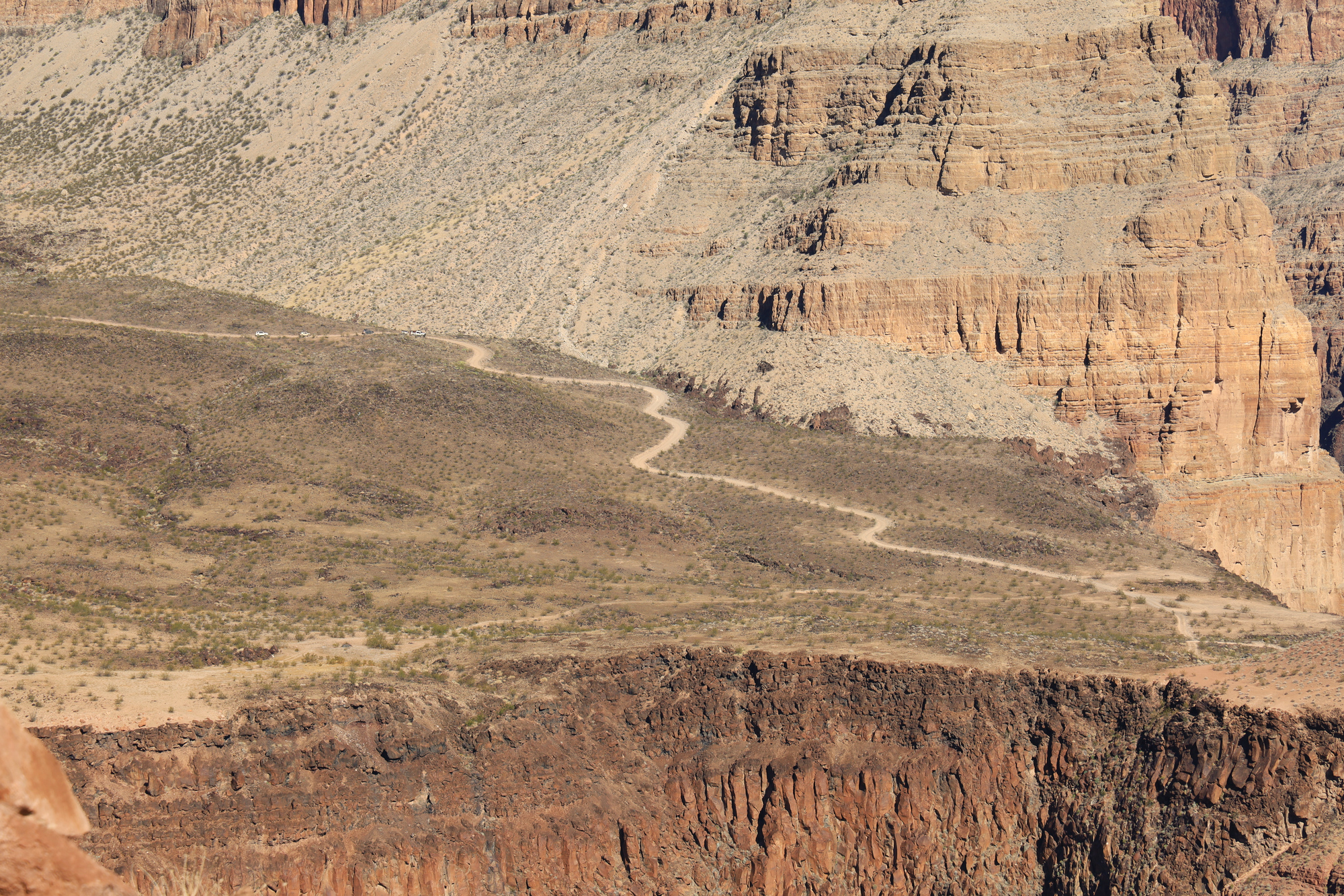
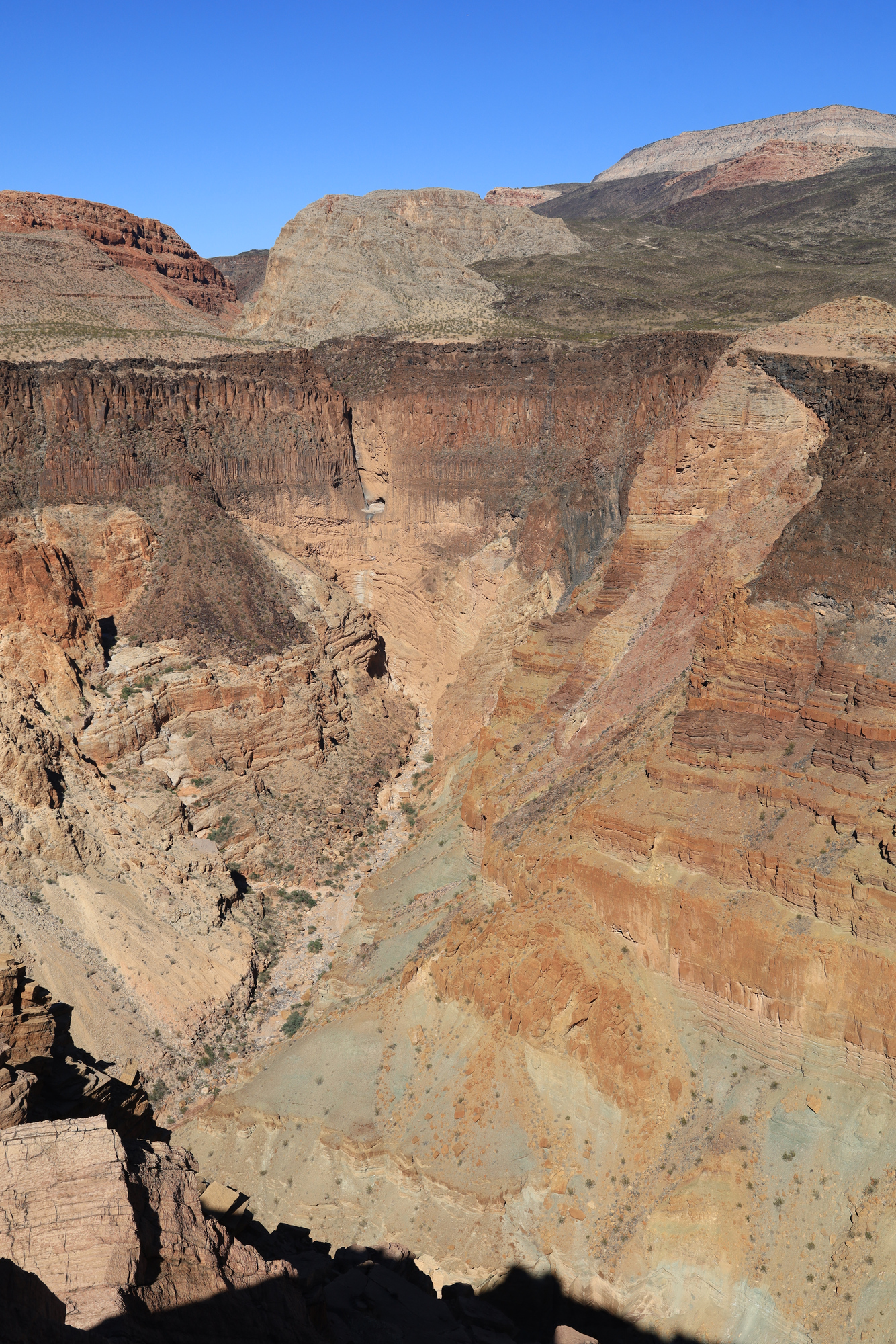
After relaxing at this point for a while I continued up towards the next level. For a while my hopes were high and the going continued to be easier. I even spent a few minutes on a real trail! But soon enough it was back to scrambling straight up a hillside whose steepness only seemed to be limited by friction of the rocks and gravel that formed the hills. My weight shifted some rocks and boulders more than once through this section. I was very glad to have my hiking poles. I ended up stopping somewhere in the middle of the broken Redwall and took another moment to take in the view. As I was relaxing in the shade of a cliff I saw the most surprising thing of the day: A caravan of cars on the 4×4 in the distance. Someone else was having their own adventure to this incredible place, though in a very different way.
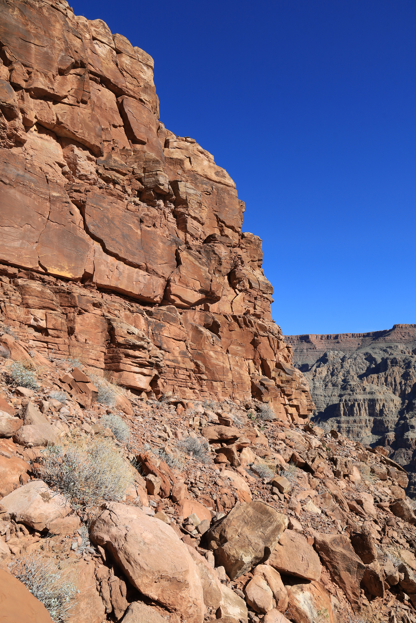
The Redwall is always more impressive up close, even when its broken like this. This section is where I turned around
The most rare sighting in the canyon: A road and cars
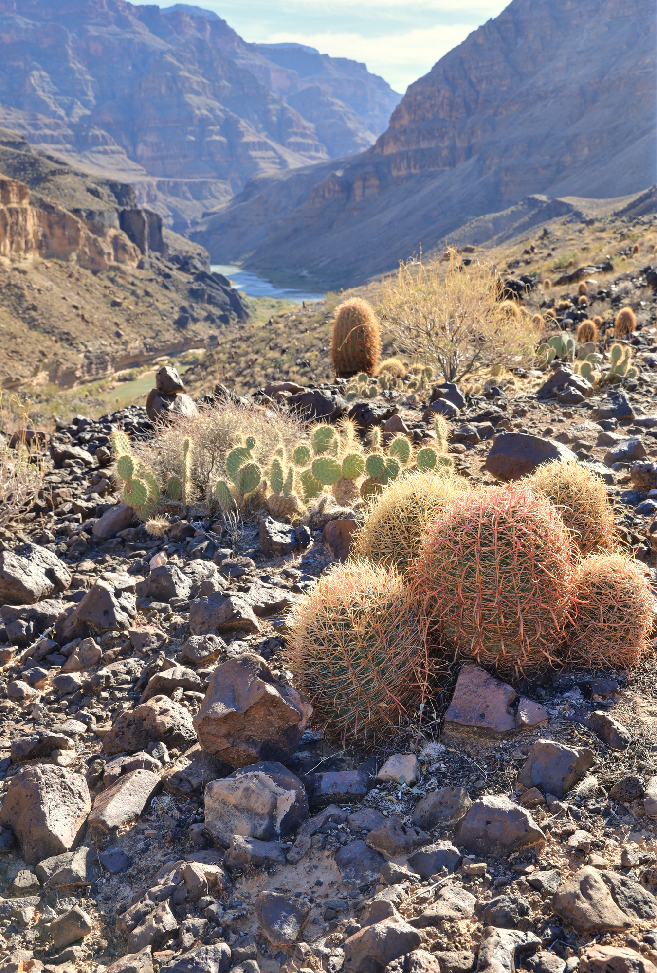
The route in the book continues uphill from here, but I didn’t want to push my luck with the rough terrain and the limits of my water supply. I headed back down towards camp. The descent went smoothly, with a couple stops for photos and water on the way back down. All told the hike was only 3.6 miles, but it took me over 4 hours. Still, it was well worth the trip.
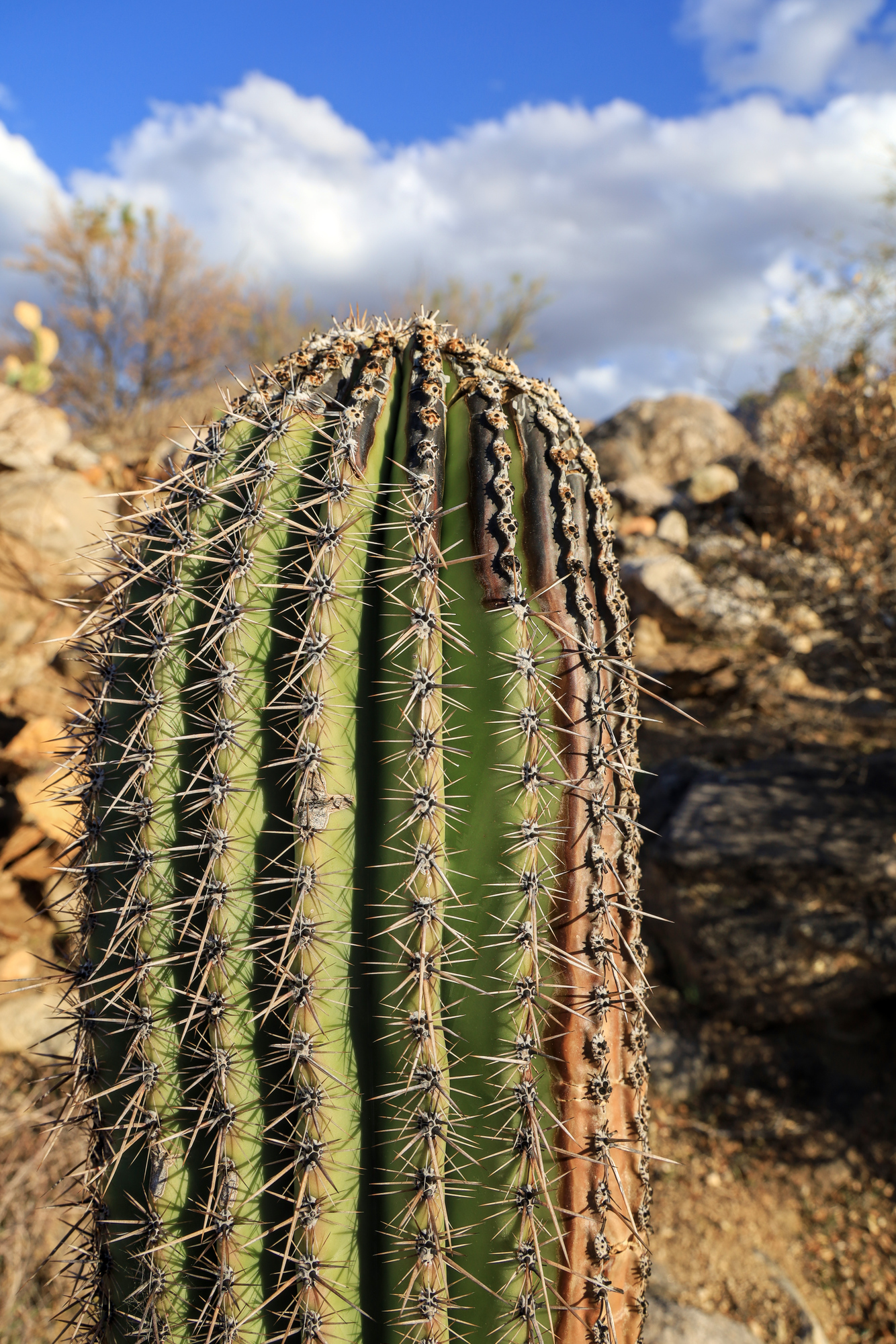
A family of barrel cacti living just above the edge of the basalt cliff
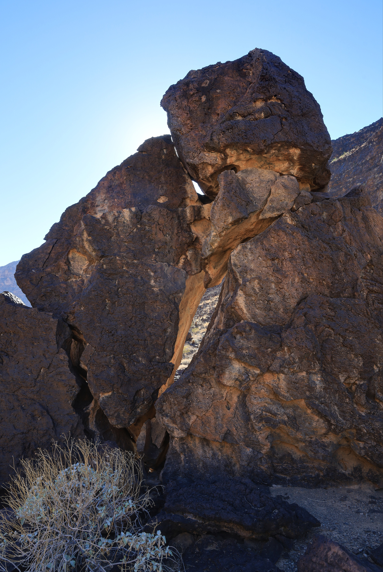
This wild rock stood alone on a flat plateau just below the cliff
Once back at camp I had some time to go for a swim, take my second bath in two days, and relax on the sand. All told it was a wonderful day, capped off by a wonderful sunset. Next time though, I’ll take that guidebook with a little bigger grain of salt.
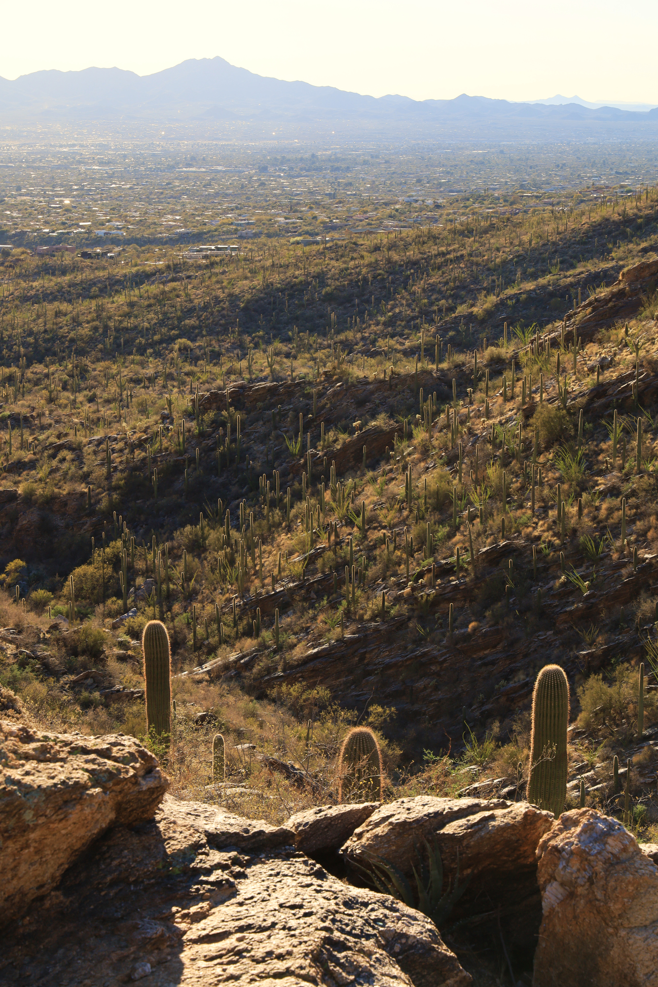
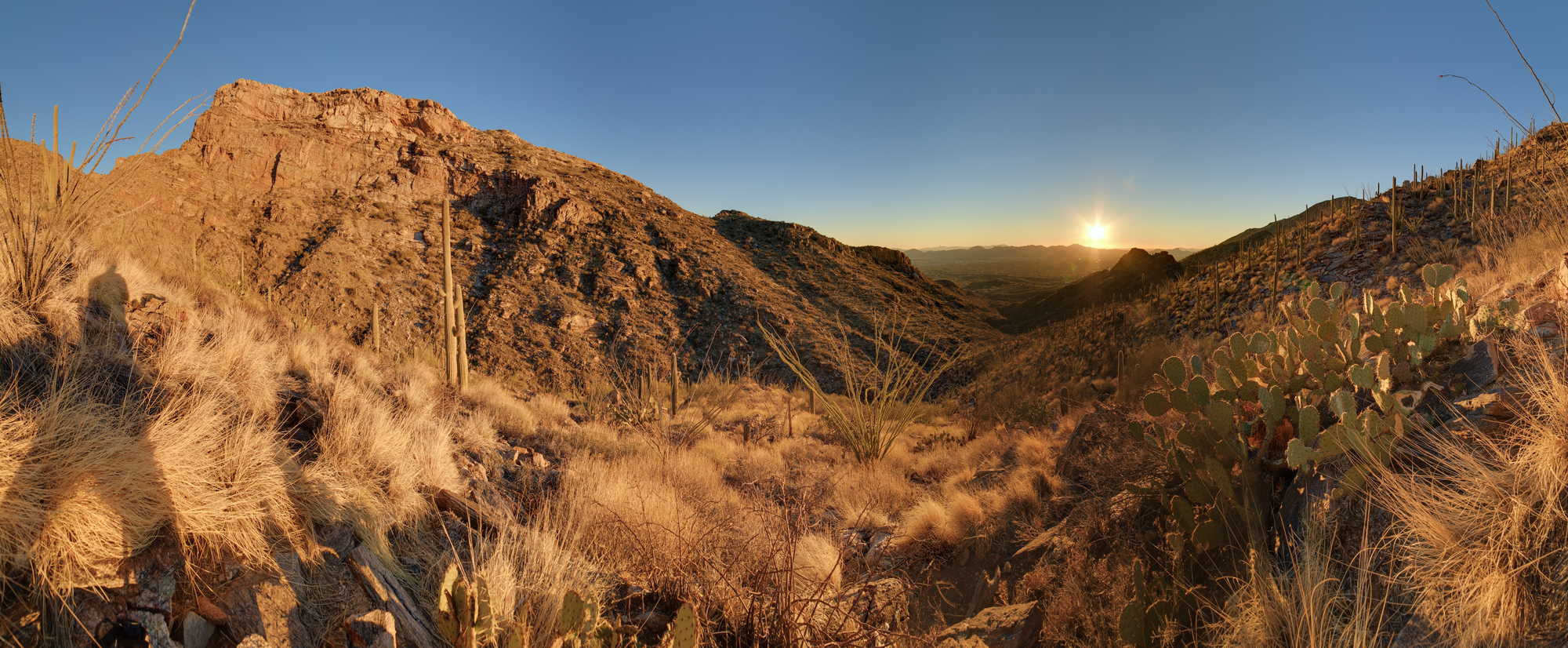
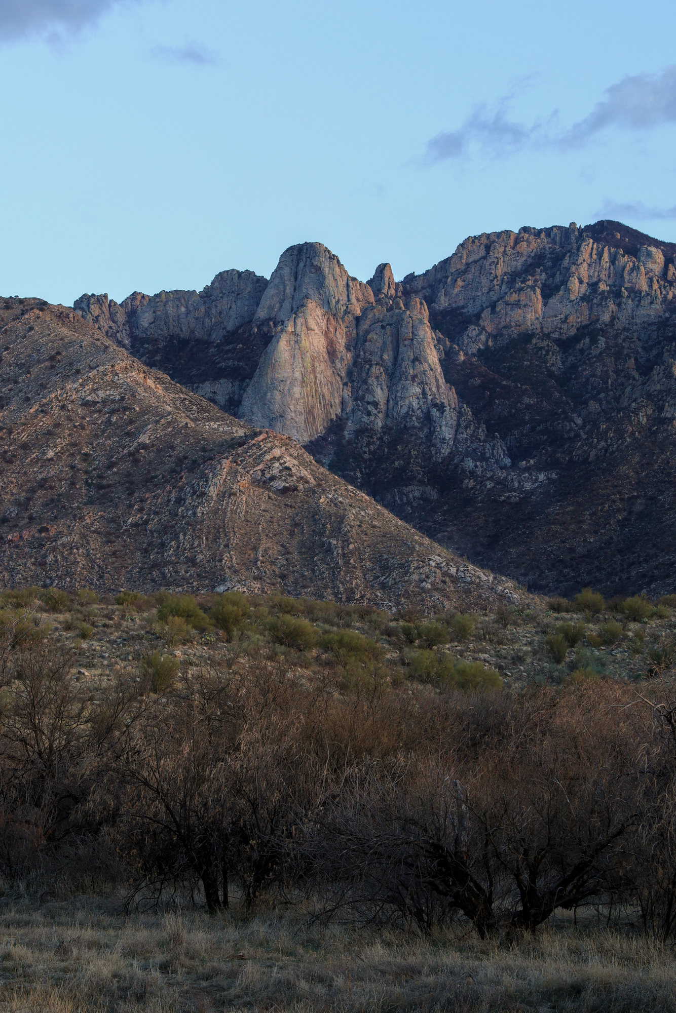
Sunsets in Arizona are some of the best I have seen anywhere. The combination of consistently great weather, open views, and some interesting topography means that they rarely disappoint. As we wrapped up the first couple days of work from “home” at our Airbnb, I decided to go for an evening hike to enjoy one of those sunsets. I started up the Pontatoc Canyon Trail about an hour before the sun set with the goal of climbing up far enough to see the sun set in the valley behind me. As soon as I started there were great views up the sides of the canyon, as well as out across the foothills towards Tucson.
Looking up towards the top of Pusch Ridge
Looking down the trail to the west
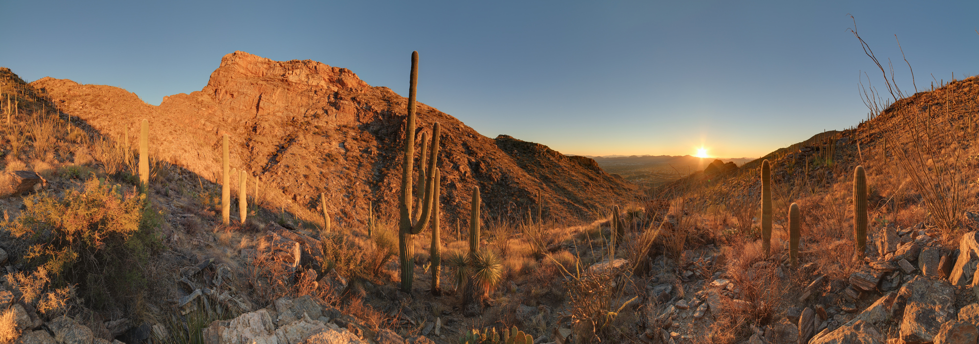
As I continued up I started to get further and further into the canyon I got more and more worried that I was going to end up without a good view of the sunset. I kept picking up the pace, hoping to get to where the trail climbed up out of the bottom of the canyon. It turns out my planning was correct though, and I soon started heading up the left side of the canyon and into the setting sun. Once I found a nice spot it was time to get out the camera and enjoy the view.
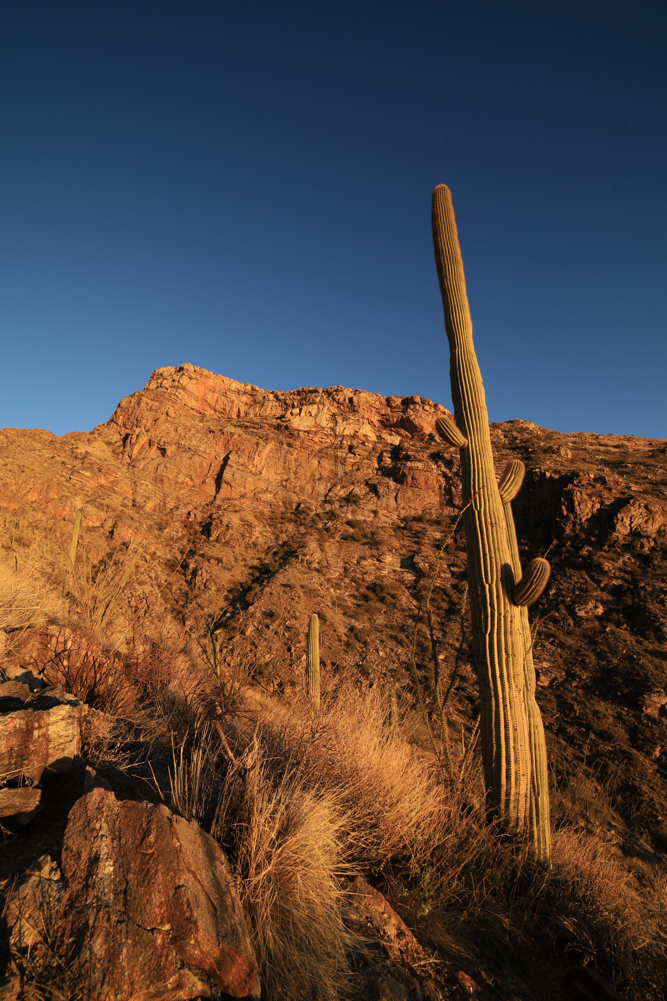
Looking up at the Pontatoc Cliffs
As I sat enjoying the view the sun lowered down into the valley, lighting up everything around me in an orange glow. The Pontatoc Cliffs just across the canyon were particularly bright and impressive. The colors were so intense that some of the phots just looked fake.
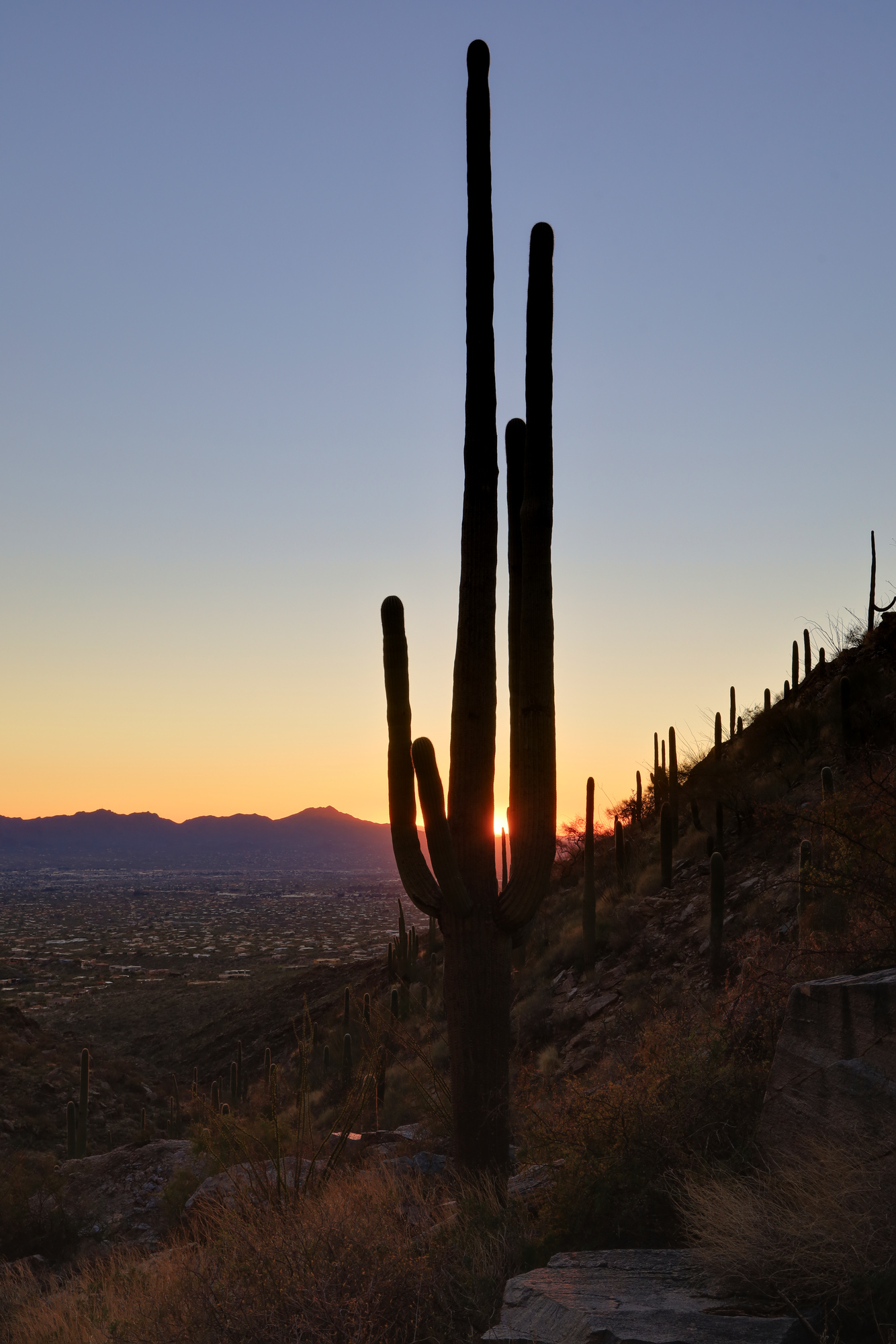
Shortly before the sun fully set I started back down the trail. I didn’t really want to hike out in the dark, so I rapidly worked my way back down the trail. As I did the color deepened, and the sun sank below the horizon. I snapped a couple quick photos before continuing down the trail.
A saguaro silhouetted in the setting sun
I made it back to the trailhead just as it was getting too dark to see clearly. The last bits of light were still lighting up the ridge, but the stars had started to come out. Another great hike in the desert.
I could just barely see the stars from this view to the east as I finished the hike
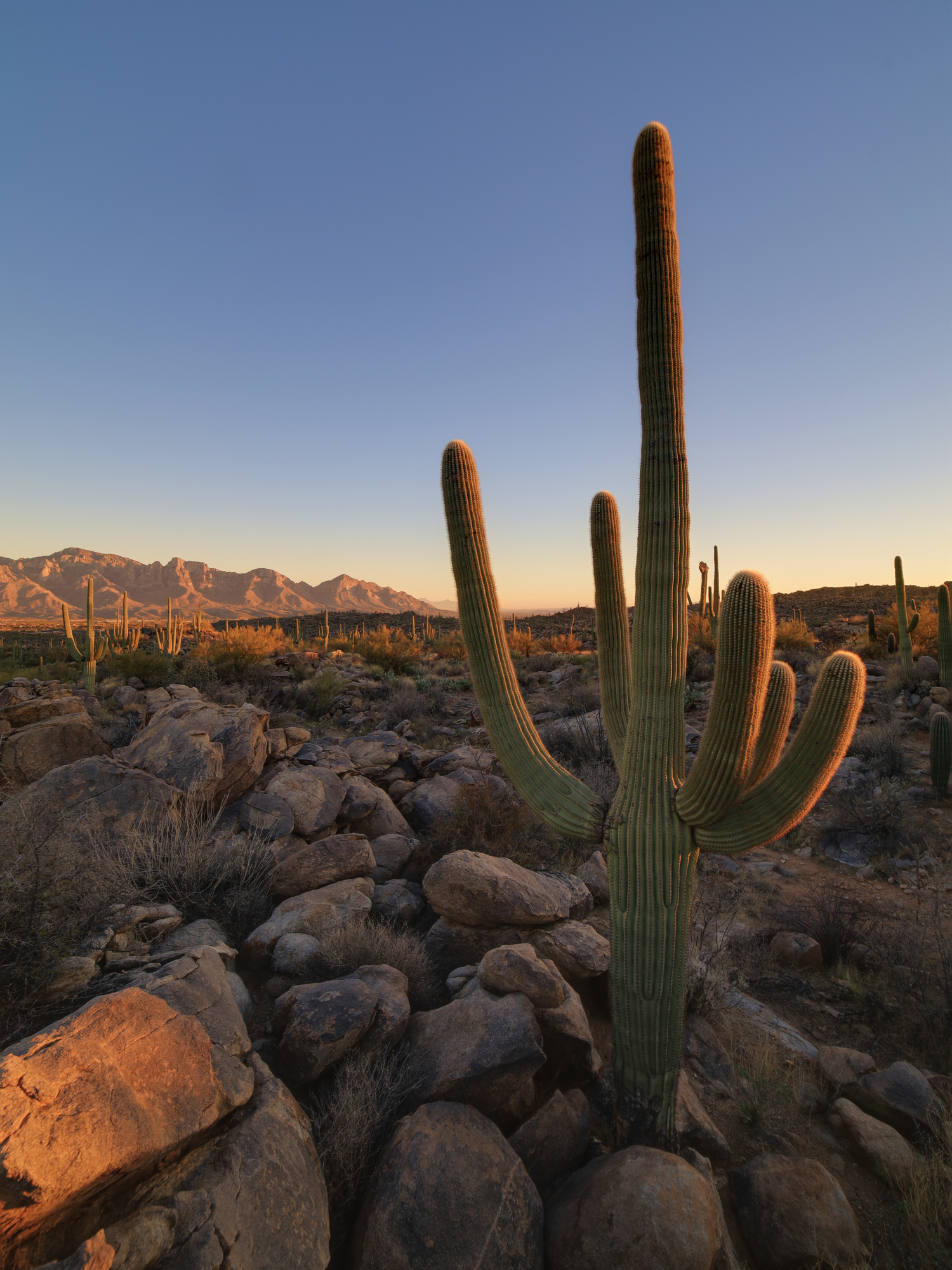
Early this spring we finally found the opportunity to travel out to Arizona to see my parents. As you might expect, travel in a pandemic is extra stressful so we were very happy to get outside and enjoy the excellent desert weather as soon as we arrived. We headed out to Catalina State Park for a tour of some of the burn scars from the Bighorn Fire that swept through here last summer.
The landscape was noticeably more brown than normal, but only on the left side of this hill
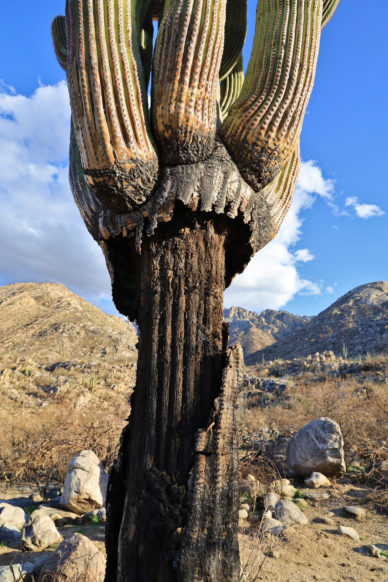
A badly burned saguaro
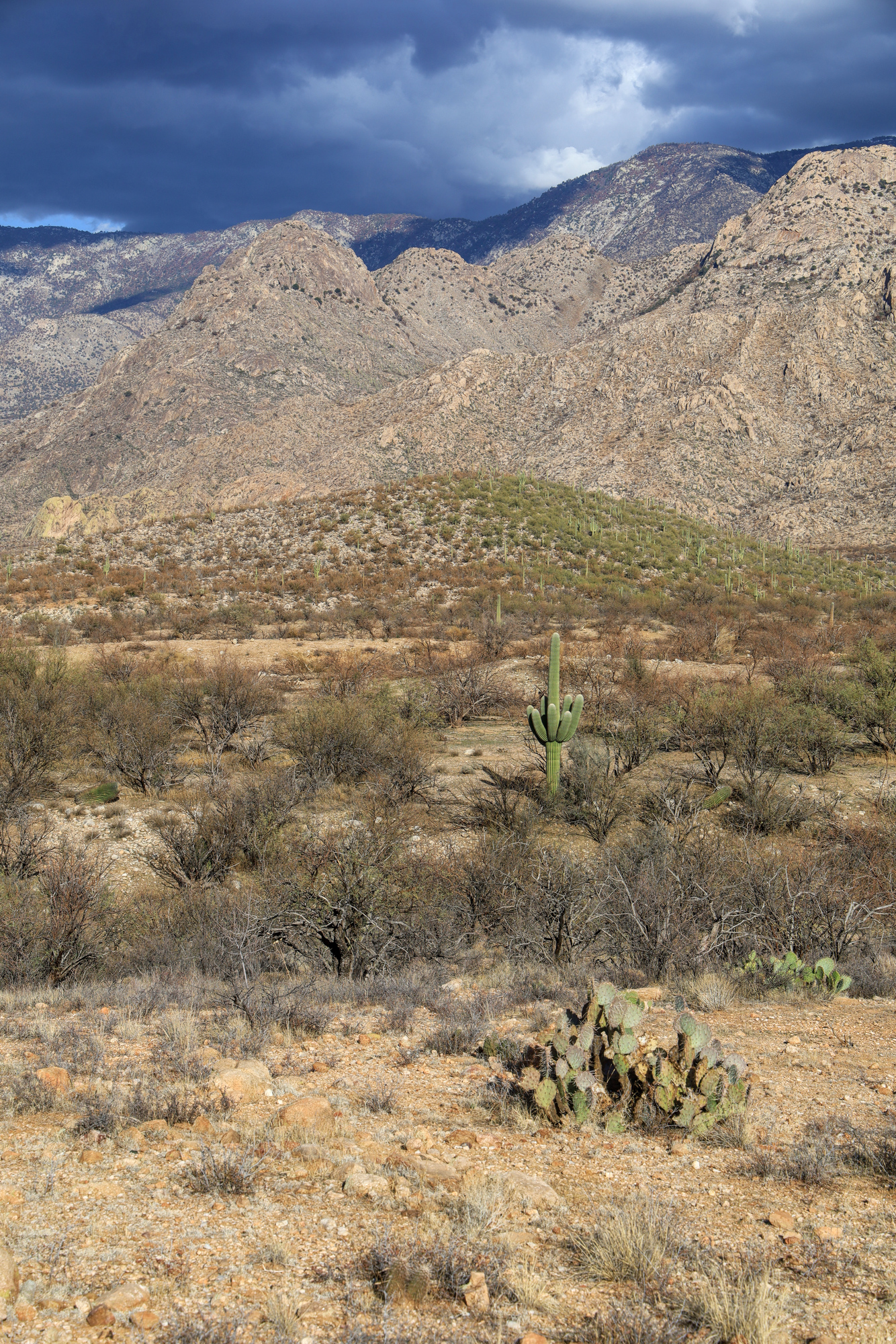
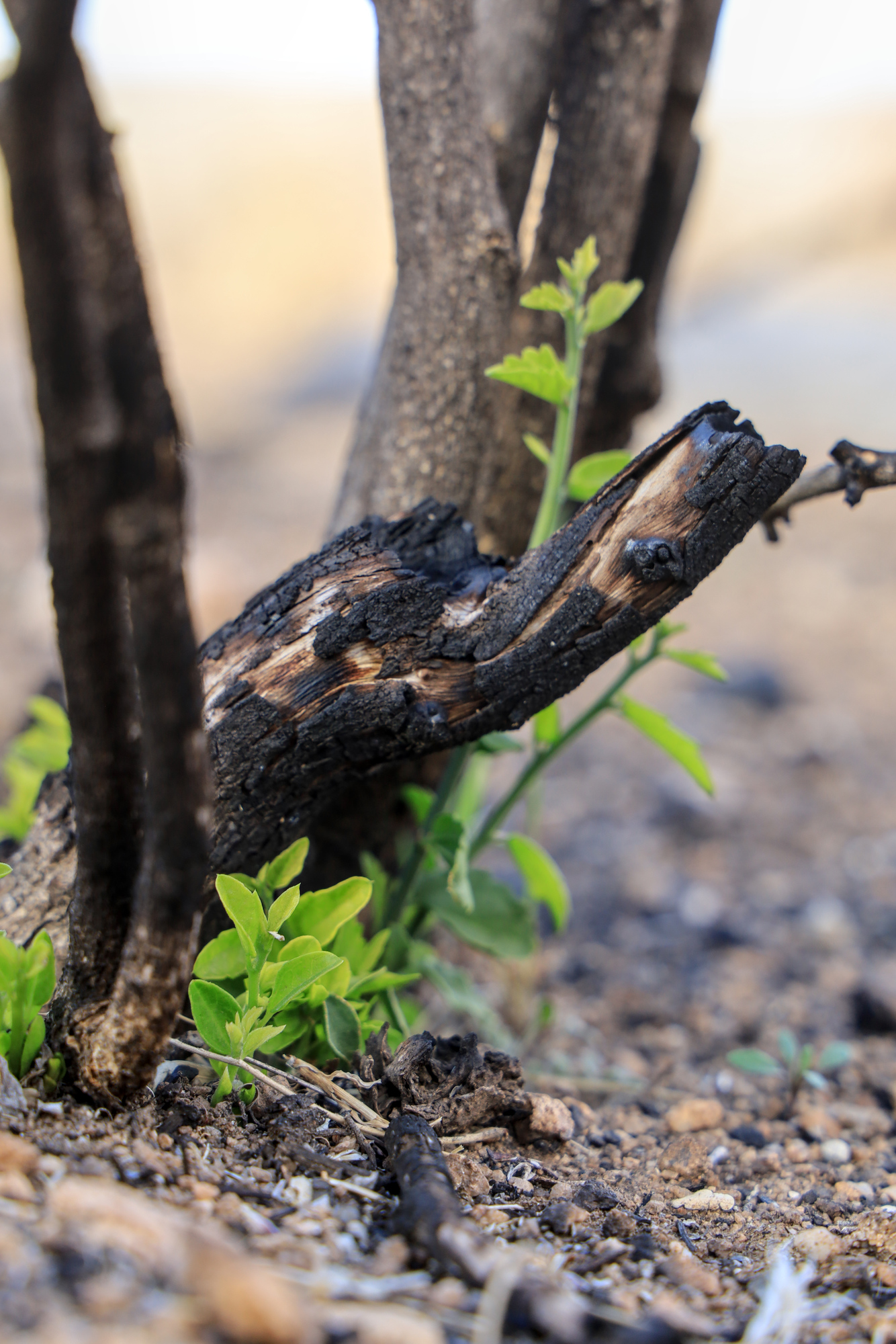
As the trail made it’s way up the hillside we quickly encountered signs of the fire. Many areas were thinned out, and some were completely barren. The fire was clearly very erratic though, as some areas appeared to be untouched. The shells of doomed saguaros were a sad sight along the trail. Somehow they continued to stand strong, but many will clearly not make it. However, there were also signs of life among the damage. Some cacti seemed like they might be able to survive, and new growth was already starting at the base of the bushes and trees.
Not sure how this young saguaro will fare, but we wished it well
The bush may be charred, but still it comes back
The way back down the loop took us through some areas which were entire unscathed in the fire. The contrast was remarkable, with far more underbrush and grass. It was a very interesting combination of sights, and I’m sure we will be back to watch it all come back.
The setting sun lighting up the mountains above us
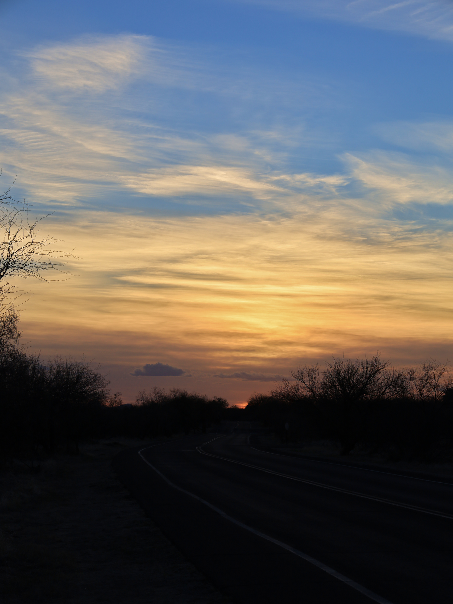
The sun setting over the state park road
In true Arizona style, we were treated to a marvelous sunset as we approached the trail head. It was a great way to kick off our desert trip.
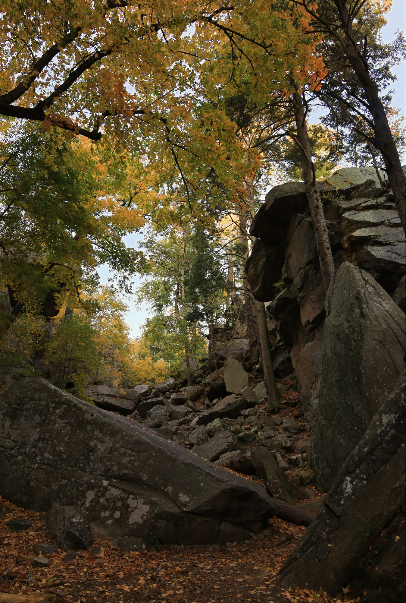
I realized as the leaves were turning that I had not been to Purgatory Chasm all year. Given how interesting a spot that is, I figured it would be an interesting place to visit for some fall color.
The colors in chasm had just gotten started
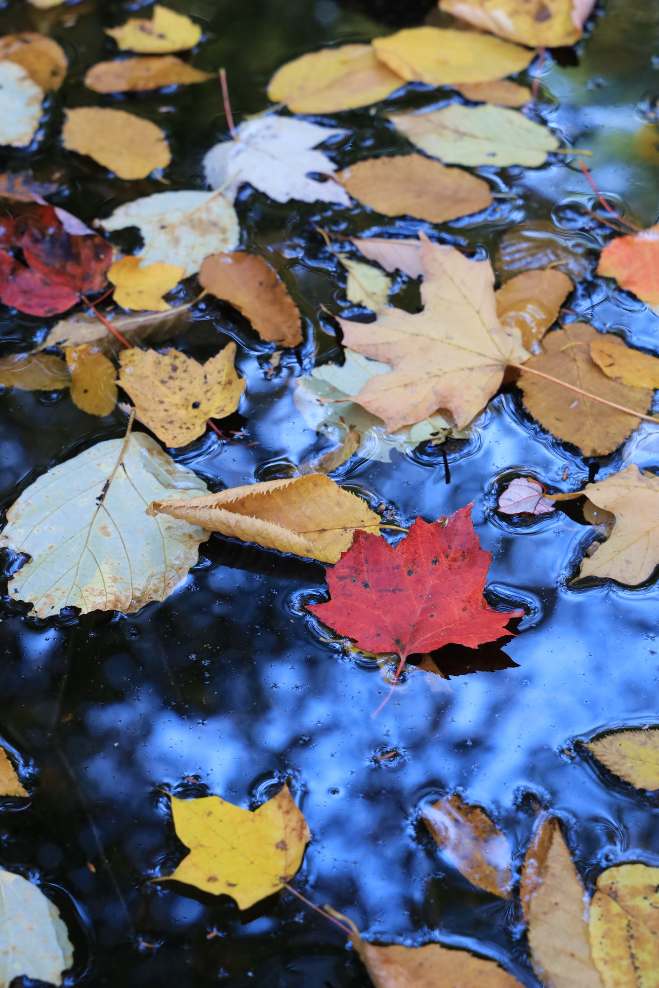
What I found when I arrived was a different matter though. Instead of the color I saw everywhere else, the trees in the chasm were on a whole different schedule. They had really just started turning. Given this I didn’t come away with too many great shots of the chasm. However, the rest of the park did delivery some pretty sights. Though it was quite dry, I enjoyed exploring the little creek that flows behind the chasm. The combination of calm water and still air really showed off the colors here.
The fall color sampler
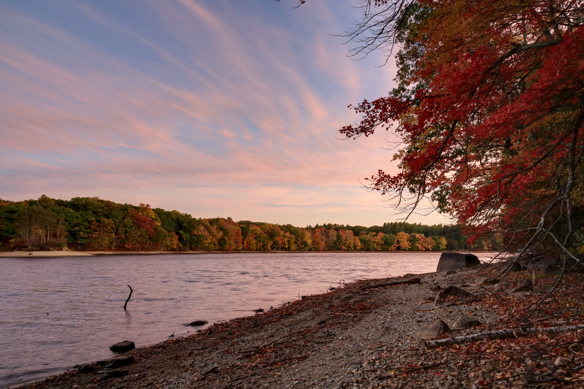
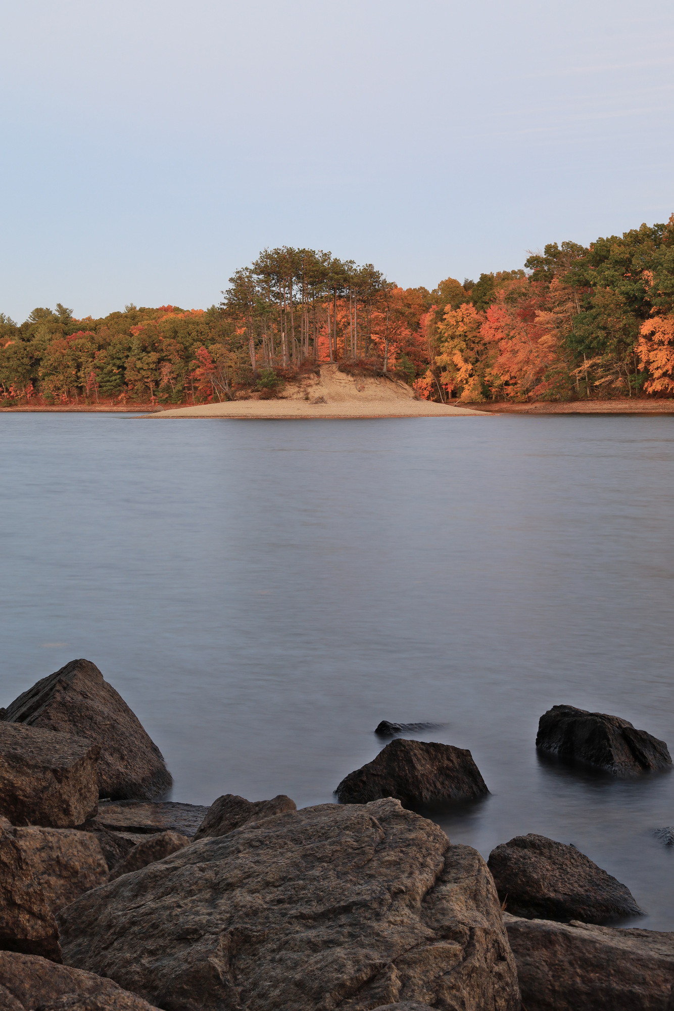
On the way back I stumbled across some more great color and views along the shores of the Hopkinton Reservoir. I caught it right at sunset, with some wispy clouds high above giving a perfect pink glow.
After the sun set I continued taking photos of the water. I particularly appreciated the views of the warm fall color on the other side combined with the cool blue water.
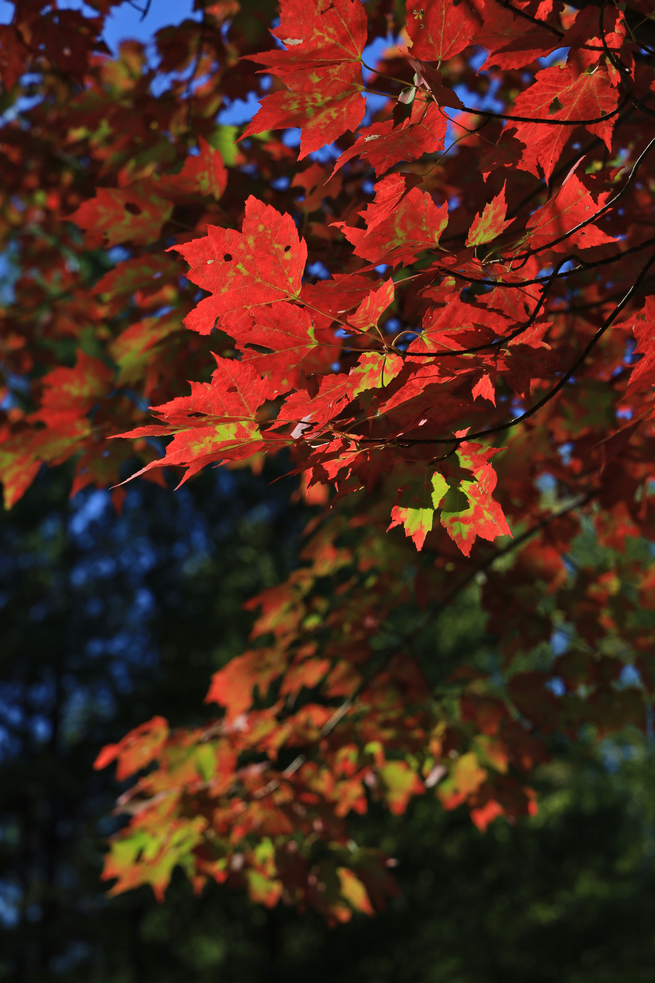
As the colors started to turn around home I was eager to look for some good examples to capture. I returned once again to an old favorite, Callahan State Park. I went repeatedly over the course of a few evenings where I thought I might get some nice color in the sky, and I was not disappointed on any of them.
With all of the chaos that has been 2020 I decided I wanted to find something special to do. Given the limits on travel I was focused closer to home, and ended up setting on a trip up to Baxter State Park to hike the Knife’s Edge trail. I booked a lean to, completed my Maine quarantine, and headed up. My goal for the first day was to really just get up there and get set up for the hike the next day. However, it turned out to be an amazing day all by itself.
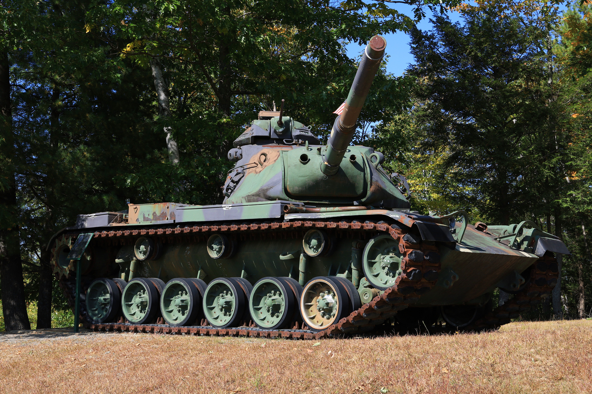
The first sight that caught my eye was the Medway Veterans Memorial Park in the town of East Millinocket. It was in a pretty little park just off the side of the road, but had an impressive tank on display as well. Given that I had been in the car for nearly 3 hours at this point, it was a nice little spot to stop and stretch my legs.
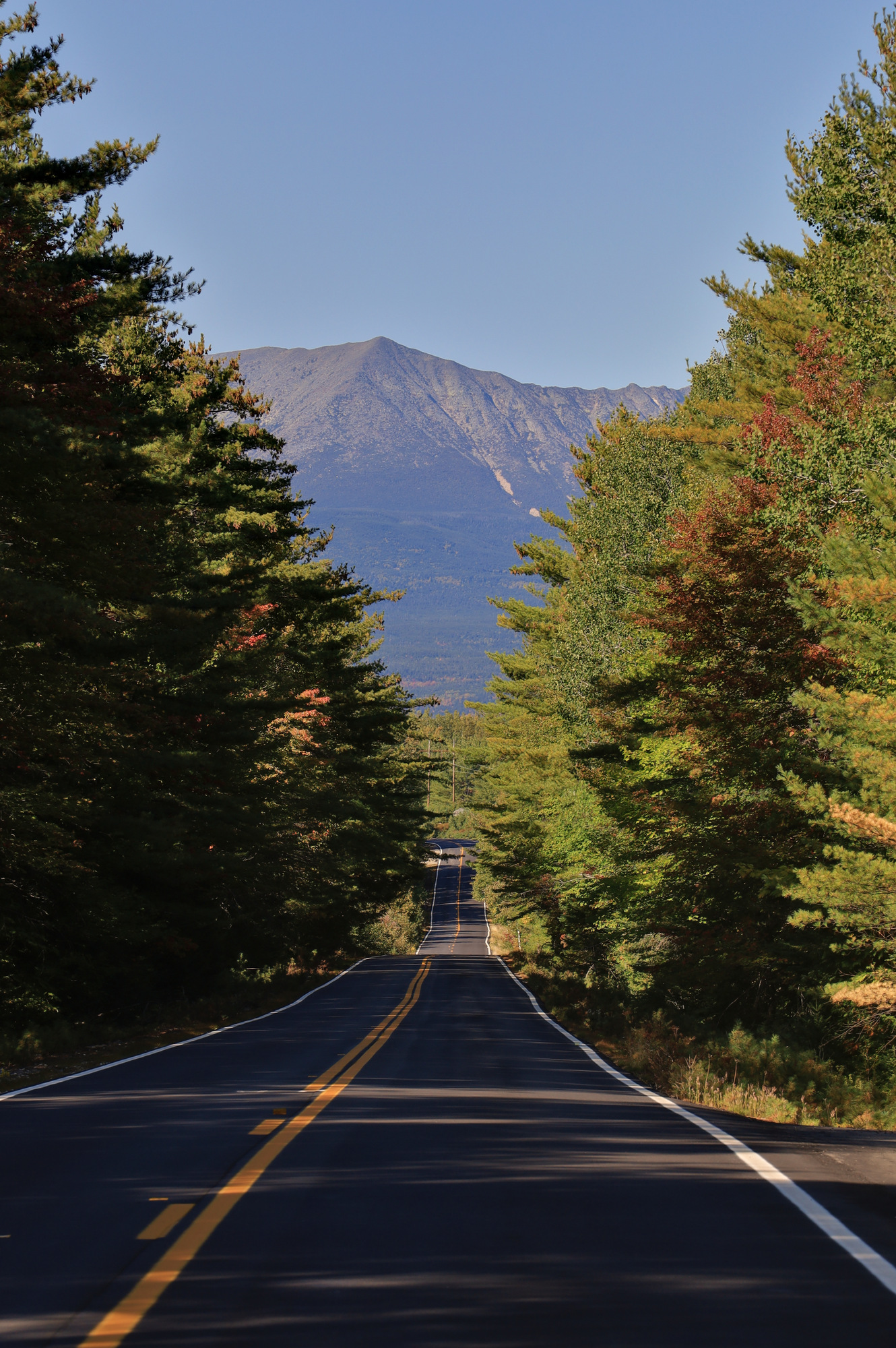
After another 20 minutes of driving I started to catch sight of the mountains in the distance. I made a few more stops to take in the amazing fall color and to simply enjoy the solitude. There isn’t much development this far north, so everything felt quiet and private, even when I was standing in the middle of a road.
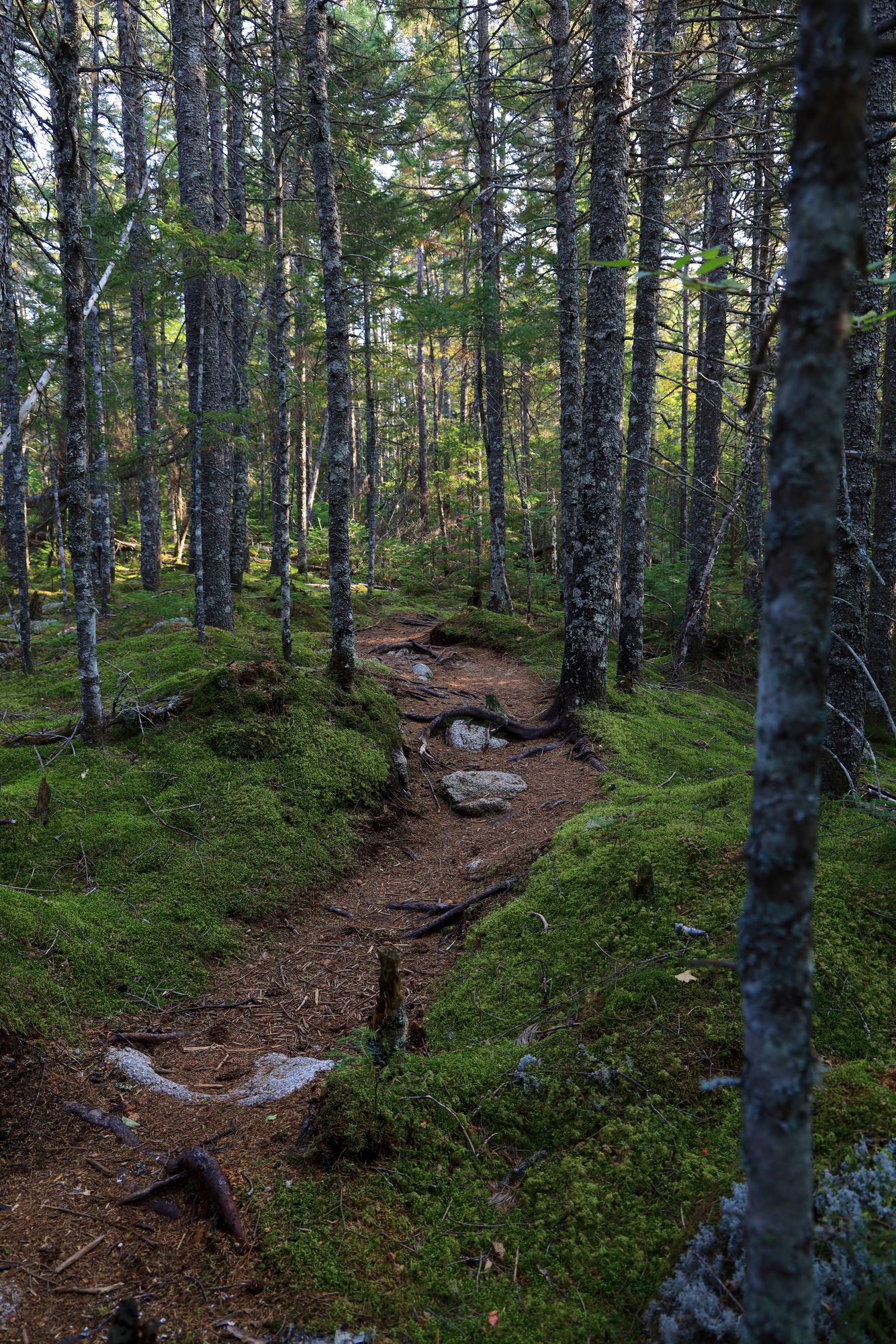
Once I made it to the camp site I dropped off my camping gear at the lean-to and went for a walk along the Appalachian Trail. I hardly made it 100 yards before I was amazed at the beauty of this place. The tails were beautifully maintained, the landscape changed at every turn. I walked through clear pine forests, across small streams, through marshes, and over little hills.
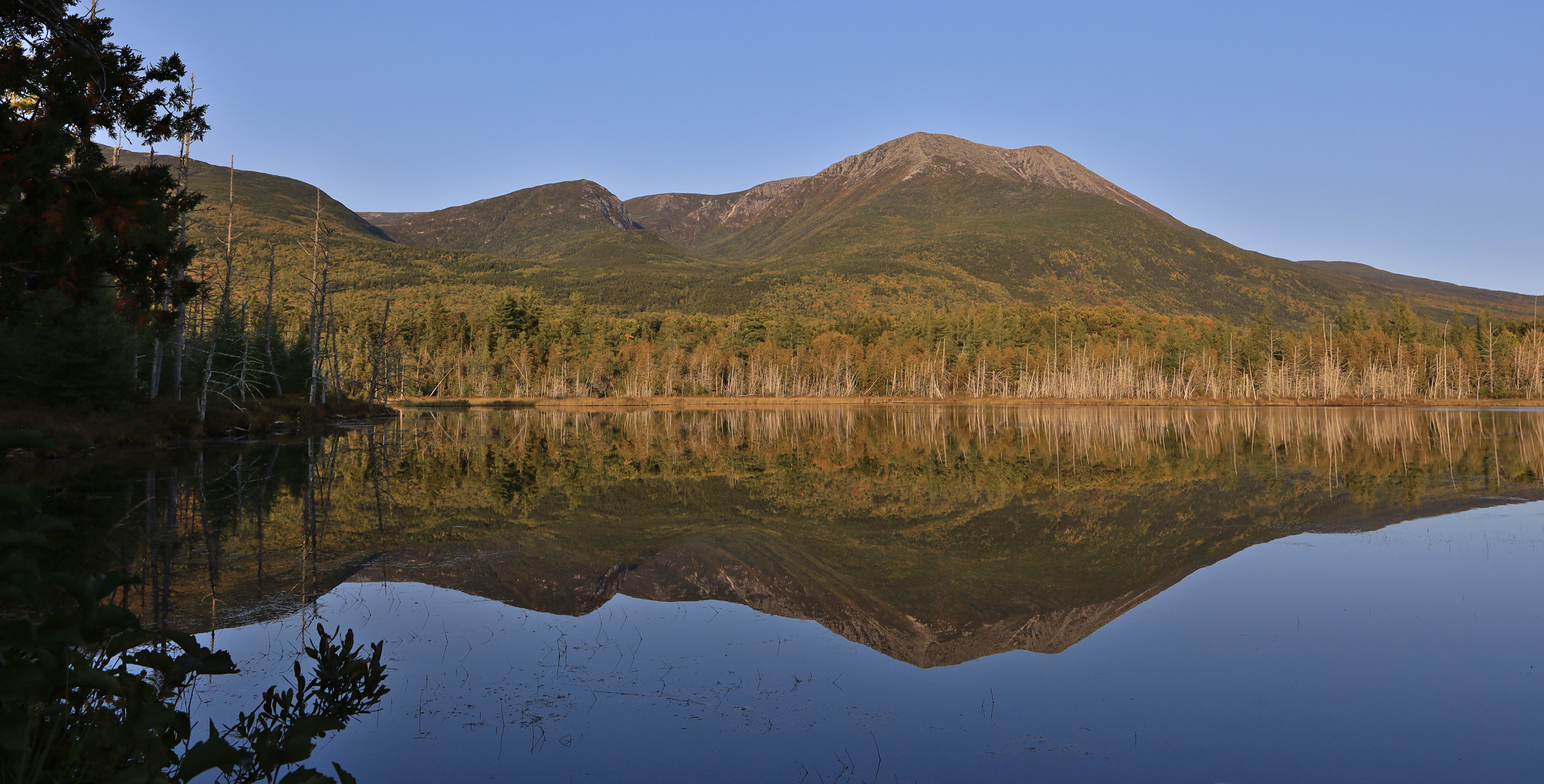
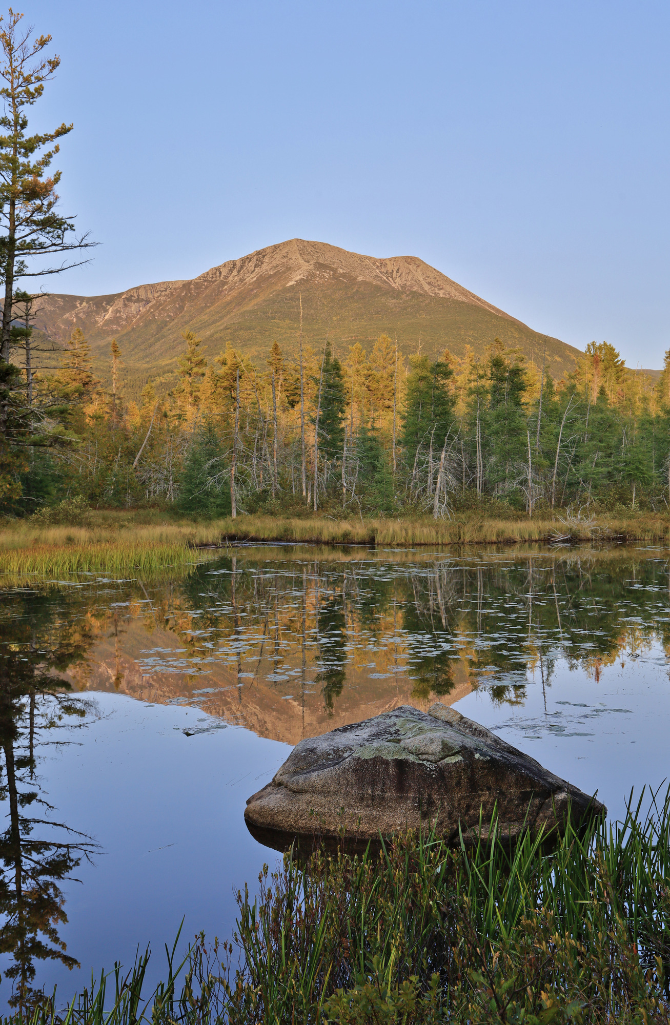
The clear highlight of the hike though was the string of little ponds I wove through. The images above are from Grassy Pond. The glassy water perfectly reflected the mountains glowing in the evening light. I’m sure my hiking pace was slow as I stopped every quarter mile to take in another incredible view. Throughout all of this I never encountered another person. Some day I will have to come back here just to explore these ponds some more.
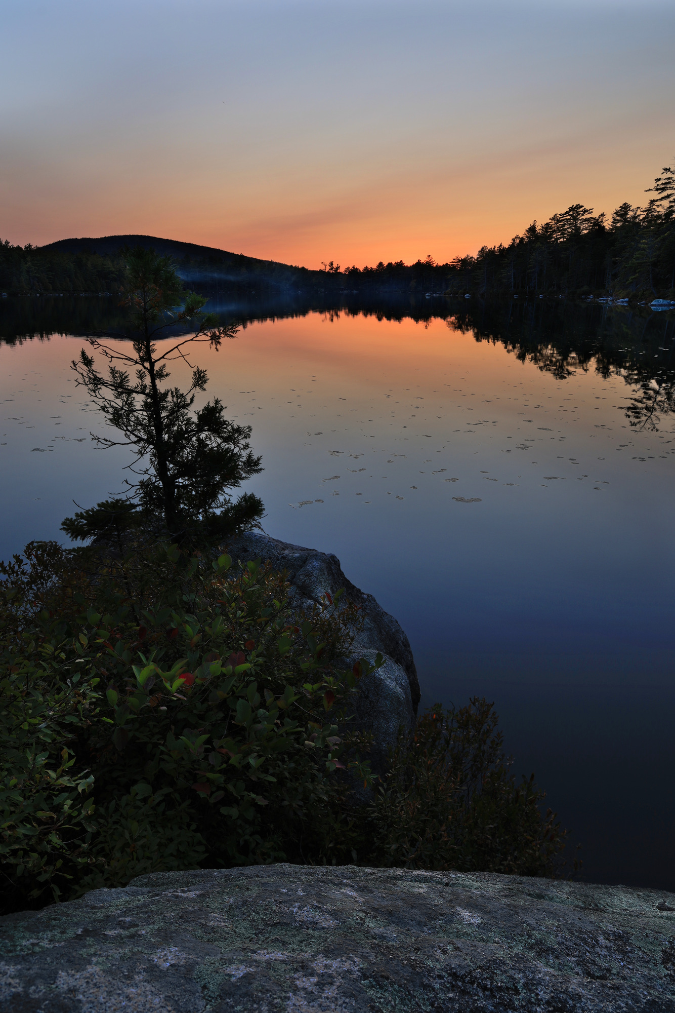
After weaving my way past Elbow Pond I ended up at Daicey Pond just as the sun was setting. Though I still didn’t run into anyone, I did see some signs of activity here. I could hear a few people cooking dinner at the campground at the end of the pond and saw the smoke from the fires floating just above the water. I also saw two people out enjoying the sunset in one of the canoes provided by Baxter. I tell you, this place has more to offer than any other state park I have seen.
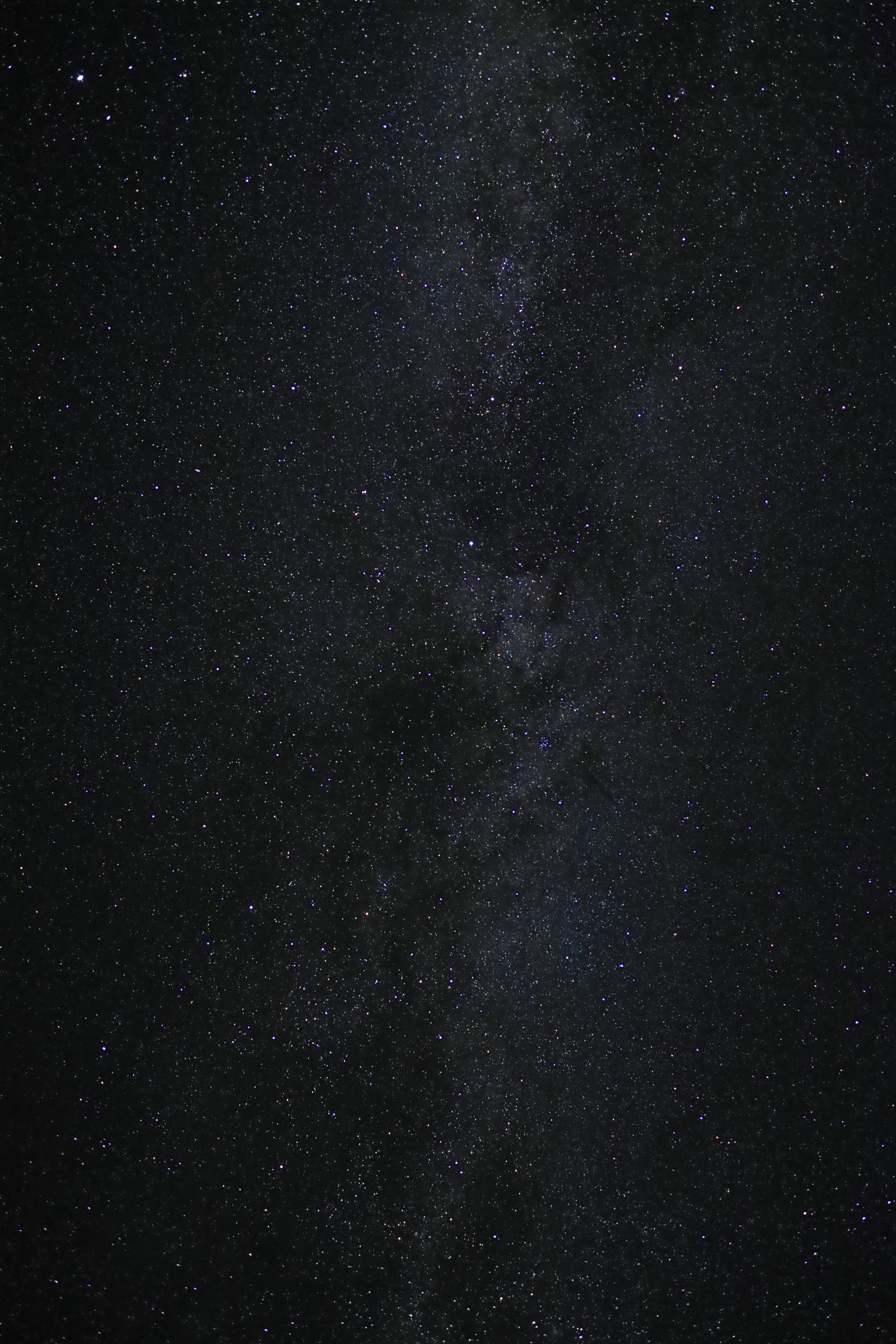
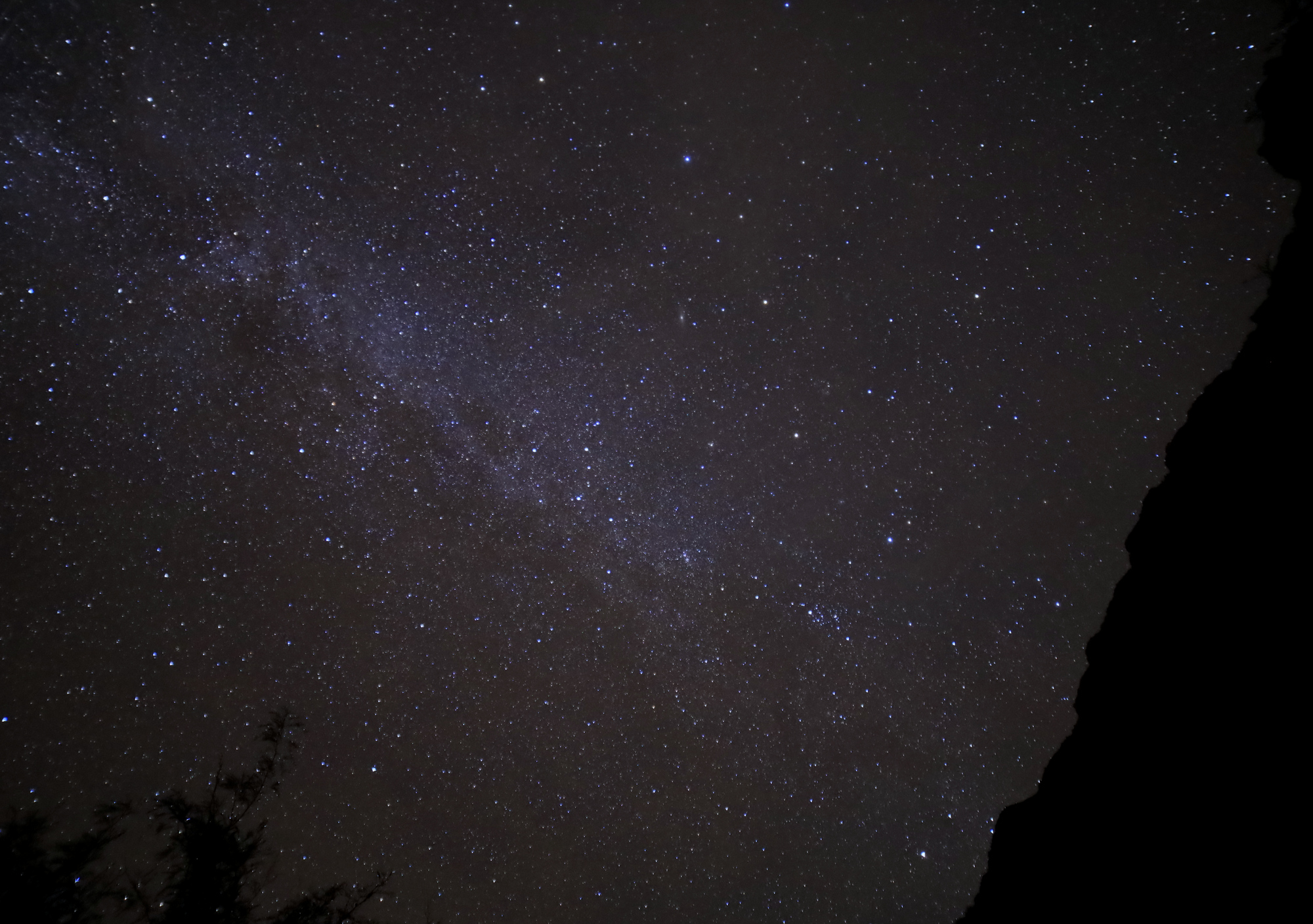
After the colors started to fade I pulled out my headlamp and headed back towards camp. The last mile of the hike went by quickly. Once back at my lean-to I put together one of my top backpacking dinners: tortellini. Once the dishes were washed and all of the food was safely hidden in the car, I stopped by the group campsite to see how the stars looked so far north. Once again Baxter did not disappoint.
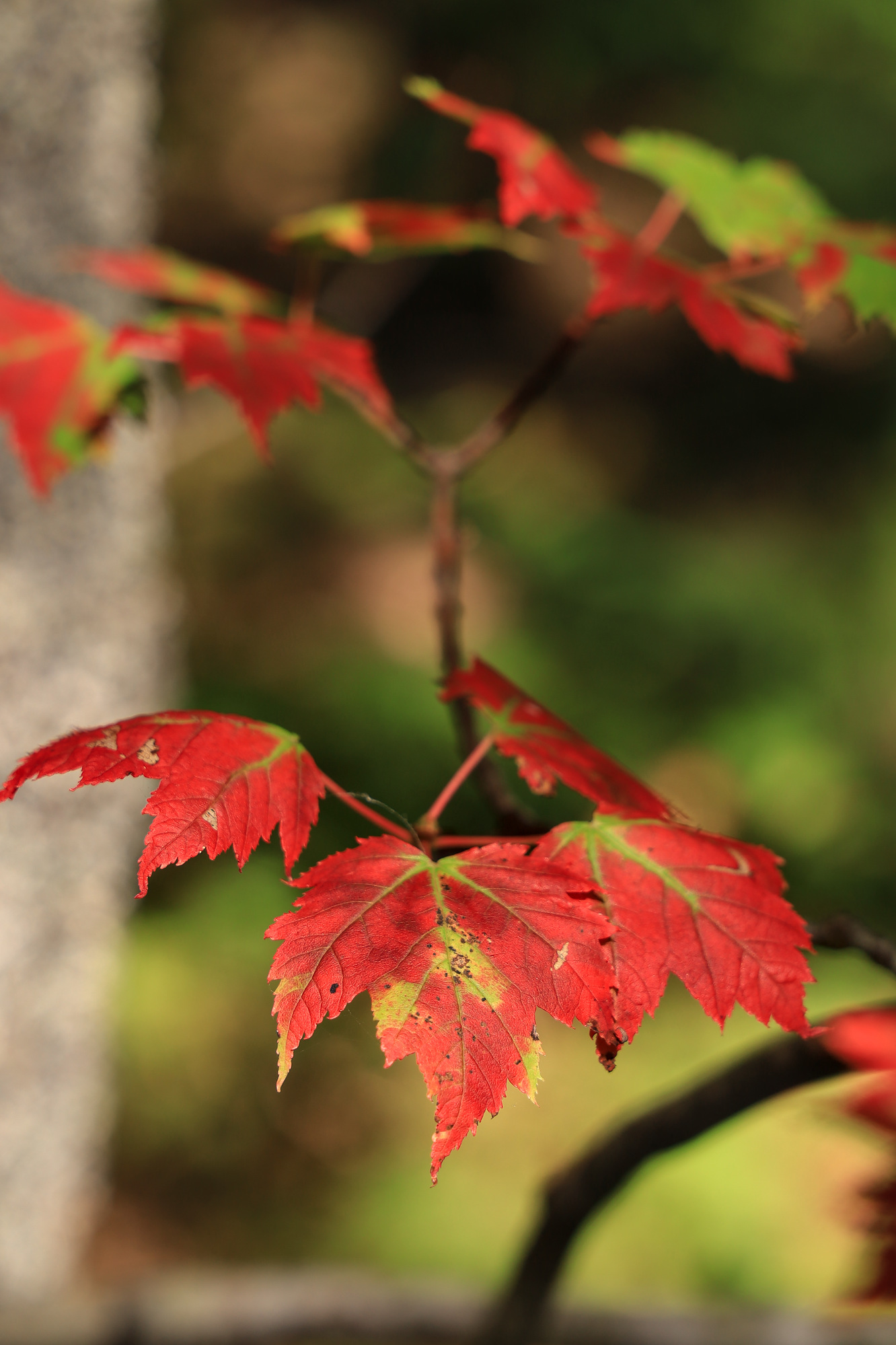
One of our last boating adventures of the season this year was another trip out to Little Whaleboat Island. Our last trip out there was mostly focused on paddling and enjoying the water, so this time I spent a lot more time on the island itself. It turned out to be a fairly cool and breezy day, and the trees were starting to show more signs of the rapidly approaching fall.
We anchored in a small cove we visited last time, and I tossed the kayak in to head toward shore. Given how late in the season it was, the island was completely deserted. I spent some time poking around the woods as well as the shore. In addition to the fall colors I found some wildflowers, and even what looked like flowering fungi.
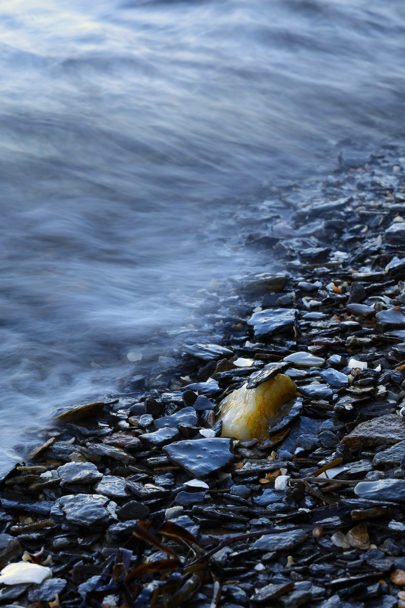
It was a bit of an overcast day, so I also stopped to have some fun capturing the waves in motion. I was particularly happy with how this one came out. I had actually set up this shot before a wave came along and perched the little flake on the tip of the piece of quartz.
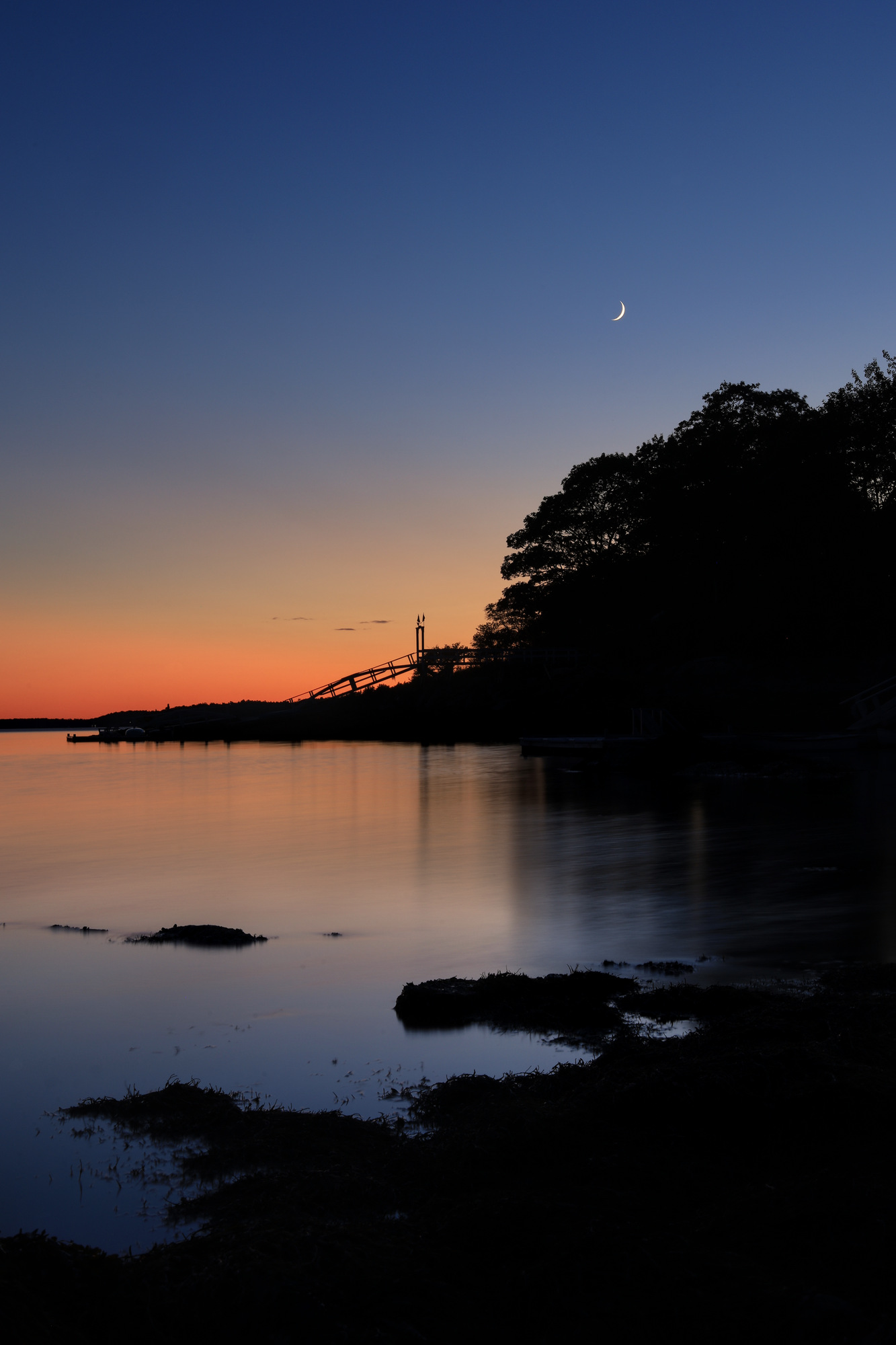
Later in the evening I took some time to capture some photos of the water after the sun had set. By this time the water had calmed almost completely, and the moon was chasing the sun down toward the horizon. The combination looked quite serene. Definitely a fitting end to the day.
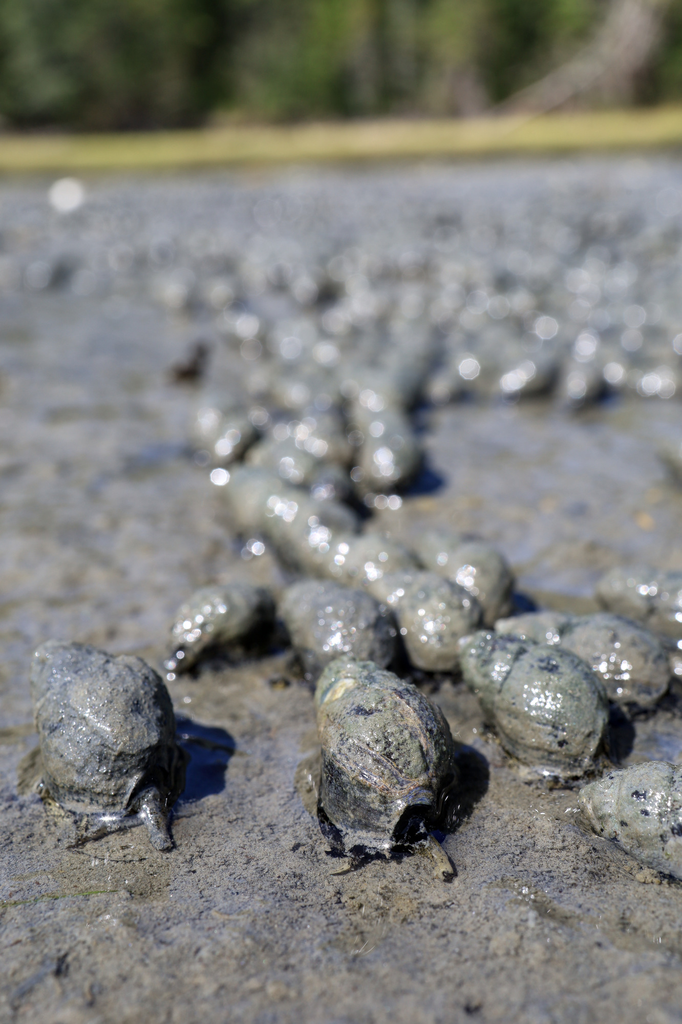
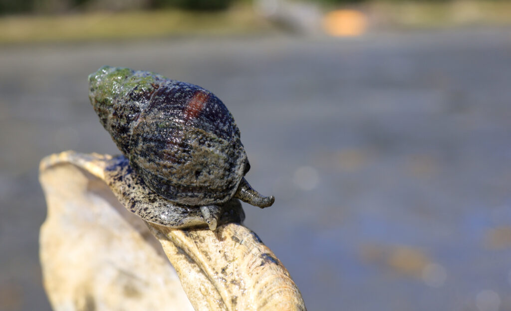
A few more ocean side odds and ends today. We went for a walk one afternoon down to the boat launch at low tide and spent some time poking around the tide pools. However, these snails on the mud flats were even more interesting. There were easily thousands of them. A herd of little snails all “running” towards the receding tide. They were fascinating to watch, and you could really see them making progress.
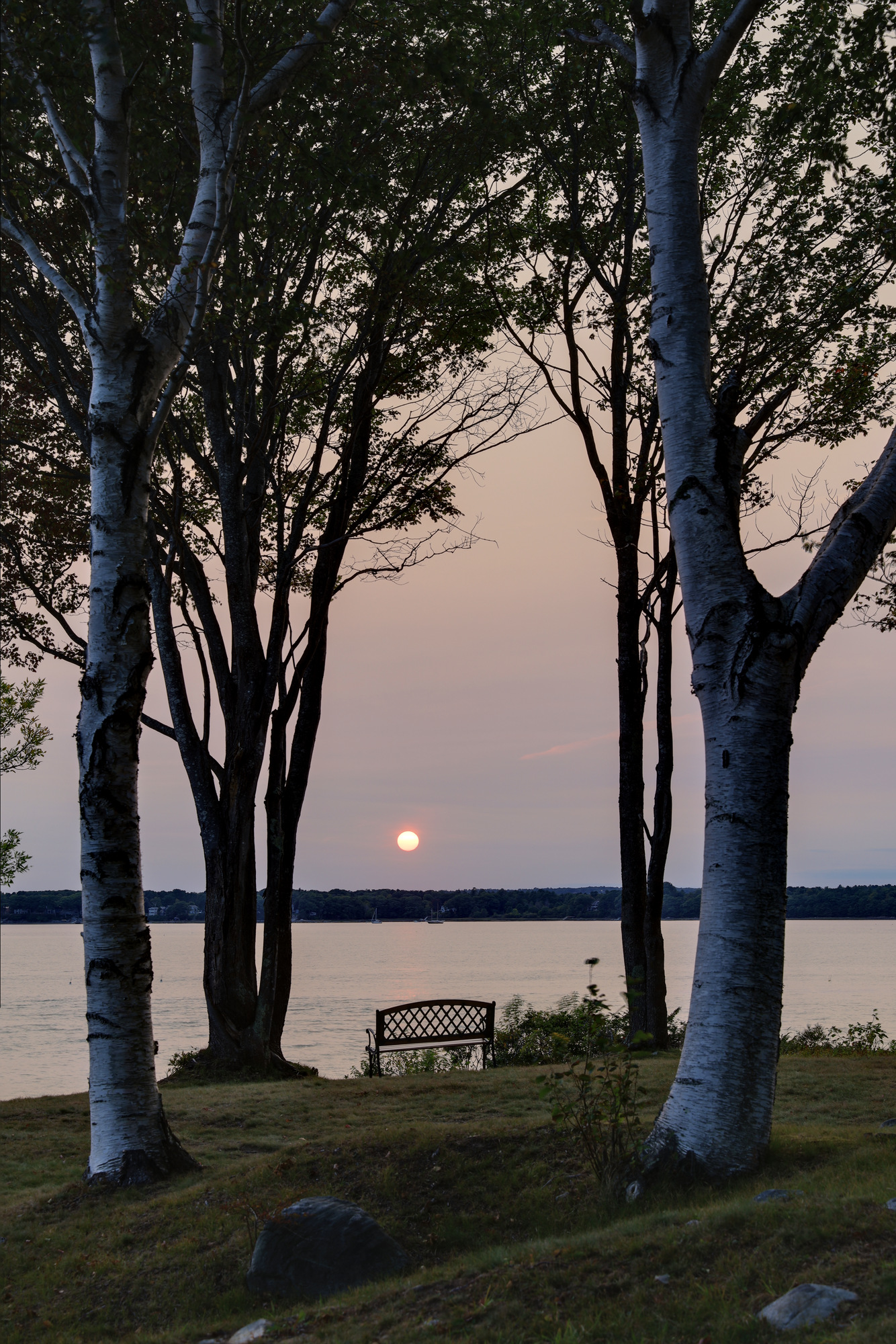
One of the other highlights was seeing our own effects of the California and Oregon wildfires. We had a couple days of strangely overcast weather with some very odd sunset colors. One evening the sun basically just faded out as it got lower until it was gone. It really drives home how bad it all was out west.


FOV: 14 x 21
Ev: 14.24")

FOV: 14 x 20
Ev: 11.32")

FOV: 36 x 50
Ev: 12.57")

FOV: 50 x 36
Ev: 6.87")

FOV: 14 x 20
Ev: 8.61")

FOV: 14 x 21
Ev: 8.97")

FOV: 17 x 25
Ev: 10.61")

FOV: 44 x 62
Ev: 4.32")

FOV: 71 x 51
Ev: 14.24")

FOV: 71 x 51
Ev: 14.30")